Lake Fork Peak and Williams Lake
Carson National Forest
Click for map.
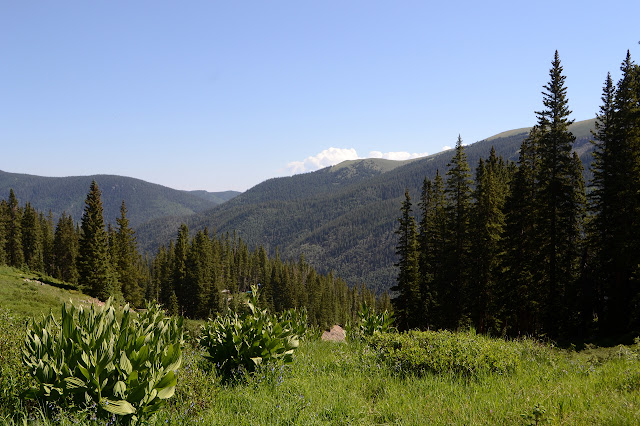
I've decided to do those other three peaks that circle Williams Lake even if I probably won't continue all the way to Wheeler again. It would be pretty cool to get the state high point by a second route, I've done the other state high point by two different routes, but the guy on Peakbagger who waxes poetic about how going from Kachina around to Wheeler is a most delightful learning route progressing steadily from class 2 to class 4 with generally solid hand holds makes me pretty certain I would have no business trying it, especially on my own. Others assure me that it will also be delightful to drop down and visit the lake, but requiring no more than a scramble. So the plan is to go up Kachina and continue to Lake Fork Peak and unnamed 12819 before retreating and dropping down, unless something makes me drop down sooner. Getting up to Kachina can be done by a cross country route or just following ski roads most the way. This being the weekend and already fairly late as I get started, there is also the option of waiting an hour and taking the lift for $20. It only gets as far as the roads go. I'm feeling lazy, but not that lazy, so will follow the roads. There will be plenty of time for harder route finding later. The first challenge is finding a parking spot in the lot. It was so much emptier when I hiked up and was up 2 hours earlier on a weekday.

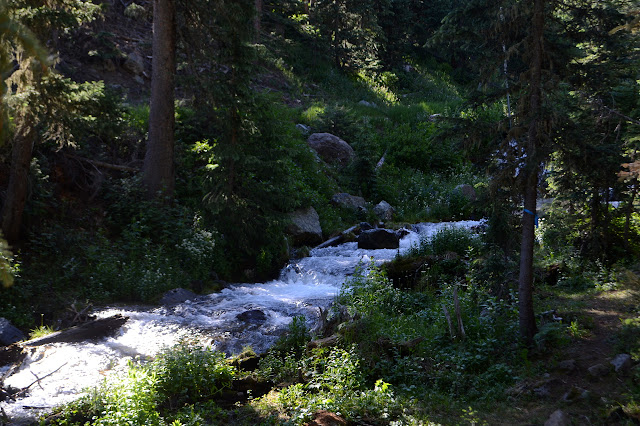
Just as before, I follow the signs for Williams Lake Trail along the side of the private road and past the base of the ski lift. This time I turn to the side as the trail crosses one last road and start up it. One road has a most lovely waterfall coming down next to it, but I take a steeper one that misses that. There are a lot of roads to choose from as I climb and while I sort of thought I would use a photograph I took from the Wheeler Peak Trail as direction, I'm not certain now that it would be useful to dig it out. There's a little bit of a trail and when I turn around, a bottom black sign seems to be pointing out a trail among the named ski trails.
The lift starts and stops a few times, probably some safety checks. I suspect the first riders could be getting to the top as I do. A sign welcomes me into the last bowl with a warning about unexploded rounds. What, the slope is an old artillery range? It takes me a moment to realize that these are probably fired each year to minimize avalanche risk. Across the canyon is a natural ski slope cut through the trees by a series of avalanches.

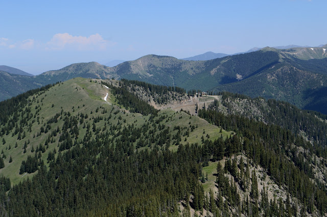
I am undecided about what route I want to take for the last. Some suggest under the ski lift that climbs from the bowl to the peak adorned with warnings about experts only and there is no easy way down. My instinct is to go for a short saddle just above the top of the operating ski lift. It now does have a rider, but this seems to be a second worker to join a first who drove up. I decide to go up a rock slide then work over and up to the saddle or the ridge and it is a poor choice. There is nothing particularly dangerous about it and there are even some game trails to follow, but the direct route would have been fine and less annoying. And my feet are still sliding around in my new shoes making off trail on slant particularly difficult. I get to the ridge, but it takes longer than it should. The ridge is decorated with rope and closed area signs and has a faint trail that stops by a little dilapidated cabin with more rope and signs then climbs on.


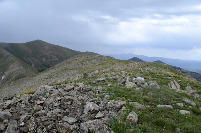
Looking back, I think I would have liked to grab a different road up that would looks to go up to the top of the bump north of the saddle I aimed at and then just stride all of the ridge up. It is grassy and has an obvious trail. The trail through the rocks is not too bad either. It's not a proper trail, but it makes the footing easier. Someone has been dropping off materials and big water jugs along the way. I actually saw those jugs going up the road and probably listened to the helicopter taking them the last mile another day. This ridge is going to be changing. The top is grassy and decorated.

Two trail runners come up from Lake Fork Peak. I'm not sure what all they're running. They might have done Wheeler Peak Trail and come along that ridge I don't want to do. I have had a clue somewhere that people do that. I almost ask them, but let it go. Maybe there's an easier trail. As I look out at lake, following the ridge line looks to hit a brief bit of cliff I don't like, but there is a trail scampering far out to the right instead. That looks like the one for me. I'm just not sure where it leaves the ridge.

There is nothing surprising on the way down to the saddle between the peaks, then it is time to climb. I am quickly aware of being too high for the trail. There was actually something heading off to the right and slightly down from the saddle itself, but only a little bit of me wanted to take it. Now I'm getting certain that was the trail I was looking at from above. I figure I can just wander up and to the side and eventually get to it. Eventually there it is right below me, I think, but I don't want to go down. I'll catch it on the other side of this rock. Scrambling upward on rocks embedded, but not very strongly, in a cliff of dirt is yet another lesson that sometimes it is better to lose a few feet and find a better way than to push ever upward. Will I learn it this time?


There isn't much trail to find on the far side of the rock and dirt nonsense. It just isn't needed anymore to get around nuisance cliffs. I just pick my way upward through the rocks and eventually find myself at a top.

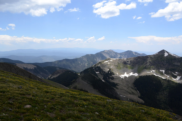
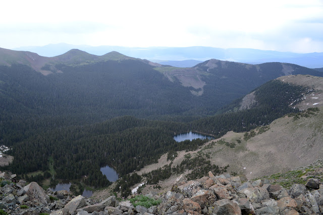
Down the smooth portion is easy. Approaching the jagged portion of the ridge, I start to think that dropping down the right side would make it best. I might even drop down all the way to the pretty little lake. The ridge drops down a lot anyway so the lake is only 400 feet lower than the low point. I watch the rain begin and then listen to a distant roll of thunder. That makes it easier to choose a route that is not exactly on the ridge. The pattern of recent has been for a rather weak bit of storm, then clearing and regathering for a more solid wallop. I figure I should have a 2 hour break to grab the peak and get down onto the side of the ridge with trails.

The slope is steep, but the grass growing on it generates steps so that each foot placement is on a flat surface easing the whole process of shedding elevation. I wander first to one side, then the other as a light rain starts. As the rain turns heavy, there is a cave right above me just large enough to shelter in. It looks like water seeps a bit through it, but that is all. I haven't seen anything like caves and just as I might actually want to use it one appears. I feel sufficiently far below the ridge top via steep slope to be safe from lightning, but drop the poles outside as a sort of sacrifice. You hear stories of lighting doing some wild things that could not possibly be the least resistance.

Not that I am very good at waiting out the storm. The rolls of thunder get more distant and the rain lightens and so it is not long before I'm moving again. It did give me a chance to eat something and to notice the trail in the rocks. I study it, but lose it as it goes down toward, but not to, the lake. On the other side it climbs distinctly to the saddle. Perfect. I make my way sideways and down along whatever route is most comfortable. There are game trails along the way, but none anywhere near as distinct as the trail I am moving toward. I worry that I won't see it once I'm on it. Some trails look very distinct from afar and then vanish up close. This one doesn't. This one is obvious once I get to it and very nice walking all the way to the saddle.

The saddle is occupied by a benchmark to remind me that I probably wasn't supposed to be going off onto the right side of the ridge. Whoops. It is the first of many heading up to the third peak. I was thinking the dividing line ran along some ridge to the south, but there are no candidates there. There should have been one on Lake Fork about where I started down and they aren't exactly easy to miss. They all stick out of big rock piles.
The rain is not done, but it is quite light. The trouble is, as I make my way toward the peak it comes with a bit of a gale for a wind so I am plastered with water on one side. The top is long and flat. It drops a little as it goes to the east, but I decide to take it in wind and all.


Then down again, as the light rain gets blasted into me with an even harder wind. My plan is to follow the ridge back to the low point and then down. Tracks from people who have just done this one peak tend to join and leave the ridge a little higher, but that part of the ridge is quite easy to walk so I figure I'll just loose as much elevation as possible along it.
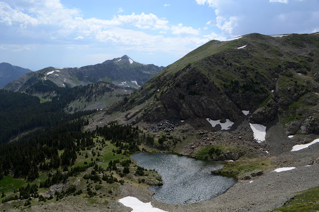

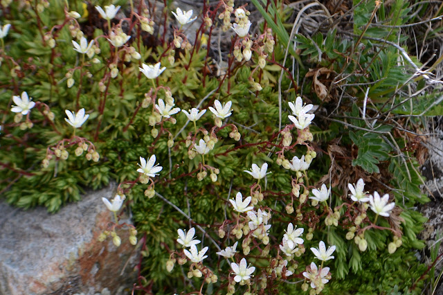
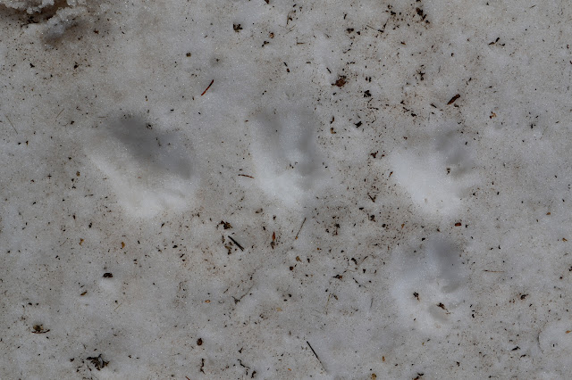
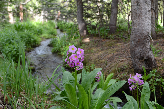
Once there, it does look a little less steep and therefore maybe easier to get down off the ridge from a little further up. Still, it is only a matter of stepping carefully downward to make my way. It is a way studded with flowers, then covered in snow. The snow has a great big marmot hole in it with a track of marmot footprints downward to the rocks far below. I cross to some scree, but it is more unstable than the snow, so I roughly follow the marmot instead. Footing is better in the sort of bowl where the snow stops.
There's more snow available to smooth out the footing, so I go for it. Careful at the sides, one never knows how the edges are undermined. I suppose one never knows about the middle either, but it tends not to be. Then there is dirt and grass and trees to help smooth it all out. In it, I need to watch out for creeks and swampy bits and the odd bit of cliff. I can't help but notice that when I was expecting the weather to regroup for more thunder it is actually clearing up into something pretty.

There are trails in under the trees. I follow one for a bit and leave it as it turn uphill. That is when I encounter the cliff. It takes only a little work to get around it, but perhaps there was a reason the trail had climbed. Eventually there is another trail that takes me down to a well used camp site above a waterfall.


Trail down the side of the waterfall is well used and steep. Below is another camping area, but this one is occupied. Beyond, there are more and more campers by the lake, some who seem to be practicing get maximum notice and leave maximum trace. Tents are up just feet from the water. One I pass near actually shows a little impact already, so they weren't the first to decide to help make the area by the water barren. One further off is clearly sitting in some very lush green about fifty feet from a creek. A creative force behind the establishment of new sites. Perhaps there is no hope for this spot just 2 miles up the trail. The number of day hikers and backpackers are both extreme.


The spot by the sign where the trail officially ends is a well used area, too. I head up and out of the bowl past more camp sites. These aren't used, so it must not be a particularly big weekend for the lake. Heading down again looks a lot like heading up a few days ago did. I decide to take a piece of mystery trail only to find that it is the old trail. It seems to have been rerouted for a number of reasons. The first I see is the avalanche chute it crosses and next seems to be some new construction, but I have figured out where the wilderness sign got to. It should probably get moved to the new and better trail.


There are a jumble of old roads before the old trail finally disgorges onto the road I turned up in the morning. It is offset from the current trail. I'm sure that is new too, but I'm not interested in finding the rest of the old route. Some other hikers seem to be using this in a familiar way, but I can't imagine that being anything other than nostalgia. I head down the last bit on the nice new trail. The lot has plenty of spaces as I leave one more.
©2019 Valerie Norton
Written 8 Aug 2019
Liked this? Interesting? Click the three bars at the top left for the menu to read more or subscribe!


Comments