Silver benchmark on the Continental Divide Trail
Rio Grande National Forest
San Juan National Forest
Click for map.
Oh, dear, the weather looks absolutely dreadful, but in the spirit of having no idea what it will really do so I might as well go for it, I'm going for it. There have been some mornings that looked just as dreadful and did nothing much. A random section of the Continental Divide Trail that happens to have a benchmark nearby is the goal with maybe a little extra look about to the south. Access is via a short trail to Bonito Pass, but it goes off the end of an old logging road marked as unimproved dirt road #388 written vertically, both basically code for you ought to have a 4WD and better have high clearance to drive this, especially if it has been raining. It's positively soggy and since I have neither, I have an extra 2.5 miles from gravel road #390 (signed for Tucker Ponds) at a place labeled Campo Molino.
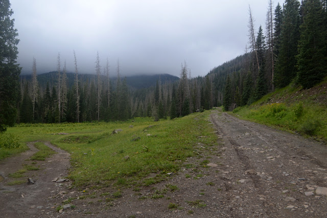
Someone has driven up this road soggy and down again with it even soggier. More old logging roads spur off the sides of this, but they seem to be being left alone by the sort that would normally breach the barriers on them. The sky shows some bright spots and then darkens so much it feels like night is coming on in mid-morning. The clouds are clearly lower than the pass, but I think they are rising. A little bit. I don't want to get high up and hike in clouds. That could be miserable even if it doesn't rain.


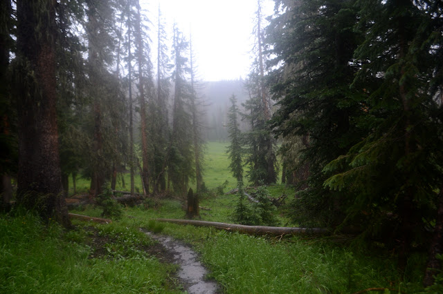
The tire tracks go all the way to the small turn around at the top where "area closed" signs decorate the start of the trail. As usual, the small type says "to motor vehicles". There are some fresh muddy footprints to go with the fresh tire tracks on the well used and maintained trail up to the CDT.
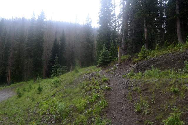
The top is only marked by small logs lining the trail through a soggy meadow as it intersects with the CDT. I see no sign of the Hot Creek Stock Driveway that supposedly goes down the other side, but I'm not looking very hard. The clouds have lifted a little and there is some view, even if it is only of the nearby trees. On the other hand, it has already started to rain and even a rumble or two. I think I'll do that extra spur to the south first since the map indicates slightly better cover and refraining from being at the top of the ridge there.
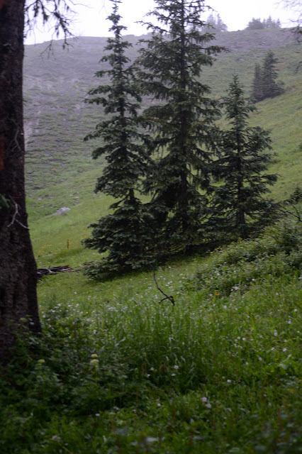
As the trail sticks generally to the San Juan side of the divide, I should be getting some new views in the breaks in the trees. Not so much. There are breaks and even wide meadows to cross, but the view is of peaks nearly completely obscured by more cloud. Meanwhile the meadows do make the rumbling threatening. Maybe I still haven't learned reasonable respect for lightning. They like to say you have more chance of getting hit by lightning than of winning the lottery, but both have a certain aspect of having to "play it". I mean, someone could hand you a winning ticket for no good reason and lightning has been known to do some crazy things once in a while, but mostly you've got to buy the ticket to win or stick yourself out in it to get hit. I'm certainly upping my chances. My 1986 Guinness Book of World Records that I got in grade school said, to the best of my recollection, that the person who had been hit by the most lightning strikes was a park ranger with 12. There's a job where you can stick yourself out in it. Also, that means the person survived at least 11 strikes. I wonder, does survival increase with a lower cloud ceiling and therefore nominally shorter distance for the lightning to bridge? Good things to think about crossing an open meadow near a ridge line under a low and rumbling cloud ceiling. Rather than how it might be a good idea to just do this another day.


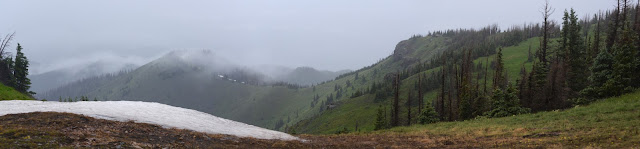
My turn around for heading south is a spot where the trail is popping out onto the top of the ridge in an even wider grassy pass that supposedly has some easy access too. It actually seems to be clearing a bit and the rain stops. It is long enough to pull on my fleece under my rain coat. It's really cold up here even without a breeze.


It's positively pretty as I start back, but the rain starts again.


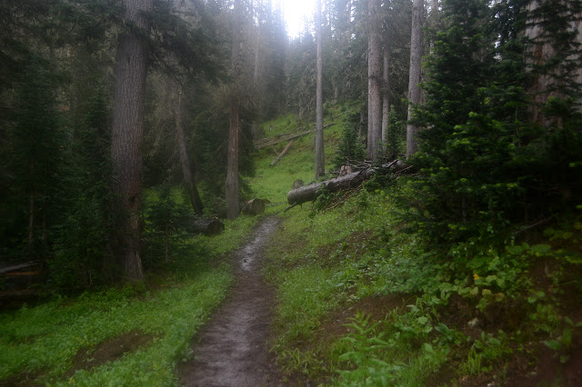
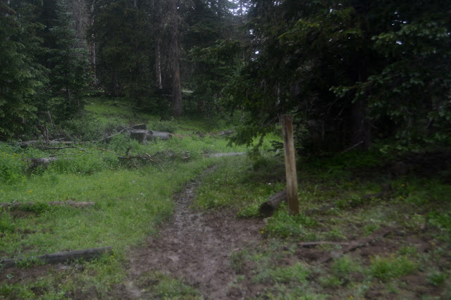
Once back in the trees, there's not much to see. At least the thunder, when I hear it at all, is sounding really distant. Across the meadow with the unsigned junction where I joined the trail, there is actually a crest to identify it on the marker post. Since those are common just incrementally along the trail, that is still no indication of a junction. I continue north through more trees and then out into meadow as switchbacks, sometimes difficult to notice, start to climb up toward the Silver benchmark. Now a breeze is starting and it makes it even colder. The jacket I have seems to do almost as good a job at keeping it out as keeping the water out. My right elbow has begun to slosh.

There is a sort of pass with snow patches remaining. I haven't heard any thunder in at least half an hour and the peak is not entirely nude. Seems okay for now. The benchmark is only a short way further up and there even seems to be some sort of gently used trail on the way.

The benchmark is in a non-obvious place, but the trail passes right by it. Judging by the cut branches on the nearby stunted trees, it might have been made by the surveyors. I can't find any references as I circle a few times at different distances.

I think I'm going to be a little adventurous and continue north to Silver Pass where the Silver Creek Trail should be. There, the distance to the road is not very far and the drop is not much more than 200 feet. For all I know, there will be some old logging road to walk all the way down. I was thinking to do a loop backpacking Treasure Mountain and Silver Creek with the CDT before but got concerned by the amount of road through inholding that passes between the trails and they don't even have trailheads marked. I'm a little curious to see what this end of Silver Creek Trail looks like.
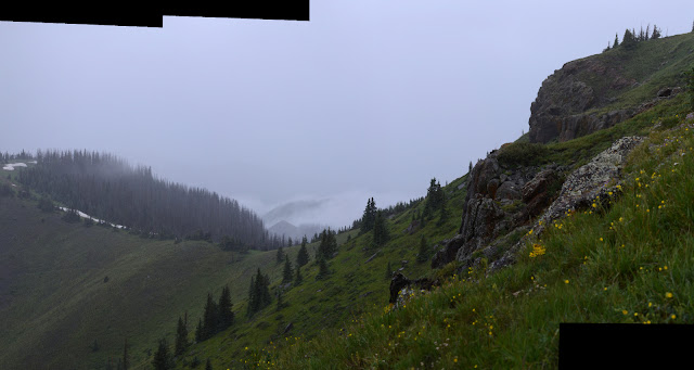
It's a long way down to Silver Pass with something like a cliff on the far side and lots of canyon to go with the creek. The pass is signed "East Fork San Juan River 5" which is basically the road. The trail has some distinctly recent tree clearing. I guess I shouldn't have worried although it is distinctly weird that these two don't have trailheads marked while a Silver Falls does although there seems to be no trail.


The trail was on old logging road for the last bit to the pass, so I expect to just follow it down. In my direction, there is a sort of trail and someone even cleared the first log, but it might just be cows. It certainly doesn't seem to be going quite the way I want to. The vanishing road is lost in the meadow, but I find another to follow with a little better path along it. Passing some earth barriers and road closed sign dumps me back out on the open road just short of the creek crossing to follow it the rest of the way down.

The road is now even soggier than it was in the morning, but at least getting down in elevation is allowing me to get warm enough to remember my limbs. Oh, and after trying it in rain a couple times, I think I can safely say that the River Toadz Pack Jacket by Frogg Toggs cannot accurately call itself "100% waterproof" for more than 20 minutes in a moderate rain but it doesn't tear at the first touch of a shrub.
©2019 Valerie Norton
Written 2 Sep 2019
Liked this? Interesting? Click the three bars at the top left for the menu to read more or subscribe!


Comments