Table Mountain
Rio Grande National Forest
Click for map.
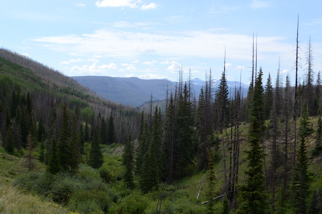
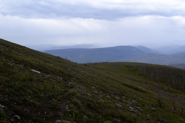
Ever plotting for loops, I noticed that the local "Table Mountain", quite a popular name for a mountain, is very nearly visited by the local "Highline Trail", which also seems to slightly less popular, but they tend to be worth visiting. Kitty Creek Trail provides a way up on one side and Tie Hill Trail on the other with Shaw Lake Loop Trail (which does not seem to loop, but perhaps it is just a piece to help make the loop I am doing) and a little bit of Lake Fork Trail to finish it off. Well, also about a half mile of road along Shaw Lake, but it is gravel and flat and will go quickly. The spot on the map marked "Stairsteps" has me intrigued. I have decided to go counterclockwise making it about 8 miles up and 4 miles down from the peak. Kitty Creek is marked with a sign listing the dangers of entering a burn area, but the Shaw Lake Loop Trail seems to have not had even that much attention given to it. The road is closed just past the trailhead and crosses the trail a few miles up, so I guess if I'm ready to give up on trail I can get over to the road and have it all to myself. Anyway, the start of the trail is clear enough as it drops down to the north spillway.


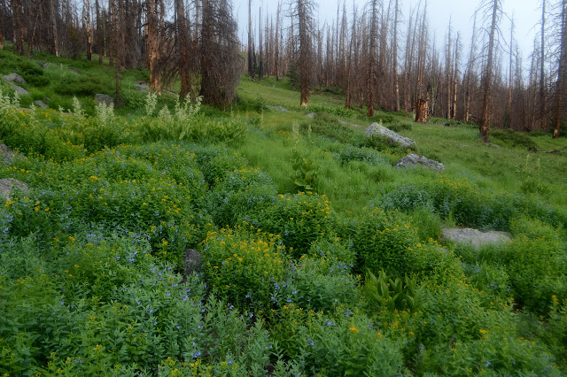
Once down by the dam, there is an old wooden sign to mark the distinct trail. The forest right here was not burned badly. Unfortunately, the trail is only distinct as far as a couple campsites, then everything transitions into clearly beetle killed and then torched forest devastation. Every few steps is a step over a downed tree and it becomes very helpful to have an electronic map so that when one path doesn't seem to be working out, I can consult it for which direction I should proceed to find the real trail. The Forest Service quad seems to be spot on as to where the trail is. (OpenStreetMap, on the other hand, has never heard of them.) It looks like there has been no maintenance at all since the fire, but someone is trying to keep the trail marked. The little aspens growing up have been broken frequently along the route. Annoyingly, this is usually into the trail. I have to admit that this is the direction most easily done when marking trail by hand. Old cuts remain on burned logs for further clues.

With a little practice, I can follow the clues and don't need to consult the map so often. There is tread here still, except where a small debris flow around a trickle of water has disrupted it for about 30 feet. Another bit of water has cut down deeply leaving a rather steep climb out. Still, once it drops down to the Lake Fork (presumably of the Rio Grande that it flows into) there is a log bridge and more obvious trail makers to help get one to Lake Fork Trail.

The Lake Fork Trail, which comes up directly from US-160 about 2 miles below, has had some maintenance since the fire as well as a lot more use. There are still new trees down and sometimes a wrong trail, but finding and getting back to the right one is easy enough.

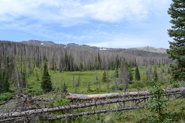
The junction with Tie Hill is still marked, probably because it is in a meadow area that saved the old signs, or at least the sign posts. There is only one sign left and a fourth post on the ground used to have a crest. USGS offers a clue: the trail from US-160 to Highline used to be a National Recreation Trail. No longer by the more recent Forest Service map. Did the fire lose it its favored status? This, too, shall pass. The forest will grow again. Well, one hopes. Actually, there aren't a lot of pines sprouting. Tie Hill seems to carry with it an injection of horse traffic to the trail.

In spite of the traffic injections, it is clear that a lot of what is keeping the trail visible is cattle. I see none of them, but their footsteps cover the trail to the exclusion of all else at the moment. The trouble with cows keeping the trail open is that they are likely to wander off their own way eventually. When it is a canyon of small alder, they are steadfast. When the trail is crossing a vast meadow, there is a moment of a sense that the curve of the trail is starting to be wrong. Indeed, that helpful electronic map shows the cow track veering away. There is a thinner trail, and then there are posts to follow across the meadow instead.

The road crossing comes with signs, but it still takes some guessing to find the trail on the other side. I think I have it, but then things are not quite right as I cross a creek and start up a hill. I must not have had it, because once I get determined to just climb directly up the hill to a trail, there is a really good trail 200 feet later.

Trail is good all the way to the wilderness boundary, but not nearly as good as the trail coming from Hunters Lake. It is only about a mile from the road, but that is the road closed down at the reservoir, so this use must be historic rather than recent. I thought I might take a spur to see the lake, but now I am starting to wonder about getting through all the burn. I guess I will leave it today. There was a wilderness sign just before the junction, but the junction comes with a second and a register. It actually has a book inside, so I add myself to the next line before going on. Wouldn't want them to think this trail is not deserving of the work it will undoubtedly need over the next few years.

The weather is determined to remind me that there was a reason to go the other direction. Then I wouldn't be aiming to be at the top of the mountain, the long, wide, above tree line mountain, at prime thunder storm hour. There has been no rumble yet, but the days prior have had rumbles and even some good deluges and the clouds are getting thick. I need to hurry, giving another reason not to visit the lake.


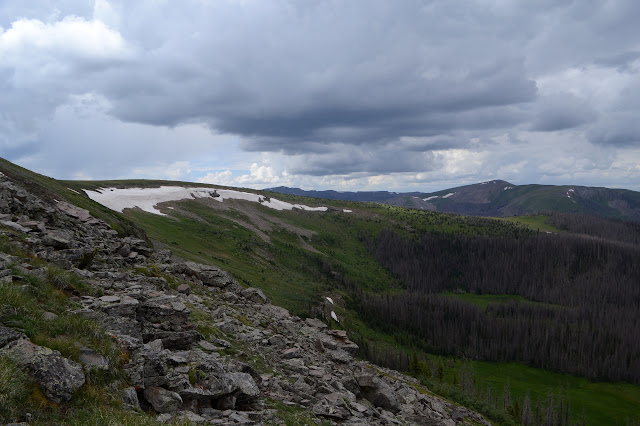
There are trees down on the trail but it is well established. Possibly by animals rather than people. At the top, there is a nice carved stick to say this is the Tie Hill Trail and some cut trees and a path to show the Highline Trail. The trees, still largely dead, end quickly to reveal the "Stairsteps".

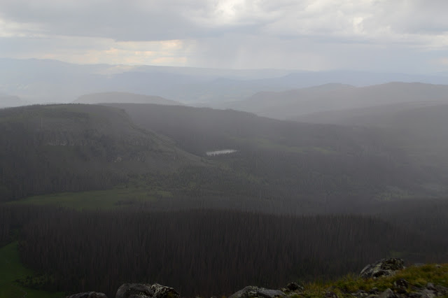
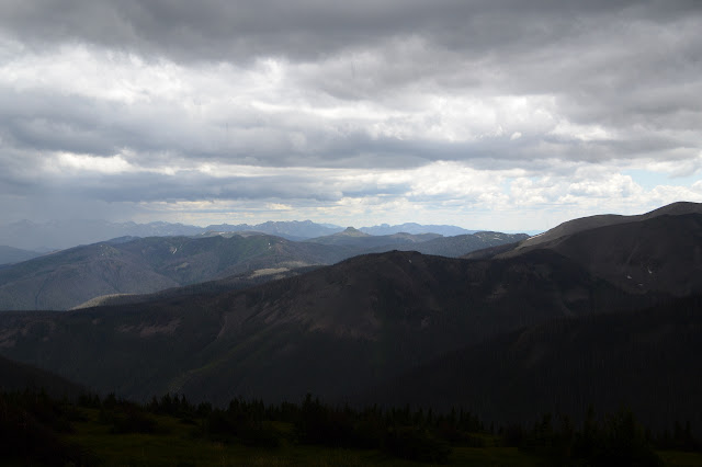
And a lot of new view. But it is already raining lightly.


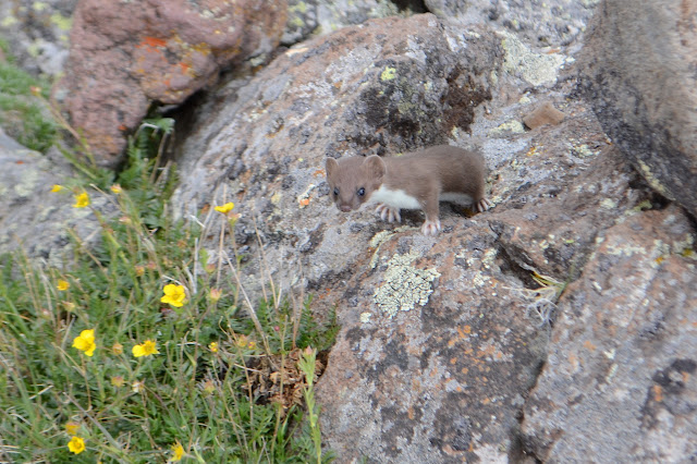
I expect marmots at the top. There's always marmots up this high. Probably some pikas. This time I get a curious little weasel. I don't think I've met these before. The ones up here are a little bit on the bold side.


I sit down a few feet past the first, shorter peak, to pull on some rain gear. I'm sure it's going to get to splashing down. I'm hungry too, so it is good to pull out a little food. It should help get me going faster. The trail has just about vanished in the high altitude grasses and flowers, but a series of cairns mark the expected way. It's not quite the same as having tread underfoot.


There are rumbles now. When I can see a flash, there are 5 to 6 beats to the thunder. Also known as just over a mile. That's not far, but it's in the other direction to where I'm going.
There isn't really any indication of a trail junction near the top of the mountain. The cairns sort of curve sharply away from the peak and I sort of ignore them and go to the peak. A little higher, a little more view.
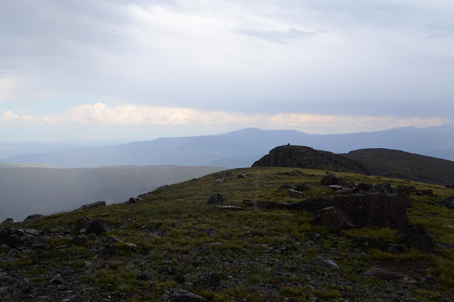

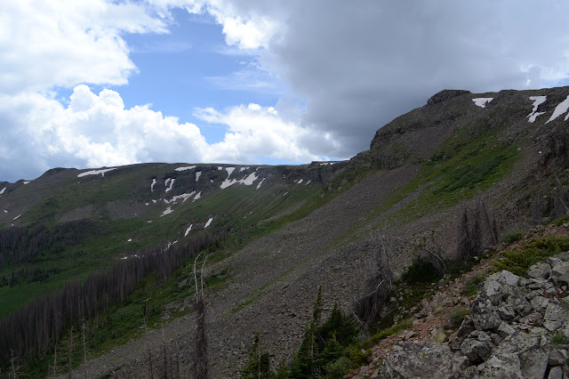
I clearly have not learned the respect for lightning that I should have, especially around such a wide, flat mountain. Having just found the benchmark, I turn my back to the rain to pull out the camera for a quick snap and in that instant a bolt of lightning comes down on that other peak just 0.8 miles away. That one in the picture above. It does look like a very attractive spot for lightning. Poking up and then the somewhat sharp edge of the dropoff. The bolt was a little wide of the peak, then curved around to touch it. The plasma it left made it look so very thick and huge from here. There should be some reference marks, but there will definitely be no search for them. Down. Off this mountain. Now.


I set off a little bit in the direction of the junction with the last bit of trail that takes Highline to the Continental Divide Trail and a little bit the way Kitty Creek should be going and soon note the line of cairns. It even has trail connecting them when I get to it. It is a trail that dips slightly below the top of the mountain and then follows the ridge before popping up over that ridge at a shoulder and finally dropping down to the very start of Kitty Creek. There is no wilderness sign on this side. The shoulder, though it was only covered in a very sparse bush sized tree, is now burned and that is where the wilderness sign should be.
Rather than throw electricity at me, the clouds choose to go with hail. It increases in size as I make my way along the ridge, nearly getting a centimeter across. It may be about the biggest hail I have seen and it stings right through the rain coat. What do I do if it goes to golf ball size? Baseball size? Maybe my backpack becomes an umbrella. (Worry not, say the Coloradans, that's a plains thing.) Stinging seems to be enough for now.


Disappointingly, the trail gets harder to follow as it drops down off the ridge and into Kitty Creek. There are some cairns that indicate a rather direct route downward that is becoming a creek bed, but the map confirms. It wants to follow those first vestiges of creek bed until there is a little water and then cross it in a spot full of potential to be soggy. Good grief, why am I following this? In the hope there's proper trail through the burn that I might not find if I don't get in on it at the start, probably.

There is trail, but it randomly vanishes completely. Someone has been through cutting trees since the fire, but the old tread does not always follow the new cuts. I find myself crossing a particularly soggy hill on a game trail instead of proper trail. There seems to be a stream every 5 feet and most are just wide enough to be a challenge to cross. Honestly, how can a sloped piece of land be this soggy? The map suggests the trail is above me, but I'm not seeing a way in the long, rain wet grass, fallen trees, and constant streams unless I follow some sort of trail and the animal trails are it. When I can get a little way up, there is clear trail again. Which I somehow missed before.

But that doesn't last. Eventually the trail gets out on much drier lands (except that they are just wet from rain) and is usually findable. The map promises an old logging road and it is there. This could be a long walk back to the closed road and down, but it should be shorter on the trail. I'm not going for it. Surely a trail with recent tree cuts will go through.

About a mile above the reservoir, I get to a spot on the map that is a thick blue line. Turns out, it is a ditch that feeds the reservoir from Kitty Creek. There is no bridge, but the reservoir is full at the moment and there is no flow either. The thing has obviously recently had maintenance too. Some sort of very all terrain vehicle came through from the creek to a spot where the water is basically allowed to drop and it accessed these spots away from any road via the trail. There is no way I can miss the trail now. The thing is, the vehicle is somewhat wider than the trail was and there are a lot of little alder crushed in its path. They splay every which way making finding footing hard. There is even one large alder along the way that this vehicle simply pushed over. A couple rows of boulders have been added to the end of the trail to keep the encourageables out, not that there are a lot of vehicles that could follow the path of this ditch digger.


It is a quick walk the rest of the way on the road back to the car. There are a few tents on the far side of the reservoir. It seems to be a somewhat popular spot for camping. Could have a bit of mosquitoes, I think.
©2019 Valerie Norton
Written 1 Sep 2019
Liked this? Interesting? Click the three bars at the top left for the menu to read more or subscribe!


Comments