Posts

Showing posts from October, 2019

Sandal Trail and the rest

Image
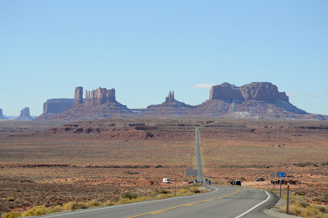
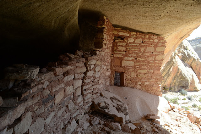
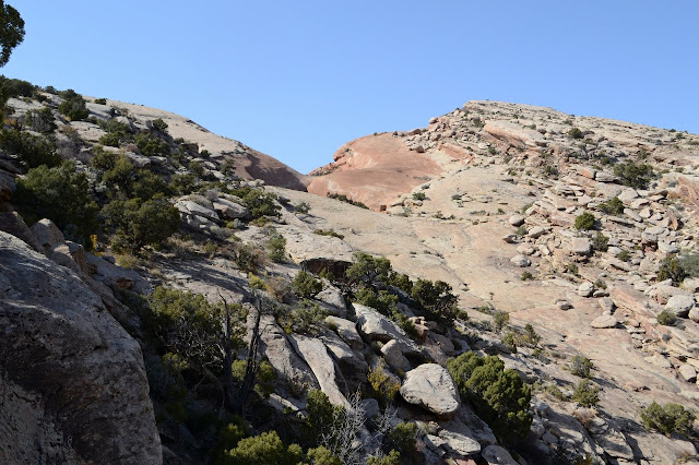
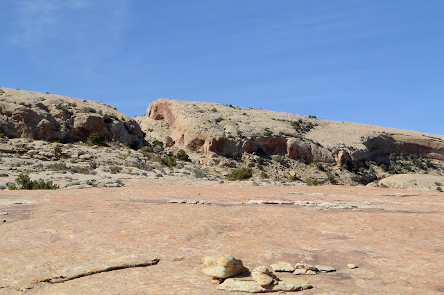
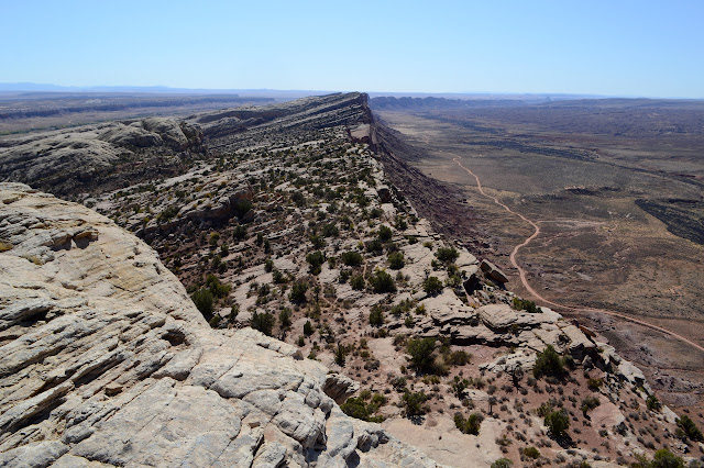
Navajo National Monument Click for map. Navajo National Monument was formed to protect well preserved cliff dwelling ruins and prides itself on being a free monument. That's not just a lack of entrance fee. The camping is free. The tours are free. Water is available and its free. The items in the visitor center shop aren't free and donations are happily accepted, so there is still a way to support them in some little way. Unfortunately for me, there is also a season. The seasonal rangers have gone and the snow fall last night has put an end to tours until spring. The actual land of the monument is just a couple of quarter quarter sections and you can't actually step foot on it without a tour. With the tours shut down, the only hiking is a few short trails around the visitor center. There is a longer trail to get to the further portion of the monument, but that is closed to entry when there are no tours on. I had time, so I set off to hike every inch I am allowed to

Tsegi Overlook

Image
Navajo Nation Rough location: 36.67588, -110.53802. I was debating stopping by the Navajo National Monument and decided, well, why not? It's only a few miles off the road. The landscape was getting very different, so I stopped for the overlook on the way. Besides, the snow on the red rocks can't be beat. The overlook comes with a pair of interpretive signs, but the one I find interesting is the one about how the climatic zones found going up mountains are reversed here and found going down into the canyons. The sign about climatic zones. Not that one can really see these changes in vegetation without descending down into the canyon. I believe that requires a permit in the general area and can't be done here. The canyon is closed to hiking. Still very pretty to look at. Looking out over the canyon. A more encompassing view of the canyons. Funny to see how the snow settles in and around the pines. ©2019 Valerie Norton Written 9 Dec 2019

Monument Valley

Image
Navajo Nation Rough location: 37.102367, -109.98923. I had a bit of a scare at midnight when I heard plops of water on the roof. The sign says "impassible when wet" in rather big letters and with my rig, that will be more true than with most. I wasn't sure I'd be able to leave in the morning like I planned. I told myself that after so many months of dry, it couldn't possibly be enough water. I woke up to find that it was actually snow and, indeed, there's not enough of it to worry about. Judging by the cars coming from the south, it was bigger there. The monuments are all dusted with snow in Monument Valley. The Utah portion is littered with turnouts to pull aside and look about. The Arizona portion is a little less accommodating. Careful along the bit where Forrest Gump decided he was done running. There were two out to run that bit while I drove by and I expect it's an absurdly popular activity. It's even in that "101 Ways to Experience S

Even More Bears Ears Ruin Sites

Image
Bears Ears National Monument These are some particularly nice ruins (or at least that I particularly liked) that came up somewhere along one of the hikes presented. Or not. You never know, maybe I didn't actually post something. It seems out of character, but it might have happened. A little piece of my most favorite. Notice beside the door is a grinding area. I expect this is too small for a door for people. These are probably so nice because, well, you can't get to them. There are other forces at work, too. They had to be well built in the first place and it seems like being at just the right angle to the weather helps. The right hand ruin isn't so grand. But the left hand ruin is quite something.

Just One More Peak (and 3.5 More Canyons)

Image
Bears Ears National Monument Click for map. This is just one last hike to a space along Comb Ridge that I haven't been all that near yet. Like the last hike, I'm starting at an approximate location a certain number of miles from the highway to the south and just seeing what presents itself. It is suggested by a sketchy "map" of sorts. I'll also go and tag a peak or three that are marked (just as numbers) on Peakbagger and expect to stop by something marked on the map. Okay, so I'm not quite that undirected. There is a trail near the parking. There is always a trail. Well, there's always something to find. That could be said to be an oversimplified summary of why the place was made into a monument. A well used track crossing the wash and leading into the rocks. There's actually lots of trails and nothing presents itself overly much. So it goes. There's no markings at all to what "speaks" to me. Well, that's no reason t

Procession Points

Image
Bears Ears National Monument Click for map. I drove just a mile south of where I had been hiking to hike a little differently. I followed to roughly the mileage from the highway below that was indicated on the pullout that couple a couple weeks ago strongly suggested I should photograph to have for myself and now I'll just follow the trail that seems to present itself most. I might as well make some sort of use of this thing. I expect I'll then proceed to a couple peaks marked and named on Peakbagger as Procession Point and Little Procession Point. Little is taller than not Little. Go figure. There is another parking area a little further up absolutely full of cars that also might be the indicated spot. I'll ultimately explore two different canyons again. Anyway, this one does have a very distinct trail that does, in its way, present itself. Now that is quite a distinct trail. Animal trail like that that crosses it seems to run along the length of the wash on

Monarch Point

Image
Bears Ears National Monument Click for map. Today is another day for peak bagging, but there may be other goals along the way. The name of the peak may even be a clue. There's actually a couple peak goals, but I decided to break it up into different hikes with the usual checking out one canyon on the way up and a second on the way down. This one starts off not just on trail, but with an official trail marker! There can still be a challenge to follow it among all the other trails. Most of the challenge is in the wash. Once on the rock, there's a clear trail of cairns going right into the canyon I'm aiming at for the climb. Marked trail. The trees may look a little funny, but that's because they are growing from a level about 20 feet lower. A cairn to at least suggest a way to those who pass. Just a shallow canyon at first and even with some fall colors remaining. The trail finishes under a magnificent waterfall, at least I'm sure it would

Sand Island Petroglyph Panel

Image
Montecello BLM Rough location: 37.26215, -109.61783. This panel is located next to the Sand Island Campground. It is quite large and diverse but has a long history of more recent visitors "adding" to it. It is currently behind fencing to try to prevent further destruction. I visited it after a visit to the Bluff Library (which leaves its WiFi on all the time but is only open for the afternoon of Tuesday and Thursday) and a little meander around the Bluff Fort (which is just a square of houses without a main wall, not a fort, but they are generally furnished by the descendants of the people who lived in them). It was just past sunset when I got there, so everything is guaranteed to be in shadow and darkening. Turns out, it can take a while to look at a large panel. I only took a few photos of some details. Whole herds of goats to be found. Lots of contrast in editing used to really bring them out. A nice old female figure. I picked it out to be my favorite for the

Bears Backbone

Image
Bears Ears National Monument Click for map. It may be called Comb Ridge now, but I heard a rumor that there are bear bits all over and this is the Bear's Backbone. An article from a Salt Lake paper from when it became a monument calls it nature's backbone. Whatever, I can see the vertebrae easily and not so much the teeth of a comb. There's even redder cartilage between the white bone peaks. Today's plan is simply to wander around those bones ending up at something marked on the map. No driving, just set out from camp and see what there is to see. I picked out a canyon to start with a bit north of camp simply because it has a vast overhang. For ruins, it's probably just a bit too obvious and won't have any. But it feels so attractive, I must go and see. That overhang out there is my target. There are heavily used trails crossing the wash near the tree with parking in the turnout and along a short road just past that. The canyon is a bit to the nor

Tooth Benchmark

Image
Bears Ears National Monument Click for map. Time for some peakbagging, or as near as can be had along Comb Ridge. About halfway along where it ripples, there is a benchmark. The "peak" has only very nearly 400 feet of prominence and a few miles north, the ridge starts hitting some higher points. But it is the high point for a while and those points don't have benchmarks. To get there, I just picked a canyon and parked near the bottom of it. Morning from my new campsite in Butler Wash, about 6 or 7 miles south of the hike. Getting started. I parked at the first spot along the road. While these side roads are usually fine, I don't feel like risking it. This one gets down into the wash and stops. So much for fall colors. Three nights in the mid to low teens and a brisk wind has taken the green leaves off. The road drops into the wash and trail climbs back out the other side. It's a well used trail. It has its own destination and then the ca

Above Mule Canyon

Image
Utah School Trust Lands Bears Ears National Monument Click for map. I decided to explore three roads to nowhere that leave the highway at gates and get to spots out above Mule Canyon and its larger tributaries. They're all rough for my little car. The first, just slightly east of the Mule Canyon Roadside Ruin, is part of the School Trust Lands rather than the monument. Rules are pretty much the same with motorized travel allowed on existing roads and camping allowed and so much as disturbing cultural artifacts illegal. Signs at the second gate explain the broad rules. A bit of mountain with a line of canyon just visible somewhere between here and there. Also a few of the people waiting on the highway for the flagman because there is a lot of road construction on at the moment. It isn't that far in that they feel the road isn't good enough for low clearance or longer vehicles. There is a big lot next to yet another drill hole. (This one has no writing

follow by email