Bears Backbone
Bears Ears National Monument
Click for map.
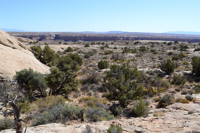
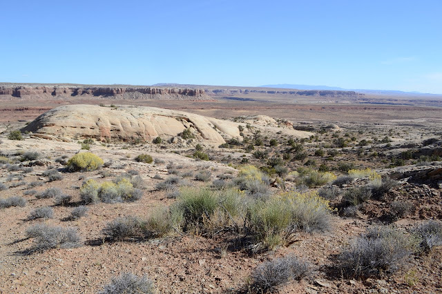
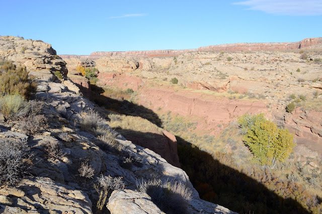
It may be called Comb Ridge now, but I heard a rumor that there are bear bits all over and this is the Bear's Backbone. An article from a Salt Lake paper from when it became a monument calls it nature's backbone. Whatever, I can see the vertebrae easily and not so much the teeth of a comb. There's even redder cartilage between the white bone peaks. Today's plan is simply to wander around those bones ending up at something marked on the map. No driving, just set out from camp and see what there is to see. I picked out a canyon to start with a bit north of camp simply because it has a vast overhang. For ruins, it's probably just a bit too obvious and won't have any. But it feels so attractive, I must go and see.

The canyon is a bit to the north, but I cross at a well used crossing beside a tree. Trails go generally directly up and a little to the south, but some lesser trails go north. Either way, I get out onto the rocks where there's pretty free movement north and south along a section where the canyons cutting into the wash tend to be very shallow. There also seem to be cow trails through the sage brush lower down. Diagonally toward the overhang seems the most reasonable although I know the lower section of canyons sometimes have ruins, too, because I've seen them there on other canyons.


Since I have gone diagonally, I'm no longer at the easier entry point for the canyon when I get to it. Instead, there is a steep and broken rock a long way down into it. There does seem to be a couple routes, but once I'm tumbling down one of them, I think there's not much to recommend it. Some parts are a little too steep, some a little too precarious. Only a few rocks have moved under me in unpleasant ways by the time I have landed in the stream bed below.

There was definitely nothing of a ruin bent under the overhang visible from above when it was all very much laid out for me. From below, anything could be going on up there.


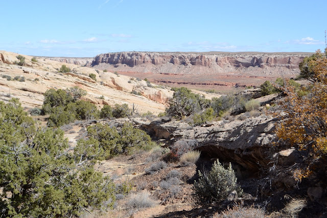
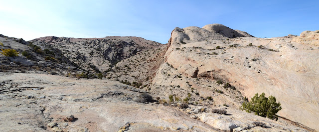
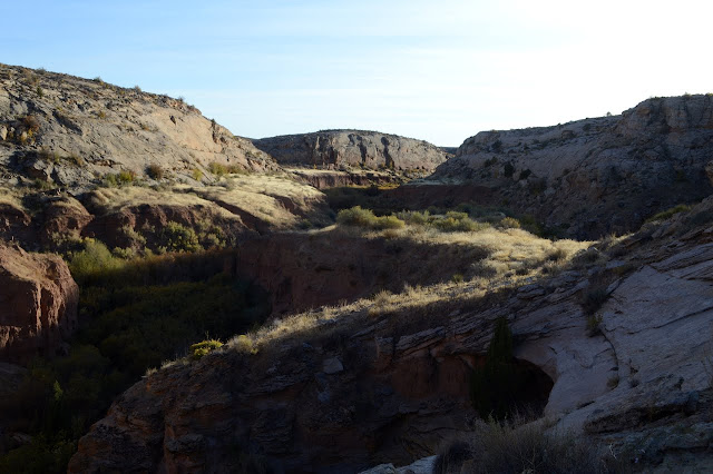
The canyons down here are shorter than the ones to the north and it isn't all that long before I am coming out into the cartilage and thinking about how to get past the vertebra to wander down the next canyon.


I make my way up along a layer until there is a break I can use to get to the next. Ever upward until there is finally a way around into the top areas. No one has gone and added the peaks around here on Peakbagger, so I can more easily leave those tops alone. (Of course, I could "fix" that, but I won't in this case.) Instead, I stick to the lower sections where there are hills and gardens.


Getting across the top, the wander through the layers is repeated in reverse. I follow along one until I can move to the next with a particularly layer as my interim goal. That one being the one that seems to connect to itself and thus really starts the canyon down. The north edge seems easier with wider rocks and smoother sidewalks and fewer layers to traverse.

Somehow although traversing the top is more difficult, it is going down the canyon that causes me the most worry. It is simply that maybe there is a sudden drop with no way around it. I shouldn't even be concerned along here since I could just turn and continue on to another canyon, but I still get more confident as the canyon develops a trail from the other visitors.

A side canyon catches my attention. It's only a little way, so I go up and look. It, too, rises to a top and then there is more canyon heading down the other side. Also some footprints but not much trail. Since I'm working my way south, I backtrack and head out the canyon I started in.


Once out the bottom, it is time for another pair of canyons, so back out across the rocks. Now they seem to be trying to gather smaller rocks and dirt across the barren flats.

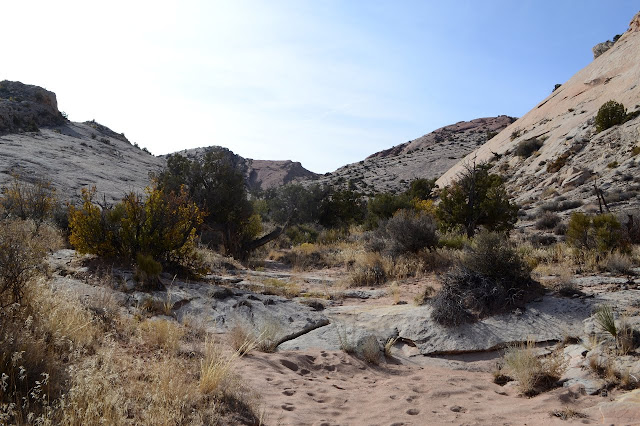
This canyon is one of the ones the people parking below have been going for, so there's plenty of trail in it along with plenty of footprints. Both dissipate a bit as I go up.

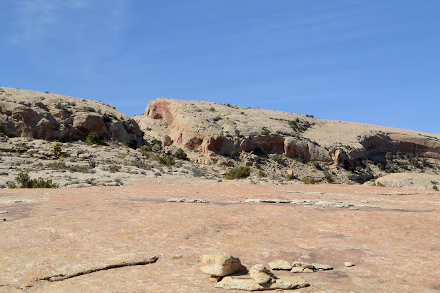
I tend to the right to be climbing for the top but once climbed, it looks like I may have overdone it and could have stayed low on this one.

Or maybe I didn't go up far enough as I follow a small wash down the top. The lines on the map have me worried about if I go directly to the canyon, so I make my way down the dip at the top to an entry point that looks safer. There always seems to be another spot to poke around along the way.


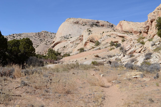
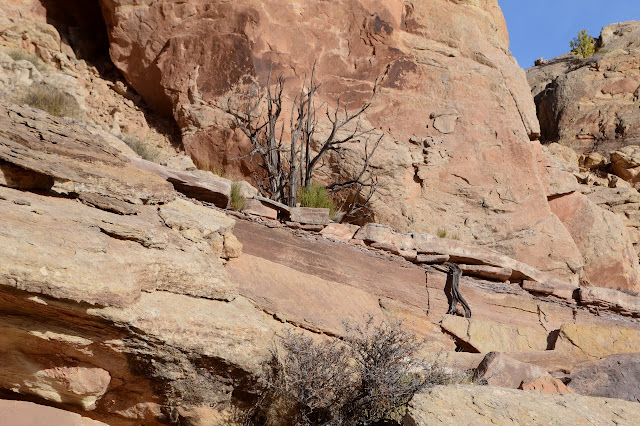
Once in the canyon again, I head up. There's not so much evidence of people, but one left a mark in 1929. The survey markers are from all different eras around here.

There is a lot of cliff by the spot I was wary of, but there is also a slide that looks like I could walk it. It's all quite random.

It's getting late and I meant to be going up the next canyon which would put me going down the one I plan to be my final canyon. This is one with a long arm swinging out to Butler Wash for the crossing and return whereas most look like they'll sort of drop when they get to the wash. I head up the side while the canyon will let me and over the top to the next one south.


So I go up this one last canyon, at least a little bit. There aren't really trails here, but there are footsteps.

The character of the shapes of the rocks is changing as I go south. Variations on a theme, certainly, but distinct variations. Are the rocks harder? It comes down to the shorter canyons? Just blind luck with where the raindrops fell? I round the top to the final canyon.


Then I start to wonder if maybe this one might end in a waterfall too. Maybe there won't be a way down and across. But then I can just trot back up along the lower rocks to the original crossing, although I'll try a little lower first.


It is a waterfall. Well, it would be. Give it a few days, the tiny clouds have ripples in them. That's supposed to mean storm, except that there's so little of it.

I head downstream along the top of the cliffs to where I think there should be a trail. There is and it comes halfway up this side of the cliff. Which is just short of where I am. There's people on it and since they have the better vantage point to the cliff, I go ahead and ask them. They point to a best case scenario and their eyesight is good. It is a way down to their level. I get to explore what they are exploring.
And once I find the trail up, I can get back to the road and my camp. It takes a bit of doing and a bit of faith, but there are some cairns to help.

Along the way...

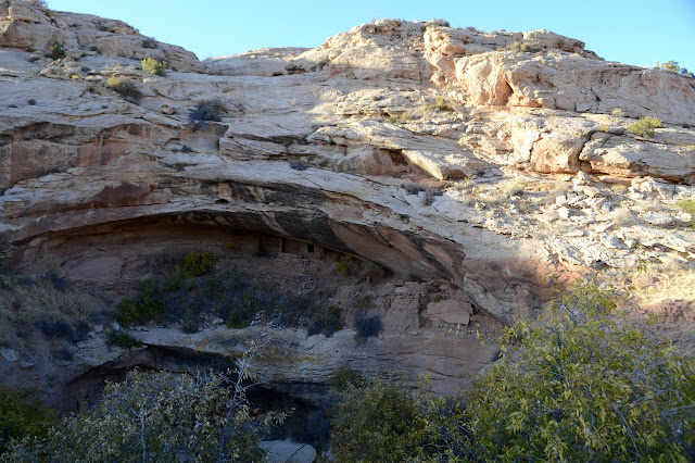

*photo album*
©2019 Valerie Norton
Written 24 Nov 2019
Liked this? Interesting? Click the three bars at the top left for the menu to read more or subscribe!


Comments