Butler Wash Ruins Overlook
Bears Ears National Monument
Click for map.
This particular "road side ruin" is not quite at the road side, but requires a half mile hike with a little up and down. There is a bench about halfway along and little signs to help learn about the plants along the way. It finishes with an overlook of a ruin site. Fees for Bears Ears, which apply to hiking only, are pretty minimal even once they roughly double at the start of 2020, but don't apply to a few "developed areas" such as this one. It seems like a good idea to steer people toward a few sites where they can get a taste and move on if that's what they're looking for, or have a better chance to read the signs about proper ruin etiquette if they're out to stay longer. Fingerprints can be damaging and footprints downright destructive, after all. There is even a toilet so visitors don't go messing up the delicate desert.


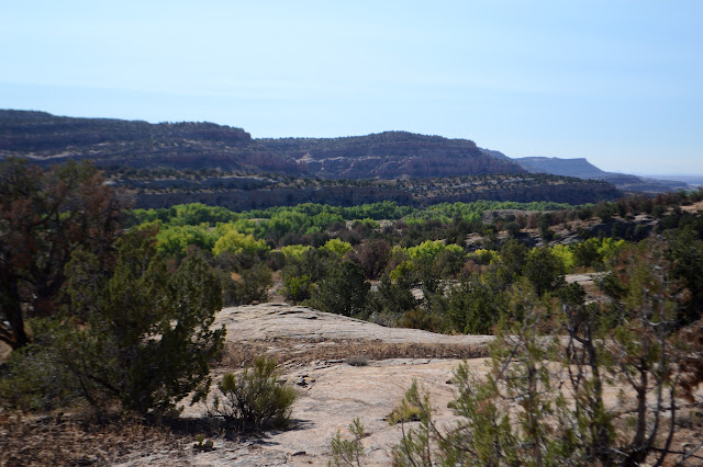
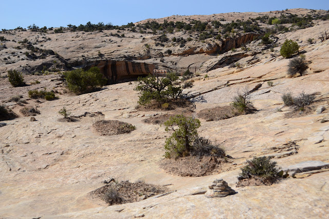
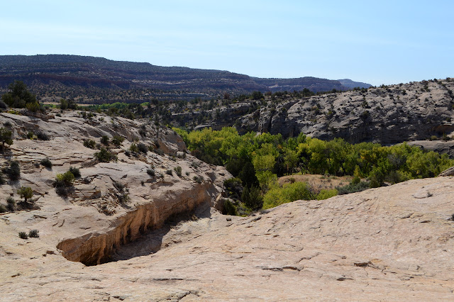
I walk the trail avoiding the biological crusts on either side at the start and the islands of crust out on the rocks as the trail finishes. Fencing and more signs edge the little box canyon where the ruins are found. There is no way from here down into the site, but they are quite visible from the position above.


I move over to a more southerly viewpoint without the protections of the main one and ponder that the lower, larger alcove is empty, but there could be a number of reasons for that. It might have been more vulnerable to floods. It might not even have been there. The sign says, "The current deep wash is a result of an erosional cycle which started in the 1890's." What does the suffix -al denote, anyway?


I head back. I'm actually out to find Posey's Trail today.
©2019 Valerie Norton
Written 29 Oct 2019
Liked this? Interesting? Click the three bars at the top left for the menu to read more or subscribe!


Comments