Just One More Peak (and 3.5 More Canyons)
Bears Ears National Monument
Click for map.
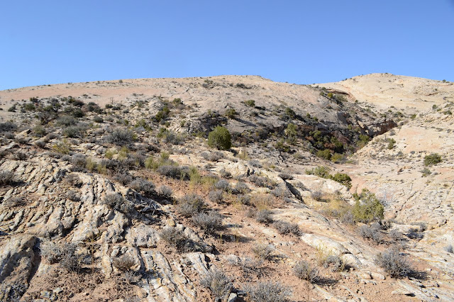
This is just one last hike to a space along Comb Ridge that I haven't been all that near yet. Like the last hike, I'm starting at an approximate location a certain number of miles from the highway to the south and just seeing what presents itself. It is suggested by a sketchy "map" of sorts. I'll also go and tag a peak or three that are marked (just as numbers) on Peakbagger and expect to stop by something marked on the map. Okay, so I'm not quite that undirected. There is a trail near the parking. There is always a trail. Well, there's always something to find. That could be said to be an oversimplified summary of why the place was made into a monument.

There's actually lots of trails and nothing presents itself overly much. So it goes. There's no markings at all to what "speaks" to me. Well, that's no reason to ignore it. It's not the canyon the map has marked. I look back to see I am being followed. They look confident, but then I'm striding along confidently and they have me to follow. And it's confidence inspiring to have people confidently following. It's very circular.

One follower almost catches up when the canyon tosses in a minor challenge. A narrow section with brush stuffing it has trail up on the side, but that necessitates dropping down a slightly high ledge to get back to the bottom. This guy sees me stretching out to drop and turns back. I was only stretching out to a broken rock below. I didn't even have to jump. Much.

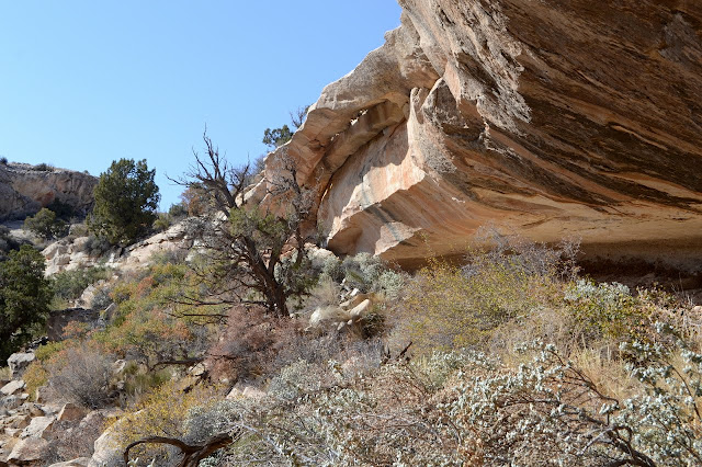
My followers are unimpressed with the minor natural bridge at the edge of the cave. They were looking for something else, but I can point them toward something like that, too. The crumbled rocks have made a usable path up the ledge next to the bridge and so we climb up. I fail to tell them about all the stacked up lines between here and where they want to go as I take off full of confidence and totally different goals. They'll find a way. It'll be fun. For me, it's hills with ledges at the end and more hills. The ledges aren't quite so short and I can't just stretch down, but I find a way.
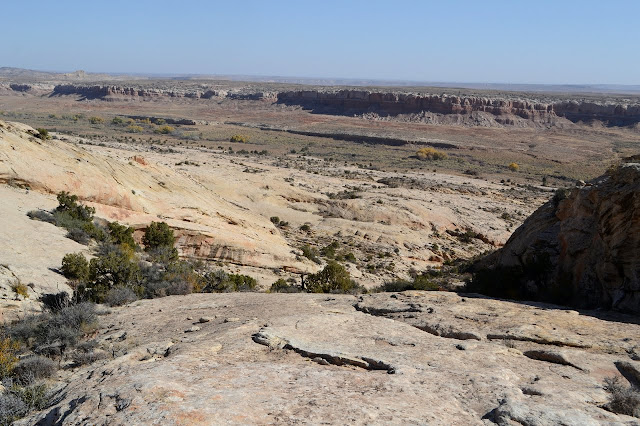


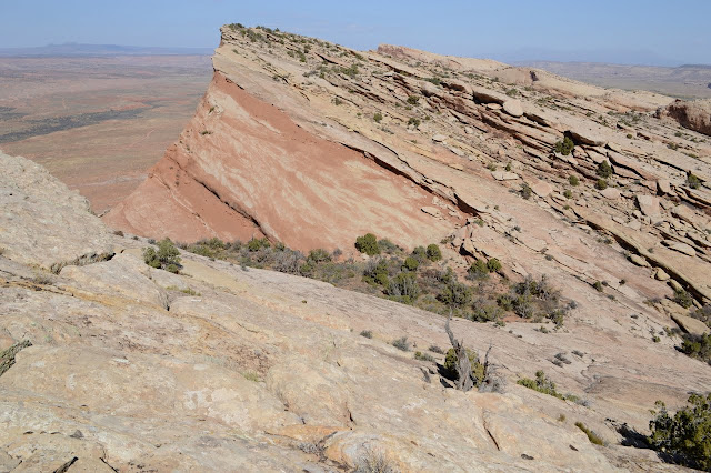
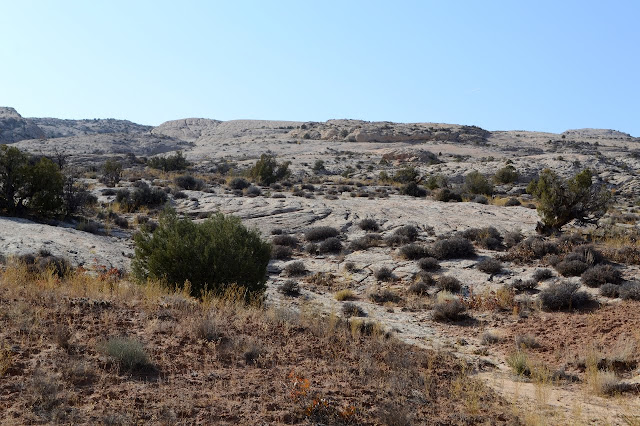
It's a little friction climb to the top that isn't too steep. There's some chemistry going on with the rocks and the water in this area and they run with colors down below. I wouldn't even know it if I hadn't tagged the peak, since it is all going on down in Comb Wash. I wonder how noticeable it is down there. It's stark from up here.

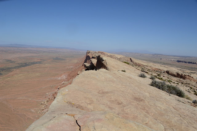

The peak is wide with a few spots that might be the highest bit. I wander along them all. Might as well be sure.

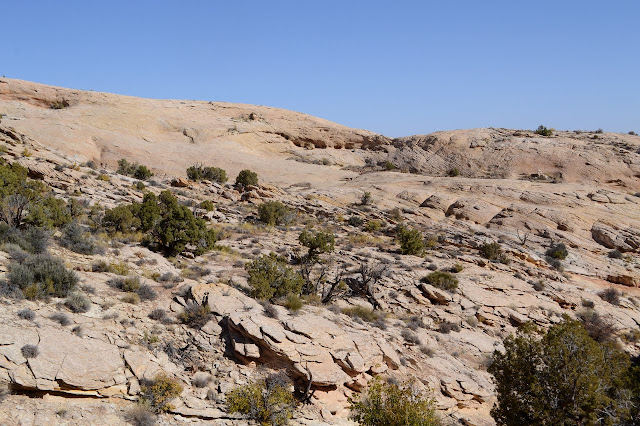
The bowl at the top is broken up and takes some attention, but canyon is easy at first. The only footprints are very recent: my erstwhile followers. Otherwise, people don't seem to like coming up here. It might be the waterfalls. There are two mildly challenging obstacles. A thin trail marks the way around, but there probably isn't much use.


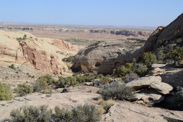
Trail below there is quite massive. Lots of people come here. As it joins with another canyon, someone has put a stick across it. They feel this is the wrong way. I go ahead and head up the other canyon. This one is without obstacles, at least of that sort, to the top. Just big, wonderful overhangs. Sometimes I stand where the water now flows and look up to find rock.

Eventually the canyon gives way to a bowl up at the top. Where the one from the south canyon is broken up and difficult, this one is a smooth and gentle rise for me to wander.

And once nearing the top of the canyon and access to another, I might as well start down a new one. There are a couple numbered peaks on Peakbagger, but I'm skipping them. There are moments when I think maybe I shouldn't have, but they pass quickly.

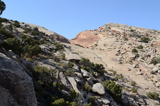
A patch of bright rock caught my eye above. It is a sign that these canyons can have their violent moments. There have not been many such signs, so I wonder how old it might actually be. There is human trail beneath the rocks, but more telling are the pieces of torn up juniper. They are still green. This probably happened just this year. Other than that, the canyon is as easy going as it gets.

I'm a bit further than I planned to be. I only was out for two more canyons but got distracted by that first one. Now I have to make my way back to the car. The game trail following the wash is tempting at first, but I soon opt for the rocks instead. I'm just starting to feel like I might be getting the eyes to see the ruins and such. I still pondered one with uncertainty, but I also looked up at one time to note a petroglyph just out of reach and along my way back, there is a pottery shard. It could almost be rock, but it has such perfectly parallel curved sides. It looks a bit like there might have been organic matter placed within the clay like adobe. It washed there from somewhere above and will likely wash further eventually.

A little bit after the shard is another artifact, but I'm not so excited by it. The rusty old can probably has its own story to tell, though.
This route passed by a small site and a large site that was fenced off. The fencing was not to keep people out, just control their movement as it has an entry in the east side. It keeps cows out if there are any. I'm a little confused by it because once people have entered the fenced area, they seem to be pushed into paths that may not be good for the site, specifically crossing the kiva with a roof beam intact.


©2019 Valerie Norton
Written 4 Dec 2019
Liked this? Interesting? Click the three bars at the top left for the menu to read more or subscribe!


Comments