Ridge Top Adventure above Butler Wash
Bears Ears National Monument
Click for map.
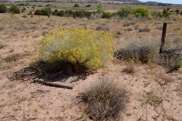
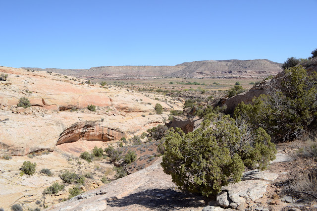
Now I've done it. I've gotten me started on hiking instead of traveling down to Bluff. Anyway, they're short, so surely I have time for another before starting down to be there before the library closes. Which I have no idea when is. Anyway, I eyeballed a side road that seemed to be below something marked on OpenStreetMap and then pulled in one too soon. It goes to a pipe. I almost hiked from there, but decided to continue on slightly to park between a camper and the drop to the wash. The road continues but I wasn't going to. It looks like one person thought they might, then turned back once they actually saw it. Past the wash, there are old ATV tracks and footprints briefly, but nothing else. The road also goes to a pipe. A lot of these roads seem to do that. I expect oil exploration is what drove these roads getting built in the first place. Now they are trailheads and dispersed campsites. Past the pipe the road makes a big loop around an illegal campfire ring. Past that, there's a trail.


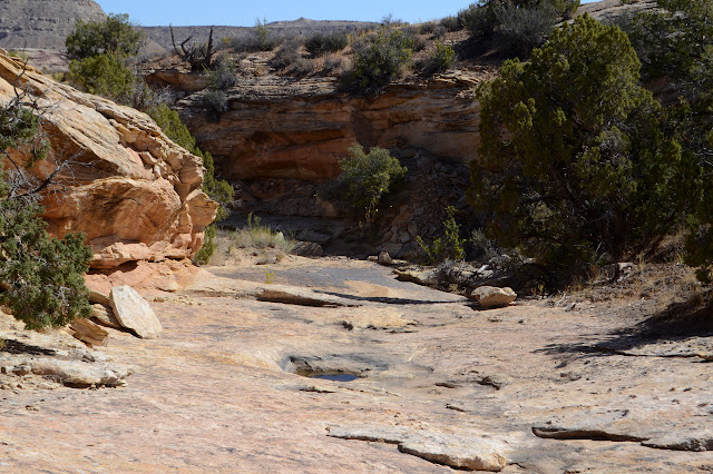
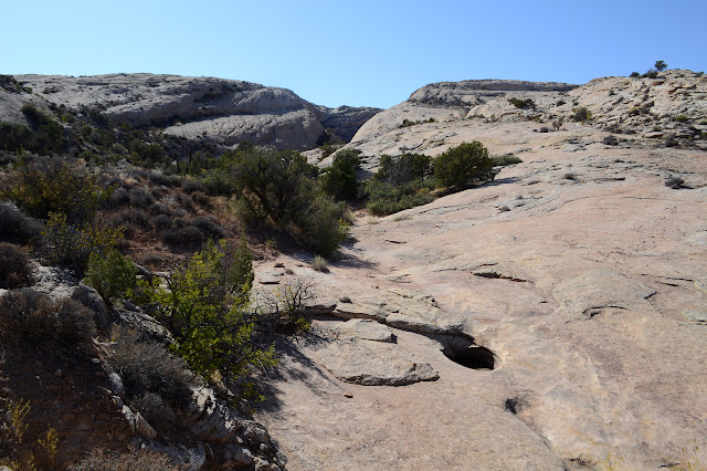
The trail seems to go up into the rocks, but traces quickly vanish. There's another down in the canyon, so I make my way there to continue toward the ridge. It looks well used. And then there is the true treasure: water! The potholes in this canyon are very nearly full. Well, some of them.
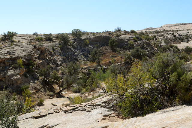
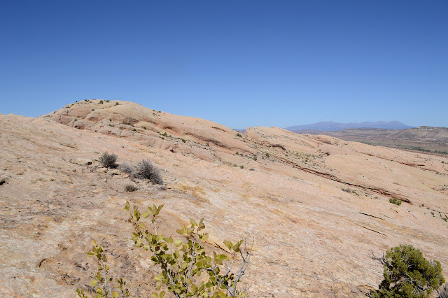
The trail seems to leave the canyon again to the left, so I follow it along. The rock is like a wide sidewalk as it climbs higher and higher with only occasional wide grey lines through the soil crusts to mark the route. The one below had no footprints and the one over the rocks is not even marked with cairns, but both show that humans have been here often.
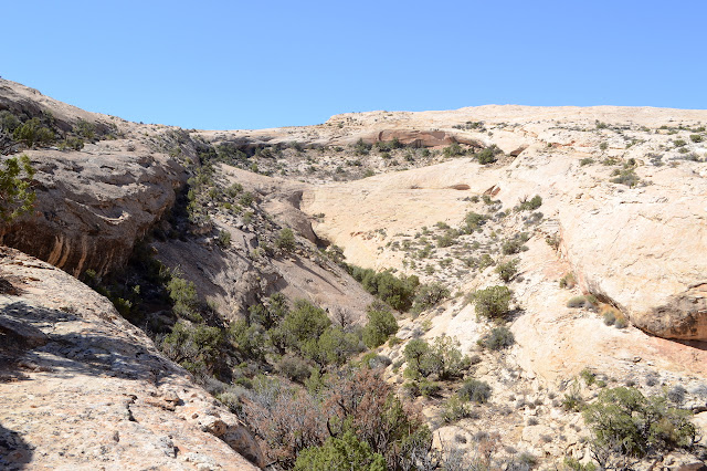

As I go higher, the possible travel space grows. Now would be a good time for cairns, but there are still none. And yet, I almost think I can see a line of disturbed sandstone. Anyway, it doesn't really matter because I do have a destination to go after. The upper sections of the rock do look a little difficult to navigate. They seem to rise and fall into a collection of sandstone hills and dirt pools.


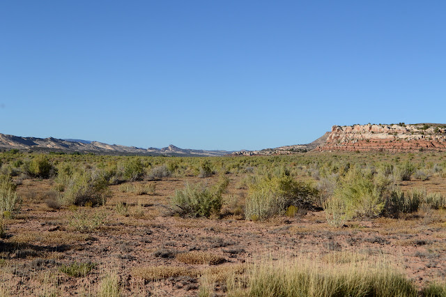
I make my way to an apparent high point to try to see better what is going on and how I might get south to the next canyon... or maybe it is actually the one after that. Anyway, I intend to get to the south. The climb is a bit of extra energy expended as I need to use much lower routes to move that way. At least I can see that for certain from above. I try to get to the edge, but it requires difficult navigation through patches of garden and is also extra energy. It is hot up here, too. It might be 30°F in the morning, but it gets to the mid 80s in the afternoon. I knew there might be as much as a 50 F° difference in a dry climate, but this is a little more than even that.


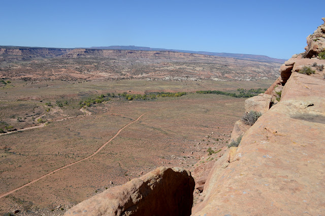
The edge is its own reward. I sit on it for some lunch and to swap my water bag. I didn't start with much and just stuffed in another bag with maybe a liter in it. I finished the first one an hour ago, but kept on wanting to keep my feet going more than I wanted better access to water. I worry a little bit about it now. The hike is getting to be a lot longer than I expected and there is the heat. Still, there's more left than I have drunk. I should be halfway by now. It'll be fine.

I start again maneuvering south. There are so many different ways the rocks put obstacles in front of me to hinder my travel. It has been quite fun figuring out each one. It looks like I only have one more. If I can manage it, there is a very distinct trail below to follow back. I must be standing over a massive overhang because the map actually says I've gotten to what's marked on it, but I can't see it. All I can see is the massive drop that I won't be navigating. It all looks quite impossible until I finally see the long ramp on the far side. If there is a ramp like that on this side, I am set. Examine the layers. One is best. I pick it out and find it on my side and go for it. I need to get down a few layers. They form ledges often just a little too tall, but they also have broken spots where I can carefully get down. Then I am on the right ramp and have a sidewalk all the way down. Also, some unique views.


Once I am down, I can very nearly stick to the rocks all the way to the trail. No wonder it was so obvious, it is actually an old road. It goes up to the edge of the ridge at this low spot and stops abruptly. There's a pretty good view almost as good as the one I had with lunch.

I poke around a little. There are footsteps everywhere through the dirt. Then I start down. Across the dirt, the road is easy, but it hits large rock and there are no cairns. I just follow the most road like shaped bit of rock and it works perfectly. Not that there is any challenge to staying within the canyon up until the old road heads out.
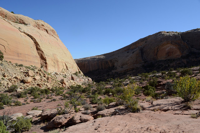

There is one more thing on the map to visit, so as the road heads out of the canyon, I look for another route. It is even better traveled than the one I have just come down, so not hard to find. Probably because this is a shorter canyon to explore. It has a metal fence lacking in a way through with signs that imply it should have a way through. Then the canyon turns absolutely lush.

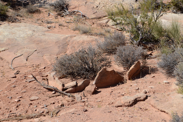
I keep coming to alcoves that look like they might be good spots until water comes to flood them out and thinking how smart folks were not to try to live there, then remembering that it might be a more recent carving by the creeks and if not if anyone had lived there the evidence would be erased by now. Here there is a massive overhang with nothing showing on the ground, but the roof has dark spots where no water could get. It looks like soot. Ooh, I expect an NMR Mouse could sort it out well. Then again, the contact might be undesirable. I wonder what quick tests people might have to sort out for certain if the black is carbon or just varnish. Chemistry would do it too. But the NMR might be able to see what is invisible to the eye. (To be honest, I tend to think NMR is the answer whatever the question. Well, not for particle physics.) How far into the rocks can the soot get?

The canyon goes further and the trail goes further. Some spots are wet enough to be slightly muddy. Around the corner is another item marked on the map and as far as the trail goes. I want to look around the other branches of the canyon, but there is only lush vegetation there and then my water runs out. I am standing in front of a rock that seems to be focusing the hot sun onto me and suddenly there is nothing more to quench my thirst. And, what, 2 miles to go back to the car? The feeling of thirst just rises and I scoot myself back into the moist and shaded cool, then out into that long sunny stretch back. At least it's basically flat. There is a little bit more old road back before the current parking and I somehow seem to follow it better than the current trail. No idea if that is a good thing or a bad thing, just that for a bit there aren't very many other footprints.

It's a dry march back on the road, but I've mostly kept myself hydrated so there's plenty of water to get back. There is yet another pipe along the side, this one marked "plugged and abandoned" among other things.

I get back and drink down half the water that I'd left in the car, about another liter. Unfortunately, it is now undoubtedly too late to be trying to some WiFi in town, and Bluff is a very small town. There is one more little thing I want to do.
A little of what may or may not be marked on the map.


©2019 Valerie Norton
Written 9 Nov 2019
Liked this? Interesting? Click the three bars at the top left for the menu to read more or subscribe!


Comments