Granite Mountain
Yuma BLM
Click for map.
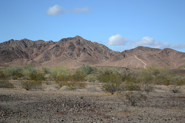
There's lots of Granite Mountains around and this one probably isn't a very impressive specimen. It certainly isn't as grand as the various other things I went after while I was here last. It's still an excellent excuse for a walk with a little challenge along the way. I could probably drive a bit closer, but then I would miss some small sites along the way and it's really too close to camp to bother with that. Anyway, it would only get the easy flat stuff out of the way and the sky is quite beautiful after the rain yesterday. Best to stretch the legs and enjoy it.


The first part is easy and flat and quick, but that is deceptive. As small as Granite is, it does have some foothills. Among the closest of these are some marked petroglyphs by a mine and a wash. The geocachers have helpfully pointed out some mortars on the far side of the wash and some fellow explorers point out the mine. Today the wash is running like a wide muddy river. I guess I could have got away without having to cross that, too, if I had driven around, but the petroglyphs and mine are on this side of it and the mortars and mountain are on that.


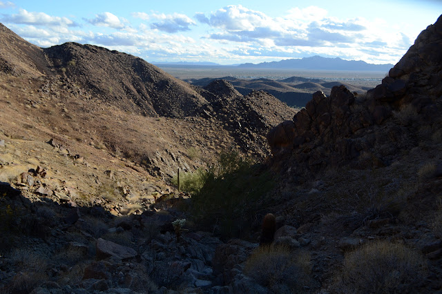
Then there's the hills and the peak still to go. I climb one hill and plot my approach. There's a ridge that looks like fun, so that will be it. It's rather blustery on the hill although it wasn't bad down in the flat. I'm not sure if it's the elevation or the wind is just picking up. The change corresponded with the climb and it lessens as I go down. I sure hope it isn't worse on the mountain than the hill.

So I get to climbing. At first it is easy. Roads go everywhere. Some are old mining roads, some are new ATV roads. There's no way to tell which is legal and which isn't and I doubt anyone cares. I can have an even easier time of it without so much up and down by taking even older trails that go even more places. But the mountain does not yield itself to anyone driving. The roads get up a little way and down again when the going gets too steep. It really is steep and loose and the wind is crazy. I decide to tend a bit more to my right to get out of it even though the mountain looks harder there. Oddly, once I am looking down at it all, it is clear I was directed well by the gale.


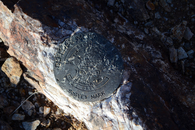
Once on the ridge, it is almost a stroll to the peak. I first turn the other way to grab a point and a geocache that takes way too long to find with no help from the wind making it feel dangerous to move. Then along the ridge to the top. There is practically a trail to help suggest ways around the spots with slight climbing. The top has a benchmark that seems excessively bruised considering it is only from 1987.


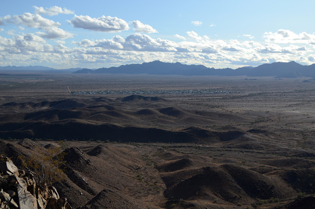
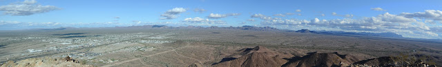
I ponder continuing the ridge. The mountain does appear to have a single major ridge running through it making a half moon and I've done the shorter part of it. Instead, I go down a gully that nearly comes to the top and is kind of going my way. It seems rocky and steep to look at, but it pretty solid going. I do have to avoid the palo verde that has established itself in the seem of the wash toward the top.
It's a fast way down, quickly leaving me with the smaller hills to navigate over or around. I get a bit of traffic, but it's the first of the day, so not too bad.


As the sun hides behind the taller mountains to the west and the light turns golden, I find myself paying a lot of attention to all the colors in the clouds. Quite a bit more than I'm giving over to walking. The roads, although a bit rough for my car, are still quite easy for inattentive walking.


I take a different way back. (To get more geocaches. What can I say? I like to hunt Easter eggs.) I am starting to worry about how I have not got to the wash yet and even hope that it is underground along this route. Then I hear it up ahead in the dark. It is a lot smaller now, or it is just this location. The spot is just as wide, the water clearer now, but but only a few inches deep. There even seems to be a series of stones, just a little far for comfortable steps, to cross it on. I really lean on my poles to balance as I go. They are so perfectly (if a little far) placed that someone must have thrown them out there. I feel like I've pulled off a little coup to get across with dry feet. The whole wash will just be puddles by tomorrow afternoon.
©2019,2020 Valerie Norton
Written 5 Jan 2020
Liked this? Interesting? Click the three bars at the top left for the menu to read more or subscribe!


Comments
My name is Vic Hanson, I'm retired and travel full time, love to hike and climb mountains. I'm also a member of Peakbagger, and a mostly inactive member of Summit Post, but I have a lot of stuff on there, most of it from when I lived in Peru for 6 years. I've seen your name in many summit registers as we climb a lot of the same peaks. I hike and climb alone most of the time but would love to meet up with others for climbs but due to my traveling schedule it rarely works out. I got your card out of a summit register box a few months ago, somewhere in SoCal. Anyway I don't know where you live, or if you would be interested but it would be nice to meet up sometime and do a climb or two. I'm at Quartzsite now and just did Granite Mountain. I went up a ridge on the SW side but came down the same gully you did, using your GPS track - Thanks!
I'm heading to Phoenix tomorrow and plan on spending a couple of weeks there, mostly in the Superstition Mountains and nearby.
Vic Hanson
vichansonperu@yahoo.com