Lenox Crater and Bonito Lava Flow
Sunset Crater National Monument
Click for map.
I generally don't think much of fee free days. They have the potential to be extra crowded, plenty of places cannot be seen in a day, and getting there costs more than the entry unless its practically in your backyard. (Even places with no entry fee in the first place see an uptick in visitation on fee free days because people do not realize that the majority of our National Parks, National Monuments, and National Recreation Areas are free to enter anyway.) However, there are a number of places that are rather small. Sunset Crater National Monument is slightly more than a postage stamp in size, but strictly prohibits off trail travel, so a few hours can be a leisurely visit. The $25 entry fee gets you into neighboring Wupatki National Monument as well, but is still on the high side. Noting that the last of this year's five fee free days was coming up, I decided to just take on the crowds. The visitor center seemed mildly busy, but there aren't all that many people out today. I stopped at the Lava Flow Trail set to hike every trail in the monument except Lava's Edge that parallels the road.
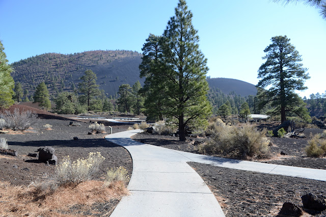
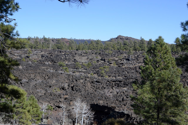
Lava Flow Trail has a number of loops, one of which is paved and very suitable for wheelchairs. They circle through the cinders and the Bonito Lava Flow at the base of Sunset Crater. Interpretive signs are scattered throughout and even more numbered signs that need a brochure can be found. Among the signs is the fact that Sunset Crater is only 1000 years old. That puts the area very much in the "active" category. The previous eruption buried numerous pit houses, but not without warning. Most possessions and even roof beams were carried off before it hit.


Branching off the paved trail, with little indication it is official, is cinder trail. It is shown on the map at the sign at the start of the trail and described as a "0.75 mile loop over cinders, through lava clinkers, and near a splatter cone."


It is no longer legal to hike up Sunset Crater itself. The old trail has left a lasting scar on the young cinder cone. I would like to go. There's a benchmark up there and everything. But I'll stay right down here at the base wandering the lava flow instead.


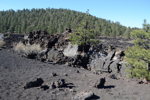
The trail circles around to a staircase to climb back to the higher level of the lava flow. It's warm as I climb it although nowhere else was. The heated black rocks are radiating the heat of the sunlight they have greedily sucked in.


I follow it back to the start, then head over to the other side of the parking lot. There are a few more cars now. Bonito Vista Trail starts at the far side. This is another accessible trail and only goes on for 0.3 miles round trip, but it packs in a lot of crazy lava shapes on the way.


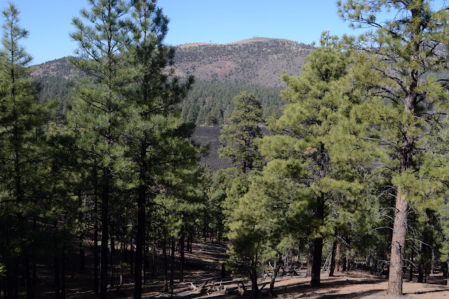
The Lenox Crater Trail (or at least its east trailhead) leaves off the side of Bonito Vista Trail. This is really just a connector over to the loop that climbs the older cinder cone.

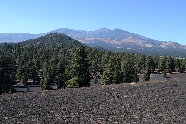
I turn left at the split although it seems to be trying to get me to take the loop in the opposite direction. This is the monument's hardest trail, so they call it strenuous. It is 1.6 miles with 200 feet of gain. I climb the rather pleasant "steep grades" under the cover of pines.


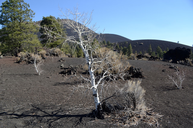
The trail comes within 20 feet of the very highest point of the peak and stops to say a little something about the surrounding volcanoes. There are more than 600 that have popped up in the last 6 million years or so. The trees are more dense where it is cooler and water stays just a little bit longer. This is noticeable within the crater and down the north side as I find it harder to look out at the surrounding landscape. I keep trying to find a spot I can photograph the stunning black cinder hills north of Sunset Crater, but I just can't find the spot. I can only "see" them because of the way the brain pulls together a whole picture over time, but there is no spot for the camera to see them.

The western trailhead for Lenox Crater is across the street from the A'a Trail. This has a second, smaller parking area without facilities. The A'a Trail is a 0.2 mile loop among the lava to point out additional features. This is also the eastern trailhead for Lava's Edge Trail, which continues to the visitor center. I hop across the road to take A'a Trail, although from what little I can see of Lava's Edge, I might be missing something by letting it be.


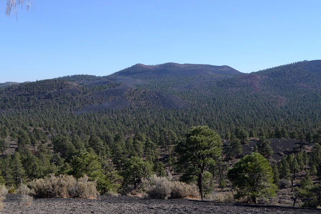
Then I head back across the road and along the final little bit of Lenox Crater Trail. The trails are done except for Lava's Edge. There is a viewpoint on the far east side of the monument and the other side of Sunset Crater where I make one more stop. It includes signs discussing the impact of traffic on the younger volcanoes. To the west is Sunset Crater with its closed trail no longer visible. To the south is an off road vehicle area of Coconino National Forest. Most of the time that means you can use your vehicles on a network of rough roads, but the users interpret it to mean they can go anywhere. I have not checked to see what it means here, but it is functionally the second. The cinders to the south show many romps by vehicle to their tops, but it is not really a good comparison. A good comparison would be to those black hills north of Sunset Crater which are so stunning in their little touched state.


And thus my time at Sunset Crater National Monument is over.
©2019 Valerie Norton
Written 20 Dec 2019
Liked this? Interesting? Click the three bars at the top left for the menu to read more or subscribe!


Comments