Lizards Mouth Rock
Los Padres National Forest
Click for map.
I popped around to Santa Barbara and visited Bernard, who was skipping the holidays for the Wednesday night hikes, but out for the very short Lizards Mouth hike for the weekend. We hiked a mile extra along Camino Cielo on the way in and got that shortened for the way out. That meant passing the Playground, which wasn't so busy, before getting to the rock, which was bustling and humming with all the folks out for the last weekend of the year.


I take the first trail into the exposed rocks around Lizards Mouth, which means a fair bit more traveling cross country and scrambling than is strictly required to get there. There are trails everywhere and often I seem to take the lesser ones. I pass three or four groups both wandering and settled among the lower rocks.


The group I'm with is settled down a bit from the top, but I decide I'll grab this "peak". It's on Peakbagger after all. I'm pretty sure I did before, but apparently I didn't claim it. There's another group just a few feet from the top, but if they shouldn't have taken the prime real estate if they didn't want brief visitors.
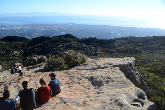
There's a little bit more to see from the top. Some things are even hidden just twenty feet down.


We head out via a well used trail that today has a lot of water running along it. It's still not so difficult to keep the feet dry. This is a short way to the road without so many rocks to scramble up and down. Turns out, there's even a sign for the place if one enters at the right spot.

And then we're off again.
©2019,2020 Valerie Norton
Written 24 Jan 2020
Liked this? Interesting? Click the three bars at the top left for the menu to read more or subscribe!


Comments