Ecological Staircase to the Pygmy Forest
Jug Handle State Natural Preserve
Click for map.
I noticed an Earthcache that looked interesting as it asks for study of an area with some unusual geology. The marine floor has been uplifted without tilting slowly over time resulting in terraces. Leaching processes slowly change the nature of the soil so that it supports different plant communities as it ages. Up the hill, where it is oldest, the soil is so bad that the forest that grows upon it is severely stunted. There's no fee to stop and see. Brochures for the interpretive trail are available at the trailhead or can be downloaded. It says, "Welcome to the Jug Handle State Natural Reserve. You are standing on one of the most interesting geological areas in the northern hemisphere. Here, time, geological forces and climate have all interacted to form a staircase of distinct plant communities and associated soils, culminating in the unique Pygmy Forest." Alright then.

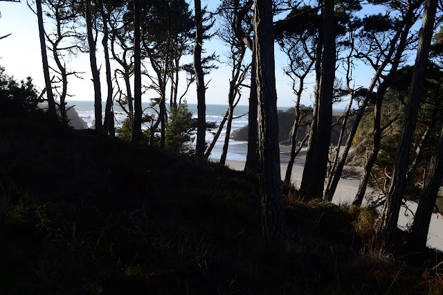
The trail first swings out over the current lowest terrace to look out over the next one developing under the waves. I ponder the eroding cliff side and how this couldn't be a slow, constant process. The first couple stops have lost their numbers, but the information is general to the area. It points out that this first terrace formed in one go, but not how. Sea level fall or a rather large upward jump in some earthquake are possible. It mentions each terrace is about 100,000 years older than the last as well.


Turning away from the waves, the stops focus entirely on the plants of the three communities that live on this lowest terrace. Grasses, nearly all introduced species seen today, are one. Closed cone pines is another community. They are severely shaped by the wind, which is blowing only a little stiffly today. I have seen claims that the shaping is due to the wind, but here it says it is actually the salt that causes the slow ramp shape of the trees. The trail gets indeterminate as it goes around either side or into the middle of the trees. The middle is an open space shielded by the green ramp and crossed by branches resting on the ground as they grow.
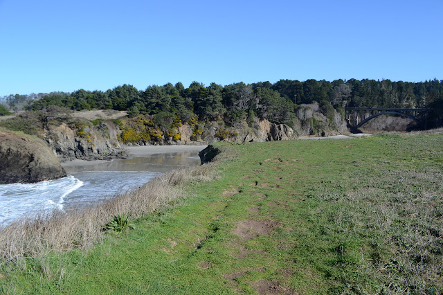
The loop comes back to the other side of the parking lot, then sneaks under CA-1 at the bridge over the creek. The creek is an another chance to point out specific plants beside the boardwalk down, across, and up the other side. It's not so good in this season because it tends to identify the trees by their leaves and they aren't wearing any at the moment. Pines tend to be identified by their needles and those are usually too high up for a close look.


The trees are much taller as I make my way slowly uphill. There are Monterey pines, which are going to be removed since they are another introduced species. Outside the stand, the trees are Sitka spruce and Grand fir. There was no distinct upward climb besides that which was getting out of the creek again, but this is the second terrace.

I am feeling quite surrounded by redwood by the time the brochure decides to point that out. This is still the second terrace.

There is a little bit of a climb beside a stream, but seems more like the edge of it rather than a transition. Still, it says I've climbed to the third level where the Pygmy forest is. The trees are not yet short, but then the tops just drop out of the sky. There is very nearly a line between the tall and the short. About this, the brochure says, "The soils here are 1000 times more acidic than soil found in the redwood forest. Heavy winter rains have leached iron and other soil nutrients from the surface of the ground and washed them down to the subsoil The iron, soluble under acidic conditions, combines with eroding bedrock (subsoil) to form an iron-concreted hardpan eighteen inches beneath your feet."


The iron hardpan holds water in, so the area is a bog. There are red puddles all over and small runners of water flow across the path until it launches up onto a boardwalk. This protects the delicate Pygmy forest although in the past it was not well cared for.

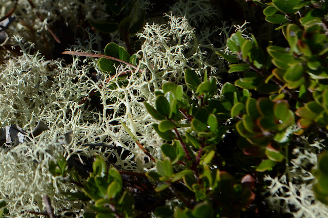
These trees can be 100 years old and only a few feet high, or so it says. They look young. I strive to find some sign that these are as old as they say they are. Perhaps a cross section on display would help? It hints at one way saying that lichen is also slow growing. The little trees that only look a few years old certainly have a good amount of it hanging from them.

Continuing along the boardwalk, there are more plants being described. I have not encountered some of them.
The end of the boardwalk leaves me next to a stream which shows off a cross section of the soil here. There's not much to indicate direction, but there is a little bit of trail beside the stream before it just drops in. I follow that back to the start of the little loop that includes the boardwalk.

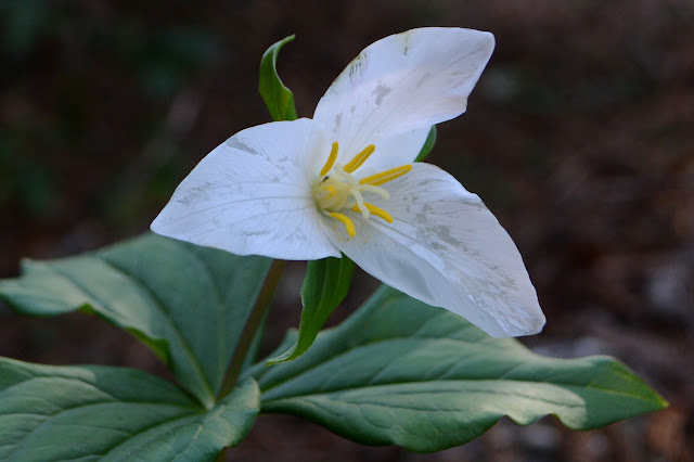
The forest seen and pondered, I just have to go down again. Well, I also have to compare the rhododendron that I have seen among the Pygmy forest to that below. This is curled and discolored and hangs dejectedly downward although it isn't much shorter than some. Indeed, on the lower terrace under the redwoods, the leaves are flat and wide and far more ready to collect sun although there is less to collect. There is also a surprise in a lone trillium with a grand bloom.
I'm a little disappointed. Even with the brochure, it isn't quite as accessible as it should be. I just want something to point at to definitely believe that those trees are the ancients claimed. I guess in the case of bristlecone, it never seems so difficult, but they certainly have a look. I guess these do too, with a knobbiness and a load of lichen all over.
©2020 Valerie Norton
Written 26 Feb 2020
Liked this? Interesting? Click the three bars at the top left for the menu to read more or subscribe!


Comments