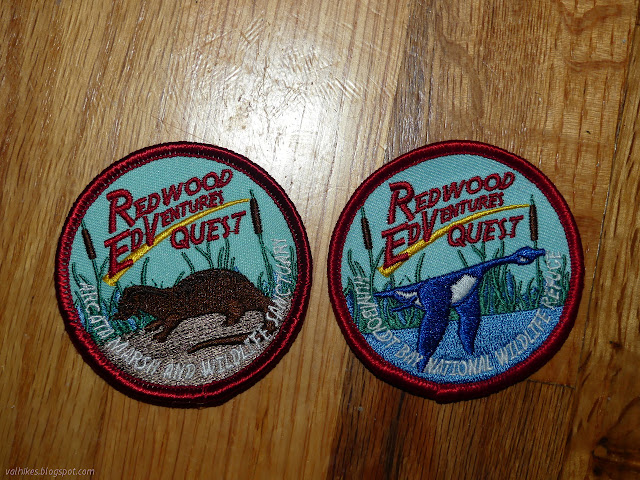
Redwood EdVentures Quest at Arcata Marsh
Arcata Wildlife Refuge
Click for map.
Click for rough map.
R saw my patch from the Redwood EdVentures Quest along the Hidden Valley Trail in the King Range and said she wanted one too. I'm not sure if she would do that one because hills are involved, besides it's rather far to go for a short hike. I know she pokes around Arcata Marsh sometimes, so suggested we try the one based there. I wanted to get out for the first day of spring. (Isn't it a bit early for that? Farmers Almanac says it's the earliest in 124 years.) R needed a little extra motivation go just do it, but the county shelter-in-place order taking effect at midnight provided enough push. We're not exactly what we can do after it. I was a little worried there would be others thinking they better get out before getting locked up, but the parking lot has lots of room and the paths aren't crowded. Of course, the Interpretive Center is already closed for the duration. The Quest starts there where there is a puzzle that shows in layers all the things this area was in the past. That sounds fun to play with, but also a nightmare to try to keep germ free. We'll have to be back to check it out.

We set off for the next stop. This one has a tendency to use benches and signs as stopping points, so it's easy to figure out where we should go. We get to learn about the various things this land has been anyway. First up is the plywood mill that once sat where the Interpretive Center is now. There are still posts driven into the ground to mark its location. We take it in, and the sign about otters, but our greatest attention for a bit is a snowy egret and then a multitude of the things.


Since this place is now a wildlife refuge, the egrets are part of its history, too. The part happening right now.


The next stop is about another thing that the area now is: wastewater treatment. While others have been quite distinctively so, I have not noticed this one being so. There's still a few pools they indicate you should not swim in or allow your dog into.

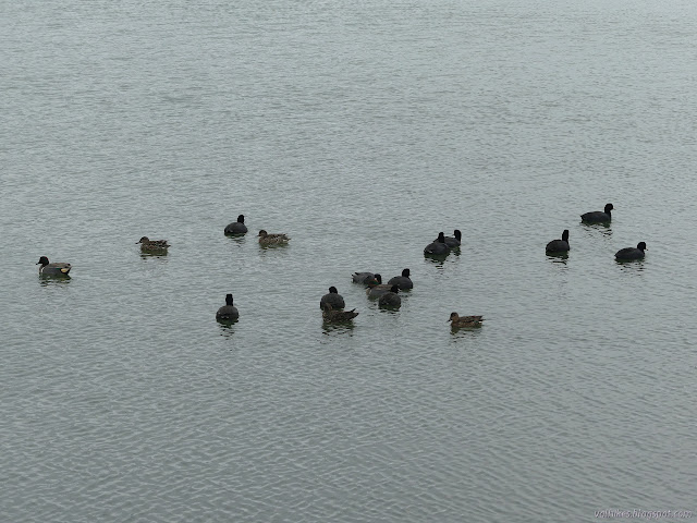
We ponder the old posts that stood as a wharf along which there was a rail pulled by a horse. There is more about it on the nearby signs. Then we turn to climb "Mount Trashmore", the few foot high hill that hides the trash from when this place was a dump. We find ourselves wondering about the birds lurking just inside the bushy trees on the far side of the water. A sign says they are night herons and there can be hundreds there in winter. Now there are a bit over a dozen and one or two egrets.


The Quest states it's about to get tricky, and indeed it does. I think it might have things written in the wrong order for best clarity. It marks the tracks of a long gone train as a marker, but it is the road that one comes to first, then must follow it briefly across the tracks to more trail. We have more pools to ponder as we go to find our clue.


We can't just pick up our patches as we finish. The Interpretive Center remains closed, after all. We have one more step and a little wait, but prizes can still be had!
©2020 Valerie Norton
Written 6 Apr 2020
Liked this? Interesting? Click the three bars at the top left for the menu to read more or subscribe!


Comments