Bug Creek and Chaparral Mountain
Six Rivers National Forest
I have to admit that in planning, Bug Creek Butte didn't even get a notice until I was looking on Peakbagger and noticed the "1k" marked on it. The trail I was looking at goes to Chaparral Mountain. I tried to do it on May 1st, but only got a couple miles down Titlow Hill Road before failing to watch for the fallen rocks. (I destroyed the rim. Again. The tire didn't fare well either. Expensive mistake.) I probably could have made it on the compact spare as it is paved all the way and mostly in good shape. It was getting late then and even this start was a bit later than optimal. There was a storm a couple days before with predictions of up to a foot of snow down to 5000 feet, so I wasn't sure what I'd see up high. There were plenty of freshly cleared trees on Forest Route 1, but I didn't see any snow until after I parked. It was just down a dirt road to a camp site. I noticed a couple old roads by where I parked, but went the way toward the site thinking that would become my trail. It was actually the overgrown old road that split off to the left on the way, but I found some nice flowers on my way scrambling up to it.

The junction a little over a mile along was clear, but unsigned. Trail to the left was my plan for the return, but popped down it the few feet to see the marked campsite. I'm not sure how nice the nearby spring might be because water was flowing down the creek from above. My first impression of the site when looking down on it wasn't too nice, but once I stood in it it felt comfortable enough. There's a fire ring and a broken shovel, so it must get some use.

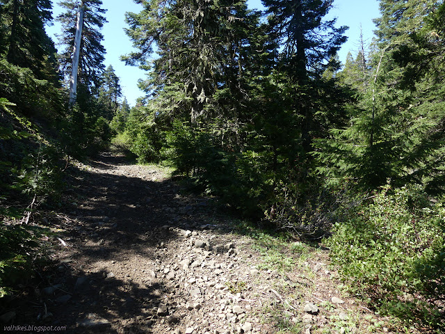
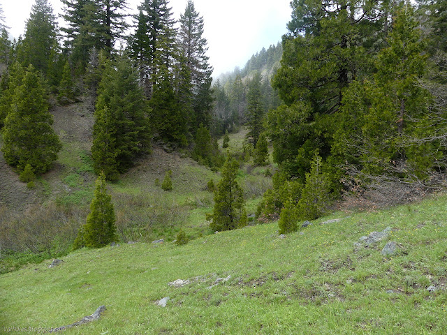
Past the junction, the trail was old road again although I definitely wouldn't do the last bit in anything short of an ATV. It passes through shrubby oaks that were still brown from winter and allow for some bigger views of the surrounding ridges.

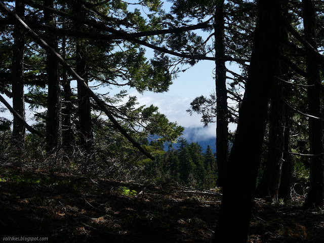
I was thinking there seem to be some extra junctions around when I accidentally found myself among the footings that are all that remain of the old lookout that was once on Board Camp Mountain. I mean, I meant to do that, but it still snuck up on me. There's not much view from the top, but it does point the way I was going instead of the way I came from. I'm always keen on a bit of new view. I stood on top of the old footings to try to see better, but there really wasn't that much to see.

I followed the old road down the other side to another very clear junction with no sign. The road further down looked like it was decaying quickly. The trail looked fine as I followed it along. I couldn't find the benchmark on Board Camp Mountain, so when I saw a yellow location poster, I decided to go the 100.8 (no units, meters or yards as it turns out) at N68¾W (about 69° north of west) to find the section corner as a consolation prize.


Then after one more hill, it all started to drop along an open ridge, sometimes in particularly small and steep switchbacks that were really just wiggles. A little climb followed by even more drop with the land falling off on both sides.


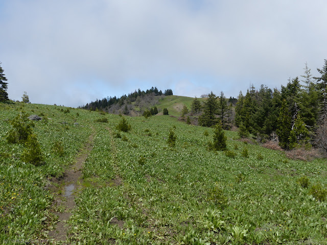
The trail settles down into meadow and more sign free junctions and a use trail up a small rocky butte that looked like a popular stop. I didn't resist the temptation to pop up it. The junctions weren't looking like what I expected, but I could see the trail coming up from the east fork of Bug Creek that I meant to go back along and one trail staying high along the ridge that I meant to continue on. I didn't quite pick out one along the main Bug Creek, but figured I could just try to find it on the other side.


I headed down and picked my way along the trail along the ridge tops. The other trail down the creek looked better used. Through the meadow it was soggy and I often had to pick my steps carefully so I wouldn't sink in.


I was having quite the easy time of it until most the users of the trail turned down the wrong side of the mountain. I followed the tracks pushing down the grass up the next hill to find there is still trail up there, it just isn't visible everywhere along the way. I kept following it until realizing I was supposed to be making my way down toward the creek and had missed a turn.

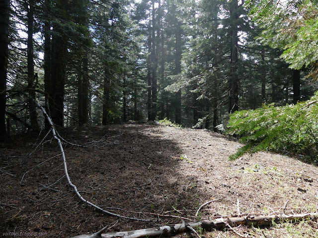
I went back to look for the trail I meant to be following to find only animal trails through still brown shrubby oaks. I gave up on the one I was working on and went up the hill to try again. I found another just a couple feet right of where I was before. This one seemed continuous like a human trail, but I lost it entirely under the pine trees. There was no sign of an old track and I gave up and just made my way toward the stream below that I needed to cross. Under the pine trees, I didn't really need trail. Getting through the little oaks it is very nice.


There should be a junction down by the stream, but I saw nothing of any trail, so I found a crossing and followed another stream up until realizing that the smart money was on the other side for a trail. I had to backtrack for a good crossing. Much of the way through the meadow, the stream was swampy. I started to see a bit of a track and eventually even found trail markers. First there was a bit of painted metal that had got loose from a tree, then I found myself standing beside an actual ribbon. I also saw the first footprint I had seen all day. Someone has been out on this trail other than me.


I thought I had a good grip on the trail again, but it went from strong to nothing in a few feet like animal trails will do. The map suggested to try to the left, so I followed a different string of stream to find a few more markers as it climbed to the ridge. At the top, I could find bursts of markers nailed to the trees and too many trees down to follow it closely.


I found a little bit of what I was expecting when hiking to Chaparral Mountain: chaparral. Mostly, I could see the trail through it, but the ribbon hints were very helpful once or twice. As the trail hit trees again, I decided to leave it. The map says it follows along around the peak to the right and just stops. I figured it would be easier to ignore it and make my own way since I wanted to get to the peak and stop.


It was easy to find the benchmark this time. It was set in 1928. I didn't think there was another place for one, but then remembered walking past a rather large boulder. I checked it out to find the reference. It wasn't numbered so I suspected it was the only one until reading the description. Some sloppy surveyor had come up and placed a second in a rock "flush with the ground" in 1961 but failed to mention how far away or what direction. I meandered in a sloppy circle around the station figuring I'd have to be rather lucky to come up with it and found some promising rocks sort of north of it. I picked one and dug down and found it under not much more than an inch of dirt and duff. That's a full win for this benchmark which doesn't have an azimuth mark.

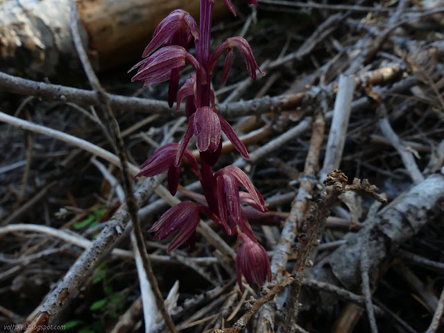
Without any view, there wasn't much to keep me there. I had a look down the mountain toward where the trail is meant to be and could see a wide shelf below a steep slope. I'm not sure what the trail might be having as a destination. Someone knows. Someone bothered to mark it. I wandered back, passing a different morel on the way. I left them both to producing their spores.

I was thinking I had no time to go trying the other trails on the way back, but on this side, the trail was clear enough as it turned off a little more to the south, so I went for it. I could find nice tread most of the way. The only problem was that some of it was topped by old bushes that had never seen a lopper so I couldn't actually use it. I followed between the trail and a tiny bit of water until the trail left and then had more luck on the tread. I took another opportunity to find a section corner along the way and found the trail again easily before totally losing it as it takes the last bit of ridge to the junction where I saw no trail at all. If I was choosing between these two routes, I would definitely choose this one to maintain.
This bit of alternate trail I wanted to take because it would bring me closer to Bug Creek Butte for that last off trail climb. I could find trail beside the creek where the map shows it, but couldn't say if it was game trail or not. I crossed when I spotted a blue marker on a tree. It was one of the few places to cross with dry feet. Then map and trail wanted to put me into a pool along the creek where a bend had eroded the outside. I chose to diverge by climbing, which put me on definite game trails down to a big flat area that has been a camp site in years past.


From the old camp, the trail climbs the main tributary of Bug Creek. I found another patch of snow on the way. Again, I had good tread to follow for the most part but no maintenance. Distinctly annoying was having to fight huge thorns while also crossing a small tributary.


I followed the path across a crossing that I couldn't quite do with dry feet until it ended in a pool. I could get around that to path again, but it just did it again and I checked the map to find I'd missed a turn anyway. Just after the patch of amazing flowers in the rocks and before the crossing that got a sock moist, I needed to cross and follow a different string of water.


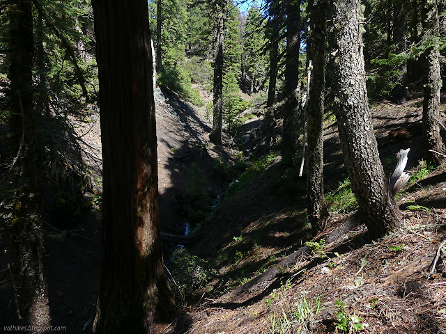
So I made my way back and made the correct crossing (after getting my socks a little wetter) and found myself between a baren slope and a forest. I quickly had to cross again, but that was an easy one. There were markers again although when they are nailed to a fallen tree resting on a steep slope, they're not very helpful. Eventually I found sections of tread and then a waterfall and more lovely flowers.


After visiting the waterfall, I had to find the trail again. I figured it was high and since there was an 60 foot boulder blocking a lot of the hill, it likely went along the bottom of that. There was a nice flat area covered in flowers. Trail? It worked for me. I saw a few more markers and had just spotted a silver one when I couldn't figure out anything about where trail might be and decided it was time to take on the 600 foot climb to the top of Bug Creek Butte anyway. There's no trail going up it, but the slope wasn't too hard to climb. Fallen trees made the route more difficult, but it really just meant more wiggles.


I found a small register in poor shape at the top and put it back together as best I could after signing it as best I could. It was beside a USDA benchmark making my total benchmarks for the day two section corners and two peaks. There's not much room between the trees for a view so I didn't stay all that long again.

I aimed following the ridge line back down to the junction by the little butte, but the animal trails through the manzanita tended to be unusable. I hung to the left of the ridge under the trees and was able to progress easily enough. Often there was animal trail there, too. Where the ridge got steeper and narrower, the animal trails through the shrub were usable and came with a prize of far better views than could be found at the top.


I got down to rejoin the trail and walked across it without noticing, then back across carefully looking still without noticing. I finally found some sign and a marker to follow along, and then found that there actually is, or was, one sign out here for the trails. A slapstick once marked it where it leaves the trail dropping down into the east fork of Bug Creek. It has been broken off now.
I wandered up the little butte once again and decided to go back the way I came instead of exploring the last alternate route along the way. It's some 1-1.5 miles longer and I only had another mile worth of light to work with anyway. I'll just have to explore it in another season. I expect all those wild hanging lily things might have gone by then, but there might be other interesting flowers about instead.


It was all easy enough to follow back as it got darker. There's blue markers along it, but they aren't needed so much. The steep spots were particularly annoying until I stopped and ate a bit. One should not forget the value of a little bit of food. Wouldn't want to mar the end of a grand hike with a stumble due to low blood sugar right at the end.
©2020 Valerie Norton
Written 28 May 2020
Liked this? Interesting? Click the three bars at the top left for the menu to read more or subscribe!


Comments