South Siskiyou: South Fork Smith River
Six Rivers National Forest
Smith River National Recreation Area
DAY 1 | DAY 2 | DAY 3 | DAY 4 | DAY 5
I found the Bigfoot Trail and even briefly thought I might like to hike it, but I just can't get too much excitement about hiking a long trail, roads and all, even if it is only 400 miles. The guide book does set it up as a scavenger hunt for conifers which sounds a little interesting. Hike a while getting to know a tree or two a day. There's 32 of them. I also found a couple trail journals that indicate the parts through Yolla Bolly-Middle Eel Wilderness and Siskiyou Wilderness are the spots where the trail gets hard to find. They're also the major bit of wildernesses in Six Rivers National Forest. I found the Bigfoot Trail Alliance which mentioned various work outings helping the trail out. I found the South Kelsey National Recreation Trail. Surely I can trust a NRT? Okay, that's just naive.
Anyway, I picked out a loop because that's how I do things and headed out to the west end of South Kelsey. I missed the sign for South Fork Road making my late start even later when I went well out of my way. I noticed the big junction for FS-15 (G-O Road), so managed to get it even though it isn't signed at all. I managed to miss all the rocks and trees on the roadway that might be paved three lanes wide most places but is being given zero continuing care. It kindly signed the gravel road down to the trailhead which seemed in very reasonable shape. The trailhead has a bathroom, information sign with map, and even angler surveys. Posh! I joined three other cars in the free for all of a dirt lot and glanced at the map on the board. It marks primary trails (stock ready, but really not) and secondary trails (not recommended for stock, could require good route finding). I made sure the one I wanted to get back on was marked primary and sort of lost interest in it afterward. Everything else was road or I'd have time to turn back if it was too much.

The trail is a piece of what was built in 1855 by Chinese laborers for mule trains headed from Crescent City to Fort Jones and Yreka. It certainly started out nice enough. I had to puddle through some little streams, but it had poured down rain the day before. I hadn't noticed the road continuing down, but it gets near along the way and then crosses without indication of which way. Some turn left, which probably gets them some river access. My map just left me wondering about the mystery road and guessing I should ignore it. I think that was followed by an indication that I guessed right, but the bears had had their way with the sign.

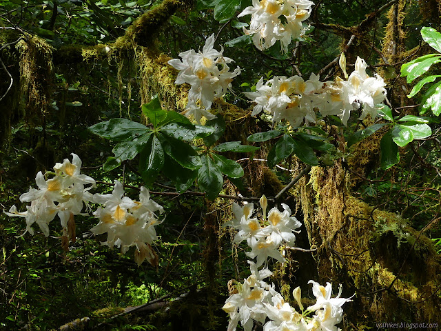
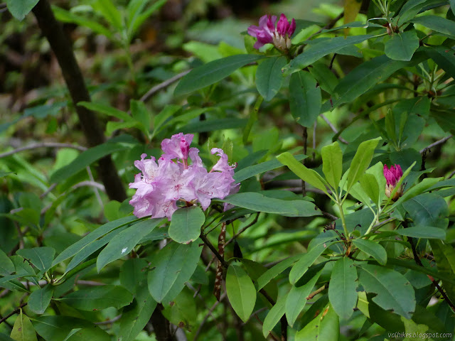
There were lots of flowers, but the poor irises were rain battered. I saw some rhododendron on the way down the road, but none along the trail. The trillium were in seed, so none of the brick red ones that are supposed to be here for me to see. I've seen some reddish ones, but wouldn't call any brick red. I could barely see the South Fork (this time of the Smith River) far below, but what I could see looked huge and churned and roared.


But there are places to see the river once the trail gets out high on the steep rock. If it is the same trail laid out more than 150 years ago, it certainly still feels solid enough now.


Near Buck Creek, there's some low lands. It comes with a shelter and a bridge for the large creek before the trail passes into the wilderness and rises again onto cliffs.


The wilderness was marked by an undersized wilderness sign on a post that showed a bit more thrashing like a bear got the last one. Those bears can get vicious with signs. More signs marked the bottom of Valley Summit Trail, my route back. It looked thinner than the trail I was on, but one might expect that. If it didn't go through, I could still have a miserable return on the paved road instead. The trail I was on certainly didn't suffer for entering the wilderness.


I paused a while at the big campsite beside Eightmile Creek and noticed the old metal strand near the junction of its trail. I got a deep foreboding feeling that my feet were about to get rather wet. Eightmile is a big creek. I looked across where the trail first met it and figured I only had to cross to the next bit of land, then work up and away from the river flowing the other side of it. Wishful thinking. That was just the larger piece of the creek. The water wasn't particularly cold, so I could easily take my time to set my feet and poles as I made my way, sometimes halfway up my thigh, through the mildly strong water. There was more trail on the far side, coming from further upstream and heading out downstream toward the river again. I wandered upward to see what was there. It dropped down to the long, level outlet of a big swimming hole that looked like the best place to cross if one can fight the way up the other side.

I sure wouldn't want to have come to that creek from the other side without knowing I could cross it. The trail was smaller on the far side, but still nice. It turns and climbs at one point where there's old trail continuing. I expect one of those old cliff sections might have fallen, so you just have to go with it and climb. Some of the reroute isn't doing well as it crosses one stream and I wouldn't expect stock to make it. And I got to see rhododendrons blooming in the wild. They seemed to just be getting started.


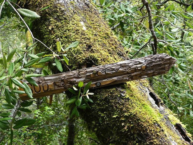
I passed a loose sign that was probably meant to be at Gunbarrel Camp. The trail got a little dim just short of the camp, but had lots of cairns so wasn't too hard to follow. The camp was my destination for the day and it was getting late anyway, so I went looking for the camp before walking just a little further to have a look at Harrington Creek. I was set up for starting the day with another wet foot crossing, but there certainly wasn't any camp on the far side. Harrington looked like it would be a little easier to cross than Eightmile. I headed back to camp to get some supper and set up the tent because it could rain a little overnight.


©2020 Valerie Norton
Written 9 Jun 2020
Liked this? Interesting? Click the three bars at the top left for the menu to read more or subscribe!


Comments