South Siskiyou: Boundary Trail, Elk Valley, and Summit Valley
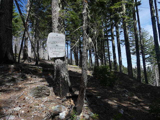
Six Rivers National Forest
Klamath National Forest
Smith River National Recreation Area
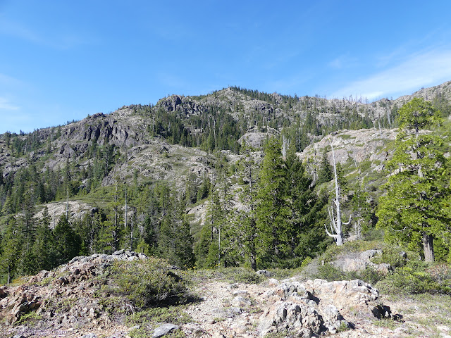
I decided I should probably continue along Boundary Trail rather than follow the one along the west side of Chimney Rock as I originally planned. It just adds a mile and three miles of little to no trail with no maintenance since the fire could easily be harder than four miles of maintained trail and road. I walked what I could find of the trail again and found it harder to see in the light than it had been in the twilight. (It's to do with glare.) For all I know, what little track is there with tiny cairns along it just turns off to Buck Camp Ridge and there is nothing heading down to Chimney Rock. The character of the topography the trail traverses looks a bit like some of the bits that had needed it reestablished, which could further complicate actually getting through. I started down Boundary Trail instead and found it lined with rocks. There's a lot more attention on that one.

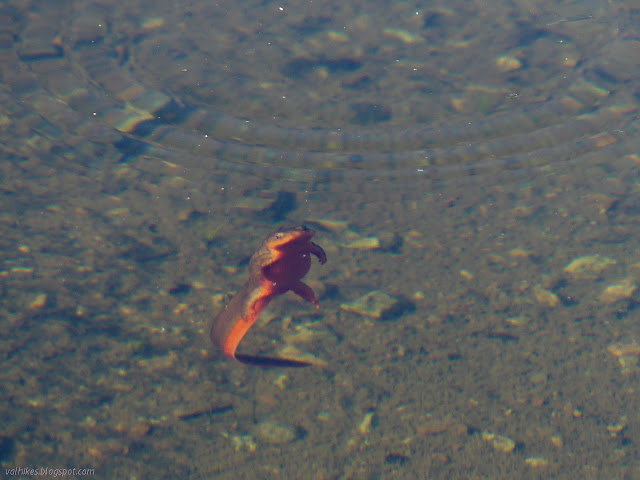
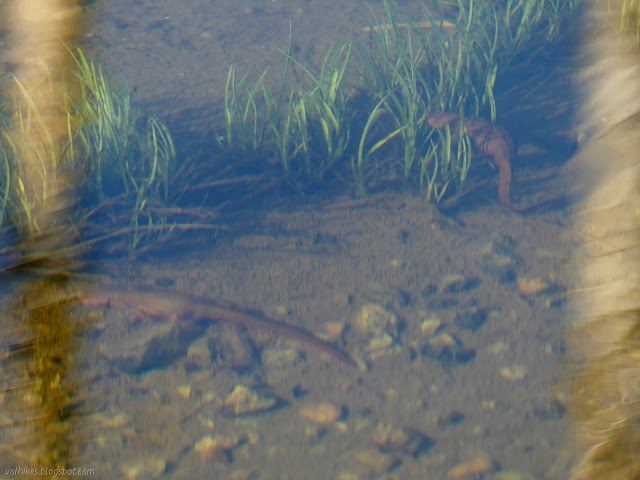
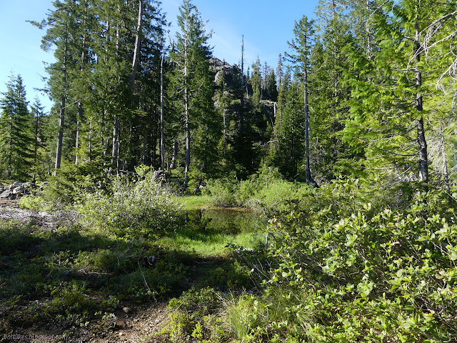
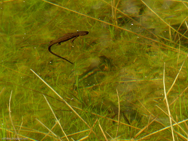
The pond sang with frogs in short spurts during the night, so I paused by it to see if there were newts too. There were. There's actually a small stream draining from the lake that comes above ground near where I was camped, so I wonder how long it lasts, but there were plenty of amphibians taking advantage.

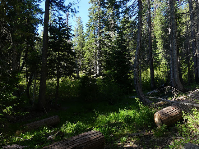
The rock lining didn't last as the trail started descending, but there were plenty of cairns so that they generally weren't even hard to find. I quickly encountered little streams of water, too. In this season, there are lots of opportunities for water, even up high.

I found a particularly large log with a particularly narrow slot cut through it. Trying to keep the stock from the rest of the trail? The old cedar log still smelled really nice as I passed through.
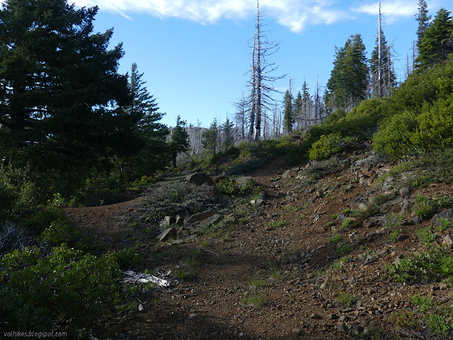
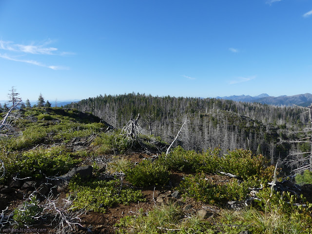
The trail gets to climbing and falling and climbing again. It does so in a way a bit more direct than is optimal from an erosion standpoint. I would characterize its directness not so much refreshing as tiring.


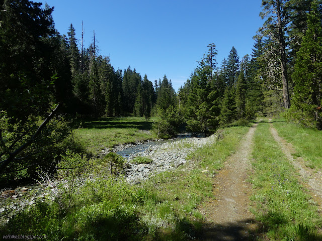
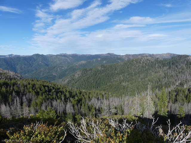
I stopped at the top of one ridge where the azimuth mark for Sawtooth Mountain should be. Somewhere. Somehow southwest of where the trail comes up and also a short way east of the trail that proceeds southeast. I looked in a few places, but didn't find the disk. I started down the long downhill along Blue Creek. It passes by a high up lake where the extra trails make it hard to sort the correct route, then is nice and clear all the way down. This is popular trail.


Nothing marked the trail where it leaves the road nearly at the end. The area is a de facto campground of dispersed sites. I wandered up to the end of the road where another trail continues an unknown distance up Elk Valley. I then walked down looking for where G-O Road turns to cross Siskiyou Wilderness and found nothing. How can a whole road go missing? I wondered if maybe there had been a plan that was put on the map and never actually built. I've encountered a couple examples of roads that were put on the map when planned and never got updated to the actual route once built, so it could happen. That could make it a much harder day than expected. I plunged into the forest to look for the road a little way away from the junction and found the clear road. It turns out junctions can vanish while the route stays clear even with roads. It has a huge blockade on either side of the creek, where it crosses into the wilderness, but is otherwise generally clear. I still didn't know what to expect. The Forest Service topo map still shows it as a road. Their visitor map marks it as a continuation of Boundary Trail. That map at my start doesn't show it at all, so if I'd paid more attention to that, I'd have been particularly concerned. What I found was an old road wide enough for two way traffic without difficulty. A few spots have bad erosion. It is not being maintained as a trail, but one particularly large tree has been cut to let people by way on the side. It was still the easiest bit of trail of the trip. My feet got extra pained from the surface hardened by traffic.


I found the a wide spot for parking and the trail past Chimney Rock to be visible enough as it meets the old road. It could just go up the rock for all I know as this looks like the easier way to approach it. That was not in my plans, so I just continued rolling along the ridge. I ignored the one stream along the way, the only water for miles, but stopped hourly to put my poor sore feet up. I passed many fire rings placed randomly along the way like someone just sees how far they can go, carrying all their water, then stops and builds a fire.


The Gasquet side of G-O Road came up a bit sooner than I expected. The Forest Service topo shows the pavement extending into the wilderness, so half a mile to the line on the map, I stepped over one last hill and looked down on the end of the pavement just past a wilderness sign. A big, proper, wood one. It was the only one I saw on the trip.
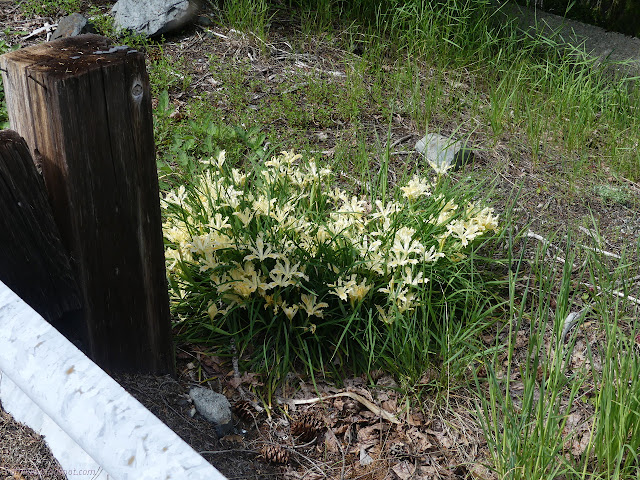
I had six miles of road walking down, three miles of paved road walking to go. That's a lot of road walking. Uphill wasn't hurting so bad and downhill, but downhill is what lay in front of me for the most part. Oh, and I was regretting ignoring that last little creek. The pavement is good, but it's down under a lot of loose rock and downed trees. Had I tried to drive to the end of the road, I'd have had to move some big rocks and one tree. I passed one car, maybe hiking Peak Eight, then it carefully passed me. All along the sides, more irises, both the ones I'd seen earlier and the ones I saw at the start.


There was a really big turnout a quarter mile down the road from Summit Valley Trail, but next to it was nothing but a bit of gravel forced by people desperate to park next to the sign.

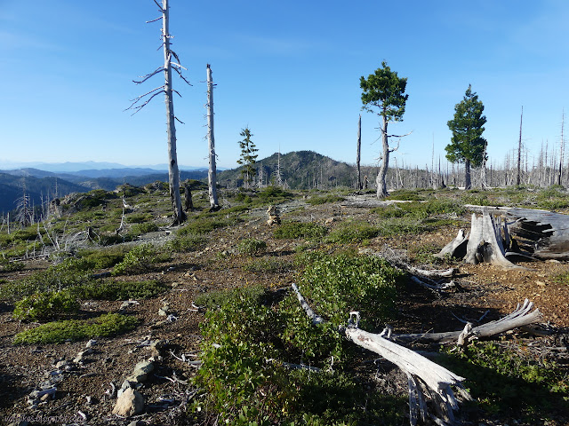
I was quite happy to leave the road. I was less happy to find that I was on another old road although this one was getting very overgrown with sagebrush. There was a fire lookout at the top, so the old road wasn't entirely surprising. It was surprising when the old road, at that point in better shape, went off along the ridge downward and an unmarked trail started up toward the ridge.

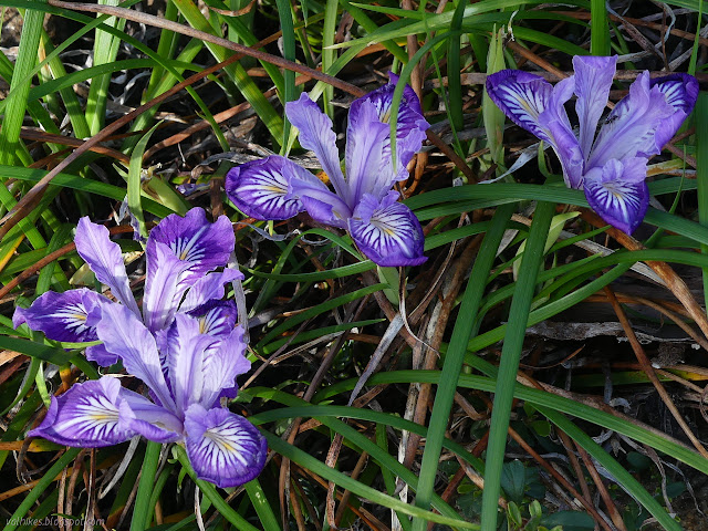
As the trail started to dip away from the top of the local peak, I headed the few feet more up to the top and then north to something slightly more top and the benchmark. It took a little care to avoid the irises. Station and references took a bit of searching, but they were all there.

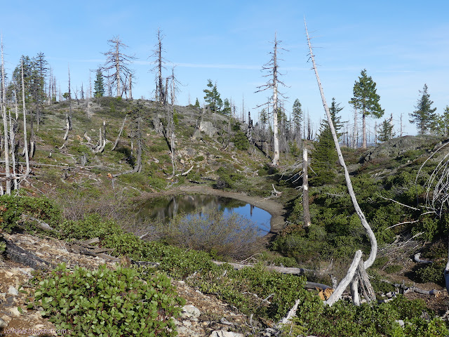
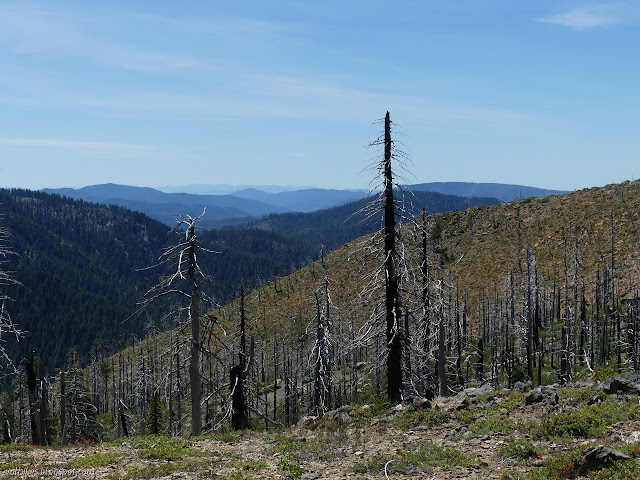
Then I headed down to the trail and along the trail again. The numerous wilderness signs stopped as it dropped down the east side of the ridge and actually into Siskiyou Wilderness. I was gambling that where the trail dipped down between the high point and the old lookout, I would find water. I'd been seeing streams above spots marked as seasonal streams on the map, so I expected I would here too. I first saw a pond, then a tiny flow into it, then started crossing larger streams. A safe camp was going to be harder to find, so I kept on going to the open space marked on the map noting a couple possible spots on the way.

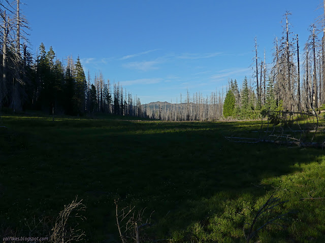
It was a huge green meadow and the intensity of it drew me on once I saw it. Off to the right, there was a well used campsite. By my estimation, it was well within the range of the taller trees at the edge. I didn't much care for that nor that the usual sleep spot was half puddle. I turned back to try an area of potential flat where the trees were short and easier to avoid and the ground was higher so drier. I found something that looked safer and more comfortable and went to gather water for the camping and a little more for hiking the next day. It wasn't quite what I planned. I planned to get water from wherever I needed to (which might have been halfway through the day) and continue up to the old lookout, but water is heavy and my feet were done walking.
©2020 Valerie Norton
Written 13 Jun 2020
Liked this? Interesting? Click the three bars at the top left for the menu to read more or subscribe!


Comments