South Siskiyou: Harrington Mountain, Elk Hole, and Sawtooth Mountain
Six Rivers National Forest
Klamath National Forest
Smith River National Recreation Area
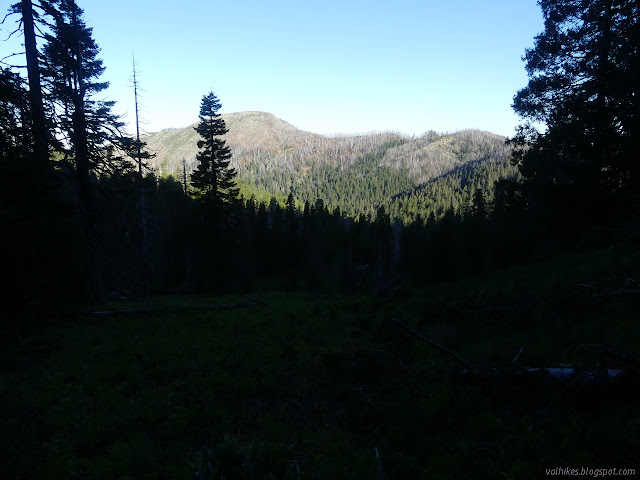
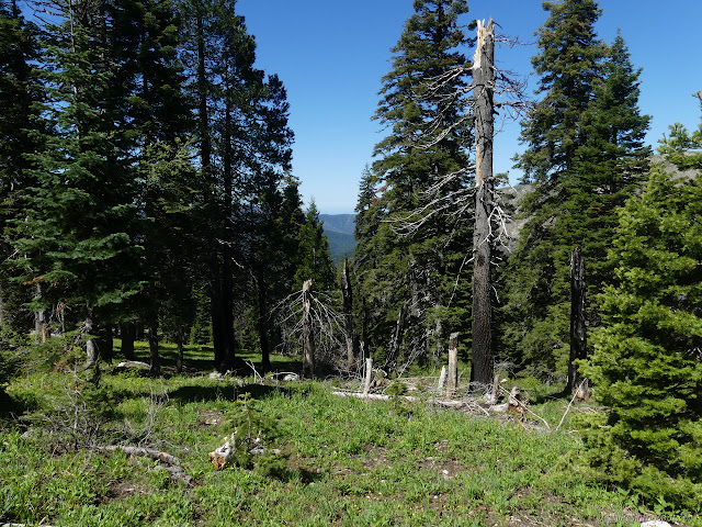
I packed up what I needed for a day hike and started along the South Kelsey Trail for the last little bit before it enters the next forest. There was only a brief moment when I wasn't sure where the trail might go. Most the way, I had plenty of idea where it went because there were so many trees cut from it down under the numerous trees crossing it and making the climb hard.

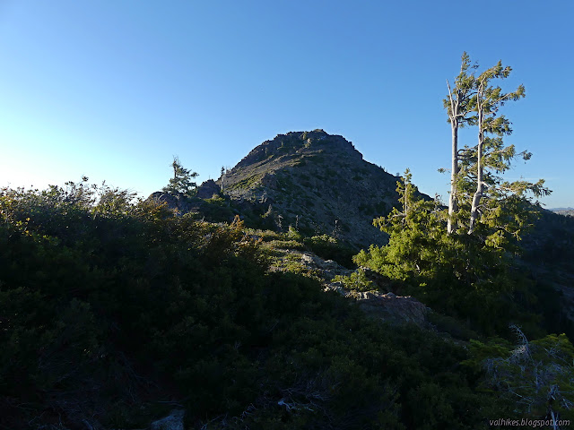
The trail reaches an open ridge top and keeps on climbing. I stopped where it turned down again and turned toward the peak, which was many rock spires away. I tried over them and it wasn't going to work well. I tried along the slopes to the west, but was pretty sure those would cliff out before the final climb of the peak. The east side didn't look like a place to go either. My legs were feeling weak and shaky (in the morning when I should be feeling fresh and with little in my pack to weigh me down) and I couldn't shake the certainty that there was just no route under class 3 climbing. If my legs were feeling better, I'd have gone for a closer look, but they weren't and I still had the day's travel for them to take on. I turned back 300 feet away from the top and sat on the minor bump on the other side of the trail instead.
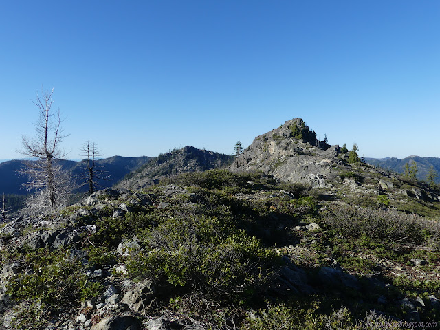


So I returned the way I came without tagging the peak.

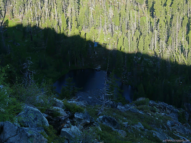
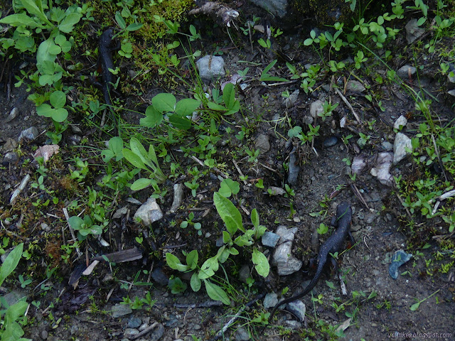
I stopped by the lake and checked to see if there were more camp sites on that side. I found none. I didn't mean to stop by the pond, but I noticed the newts, then I noticed more newts. The ripples from creatures gobbling insects off the surface were newts, not fish. They were everywhere.


I tore myself away from watching the newts feeding and got my camp down and packed away before starting off and promptly losing the trail. I'd seen a marker up along the inlet stream the day before, but I couldn't see it while standing up on a rock where my feet would stay dry. Did I really see it? I didn't want to slog through the water, so I tried following the line on the map. There was no sign of any trail, so I headed back and finally saw it running along the other side of the stream. Yes, I did really see it but from on the rock it was behind a tree branch. From there, I had a nice long run of fairly clear trail, at least after climbing over the hip high log. A few of the logs I encountered looked like I might be the first human dealing with them. I followed small and numerous scrapes of deer feet over the big log.


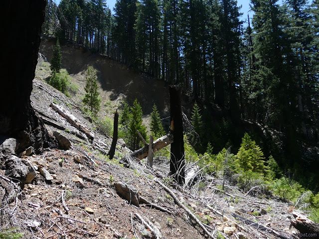
The trail split without indication which way I should go. Down looked like it had the most recent work, so I went that way. It quickly became inappropriately steep for trail, but was clearly human. I saw a gash in the land ahead and figured that was what it was trying to pass. On the map, it is a spot bare of vegetation with the trail traversing through the top. Now there is another near the bottom, but I couldn't see any trail doing the actual traversing. I suspected it might have turned and gone down a little more but went for a game trail I could see climbing out the other side instead. It was beside a dogwood somehow still in full bloom. I figured I would just find the trail again on the far side, but that proved difficult. Althoug I suspected it was below, I didn't know that for sure. I followed game trails along the steep hill and eventually did find it coming up to meet me.
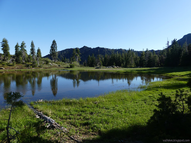
When the trail joined the high route, there was even less indication of which might be the "right" one. It was barely clear enough trail as it wandered across some minor flats of shoulders on the mountain. I passed a pond choked with willow and depressions turning to meadow.

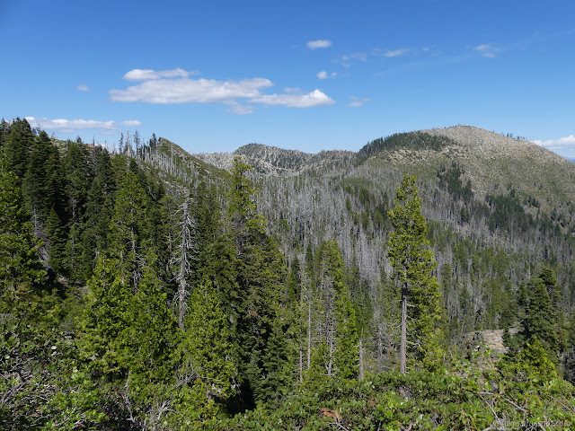
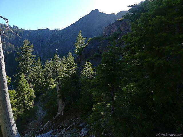
Then it was out onto the rocky mountain side among the standing dead. That bit of burn was probably older. Much bark was stripped leaving stark white trees among stark white rocks. The trail continued to be just barely clear enough.

I passed a trickle of water somewhere around where there should be a side trail to a pond. I decided against going up to see although that had been my plan. I thought the trail was clear enough until noticing that I was on an old bit and the current one was a little higher.


Trail was seeming more worked as I went, wrapping back and forth between forests and counties along the ridge boundary. Some of it had needed reestablished after the fire and had been in a very direct climb. It was feeling warm and I was getting suspicious I should have got a little water at the trickle I'd crossed a mile before.

I came upon the smallest spring high up on the ridge, but it was too hard to gather water from it. I didn't actually need it anyway. The trail started to drop into Elk Hole, going lower than shown on the map so that it passes by the various ponds on the way. I did grab water at the first good stream. I nearly clobbered a newt as I passed by the outflow of a tiny unnamed pond. I was definitely getting into some water again.


Elk Hole was already in shadow as I started down to it. It took me three tries to figure out how the trail went to cross the outlet of its little pond and a bit of jumping to do it keeping my feet dry.
There was a camp just before the trail started to climb again. I debated stopping there. It had been my first guess for where to end the day when planning and it looked like it should have morning sunshine. On the other hand, I had only two miles to the actual plan to stop and more than two hours of light left. I turned and started climbing, finding even more newts along the way.

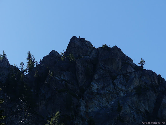
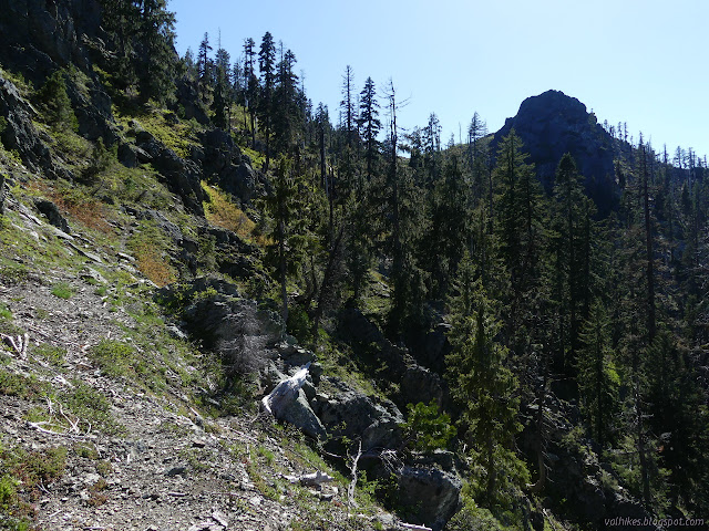
I hit the top and dropped my food (in the canister) to lighten my load a little and turned to climb Sawtooth Mountain. I still hadn't got my peak in! I found something almost like a trail along the east side of the rocky ridge, then on up some loose rocks in a gentle chute up the middle of the mountain. There is supposed to be a benchmark at the top, so I searched the little bit of high point to find a reference pointing across a few feet of stone into that chute. I found another practically pointing at the first. The description indicates the station might be in the few feet of stone before the chute, but there were just piled up rocks there. I pushed a few down and I'm pretty sure I wasn't the first to try to uncover something under them. I didn't succeed, but the rocks let out an interesting smell when they hit the ones below. My inner cat emerged and I pushed a few more just to make sure it was really coming from the rocks. Definitely. I've never smelled rocks before.
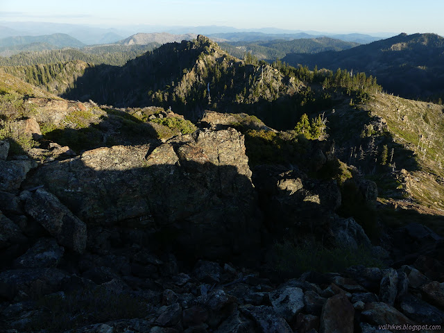
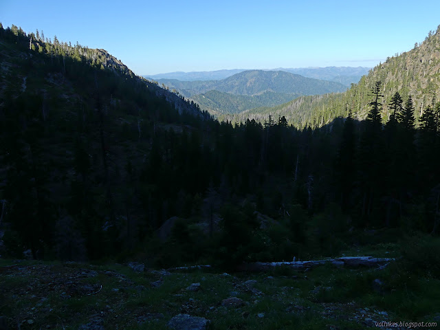
There was another peak along the ridge that looked like it might be higher, but I wasn't going to go find out for sure. My legs weren't feeling that good and the ridge on that side was not looking like my sort of thing. Anyway, I was quite surprised how long it took me to get from the trail to the top. Before my planned camp, the map shows a seasonal pool, so I decided that would be a good spot if there was a way.

There is a junction just before the pond and I was starting to suspect that the trail I had planned to take might not actually be there. Two go out to G-O Road, but one is within the wilderness when it gets there and all the work might legitimately have been done on only one. I couldn't find junction where the map showed, so explored a little. I was just making things hard on myself. I made my way back up to the trail and found a mud hole beside it, making me lose hope about the pond. I walked on and quickly saw water with a trail going to it. That is actually the junction and the trail passes along the north side of the pond. The area is completely burned, so I set about carefully looking for a site and found two options. The one along my planned trail had more use, so I went with that. I also followed the trail a little bit further only to find that it vanishes completely in a tenth of a mile, so with supper, I also made contingency plans.

©2020 Valerie Norton
Written 12 Jun 2020
Liked this? Interesting? Click the three bars at the top left for the menu to read more or subscribe!


Comments