West Elk: West Elk Creek and North Baldy Mountain
Gunnison National Forest
DAY 1 | DAY 2 | DAY 3 | DAY 4 | DAY 5 | DAY 6(purple line, map link)
It was dry and warm (for morning) under the trees, so easy to get up and pack up. I pondered my benefactor stream. Above, there is a bowl of sunken land and beyond that, no stream bed at all. It is a spring and it sinks away again as fast as it bubbles up. I headed down the steep trail into the steep valley. There was no water at the junction, but there was a little fire ring just inside the trees on the far side of the dry bed. I headed down and as the stream became less accessible in a narrow canyon, I started to hear the sounds of water.

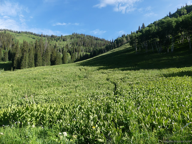
The trail was at first direct in getting down the hill and turning into a gully from the water that runs down it. However, it turned away to become more reasonable and pleasant and I got to marveling how it hasn't vanished in the meadows. Maybe because it is so free of turns? Then I came to a trail crossing mine and not much after, started losing it because I had missed the turn. So had others coming up, making the cross trail.

I had really only gotten enough water at the spring to camp because it was dark and late. I didn't grab any more water at the crossing since a lazy map reading suggested I would be somewhat near to it for a while. It's true if you neglect all those contour lines between trail and water.

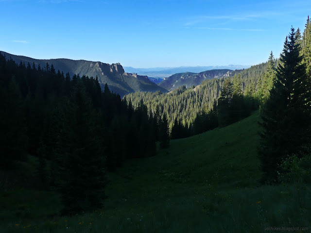
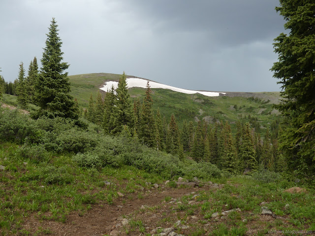
I was on a big lazy turn through the meadows to West Elk Creek. When I got to it, it was like a steep canyon with an even steeper canyon inside.
There were times when I felt like the sloped trail near the gap was trying to drop me right in. Gradually the terrain softens and the trail drops down to the creek. There were a few tributaries along the way, if I really needed water.

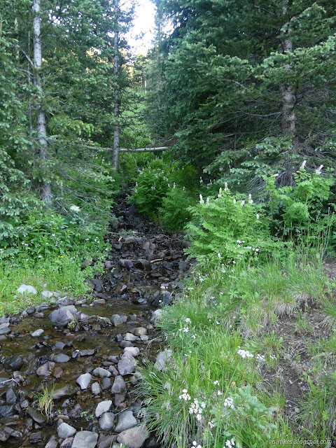
Coal Mesa Trail runs into the Rainbow Lake Trail and ends at an unmarked junction. I still wasn't sure where Coal Mesa was after walking the whole trail. Maybe I was on the east edge of it while looking out over the pillars and fins above West Elk Creek? I crossed it in my neoprene socks before settling down to collect some water. Besides a tributary the trail flirts with on the climb up the other side of the canyon, there was no water that wasn't marked as seasonal until Mill Creek, which might well be camp. Otherwise it could be South Castle Creek. I decided to get three liters.

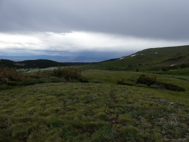
A horse and mule (and riders) came down the trail, the first people seen on the trip. After all the logs the day before and a couple more this day, it was a welcome sign that the trail might be clear of the things. I headed up under increasingly cloudy skies that finally started to rumble and drip as I reached the top. The trail flirted with and crossed water far above where it would be reasonable to assume it might based on how dry things had been so far.


There was a small pond right at the top of the ridge. There were more cows milling about it. I turned at the signed junction for the "South Baldy" direction and hit the trees as hail started pelting down. Taking shelter under one, I pulled on my raincoat and snacked as I waited. It passed quickly and I headed up some more.
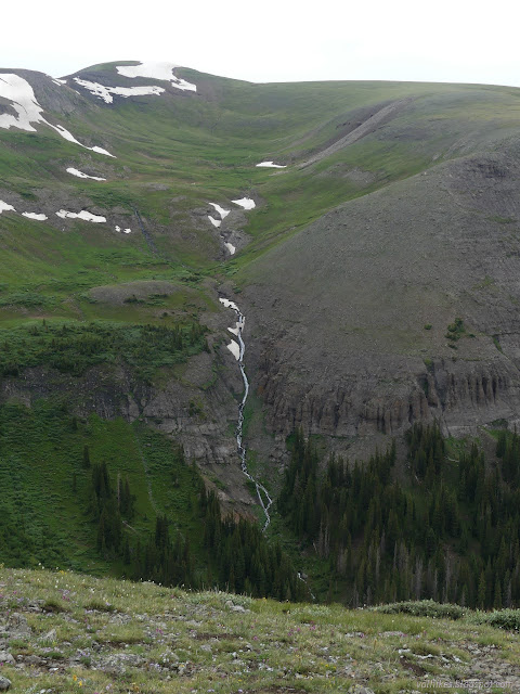
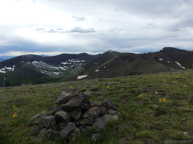
There was a very obvious use trail heading up South Baldy Mountain from the high point of the trail. I wanted to take it. The mountain even has a benchmark. Various rumblings from the sky suggested it might not be a good idea. I headed down instead where the seasonal stream presented six shallow feet of rock hopping challenge. Oh, it was running alright.


It looked like a lot more hail had come down north of South Baldy Mountain. It wasn't melting very fast so added a thin layer of white for quite some time. I kept splashing into puddles hidden by the floating white ice balls, which was slowly but surely wetting my socks.


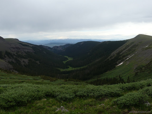
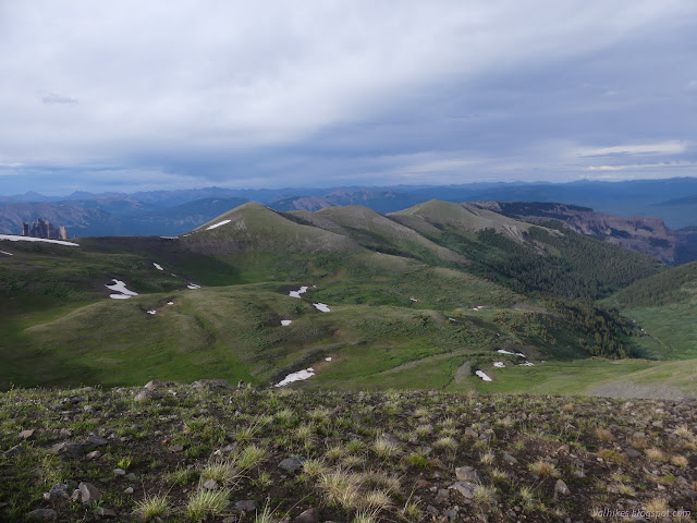
I came to the signed junction with Sun Park. I had a slight worry about my route that would soon resolve itself one way or another. The trail around the side of North Baldy Mountain was the only one the Forest Service showed but was not on OpenStreetMap, so there was at least some question as to if it was there. On the other hand, it would probably be easier just to wander across the top of Middle Baldy, Middle Baldy Mountain, and North Baldy Mountain. This last was the tallest and the trail, if it was there, nearly comes to the top of it anyway. As I pondered the easy slope up Middle Baldy Mountain, a distant rumble came along. The sign actually said "North Baldy" on it for the direction, so I decided to take that as reassurance that it was there. Why wouldn't it be there? And how was I to know that would be the last rumble of the day?


It was pretty from the trail, but I expect it would have been from the ridge too. From time to time I was threading my way between willows and small pines which both happily shed their load of water onto my pants, which would not have happened on the ridge. It was cold water. The wind was blowing. I could really have done without that. Okay, I should have at least put on the rain skirt and had a little less wet and a little more wind protection.


Over one last hump, I passed from the West and Middle Beaver Creeks to Beaver Creek itself. Somewhere on that hump should be my trail. There was no junction. There was no trail split. There was a cairn, and a stick in a pile of rocks too. I went over and started down and checked the map and found I'd gone too far. I went back and tried to be on it and I just couldn't find anything. I continued around the basin, the map telling me I was too high whenever I looked and me looking down to see nothing of help below. I worked my way around, and I do mean worked. I did find some nice game trails to help a few times as I got near the end, but mostly I was on my own.
Truthfully, it did keep looking like there was trail over there on the far side of the bowl, but it never worked out. Going for them is how I found the game trails.
I was just about to supposedly be on trail again as North Baldy Mountain was presenting me with another nice ridge to walk up. Considering I would basically be climbing the thing anyway, it would be more work to continue around the edge than to just start up. I gave up on the trail and started up.


Along with taking in the view, I also got myself a shinny new weather report so I would know just how much more rain was coming. It wouldn't be bad until the last two days.


I headed down toward the trail, which actually does exist over the high pass next to North Baldy Mountain. I could see it along the side of five big cairns headed to the south, but then quickly lost it after the cairns stopped. Getting to it is short but was hindered by a mass of residual snow. I wetted my feet some more going around that.

At the saddle, the trail was unmissable. I followed it down the steep north side to Mill Creek. Cairns were placed along the straights as it switchbacked downward. People had later placed smaller cairns at the turns to help with noticing them. I mostly made it down on trail. At the bottom, there were still cairns, but the trail vanished. I followed it down past a rocky flat spot that could do for a tent and down to where two branches of the creek were meeting. From the last cairn before they meet, I couldn't see anything of trail continuing on through willows. I saw no further cairns.

The fresh weather report said 10% chance of thunder overnight. I decided to climb back up to the exposed flat spot anyway. I would have my Faraday cage, after all. (Disclaimer: tents with ungrounded aluminum poles may not act as good Faraday cages.) It would not be a place to put your closed cell mat, but I've got 3+ inches of inflatable. It took every bit of that to deal with the jutting nature of the rock. It was another long day, but this time I had just enough time to eat and clean before darkness enveloped me. Oh, what magnificent stars to watch while scrubbing my teeth.
Continue on to the next day ⇒
*photo album*
©2022 Valerie Norton
Written 31 Jul 2022
Liked this? Interesting? Click the three bars at the top left for the menu to read more or subscribe!


Comments