Posts

Showing posts with the label Cleveland National Forest

Garnet Peak

Image
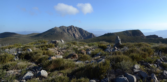
Cleveland National Forest Click for map. Garnet Peak, not to be confused with Garnet Mountain, is sandwiched between the two hikes yesterday and is the rather peak looking thing in the near distance of both of them. It is the last of the Hundred Peaks Section listed peaks for this trip and has its own trail up, but approaching via the Pacific Crest Trail gives me a few PeakBagger bumps to grab on the way. Also, I suspect Penny Pines, a place where water is available, to be easier to find. It does have a sign, but it is far enough off the road to miss in the dark. The paved pullout is just south of a big orange snow gate and cattle guard, so that can provide a landmark to find it, too. There is no indication of where the water is, but two trails head off marked as PCT. I grab the north one since I want to head north from here. It is just the longer route to actually join the PCT on the other side of a low hill. The long way from Penny Pines to the PCT passes the donor and...

Garnet Mountain

Image
Anza-Borrego Desert State Park Cleveland National Forest Click for map. With a few hours of light left in the day, I have plenty of time for the short hike up Garnet Mountain. It is easily accessed from a sliver of land between Cleveland National Forest and Anza-Borrego Desert State Park. There are a couple folks enjoying the view at the end of the road as I start and one more coming up the old road bed that hosts the Pacific Crest Trail looking like he is chugging through a chunk of it. He is quite a picture in plastic slip on sandals, hauling an army duffel with pack straps, and cradling a gallon of water in his arms. He adds to it all a greeting of, "Beautiful country, isn't it?" with so much glee underneath it that there is no mistaking that he is really enjoying being on this trail. But it is, so there you go. I follow behind him a short way. Entering Anza-Borrego Desert State Park with Garnet Mountain above. The shape of old greyback, that is San...

Monument Peak

Image
Cleveland National Forest Click for map. After being in San Diego for unrelated nefarious reasons that only slightly involved being a bit of a jungle gym for an enthusiastic child aged 1 year and 2 days, I headed out to the Laguna Mountain Recreation area to go after three peaks listed on the Hundred Peaks Section peak list , each very near a segment of the Pacific Crest Trail. My first target is Monument Peak. It has a few named peaks nearby and someone has marked a few of the minor bumps that just happen to have a poorly surveyed elevation on PeakBagger. Except for Stephenson Peak, they are all near to the trail and look easy enough to get to. Signage on the road is lacking, but my first guess at the right bit of parking contains interpretive signs referring to Storm Canyon, a boardwalk overlook, and steps down to connect to a well established (but unmarked) trail winding its way through the area. This is probably the right spot. I doubt the boardwalk helps to get a bette...

San Mateo Canyon: Tenaja Falls

Image
Cleveland National Forest Click for map. DAY 1  |  DAY 2 The night on the ridge line was wonderful and calm and warm with stars from ear to ear... or that is how smiles go. Anyway, there were a lot of stars to see with only one tiny bit of civilization glowing with its own stars. Well, not as many as there could be with the big moon. It is nice as the light brightens in the morning too. The warmth makes it easy to get up with that light. Looking back up the ridge and trail. Those sycamores I was looking for on Saturday are visible in the canyons on either side of me and even some in the tributaries. There should be water down there. Accessibility is another question. It is a gentle downhill the rest of the way along the ridge until a post marked with a message of "1.8" (miles, presumably) and "1300 feet down" with the "down" written vertically to help the reader understand the word. There was another, less perfect, site before the post,...

San Mateo Canyon: Sitton Peak

Image
Cleveland National Forest Click for map. DAY 1  |  DAY 2 Everything just looks a little hotter, so I think this 3 day, 30 mile plan will require more water than the one I just pulled off in Agua Tibia Wilderness. Although it looks more likely there could be water here, the map indicates all streams are seasonal. Since I could get no information on either water or the state of the Bluewater Trail, marked as unmaintained on the wilderness map, I have to plan as though there is no water and Bluewater could be difficult travel or navigation. The result of sitting down with the map and some mileage information that is helpfully supplied on the trailhead sign is to cut off 5 miles and the unmaintained part so that travel will be more certain and it is doable in 2 days. This leaves me confident enough to leave one bag of camping water, but none of the hiking water. Starting water weight is still 20 pounds and am considering this a rather minimal amount. Water plannin...

San Mateo Peak

Image
Cleveland National Forest Click for map. I arrived at Morgan Trailhead and started stomping up and down the first few hundred feet of trail and glaring at the gentle rolling hills covered in short chaparral. I was pacing, really, wondering if I really want to do this again. Do I want to load up my pack with three days of water, again, to hike another dry wilderness? One that looks a fair bit hotter than the last as I will be losing elevation along the way rather than climbing and the elevations here are lower overall. Maybe I should just drop it and go home. Still, I had the whole afternoon. When planning, I had noticed I could hike a nearby peak and thought I might if I had time after. It is only about 2 miles, so I have time today. I could at least get something out of being at the trailhead and gain a little more perspective on what is here. Surely there is a bit more than gentle rolling hills covered in low chaparral. A hidden sign found shortly after finding the unmar...

Agua Tibia: Dripping Springs

Image
Cleveland National Forest Click for map. DAY 1  |  DAY 2  |  DAY 3 Morning is lovely. At least it is as I wander over to the first spot of a northerly view while getting breakfast ready. There is not much long view from the camp site. There is a mist playing in the valleys, especially around the tall mountains. Thomas Mountain is no longer producing a streak on the sky because they have put out the controlled burn for the weekend. I pack up and head out for some more expansive views as the mist slowly rises. A little piece of that view from Dripping Springs Trail. The trail is still a little brushy, but not so imposing that it forces a stooped walk or anything like that. Everything from the southerly viewpoint, up past the junction sign, on down is clearly hiked a lot more than the trail above that. The few bits of brushy open up further as I go down, especially as things dry out. Thin early morning mists everywhere.

Agua Tibia: Eagle Crag

Image
Cleveland National Forest Click for map. DAY 1  |  DAY 2  |  DAY 3 It was a mild night and with the sunrise, I can have breakfast in bed. Or actually, make breakfast in bed, but then pack up my gear while the pistachio pudding full of coconut and chia seeds "refrigerates" in the morning chill. My water looks so low. I used 4 of 2.5 liters for the hike up. There is still enough to go up Eagle Crag, and then I will be right back here and can evaluate it again. Perhaps if I can hike it with just the water left over from the second bag of water, then it will be fine, so I set that line and eat my breakfast. The new view I hiked to last night. The only city lights were in that blue distance. Eagle Crag, the goal for the day, stands in shadow against the brightening sky. I toss in another bag of water and what I need for day hiking. With my gear and extra water tucked away, I am ready to hike nearby Eagle Crag. I still see none of the poodledog tha...

Agua Tibia: Wild Horse Peak

Image
Cleveland National Forest Click for map. DAY 1  |  DAY 2  |  DAY 3 Researching the Agua Tibia Wilderness, I found it may be a rather tough backpack. Its namesake looks to be very difficult to obtain from anywhere. It looks like my most likely chance is a stream that I will come to while technically outside of the wilderness. There are a couple springs on the map, but they seem rather close to some black squares of buildings. Looking on satellite, there do seem to be a couple of homes next to these possible sources. As if to drive the point home, my permit specifically calls out for the respect of private property in the "special notes" section. That eliminates the best bet. I will have to carry all my water for three days. I have found and filled a total of five Platypus bags to take. One to hike, one to camp, one to hike, one to camp, and one to hike. Camping actually takes less than one and hiking down will not need so much either, but the other two hi...

Holy Jim Falls

Image
Cleveland National Forest With my sister back in the state, she wanted to get another of the particularly old geocaches. This one is a little past a popular waterfall fabled for its graffiti. I decided I might get to see what all the fuss is about, although was not too excited about the second part. I borrowed the Explorer to come down because I wanted to poke around the roads and peaks above the waterfall. Unfortunately there are seasonal gates on those roads and the season they are closed for is fire, not winter. They were locked up tight and the only thing I got out of bringing the larger vehicle is an easier drive along the last 1.5 miles of road to the trailhead. Taking it in the Scion would have been exciting, I am sure. I grabbed a shady spot under some trees just before the fire station while the main parking is actually just after. There are at least a dozen vehicles there and four or five are small cars with clearance around 6" like mine. The Holy Jim V...

Big Laguna

Image
Cleveland National Forest Picking up my little sister after she has gotten rid of her rental car, we are on another geocache hunt. Today the primary prey is not just the oldest in the county but the oldest remaining in the state hidden in September 2000. Stopping off by the side of the Sunrise Highway, we are joining at least forty other cars of those who are also out to enjoy the area. The area boasts interpretive signs, a kiosk, port-a-potties, and a trash can that is clearly serviced next to a sign noting there is no trash service. The forest is really gearing up to be compliant with the latest ruling on the Adventure Pass in the Laguna Mountain Recreation Area. Many active at their cars are pulling out road bikes to continue along the highway. More are fiddling with mountain bikes for a trail. We head over to the start to find a map of an elaborate trail system and various other bits of information, then head on in. Meadow with sparse pines and very clear, wide dir...