Posts

Showing posts with the label Pleasant View Ridge Wilderness

Winston Ridge and Peak

Image
Angeles National Forest San Gabriel Mountains National Monument Click for map. My last hike for the day of a Hundred Peaks Section listed peak is out to Winston ridge. I hiked Winston Peak already one afternoon , but had not realized that I was "supposed" to continue on to the ridge beyond. They are a logical pair. Now I go for the ridge and will probably stop by the peak on the way back. First around the side. The road is a single gentle slope down to the saddle where use trails start out to the high point of the ridge beyond the saddle. The Pacific Crest Trail winds and dips and climbs so that it is both longer and steeper. I have been on both and know this, but the thought of taking the road when the trail is available seems wrong. Besides, it should have a bit more shade in the warm day. So, with my water filled up again, I turn down the trail right of the road at the side of the turnout to wind along the trail. Angeles sometimes has these dinky little w...

Mount Lewis

Image
Angeles National Forest San Gabriel Mountains National Monument Click for map. Speaking of list padding, next up is Mount Lewis. Okay, so apparently it is the high point of the Pleasant View Ridge Wilderness, but it is also a brief jaunt up from the road at Dawson Saddle. Trails from the same area climb south a bit longer and a bit higher to Throop Peak. I was up on Throop once upon a time feeling thankful I threw in an extra dinner ( but that story has already been told ) and not noticing the peaks to the north of it particularly. I made plans for three little hikes to grab three more Hundred Peaks Section listed peaks while I was in the neighborhood and this is the first as determined by being the next one along the road. There is a big turnout and a couple little ones to provide parking near the saddle. The only official trail is near the east end of the big turnout, but there seems to be a second trail heading south nearer to the saddle. The unofficial trail up Mount Le...

Mount Akawie

Image
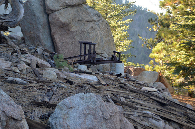
Angeles National Forest San Gabriel Mountains National Monument Click for map. There is still enough light left for something, at least for a silly little thing like Mount Akawie, AKA Buckhorn Peak. It rises a little above the campground and is most easily accessed by a road east of Cloudburst Summit and west of the picnic area. It does not seem to appear on maps and is blocked by a thin yellow gate. The spot has a huge parking area for those times when there is a grand party up on the peak, I suppose. For no good reason, I want to go up the little peak west of the main peak as well, so although the road is wide and easy and clearly the main route, I scramble upward to follow the ridge. Getting high for a view, a peek at peaks east through a wide gap. They do tend to be taller over there. In the small saddle before the little peak, there is a scattering of weathered planks. It looks rather like there was once a simple structure in the somewhat flat area. A scattering of r...

Will Thrall Peak and Pleasant View Ridge

Image
Angeles National Forest San Gabriel Mountains National Monument Click for map. A new day and new peaks to bag, but this time I will join a planned outing of the Hundred Peaks Section for some company. I have been really wanting to do the traverse of Pleasant View Ridge from Burkhart Saddle to the other side of the closed bit of the Pacific Crest Trail, especially if there is going to be a car shuttle. Unfortunately, this is not that. This is heading up to the saddle and then turning the other way to grab a couple nearby peaks. Still, it gets me into an area I have enjoyed visiting before, then out to some new spots. First, it is a little over a mile downhill on well used trail to Cooper Canyon, past various falls and with the sun thinking about getting down into the depths of the canyon. There is a lot of vertical to the land as Cooper Canyon empties out into Little Rock Creek. Past the Cooper Canyon waterfall that marks the end of previous exhibitions in this direction,...

Winston Peak

Image
Angeles National Forest Map link. I have plans for wandering up three more mountains after hitting the five while backpacking, but since I am half a day late out of that, I will just go up Winston Peak. This one first came to my attention as I looped down to Cooper Canyon and then back up along the Pacific Crest Trail. There is a very clear use trail climbing it from a saddle on the far side that the PCT also passes through. Parking at Cloudburst Summit, where the PCT crosses the road again, there is another route up following an old logging road next to the trail. There is a well used track on this side of the mountain as well. The track quickly leaves the old road, first to cut a long loop, then fully to climb the peak. Admittedly, there is no real need for a track or trail to climb this peak. The area is very open and walkable. A pair of grasshoppers.

Mountain Row: Mount Islip, Mount Hawkins, and Throop Peak

Image
Angeles National Forest Locate the trailhead. DAY 1  |  DAY 2  |  DAY 3 (Day 2 of  2  3.) It is a long night with no sleep and I am up with the moon to check out the Devil's Chair. The spur trail is mostly surrounded by metal, especially at the end when it leads out onto a sandstone outcrop with cliff sides. The sliver of moon is insufficient to take in the fullness of the thing even after waiting a while for my eyes to adjust. I head back, grab the pack, and finish hiking back along my egregious mistake. Dropping down along a dark trail under a sliver of a moon. I am back at South Fork Campground for the sunrise. The trail I had dismissed as coming from the campground before travels along the side of the sites, joined many times by trails from it, but keeps going. A major trail heads out from the end of the campground to join this one. It looks built, unlike the others, but is without any signs. The rock lined track continues up th...

Mountain Row: Manzanita Trail

Image
Angeles National Forest Locate the trailhead. DAY 1  |  DAY 2  |  DAY 3 (Day 1 of  2  3) From Islip Saddle to Vincent Gap, the Pacific Crest Trail (PCT) runs along five named peaks, two of them over 9000 feet. The section can be made into a loop using the Manzanita Trail, part of the High Desert National Scenic Trail, that drops from Vincent Gap down the north side of the mountains and the South Fork Trail that drops similarly from Islip Saddle to meet at South Fork Campground. This loop is around 24 miles. Water can be found reliably at Little Jimmy Spring. I want to do it as a leisurely backpacking trip with plenty of peak time, but the lack of a second reliable water source along the stretch of peaks does not seem to support that. The weather is predicted to be hotter the second day, so it seems a good idea to do the lower section first. There is also a 20% chance of thunderstorms in the area. As I arrive at Vincent Gap a little later ...

Burkhart Trail

Image
Angeles National Forest Map link. The high desert. While the valleys below swelter, some respite is found in the high elevations. But this desert is not dry and springs abound in its high reaches. This is not apparent as we drive through Buckhorn campground to the parking for the trail. There are no sounds from the creek beside the road and the ford doesn't even have a trickle starting across it. By the time we cross over the couple wet spots by small springs beside the trail, there are sounds coming from the bottom of the canyon. For a short distance, a second trail parallels the main trail with many spurs down into the creek, but following this route while examining below turns out to be too little effort to find the first waterfall. Further along, an unmissable use trail angles steeply back and down to reach the top of the second waterfall. This one is as difficult to get a look at as before, of course. The second waterfall marked on the USGS maps and the only ...

Cooper Canyon and (no) Buckhorn Spring

Image
Angeles National Forest Locate the trailhead and the end point . I found the Cooper Canyon Falls hike and have been wanting to go on it for quite some time. It is well outside of the burn closure, so I went for it one time, only to find the 2 was still closed at La Canada so I would have to drive all the way around, which wouldn't be so bad except the 39 is also washed out shortly before the 2. Now the 2 is open again, so when wondering where to go, I thought of Cooper Canyon again. It was even more attractive when I noticed how high up it is since it has been quite hot the last week. I double checked that it is not in burn area and noticed another closure near my destination. The hike calls for a loop with a shuttle going from in at Buckhorn Campground to the Pacific Crest trail and coming out at Eagle's Roost, but this second bit of trail is actually closed soon after the junction with the PCT. Another loop is possible by continuing the other direction on the PC...