Posts

Showing posts with the label Rio Grande National Forest

Treasure Mountain

Image
San Juan National Forest Rio Grande National Forest Click for map. I was thinking I might do a loop of Treasure Mountain Trail, some gravel road, Silver Creek Trail, and the Continental Divide Trail backpacking, but decided against. But I can still do Treasure Mountain. The starting point is up on Wolf Creek Pass as the CDT follows along the Continental Divide. Treasure Mountain Trail drops off the side after about 2 miles. It doesn't actually go up the mountain, but I can fix that with a little bit of cross country. There is an interpretive site at the pass to tell about the divide, the road, and the trail. It gets a surprising amount of business. The trail is off to the left. The trail going south seems a lot more defined than the one headed north. It crosses a meadow and then a creek with a bridge. Talk about luxury. Then up through the beetle killed trees where it needs a lot of maintenance. It has gotten a lot, too, but there is more work now. These beetles ...
Silver benchmark on the Continental Divide Trail

Image
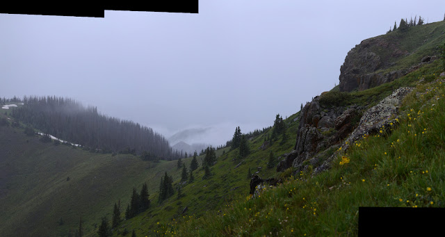
Rio Grande National Forest San Juan National Forest Click for map. Oh, dear, the weather looks absolutely dreadful, but in the spirit of having no idea what it will really do so I might as well go for it, I'm going for it. There have been some mornings that looked just as dreadful and did nothing much. A random section of the Continental Divide Trail that happens to have a benchmark nearby is the goal with maybe a little extra look about to the south. Access is via a short trail to Bonito Pass, but it goes off the end of an old logging road marked as unimproved dirt road #388 written vertically, both basically code for you ought to have a 4WD and better have high clearance to drive this, especially if it has been raining. It's positively soggy and since I have neither, I have an extra 2.5 miles from gravel road #390 (signed for Tucker Ponds) at a place labeled Campo Molino. My starting point, off the side of an impacted dispersed camping spot spur. Road #388 (on...

Lobo Overlook

Image
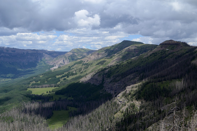
Rio Grande National Forest San Juan National Forest Click for map. Lobo Overlook sits on the Continental Divide and the edge between the Rio Grande and San Juan National Forests high above Wolf Creek Pass where US-160 crosses over that divide. The road up is gravel, starting about a quarter mile east of the pass where what is most visible is a large dirt turnout. It is finally signed at the road leaving the turnout by a gate. At the top, the road splits to access the lookout area with bathrooms and picnic tables or an electronics site where a short trail connects to the Continental Divide Trail a short way below. The overlook comes with quite a lot of view east and west with more view north to be found near the electronics site. The day was already looking quite stormy when I got there although it never quite turned into anything. The San Juan National Forest side from the overlook. The Rio Grande National Forest side from the overlook. Table Mountain should be o...

Table Mountain

Image
Rio Grande National Forest Click for map. Ever plotting for loops, I noticed that the local "Table Mountain", quite a popular name for a mountain, is very nearly visited by the local "Highline Trail", which also seems to slightly less popular, but they tend to be worth visiting. Kitty Creek Trail provides a way up on one side and Tie Hill Trail on the other with Shaw Lake Loop Trail (which does not seem to loop, but perhaps it is just a piece to help make the loop I am doing) and a little bit of Lake Fork Trail to finish it off. Well, also about a half mile of road along Shaw Lake, but it is gravel and flat and will go quickly. The spot on the map marked "Stairsteps" has me intrigued. I have decided to go counterclockwise making it about 8 miles up and 4 miles down from the peak. Kitty Creek is marked with a sign listing the dangers of entering a burn area, but the Shaw Lake Loop Trail seems to have not had even that much attention given to it. T...

Pinorealosa Mountain

Image
Rio Grande National Forest Click for map. Another day when I am absolutely certain it is just going to rain on me, but I still can't guess at this weather well, so I'm going anyway. Pinorealosa Mountain has a road up it, but after the yurt (which you can rent, at least in winter) it becomes rather rough for a small car. At least according to the map. I decided to take La Manga Stock Driveway up, except it seems to have vanished from reality. Instead I'm starting at the road to La Manga Cow Camp and then I guess just cross country up the mountain to the top. Once at the top, I've got the high point in the middle, a geocache at the far south end where the finders claim there's a fun rock outcrop, then back north for a benchmark and down again. At least starting at the road means there is a (locked) gate instead of barbed wire to pass the fence around the administrative pasture by the cow camp. Plenty of room on the locked side of the gate to walk past an...

New Mexico/Colorado State Line on the CDT

Image
Rio Grande National Forest Carson National Forest Click for map. Okay, I admit it, the only reason I set off on this hike was to cross the state line on foot and maybe find a marker. The map says there's one right on the line very close to the trail crossing. County? State? Forest? No idea. They all have a boundary there. For the rest of my planning, I figure if I go 6 or 7 miles, the hike will be about half in each state. Anyway, more random miles on the Continental Divide Trail. A pair of tents has sprouted on the north side of the highway and the cuben fiber one talks as I go by. No wonder those things are so expensive! They're too late for northbounders and too early for southbounders but perhaps with the heavy snow they are simply determined-to-do-the-high-route-bounders who have reordered their northbound miles. Or section hikers. Or just getting started, but it seems unusual that they would be camping at the start and no car nearby. I completely fail to ask t...

Neff Mountain

Image
Rio Grande National Forest Click for map. Neff Mountain sits with a cliff face to the west and I decided to climb it. The high point is a few feet back of that cliff face and an older geocache is some distance down the other side, so I decided to go and visit both. It looks like a long ramp up around the south edge of the cliff and another route is possible around the north side, so these will be my routes up and down. There are also old logging roads that come up the north side, but nothing I have documents much of them and the cross country routes look quite fine. It is too short to feel the need to resort to a road. Just a little mountain about a mile off with a mesa flavor. I do have to make my way along the road a short way to start up the south side, but there is plenty of shoulder along the way and turnouts should I have decided to do an out and back along the south route. Just past a small creek, I start to climb upward. It is a late start, so I get to watch th...

Flat Mountain at the edge of the South San Juan Wilderness

Image
Rio Grande National Forest Click for map. Finding myself once again at a crossing of the Continental Divide Trail (but not as it edges along the Great Divide), I am drawn once again to finding some destination along it to hike to. The benchmark marked FLAT which seems to designate one minor corner of the South San Juan Wilderness looks like a good one, if a little far. I estimate it at 11.5 miles. (Actual: 11.3 miles.) Doable. Especially as the gain really isn't all that much for the length. The trailhead along the old highway behind the train station sits just about exactly at 10k feet and the peak at nearly 12.2k feet. Just 2200 feet gain over 11 miles is what I am willing to erroneously call flat, but then FLAT is the goal. There is a bathroom out of sight of anyone following the trail and a couple possible dispersed camping sites somewhat near the trailhead, but not actually any parking except where it crosses the current highway. For good measure, they don't sig...

Trujillo Meadows Reservoir

Image
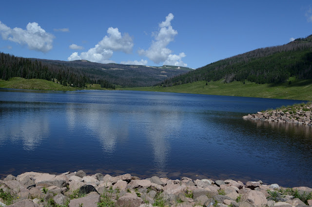
Rio Grande National Forest Click for map. I did a little wandering including a visit to the Trujillo Meadows Reservoir. There are two ways for quick access. One is from the campground where a day use fee is expected and gives access to the dam and outflow most easily. The other is a little further down the road where parking, bathroom, and boat entry can be had for free near the inlet. I, of course, went with the free option. There are fishermen trails around the edges to move around the lake. These are sometimes indistinct and do have some small streams to cross getting from inlet to outlet. I didn't go all the way around the reservoir as the inlet is really quite wide and I don't like getting my shoes wet. Looking toward the inlet. The area is meant to be ADA accessible. A little bit of trail at the edge. Look to the far edge and there is a boat out on it. That was one of two while I was there. I wouldn't eat that one. Looking across the reser...