Posts

Reyes Peak

Image
Los Padres National Forest Locate the trailhead. When everyone else went on down the mountain, I went further up it to see if I could get to the peak. The road did not actually go there although it was rather obscured by other details on the forest map. There was a trailhead instead. A short way down the trail splits one side heading off to one side of the mountain, the other to the other side of the mountain and a usage trail splitting the difference heading up the mountain. I met a man walking along with his kids that looked like they weren't more than five coming down the usage trail. He said that the trail started off quite steep but got quite flat above. Although I didn't actually see little footprints all the way up, it was pretty good for a usage trail. It was especially good for a usage trail that travels along a ridge passing about four false peaks. It looked like a lot of people don't actually get all the way up to the peak. There was a wide, fla...
Raspberry Spring

Image
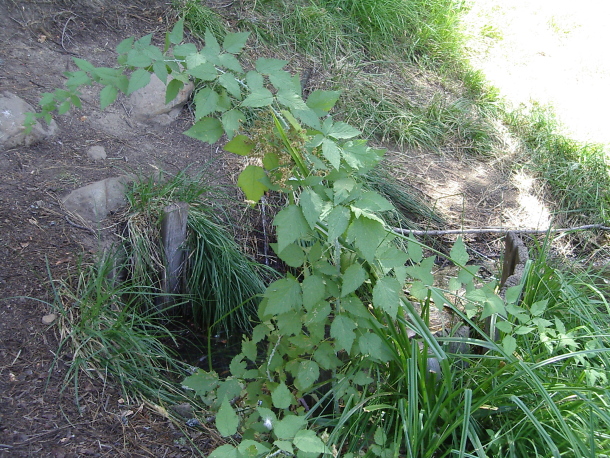
Los Padres National Forest Locate the trailhead. We spotted the sign for Raspberry Spring on our way to Chorro Spring the day before. It was a little way down the hill on the near side of Reyes Peak campground where trailhead parking could easily be mistaken for campsite parking since a campsite was also there. The trail was a little harder to see from the road but easy enough from the sign. It is only 0.4 miles down to the spring. Finding the spring itself proved a little harder. We came upon a campsite, since this is also a campsite like the other spring complete with campfire grills, and then another one but didn't see a way off to a spring or any sign of a spring. I followed an animal trail a little ways figuring it would go to the spring. It probably did in the other direction but I found a third site up from the animal trail a little way instead. Then I found myself at the first site again and spotted a people trail that headed to the spring. The spring on...

Chorro Spring

Image
Los Padres National Forest Locate the trailhead. The trail down to Chorro Spring started at the far end of Reyes Campground. It had a large road sign to mark it so was easy to find. The first few feet looked like road and had a road block on it, but shortly after that it was only trail sized. The trail actually goes past Chorro Spring to Oak campground and then on to 33. On the way to the trail head, we found a former bee hive. A little bit of honeycomb is still visible in the hole that was once occupied by a bee hive. The hole still smells strongly of honey, too.

Reyes Peak area (camping)

Los Padres National Forest Chorro Spring | Raspberry Spring | Reyes Peak We headed out looking for a place to camp. The main plan was somewhere on up highway 33 near Wheeler Gorge. First we looked for a spot in the valley, but the Gorge campground itself was full with people reserving spots and had weird rules for weekends. Middle Lion and Rose Valley were both quite full when we went by, so we climbed the mountain. Dropping into Pine Mountain and found one site empty. I dropped off my passengers to hold it and wait for the second car while going up to see if there was something in Reyes Peak, our preferred spot, but there wasn't. It was quite nice, though, and I found the trail down to Chorro Grande. After setting up and getting ourselves fed lunch, we headed over to Chorro Spring on foot. Then back for lovely dinner and a bit of star gazing. The stars were nice and crisp and plentiful. Then along came the very annoying not quite teenagers who felt the nee...

Arroyo Seco to Switzer Falls

Angeles National Forest Locate the trailhead. Fellows who claim to have hiked it before claimed Arroyo Seco connects with Switzer trail for a total of about 8 miles of hiking.  The sign at the turnoff to the bottom of the dam would seem to imply the same thing, although maybe it's 8.5 instead of 8.  The map shows the trails connecting.  A brilliant plan would be to hike up the 6 or 7 miles to the bottom of the falls instead of hiking down only 2 miles to the same.  It would be just long enough and probably not too long. Unfortunately, it is 9 miles to the bottom of the falls.  As the sign where the trail I was on met up with the trail I'd been on said, it is 8.5 miles to "Altadena".  It is at least a quarter mile to the falls from there.  Ignoring that signs further down claim you are going to "Pasadena" and I'm fairly certain that's "La Canada Flintridge" anyway since it's next to JPL, that's a bit of a longer distance than...

San Ysidro

Image
Santa Barbara Front Country Locate the trailhead. For a short hike with a little bit of water falling at the end, we selected to wander a little way up San Ysidro Trail just behind Montecito, oddly close to the road by the same name. Although then there was a right at East Valley Rd. and a left at Park Lane and keeping right at a Y with East Mountain Dr. after turning north on San Ysidro. The road ends at the trail since someone has decided the rest should be a private road these days. The trail meanders past a few houses and then follows the road shortly before going back to the more general trail-ish style of travel. The trail follows a stream along up the mountain. A bit of stream along the trail.

Rubio Canyon

Image
Angeles National Forest Locate the trailhead. One day short of a year from the last go , and we're off again. Well, fewer than before. We're out to see the falls and the day is just a bit clearer. As we went up the canyon, there was actually water along the bottom, we could hear it. Also, we could see it for a short bit where it came up in the litter of rocks at the bottom when the trail hits there. We powered our way right on past the first waterfall and up the canyon on the side looking to see where we could get to. Instead of going along the first trail to the left, we kept going up the bottom of the steep, narrow canyon. Further up there was another trail going off toward the various falls that are promised to be up there. Now anyway. Up and up and up we went. Finally there was a low road that looked at least as well traveled as the one still heading straight up. What we found was a big waterfall. Thelehaha (top) and Roaring Rift (below) falls: Beyon...

Vogel Flat area

Image
Angeles National Forest When I got back from the Condor Peak hike, it had gotten quite dark and the moon was overhead. I played with the camera a little bit. Just letting the camera choose its own speed, the moon is easy to see. I was holding the camera against the car to try to get this at first. Since the shutter isn't open so long, it almost worked. Result was generally fuzzier than this. After playing with night mode, I tried again with this normal picture setting but this time making it pause for a long time between the press of the shutter and the photo so I could take my hands away from the camera before the picture was taken leaving it just resting against something. Plants, in this case, which isn't ideal. In between I played with the "night mode" which seemed to open the shutter for about six seconds. This turned out to be too long to try to hold the camera, even braced against something. That's when I found the plant to hold th...