Posts

Dry Lagoon and Stone Lagoon

Image
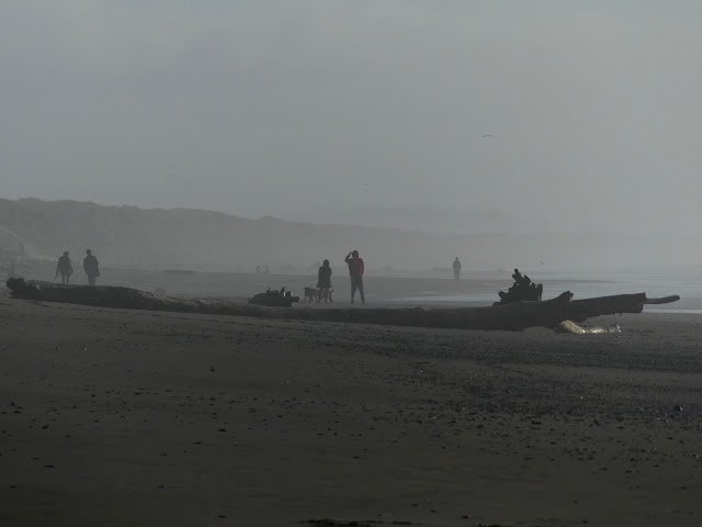
Humboldt Lagoons State Park Click for map. With the skimpy amount of daylight left, I briefly pondered stopping by Trillium Falls again instead of heading to the Dry Lagoon. The trillium do seem to be in bloom now, but when I was there before, it was in the last of the light, and I think I would like to have more light next time. Besides, plans should mean something and the trail doesn't look that long. Various AllTrails users have made complaints that there really isn't any trail at all there, but it's marked on my OpenStreetMap, so I'm pretty sure I can find it. The trail should be approximately here where there picnic tables and such. I'm not surprised to see no indication of a trail in the sand among picnic tables. I am surprised to see no mention of it on some sign. There is even a small backpacker camp (reservations required) along it. I just start walking north. The sea churns with little waves to my left and the not quite Dry Lagoon reflects ...

Miners Ridge, Fern Canyon, and James Irvine Trail

Image
Prairie Creek Redwoods State Park Click for map. I was thinking I would go out and see the Dry Lagoon in Humboldt State Park, but that's quite short, so I needed something more for the day. I settled on a big loop that would include Fern Canyon since Prairie Creek Redwoods is just a little bit further. Then, because it's much longer, I decided to start there. It's a long dirt road and an $8 day use fee to start on the Fern Canyon end, so I went to park by the Visitor Center for free. Right next to the trailhead, parking is 30 minutes only, but just past it are a couple spaces with no limits except the general no parking in the State Park after 10 PM. Pulling out my gear and grabbing a brochure with map from outside the visitor center , I'm ready to ramble! Plenty of signs at the start. No dogs as usual for the California State Parks. That's quite a tree behind the sign. The big trees start instantly. They're particularly big ones. In a few feet, ...

Beith Creek loop

Image
Arcata Community Forest Click for map. I headed up to the little local bit of Community Forest for some redwoods and to check if, maybe, the Arcata Ridge Trail goes through yet. There's not much signage visible from the road. You just have to get to the right neighborhood corner and find the steps up. It seems I'm picking a time when quite a lot of people are suddenly coming out to be enveloped in the green at the top of those steps. Plenty of information signs at the top of the steps including a map of the paths available here. Maps are also online. No paper maps are provided. I think I'll go up to the top first and come back around clockwise. Up via trail or road? Well, trail of course. The trees are a little closer that way. Annoyingly, the dog leavings are little tufts of mold everywhere. They actually provide bags for dog walkers near the signs, but the use is probably a little less than half. I have seen plenty of people leave it, plenty pick it up, an...

Mad River Fish Hatchery

Image
Blue Lake area Click for map. Continuing up Hatchery Road to the end is the actual fish hatchery. They have river access and public areas to poke around. The sign on the parking lot says it will close at 5:30 PM. I plan on taking the trail up along the edge of the river, but first, fishies! More signs say anyone and any pets that have been in the Mad River may not enter the hatchery area for fear of New Zealand mud snails. Most the pools are dry (ish) and empty, but a couple have fish and labels so you can know just what sort of trout or salmon are swirling around down there. Loads of trout in a pool. The shadow of the mountain has already moved over, so it's rather hard to see them all crowded in there. Past the ponds, they've got picnic tables and river access and a number of people fishing. There's paths wandering all over including around more primitive ponds. One could get in quite a bit of wandering aimlessly here. I decide to stop at the chain althoug...

Mad River Levee

Image
Blue Lake area Click for map. There's not much parking right by the levee, so I parked along the street a block away where there was plenty of room. Also Mad River Brewing across the street. I understand some people really need to know that sort of thing. The levee itself is open to the public along the top and the slope down to the river, according to the sign on the gravel side. There's a space for a missing sign on the paved side that gets a lot more use. Open an hour before sunrise to an hour after sunset as a walking path and river access. And in the future, I should try to notice when that lens hood is out of alignment. The paved side of the levee path, which sees more people. The Mad River. This time of year, it should be much higher. I head down the paved section because that's the way that will get me to the geocaches I'm plotting to find today. There are a few other walkers, but most of the activity today seems to be fishing. They...

Mad River Beach

Image
Humboldt County Park Click for location. I finally did something about the fact that the dSLR (Nikon D3100) has a number or problems (main lens clouding up in the cold, vibration reduction sometimes becoming vibration creating, odd light metering, probably a number of other small things I've forgotten about) by the purchase of something new. Fixing it is likely to cost just as much since it is a dSLR, even if it was about the cheapest such. I've really never used it in a way that justified having a dSLR, so I have reverted back to a superzoom. It's still a step up from my last superzoom and not just because technology has marched on in the years since I purchased the last one. I went with a Panasonic Lumix FZ300. It can run from 25mm to 600mm (35mm equivalent), which isn't quite as wide as I would like on the wide end. On the other hand, I should be able to judge the correct exposure compensation better because the view finder is fed by a LCD and not a mirror. It...

Bruhel Point

Image
Caltrans vista point Click for location. The unassuming sign for the parking just says "vista point" and points at a block of parking spaces on the side of CA-1, but there's much more than that. Signs beside the parking help to point out how much more. One talks about the small wetland. It was this that drew the interest to purchase the parcel for preservation in the first place. One talks about the ocean preserve off the edge of the cliffs. The oldest illustrates the trails. One is accessible with benches every 100 feet, which is great except that it doesn't really help to see more to go parallel to the cliff. This trail rates a "meh" in my book. The other trail trots right on down to a bench up upon those cliffs looking out over that marine preserve. This one is absolutely brilliant. There are also more trails that are dirt, but as this is a wetland and I haven't got any Wellies, I didn't get very far on the one that loops around to the end ...

Ten Mile Dunes and Inglenook Fen

Image
MacKerricher State Park Click for map. I'm not sure if I'm sneaking into the state park or not because the state consistently fails to mention if a park is free to visit. I tend to assume a state park will cost, but many do not and others only have fees in a few areas. (Hum, maybe I should take note of that. If I have not stated a cost to visit a place, it is because it was free when I went. Most places I go are free.) I cannot find any fees associated with any areas of MacKerricher State Park outside of the campground. There is certainly none from the little parking area at the north end which also accesses the Old Smith Ranch which is part of the Mendocino Land Trust. It's a handy spot to access the Ten Mile Dunes and that's what I'm looking for. I haven't been on dunes for a while. There is also Inglenook Fen, the "only remaining coastal fen in California". What's a fen? It's a peat forming wetland where the water wells up from the ...