The date stamped on the edge of my first Platypus bag is 12-1-00, and since getting that one I have only had them fail on me four times in three different ways. The first way is that the edge has become delaminated at a common fold spot and has happened twice. The first time, I had filled the bag and set it on a counter and it started making the oddest noise as it poured out a little water from the edge and then sucked in air to replace it. The second time, I had filled the bag in the evening before heading out and it was half full in the morning. Both of these failures were simple inconveniences. I inspect the bags sometimes before using them, but usually I just do not fold them anymore. The second way one has failed is when I managed to get the hose tightened onto the bag a little crooked. This left the bag draining very slowly into the bottom of my pack and I felt I was sweating a bit more than expected until I found the problem. At the end of the day when I watched the sunset from a peak, I went for my fleece to find it soaked and I was decidedly uncomfortable wearing it, at least for the first ten minutes. This was purely user error and I had been using the thing for far too long to have done it. It is preventable, just pay attention. The third way one has failed is when I had it full and tucked into the top strap on my pack and could not be bothered to rebalance it as it slipped a little, so it tumbled to the ground where it might have just hit dirt, but instead hit two very sharp rock points. Water poured from the fresh wound and I transferred it to the backup bag. There is some user error involved in this one, too, and that is not a high rate of failure, but it is a very important piece of equipment and some sort of repair kit, especially if it is only a gram or so, might be nice to have.
The bag afflicted with holes from a fall, while full, of about five feet onto two sharp rocks.
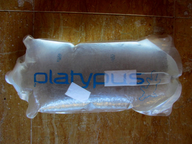
Two days after holing my bag, I wanted it to be useful again and realized I was carrying the repair for it wrapped around my extra GPS batteries in the form of waterproof first aid tape. Applied, the bag holds water again. There are no moist spots in the tape and it has been reliable for use 2-3 times a week since February when it was placed. It is working so well, that I have preemptively placed tape on what I expect to be one more failure mode, a spot where the top folds over, especially if the bag is overfilled. (The bag pictured above is overfilled. This user may error quite often with these poor, abused bags.)
Pre-bandaged top of a Platypus.
So here is another very simple do it yourself to have a repair kit for Platypus bags:
1. Take a length of waterproof first aid tape, about one foot.
2. Fold it onto itself in a small roll
The tape I have is from CVS and is just the store brand. While it has been exceptional for linear tears in the side of the bags, I expect that it will not fix delamination at the edges. On the up side, it does seem to take about ten years to have that problem. Oh, I despise duct tape. It weathers badly, it wears badly, and anything you are doing with it can be done better with something else. (What do people do with it?)
Repair kit on the right and the tool on the left.
Well, that was a very small thing, so here is a bonus MYOG I found in a Backpacking Light forum.
Ultralight folding bowl:
Take one Platypus 2.5 liter bag and cut off the top. Comes in around 14 grams. Otherwise, the lightest bowl on the market is the foldable Fozzils at just over 30 grams. Also mentioned in that thread is using the bottom of a milk carton, which does not fold but should be comparable to the Fozzils bowl in weight.
Get link
Facebook
X
Pinterest
Email
Other Apps
Liked this? Interesting? Click the three bars at the top left for the menu to read more or subscribe!
Coconino National Forest Click for map. I seem to be collecting fire lookouts, but the inclusion of Wing Mountain on the list of Arizona lookouts on Peakbagger wasn't what got my notice. It was the simple fact that the quad west of Humphreys Peak is named for Wing Mountain. I'm a bit suspicious about it being a lookout because there is not so much as a trail going up it, much less a road that is common for such things. People who have climbed it seem to have just picked a side and gone for it. I picked the side where there is a shoulder called Little Wing Mountain so I could climb and get the benchmark, then move nearly halfway around the crater to the high point. It is a side that looked highly climbable from afar, which seems like another plus. Forest road 222 (Wing Mountain Road) in seems generally maintained, but 519 only happens to be passable for my little car by a bit of luck. I park at 9230C where someone has had a camp site. It is a little way down the hill fro...
Since I last wrote about digital maps, the S1 Mobile app has been shut down and the Forest Service released a new map app that looks pretty good. It might be time for a new post on maps. (Check the "equipment" tag for older editions.) USFS app in offline mode showing a section of the Pacific Crest Trail north of Marble Mountain Wilderness including intersecting roads, streams, and contours. As before, this will focus on legal, free ways to have maps stored on your handheld computer (AKA "phone") so you can have them anywhere and any time. While these are free, it does help insure that independent developers keep going next year if you send some money toward them. My criteria for a map app: Works offline. If you only have a map when online, you don't have a map. It is as simple as that. This is non-negotiable. Maps should include contours. I'm looking to hike with these maps after all. Shows location. User configurable storage opt...
Redwood National Park Click for interactive map On the prior Thursday, I joined the California Invasive Species Advisory Committee's invasive species tour of Eureka. It was at the last minute because I figured I knew all about these things since I spend a bit of time each week hacking them down as a volunteer. Of course, they were talking about the lesser known things and the tour started out with aphids that affect Sitka spruce terribly as we toured Mouralherwaqh, a patch of land that is Wiyot again. This one is not open to the general public, but we also visited the 'O Rew Redwood Gateway, a piece of land that is Yurok again, and is open to the public as of 1 Aug and where I discovered a new trail. I also noted that although this was most recently an abandoned mill site, there are some nice rounded tree tops poking out of the forest nearby, one of the signs of old growth. I decided I would be back to try that new trail. The sign at the after hours/overflow parking a...
Arcata Community Forest Click for interactive map Speaking of new trails, the city of Arcata has been getting some built. The Beith Creek Loop in the Arcata Community Forest has a nice windy bit that dips deep into another stream canyon, making a lovely reroute for a skid road that passed as steep and slippery trail before. I keep meaning to show it off although likely very few will find any meaning in it. They've also been hard at work on their end of the Annie & Mary Trail. A while back when I hiked the Arcata Ridge Trail, I found the base layers in and it was getting close. A couple weeks ago , it was paved with a bike zooming past. I've been told that the section still under construction is quite beautiful as it goes along the Mad (Baduwa't) River. So, with the caveat that I don't want to be pressing gravel about and slowing down the process of the trail coming together, I headed out for an Arcata Ridge Trail "thru hike plus". Past the first ...


Comments