California Coastal Trail, Tey-wo-lew Section
Redwood National Park
(Map link.)
I decided to give the Tey-wo-lew section another chance. (And since it's so short, I could maybe visit those ghost pipes again after.) My first time along it, all I knew was there was a line on the map. I didn't know it was the main highway until that was rerouted inland, then was the Coastal Drive until getting gated a couple decades ago. Finding a wide, fairly level "trail" that was sometimes paved and even lined, was an unwelcome surprise. The day happened to be fairly foggy, so I didn't get any of the views. I checked to make sure there was a reasonable chance of some clear coastline before coming. Unfortunately, my camera managed to make it onto the floor instead of into the car, so that coastline got photographed with a cell phone. It's a shiny new cell phone and it has three cameras, so we shall see. It was bought so I'd be on the T-Mobile network instead of the dying Sprint network, not for a good camera, so I didn't hold out much hope. Even the old phone camera was better than nothing.

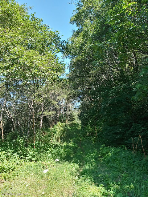
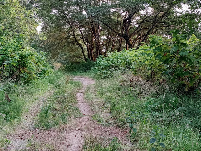
I started north on the paved road. It doesn't stay paved although it looks like a road bed suitable for driving. A bulldozer had been along to make sure in the not too distant past. The first part is probably kept up as a fire escape route for Alder Camp.


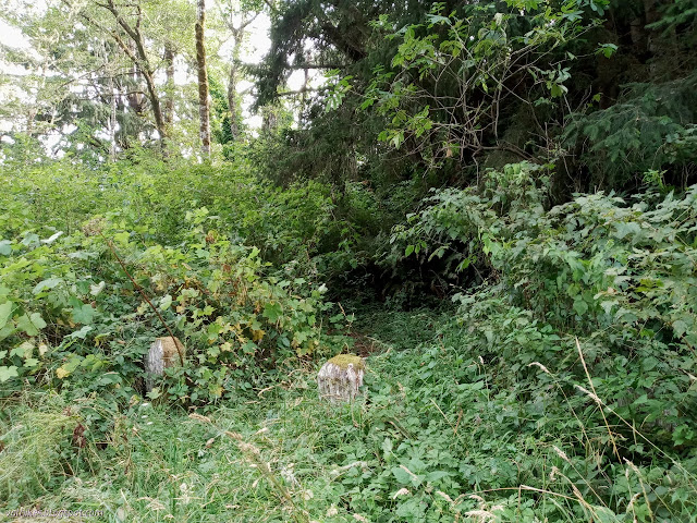
I arrived at the road into Alder Camp with its ban of all cameras, among other things. The road is rougher after that with the roughest bit immediately following the junction. It drops very steeply with ruts from some difficult wet drives (presumably in an official capacity). I made my way down it carefully, then enjoyed the increase in greenery on it except in those sections that are still paved.


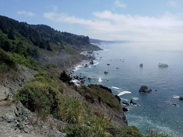
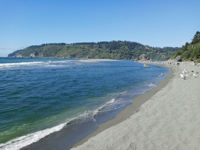
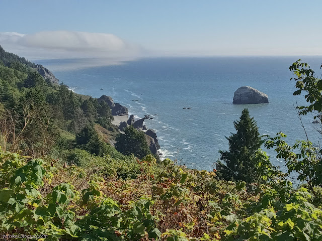
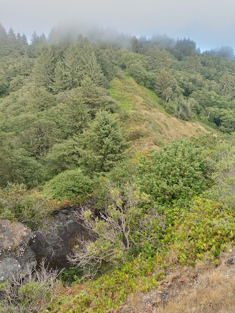
The fog was lifting a bit and I got to see Split Rock and some of the beach as I passed. There are a few places along the way to see stacks.


I wasn't even certain I would wander on down to High Bluff Overlook again when I started. I got to the end of the closed off road and had decided to go ahead and extend the hike again, rather than visit the ghost pipes. There's the radar station to visit and I'd even wander to the mouth of the Klamath River. First stop would indeed be High Bluff.
There's actually two overlook points at High Bluff. The first past the picnic tables is the obvious one. There is a trail north to the second. There is also a goat track of a trail the connects the two. I had forgotten that, so had to discover it again while not actually taking it. What I did remember was the trail to the beach marked by a sign claiming danger. I sort of want to take it, but I didn't get far because it was already in my mind that I would get to the beach an easier way. It was a brushy but usable (and likely used) trail for as far as I went, but probably gets washed out at the bottom.

Then I continued along the Coastal Drive. It is open to the public for one way traffic and consistently a very smooth gravel surface. There are pull outs along the way for most the viewpoints, but not all. There's not much more pullout for the old radar installation, which was my first stop.


There's a much larger pullout for the parking at the west end of the Flint Ridge section and a river lookout by a small cemetery. The old road still visible as access to the beach was marked as private property, so I continued to the river access beside the ceremonial grounds instead.


I founds loads of cars along the road by the gate to the ceremonial grounds. They were using up more parking than there was. The ceremonial grounds were absolutely empty as I passed. The river has scoured to the rocky edge, but there is a well trod path in the trees to get to the ocean and I found more than enough people to fill all those cars on the far side of that.

There was some conversation, sometimes even loudly, as I passed all those groups of people, but the real ruckus was out in the water. Sea lions were after the same catch with plenty of barking. Meanwhile, there was me without my superzoom to grab pictures. They weren't doing any tricks like those I watched one afternoon from the Lost Coast Trail.

Not interested in joining the fishing, I continued along the beach to Flint Rock. There was one more pair fishing and then no one. Well, that is until someone popped out from a path down the cliffs. He pulled off his boots and started south, but then returned. I suspect there are ways south at some tides, but perhaps not that tide. How much more beach would there be if the Klamath weren't dammed still?


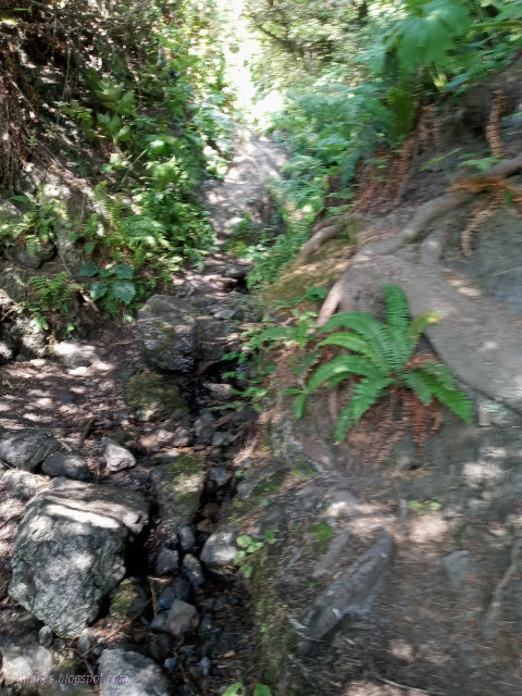
I had snacks on a large log before deciding it was time to head back. Since I was directly below the Flint Ridge parking, I was pretty sure I knew what that trail was, although the guy coming down it had seemed insufficiently armored for the travel. I gave it a try. It starts off in a stream bed (flowing -- the only possible drinking water, after treating, I saw all day) and climbs steeply up to the parking above. The last 40 feet vertical were even familiar right down to the specific blackberries reaching across it. They tended to be a little less pointy than when I first explored it a little from the top after hiking Flint Ridge. The only surprises were the sections with rope (it wasn't that steep, but maybe it is needed when wet) and the old road cut about halfway down.
There were backpackers unpacking at the top. The campground on Flint Ridge reopened sometime in the month prior. I headed south and spotted that same fellow heading down to High Bluff Overlook. My heart was set on trying out the trail by Split Rock. I spotted it four years prior and didn't do it since I had a meet time at the other end. It has kept nagging at me since then.
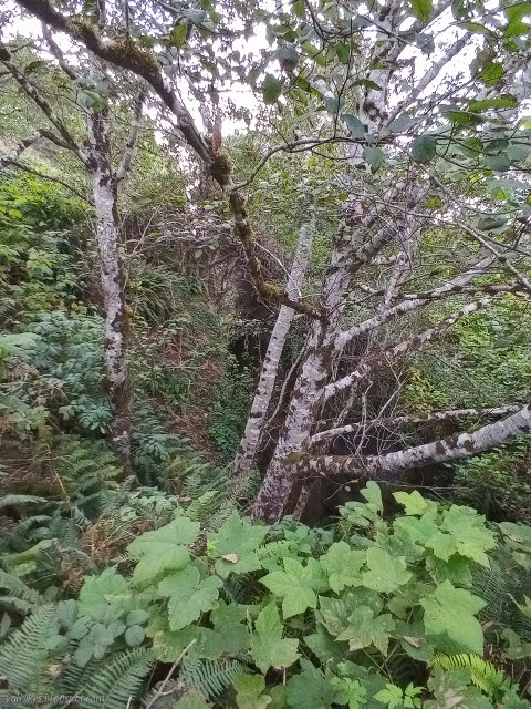
At first, the trail almost looks like it might be official. It gets used, but no maintenance beyond that use, and has a few thorns along the way. I was rather happy to have long sleeves and trousers. Trails spurred off to the north, but I think most of them might have been animal trails. One early one might be heading for the beach.


At the split, the majority of the traffic apparently takes a turn and scrambles along the edge. Brush was pushing out onto that trail and I wasn't feeling very interested in finding out why they go that way. The taller of the rock pieces was clearly accessed going straight. I headed up the last little bit to the top of the rock taking the more direct of the multiple trails.


I headed up, looking up to find that very same fellow coming down. He volunteered that you can climb down through the crack, if that's your desire. He had been down that way many times. I suspected he would know all kinds of fun things about the area but decided not to ask about those secrets. I did ask if he knew of places to find water, but there's only that spot at the bottom of Flint Ridge. Well, that's not exactly what he said and at other times of the year there is surely more.

At the top, I turned south once more. On the road again. I met no one more, but a ranger SUV did pass me at a surprising rate of speed as I neared the end, then zoomed past again in about the time it would take to get to the junction to Alder Camp and use that wide area to turn around. All in all, an excellent day, but there was no time to go see the ghost pipes after all.

*photo album*
©2021 Valerie Norton
Written 10 Sep 2021
Liked this? Interesting? Click the three bars at the top left for the menu to read more or subscribe!


Comments