King Range: Buck Creek
King Range National Conservation Area (BLM)
DAY 1 | DAY 2 | DAY 3 | DAY 4 | DAY 5Click for map.
Today is peak day! Again! I have to hike back up to the ridge and the spur to the peak is even shorter on this side, so I might as well see it in a little different light of morning instead of afternoon. My first discovery in the morning is that there is a little more color to the place than I could see before. The sun, slow to come even to the slopes around, found a nice clump of madrones to light up eventually. My second discovery is that I didn't look around quite enough for water. I was sometimes hearing some above because about the same distance above as below, there is water in the creek. It just dives under for a short distance. I still have no idea where the spring might be.

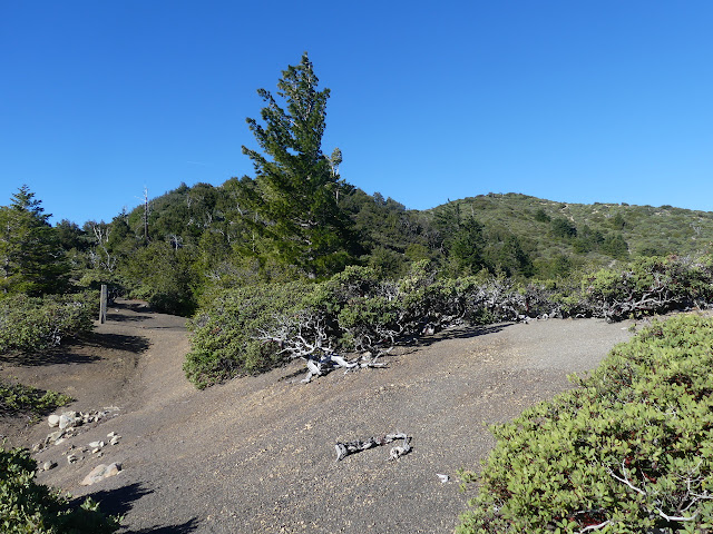
Then I turn and climb with the trail. It is quickly up onto a ridge line and out of the trees. The dreary and colorless is suddenly replaced by bright red and green of manzanita. There were more trees once before a burn. Now there's a lot of view of the morning mist in the valleys.


It really is a very short spur up to the top, especially when still fresh in the morning. The weather is basically the same. The morning is already late enough that the light is similar. Still, it's not all the same.

I couldn't find the benchmark when I was up yesterday, so now I have a look at the NGS data sheet to see what I can find out. First, it is an old mark. The 1930 description includes, "Original station mark was a brass candlestick set in cement which was surrounded by a hexagonal concrete pier with a 3-inch diameter wood core. Pier was surrounded with a heavy pine casing, and space between pier and casing was filled with pulverized rock, covering pier 6 to 12 inches." That would have been 1879, most likely, since that's what a survey crew in 1928 stamped the disk they set in concrete after not finding the old concrete pier. Further descriptions indicate the concrete they set it in was the concrete pier. I have to chuckle a little at that. Also, that should be really easy to find and it's not here. Looking around the peak, I have no trouble believing it has fallen off the side. More reading, it is, "19.5 feet northeast of the east corner of a vista shelter." Er, I don't think so, unless we are confusing east for west. "17.5 feet northwest of the west corner of another vista shelter". Ah. A whole vista shelter has fallen off the side of the mountain. In 1964, the references were found loose and the rock so bad they didn't bother to add more. My only chance at finding a benchmark is probably the azimuth.

I ponder the distant mountains. Some say they've seen Shasta from here, but I'm not so sure. The one that looks big enough has so little snow. Shasta would never have so little snow at this time of year. Not yet, anyway. The climate hasn't gotten quite warm and dry enough yet. The more distant mountain with more snow might be Lassen. I get out my compass to verify it's at least roughly in the right direction and it is. Shasta should be quite a bit north. I can see the smallest little white triangle out on the horizon in the direction it should be found. I feel like Shasta, some 4000 feet higher and not much further off than Lassen, should dominate a little more than that.

I try to puzzle out the location of the azimuth. If one approaches on the old roads and trails, one comes through a camp. Maple Camp? Could the dotting of little pads be that old? Nothing seems to line up anyway. Last is northwest from the azimuth to the peak, so it'll be back the way I came today. It is 38 feet west of a sign vista at a junction. The same junction as exists now? Maybe not. On the way down, there is a discarded post with holes to bolt a sign at the side of the trail. The way toward the crest of rock where the azimuth should be is clear enough to travel, but the crest itself is a cluster of very dense vegetation. It'll take more than a casual search unless I'm lucky and I'm not lucky. In fact, I manage to nick my upper lip while breaking a bit of long dead brush from my path. Not feeling lucky at all. And it's too far off from the sign, which could have been anywhere. The current junction doesn't look like a good candidate either. West of it is along more trail. No benchmarks for me. Time to just follow the crest some more.


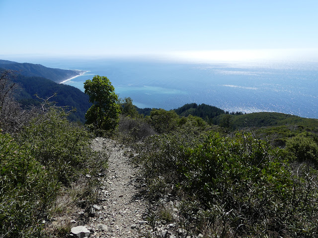
It'll be another short day, so I'm looking at the lesser peaks again. They're easier here. I saw fuel breaks when I first looked up to these and now I am to them. The fuel breaks make the way much easier. First is Fire Hill, which is just over half a mile off trail.

It's not a pretty walk, but it is generally easy. Debris from brush cutting has been strewn about but the animals have established paths through it. The peak itself is past a smaller false one and the excursion away from the crest makes the view feel worth it.


Next up is Saddle Mountain. This is closer to the trail near the junction with Buck Creek. I wait for the junction to go climbing it. Buck Creek is also a bit of old road and another old fuel break comes off it for easy access to the peak. Unfortunately, it's not particularly worth it. Others on PeakBagger have tracks that show they went far over the top to grab a bit of view, but I just got view on the nearby peak and just turn back to follow the trail down instead. There's still 3000 feet to drop.

There's plenty of views from up on the ridge anyway. There's people again. One trail runner nods and a pair who have done a few other hikes around here tell me the surfers come out to Miller Flat for the point break. It certainly does have the same sort of randomness that can be found at Rincon. They've also seen the airstrip in use. (Oh, I should have told them about helicopters in Golden Trout!) It's warm again and I'm a little worried that I might not have grabbed enough water to start with. They confirm there's no water until the bottom. But I'm going down and there's some shade earlier.
There's actually more shade than they said, but they were going uphill on a last rather open bit of trail, so I can see how it might have felt like there hadn't been shade in ages. Mostly, the trail is wide and open, but there is a section that is starting to get overgrown. A spur heads off and I wonder where it once went. Maybe it still does. It is not part of the trail system now. The map states it is a knee jarring descent, but I'm not finding it too bad except for the consistency. Not until the last mile where there is a distinct steepening. All the while, it keeps getting lusher.


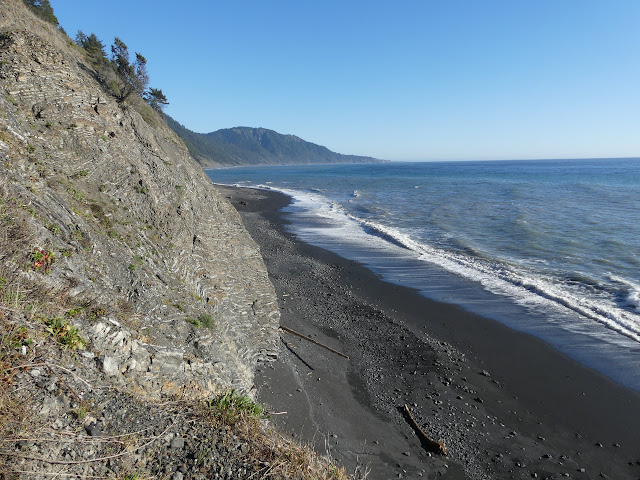
There's lots of camps to choose from at Buck Creek, but I'm not planning on taking any of them. I want to wait on the tide before continuing on and getting out of the area where only low tide travel is recommended, leaving a few miles for tomorrow. I've got about 45 minutes until the tide is below 3 feet. What to do? Get more water to add to the tiny bit that was sufficient after all. Do some washing. Check out the structure marked on the USGS map. As I notice it, I stop thinking of the road I just walked as probably logging and place it into the category of once a driveway. It does leave me further curious about the spur road.

The structure is marked on the far side of the creek and a little way up it. I couldn't see anything when I was looking down from the trail, but I was looking through a lot of trees. As I make my way up the creek, I quickly spot a chimney up high on a flat bit of land. I'm not the first. Once I cross the creek, there's a faint trail up and more trail up the side of the hill just keeping out of reach of the poison oak.

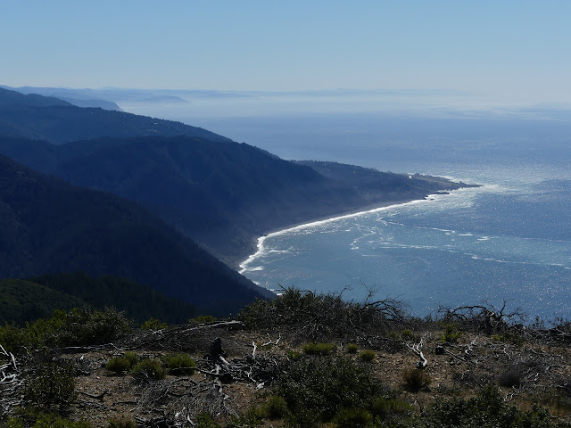
There's still a little time, so I go looking for a witness corner. It should be quite close to the road and the uppermost camp site. (A site with the fire ring built right in the middle of the trail. They do realize there's more to hike than the Lost Coast Trail, don't they?) I can see a land slide or two, but no marker. There is a nice overlook of the ocean and I'm a little excited by what I can see out there.

I think it looks like lots of noses poking out of the water just like I've seen one seal do. It's not. A closer looks shows it's just kelp getting exposed as the tide retreats. Never mind. No excitement after all. Time to head out.


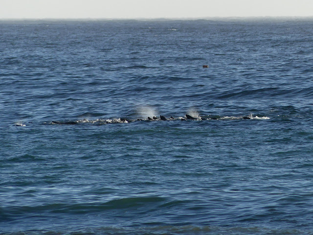
Out in the water, there seems to be a circle of splashing. After a few minutes, it is still there. It isn't some wave phenomenon. It's probably mammals. But I just got burned. But it didn't actually hurt to look then and won't hurt to look now.

There's quite a commotion going on out in the water. It looks like there are fins showing at first and a creature leaps. And more. They aren't dolphins though. One seems to pose in the air with a back fin folded. Sea lions. It is sea lions playing in the water. Or harassing something. Let's go with play. They have all sorts of energy and are not about to stop.


Meanwhile, back on the beach, I encounter bear prints. My informants heading up while I headed down also mentioned the bear prints. I only saw a couple on the way out. They said the prints down here now go on for miles, but it's been high tide in between. I hadn't really expected to see them.

The circle of splashes has been drifting down the coast and a little further out, but it still churns and churns. They have so much energy!


I poke around at the camps along the way, but I'm not looking for anything until after Gitchell Creek. With all the watching sea lions and a little poking around the beach, it's quite amazing how long it has taken me to get there. But the sea lions were so worth it. It's absolutely wild. Well, of course it is, they're wild creatures.

After Gitchell, I can camp anywhere. I was told there are some sites up the creek a little, but I think I'm heading for Horse Mountain Creek Trail. There was a site or two there although the water is a little distant.

However, I also don't want to hike in the dark just because it's hard to see everything when I do. As the sun gets low, I'm looking for and not seeing spots. There are some. With five minutes to sunset, there's a flat spot and five minutes before there was a little flood of water. Camp! I think. There is a minimal spot at the south end and it looks like more possible. I go to grab water, then wade through poison oak of various densities looking around at the possible places. (Say, I should have got some rash by now. I'm sure I touched it on the first day...) There's nothing else, so I set up perched on the little dirt cliff above the waves.
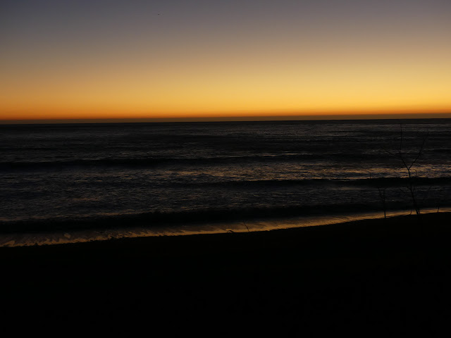
I find myself worrying about the waves. I'm just 6 feet or so above the sand and expect the water to come quite close once the tide comes in. I might be rational if there was a storm coming. Well, I do expect a little weather tomorrow, maybe. But nothing big. Nothing of the sort that set the driftwood up in other areas. I've just never slept quite so close to the waves. I'm well up off the beach. That was another thing I was told in the ranger station. Whatever you do, get yourself up off the beach for camp.
Continue to the next day ⇒
©2020 Valerie Norton
Written 29 Mar 2020
Liked this? Interesting? Click the three bars at the top left for the menu to read more or subscribe!


Comments