Posts

Showing posts with the label artifacts

Grimes Point and Hidden Cave

Image
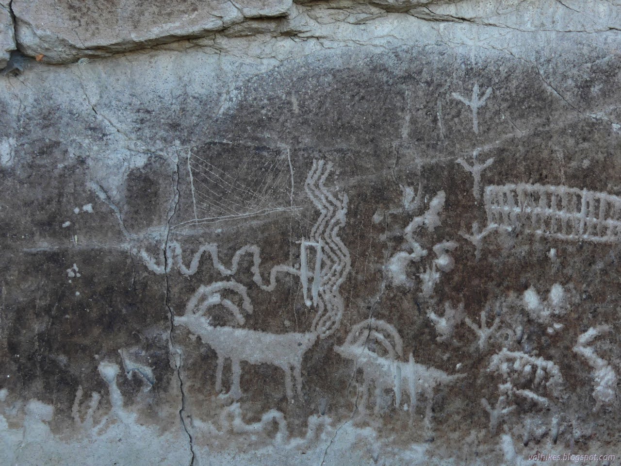
Stillwater Field Office BLM ( map link ) I passed right by Grimes Point on the way out to see the annular eclipse , which quite definitively closes my circle through Nevada that started with the Pony Express and other ruins . (There's an introduction at the Lassen overlook , but that's in California, so that doesn't count.) I wanted to stop this time because there are petroglyphs. These aren't just any petroglyphs, either. Estimated to be at least 8000 years old, they're some of the oldest in the state. There are some that are probably at least 10,500, perhaps 14,000, years old, so they're not the oldest. One of a few information signs at the highly developed Grimes Point Trailhead which includes toilets, covered picnic tables, paved road access, and more information signs. My plan for the visit was to take a turn around the interpretive trail that visits some of the petroglyphs in the area, then head up the Observation Point Trail. There were some...
White River Narrows

Image
Basin and Range National Monument ( map link ) The three rock art brochures I picked up at the Caliente Field Office included one for the White River Narrows. When I had iffy signal, I had seen, but not kept, the printable map from this site . That would have got me to the sites, but the brochure has more to say about them besides don't touch, not even to take a rubbing. (But also, don't touch. Especially not to take a rubbing. It's illegal for a reason.) I did try to visit anyway, but it didn't work out well. I debated if I really wanted to backtrack out of my way 24 miles to try again, but while flipping through the Rock Art book from the Nevada Rock Art Foundation (also available in PDF here) , I spotted a particularly interesting panel and found it is part of the site here. Okay, I do. But first, this is what it is like to visit without the brochure in hand: 20 Nov 2023 I was traveling from the Wayne E. Kirch Wildlife Management Area toward Caliente with...

Crystal Wash Petroglyphs

Image
Caliente Field Office BLM ( map link ) I picked up three brochures for petroglyph sites at the Caliente Field Office including the one for Crystal Wash. Between the rough location of #98 Crystal Wash Petroglyphs on the Ely District Recreation Opportunity Guide (on the wrong side of the highway) and the description in the brochure, which referred to mile markers that have almost entirely vanished from the highway, I guessed my starting location was a little further down an unnamed road than geocache GC14GG1: I'd Go a Mile for a Smile-Elephant Poop . It is another one saying you could take your mamma's Jetta down the road, and this road is smooth. The sagebrush down the middle still provided some very audible bumping and the faint wash near the start could get worse over time. Still, I got to the end and found a small dirt parking area and a register. (Infrastructure! Confirmation of correct location!) The register seemed to think one could expect to find brochures in the b...

Narraguinnep Fort

Image
San Juan National Forest (map link) I missed Narraguinnep Fort because I had some thought that there would be a turnout along the road past the intersection, but the intersection is the optimal place to stop. A road continues to the fort if you want to deal with the gate and can handle sufficiently rough road. It really isn't far to the walk instead. I pulled over where the road was wide and I was sure I could get out again and made my way down. At this intersection of improved gravel roads, the two dirt tracks lead off to the fort. As above, there were lots of flowers. I immediately found many, some of which I hadn't seen yet in the day's walks. It's a different elevation and a different environment. A short penstemon makes small spots of blue. Irises grow enthusiastically where it is wet, particularly by the stream. A closer look at the irises, which are actually quite small, only a few inches across. Now there is only a sign marking the fort. Th...

Fort Humboldt

Image
Fort Humboldt State Historic Park (map link) I checked the Calparks site for Fort Humboldt to see that the park is currently "open at limited capacity", whatever that means. Perhaps no school bus trips will be around? There's only about a dozen parking spots for the public, and none of them has been blocked off. Then there's a list of what is open including the museum! So I said time to go again so that this time I can wander the museum. I neglected to get suspicious that the list also contains "beaches", which is an interesting inclusion since there are no beaches connected to the fort. The picnic area at Fort Humboldt. Not all of this was parade grounds at the time of the fort. I decided to loop around clockwise, going on the self guided interpretive trail first. This has the advantage of getting the signs in the order they were meant to be read. Once or twice, they assume the reading order, so it makes a little more sense. It also comes very ...

Trinidad Head Lighthouse is 150 years old

Image
California Coastal National Monument (Map link.) Trinidad, with its sheltered bay, was a hub of activity in the 1850s. Founded April 8, 1850, it is the oldest town along the northern California coast. After a rather astonishing loss of life considering the size of the population, it was determined that a lighthouse should be built on the headland that protects that bay. The light was first lit on December 1, 1871, which makes this it's 150th year in operation. As such, a little extra activity was planned around the regular first Saturday of the month opening day. It is 3 days late, but when you've had that many years, a handful of days just slide. They planned to stay open 10AM-3PM rather than the usual 10AM-noon and had a few extra activities planned around it. People do seem to love the lighthouse and I was a little worried that it might test the parking area by the harbor, but there was plenty of room at the start. I was also needlessly worried about the king tides, wh...

Addie Johnson and Homestead-Bull Creek Loop

Image
Humboldt Redwoods State Park Click for map in new tab. I want new trails! These aren't exactly new trails, but I did the Homestead Trail in the gathering gloom at the end of a long hike and I did the (other side of the) Bull Creek Trail even longer ago in the gathering gloom at the end of a long hike . Anyway, the promised sunny day was looking good right until I got to the park, where everything was enveloped in thick clouds, so going with the plan of high trails for views didn't seem reasonable. Besides, there was some suggestion while zooming along the freeway that there might be some good fall scenes if I stayed near the running water. I ended up back at the bottom of the Look Prairie Trail, but this time turned to the Homestead Trail. It is marked by a short post. The trail immediately crosses Harper Creek, which was showing no color on its leafy trees. The Addie Johnson Trail crosses at a rather acute angle. It has it's own parking somewhere a little past...

Fort Humboldt

Image
Fort Humboldt State Historic Park Click for map. Being both free to visit and over half covered with a lawn, the old fort is to some extent just another city park, but with better direction signs on the road and historic exhibits around the edges. There's also a few museum areas, but they weren't open, so I probably got to experience less than half of what the State Historic Park really has to offer. Lots of picnic tables making this a prime place for a lunch stop with many added featurs. I headed out of the parking lot past the administrative offices (the North Coast Redwoods District office is also there) to some exhibits at the north end of the park to find they're not actually about the fort at all. They are all about area logging. Passing by one of two "tractors" for moving giant trees around. The trail crosses tracks that come out of either side of a barn and the barn holds a couple of old engines. They're a bit hard to see in the barns...