Posts

Showing posts from June, 2023

Red Lassic

Image
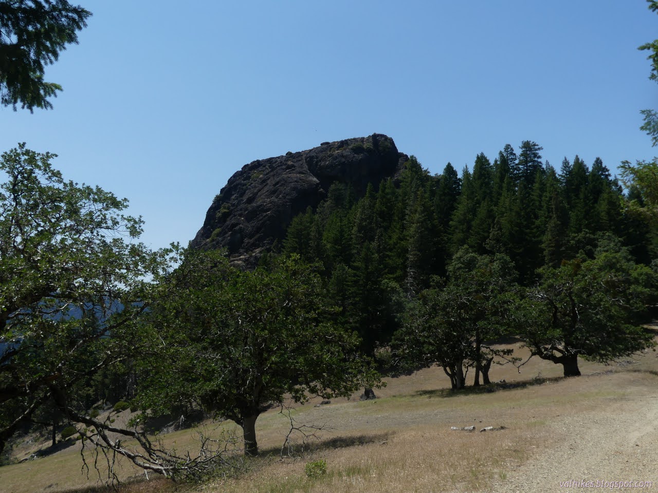
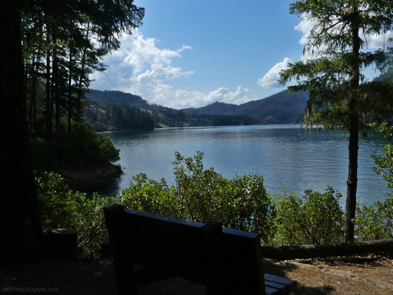
Six Rivers National Forest ( map link ) My very last planned hike on my very last day. The goal: get to the top of Red Lassic. It's not a very long hike. There would also be one more chance to find little pink lupine in bloom. On the way, I planned to stop by a couple of small ponds. I started from camp, since it is almost to the 2WD starting point anyway. Red Lassic looks cliffy from camp. The spring fed pool at camp. It's a reason not to stay here if there isn't much other water. A rough road splits off from the main road and leads to the upper pond. I followed this up and to that pond. More rugged looking side of Red Lassic. The pond at the end of the road next to the Mount Lassic Wilderness.

Mount Lassic Lookout and Goat Hill

Image
Six Rivers National Forest ( map link ) I stopped at the junction of Coffeepot (2S08) and Senteney Rock (1S07) to explore the area of Goat Hill. The motivation was largely to sort out if I've mapped the area properly, but had I paid a little more attention, I might have found another reason to do exactly this hike. As it was, I first wandered over to the far side of the intersection to where Coffee Pot has climbed from the Ruth-Zenia Road to see if there really is pavement. Down under all the pine duff there really is some smooth and hard pavement. Checked! Then I turned to the South Goat Hill Road (2S72), my actual aim ever so slightly north of the large intersection of good roads. This one is high clearance, but legal to drive. It was obvious no one has tried in a while. As South Goat Hill Road leaves Senteney Rock Road. Except for stepping over a couple tree trunks, hiking up this road was easy at first. It obviously got more use than 2S08C when it was in use. Just li

Dry Lake and Not-A Lake

Image
Six Rivers National Forest ( map link ) I found a few explorations at the south end of the Mount Lassic Wilderness, then had dark thoughts about just doing them some other time. The thing is, one was labeled "Dry Lake". Something tells me that this is the prime time to visit. In addition, I found another lake that had been expunged from the Forest Service topo for reasons unknown. The space in the green vegetation layer was still there, but the water has become a dot. So that shall be "Not-A Lake". I parked at the intersection of Coffee Pot (2S08) and its spur C, which is surrounded by, but outside of, the Mount Lassic Wilderness. I actually started out on an abandoned Jeep trail a few feet west. Boulders block the track of road I meant to follow to Dry Lake. Trees line both sides of Coffee Pot, but if I looked too closely, I saw there weren't very many of them behind the most obvious trees. This is the southern edge of the 2015 Lassics Fire. I hiked

Mount Lassic

Image
Six Rivers National Forest ( map link ) Mount Lassic actually has a trail up it, I just didn't know where. It was built (possibly by California Department of Fish and Wildlife, but still official and maintained) but not drawn on a map nor described except that its purpose is to move feet away from the rare lupine that grows over less than 4 acres in the whole world. All but a garden sized plot is on this mountain. I wanted to visit it, but not to stomp across its whole territory. (Also, I made really certain that my shoes were completely purged of any seed before arriving in the area. After Clover Gulch, that was a challenge, but worthy.) I decided to start off on a small trail I found by my parking. It was minimally flagged and marked and probably not the one meant for the public. There's a faint trail just to the left of the smaller tree here where the road drains its water. Weather seemed to be forming over the Lassics, as it had the last few days, but then roam

Black Lassic

Image
Six Rivers National Forest ( map link ) I headed up to the Lassics via the Senteney Rock Road (1S07), which is wide and smooth gravel all the way up to the county line where a small section marked as Jeep trail on USGS maps has a rather more dangerous feel when in a little car. I was looking for an old and rough road up to a "campground", or so the peakbaggers keep calling it. I didn't find it, but it is obvious when traveling north. There's no parking next to it and no driving it in a little car, so it didn't matter. I found a small turnout near the saddle between Black and Mount and decided upon a direct approach rather than looking for that road. Black Lassic from the turnout near the saddle. Black Lassic is the tallest of the Lassics and it sits in the footprint of the 2015 Lassics Fire. Besides the too many burned trees, I was struck by how absolutely dry it is up here. There's even a little patch marked "desert" just to the north of

Mad River Rock and Devils Backbone

Image
Six Rivers National Forest ( map link ) One goal I had when starting out on this trip was to meet Mad River Rock. I searched on this old lookout location once and found its listing on California Lookouts . They have an article from the Oakland Tribune about it. Visibility mappers (This is a job? Can you imagine?) located it and decided it would be the perfect point for a lookout. This rock that sticks up 200 feet from the ridge was scaled via a chimney. When they did decide to build a lookout, they decided it must be done quickly. The road was 2 days late, but the powers that be asked for it in 8 days, so that's not bad. Then the trucks rolled and construction happened including 230 wooden steps to access it. Today, the lookout is gone so perhaps it wasn't the Bestest Place Ever™ for one. The steps are gone. It's considered a class 3 climb, which is not all that hard but beyond what is wise for me to climb alone. Thus, I do not wish to bag this peak, but I would still

Fir Cove Nature Trail

Image
Six Rivers National Forest ( map link ) One of my goals for this trip was to visit the North Fork Wilderness. The north fork it protects is of the Eel River. Officially, it has a single trail which starts at 3000 feet and drops to 2000 feet, but for me it would start at 4000 feet because that's the last of the good roads. Well, the good roads if they are being maintained to standard. The firefighter I chatted with after hiking up Horse Ridge was very clear that this last winter really hit this area hard. Mad River Ridge Road (2S05) across the top was a mess even. I'd not be able to travel that no matter how much I was looking forward to it. The roads up to it all had sunken spots. You might be able to get up there with some high clearance. Secret Gulch (27N34) was definitely bad as was Deep Hollow (2S12 right out of Ruth). But I'm not sure about the shortest one, Double A (3S13). It had no "road closed" sign, but it certainly climbs steeply on the side of t

Clover Gulch

Image
Six Rivers National Forest ( map link ) Clover Gulch hadn't been on my list to do or even possibilities, but the entire trail is about 3 miles, so it wasn't going to turn into a much longer hike and I decided to give it a chance. Besides, I needed water and it is a good place to collect some. Parking is hard to find at the trailhead, and I ended up at the junction of 27N13 (Swim Ridge) and 27N33 (Cobb Ridge). The trail itself starts off as a Jeep road which happened to be marked by long yellow ribbons at the time. I thought "so be it" because you can't always go holding these things against a trail. I started out heading over to the huge culvert under Swim Ridge Road for a look at the stream of water. The gulch here includes a lovely swimming hole and too many burned trees. This is still part of the Hopkins Fire 2020, a piece of the August Complex, so there are entirely too many burned trees. I headed up to the trail, or rather road. It was not well use

Boundary Trail and Big Butte

Image
Six Rivers National Forest Mendocino National Forest Arcata Field Office BLM ( map link ) I had moved down the road to find a nice camping area and found myself at the trailhead for Boundary Trail. It wasn't on my mapped itinerary. It wasn't even on the extra stuff I've been thinking about but don't intend to hike that also got into my itinerary. However, I had been thinking about it when I first thought about visiting Yolla Bolly-Middle Eel Wilderness years ago, before the burn. This might have been my entry point for an epic loop, but the fact that the trails after Boundary Trail were not included on the Forest Service topo maps made me reconsider and it never happened. I'd had three biggish hikes and now this mysterious trail was available to me with no further effort. And do you know, I've never been to Mendocino National Forest before? At least not as an adult. I decided on doing a little hike just out to the mysterious "Mon. 128" about 1.

Blue Jay Mine and Red Mountain

Image
Six Rivers National Forest ( map link ) One goal completed, I moved onto the next: finally visit Yolla Bolly-Middle Eel Wilderness. I once made extensive plans from Boundary Trail going all over, but then got discouraged as it looked like a bunch of trails might have fallen out of inventory, and then it all burned over in the August Complex. Yes, I could have seen this wilderness before the big fire but dithered too much. This epic loop still remains to be done. For today, I had a much smaller loop planned: drop down Blue Jay Mine Trail and then climb back up on Red Mountain Trail . This is the entirety of official trails in the extreme northwest corner of the wilderness. In actuality, there's a trail connecting to roads in the west and Blue Jay Mine Trail extends south to (private?) roads there. There's no connections with the rest of the wilderness trails. I'd been told there were some CCCs (out of Fortuna) enlisted to clean up the trail. They passed me when I paus

Horse Ridge Lookout

Image
Six Rivers National Forest Shasta-Trinity National Forest ( map link ) I had gone up Horse Ridge Road (3S12 and even has a little horizontal sign at the bottom of the road) and found a camp area without too many dead trees in the immediate vicinity near the first big intersection of roads. That gave me a little over 4 miles to walk to the lookout, so that's where I started in the morning. At the next intersection, there would be (according to the map) a trail option for a short way. At the intersection after, there would be a trail to the road at the top, leaving just a short bit more on road to the lookout itself. The area is still in the footprint of the Hopkins Fire 2020, part of the August Complex that burned over 1 million acres. A firefighter who stopped in the afternoon to talk and educate said there was also an incident where some fool set off the piles, but that fire doesn't seem to be recorded on Caltopo. Starting off the day on good, but narrow road. Trav

Pickett Peak Lookout

Image
Six Rivers National Forest Shasta-Trinity National Forest ( map link ) I have had a several little hiking goals related to the southern portion of Six Rivers National Forest simmering away in the back of my mind and decided it was time to reach a few. The passing of an anomalous cold front seemed like a particularly good time to make a start on it. First up, visiting all the lookouts on South Fork Mountain. This is one of the longest continuous ridge lines in North America and it had four fire lookouts along its 40 mile length. The first two I visited were quite easy to get to as I drove along Forest Service Route 1. The one on Blake Mountain has been completely removed. Cold Springs Lookout has stout support timbers that have burned half away, but not much more. Depending on what map one uses, Pickett Peak should also be easy to visit with my little car. The older map shows the road is paved to the Pickett Peak Campground, but newer ones claim it is a high clearance road. (Ge

follow by email