Posts

Showing posts with the label Weminuche Wilderness

Cave Basin

Image
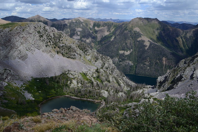
San Juan National Forest Click for map. In among many questions, I asked a ranger why Cave Basin was named such. He said there's some limestone up here and it has some caves, but he didn't know where and they are rumored to be hard to find. So probably no caves today. The trail itself is only a little over 5 miles long, but the fellow hefting a big pack makes me question if there might not be a little more to it. The long out of date USGS maps show a trail down Hell Canyon to connect with the Lake Fork Trail. But no, five miles to an overlook is all he knows about. He's just getting set up for archery season for deer and elk which starts tomorrow. I knew I'd seen something was starting Saturday. He seems to think this trail is not well known about. I think it's right there on the map. (The Forest Service topo. USGS shows it on the other side of the peak to the east. OpenStreetMap hasn't got it.) Wilderness information sign and trail register at the...

Vallecito to Windom: West Mountain

Image
San Juan National Forest DAY 1  |  DAY 2  |  DAY 3  |  DAY 4  |  DAY 5 Click for map. Since I stopped a little short of what I hoped, there are still 15 miles left to the car. My early start gets a little consumed in watching the early light play on the tall peaks to the north. Guess I can't get going at the expense of being where I am? Well, it is important to remember to enjoy the moments. Sunlight on Sunlight Peak and the rest of them. After some breakfast, light is all over here too. I have one more bald hump to get over before descending properly into the trees, leaving the wilderness somewhere in between. There's no sign to note it. Perhaps because the trail pops back in and out a few more times? One more bald hump. A bump with a view. Probably the last time to take in that view to the north. View to the southeast is of the upper portions of Grimes Creek. Down the other side and into the trees is a nic...

Vallecito to Windom: Silver Mesa and Endlich Mesa

Image
San Juan National Forest DAY 1  |  DAY 2  |  DAY 3  |  DAY 4  |  DAY 5 Click for map. Morning and as I cook breakfast, I seem to have a minor mountain goat infestation of one male. These goats are far too comfortable around people. I watch him, and it becomes clear he's looking for a rock I might have peed on for the salt. Ew. One mountain goat sniffing about for a salty patch. The weather is already threatening, although I get a sense of rain without thunder somehow. The threatening weather is reason number one it might not be a good idea to take Endlich Mesa back as planned since after climbing to 12.6k feet, I stay near that and then over 12.8k feet Thimble Pass. That first bit of staying high is at least under a tall ridge, but the next miles high on Silver Mesa are above tree line in the flat. The next reason to avoid it is that fire warning at the start. The trails I came in on are hardly affected by the fire, but Endl...

Vallecito to Windom: Windom Peak

Image
San Juan National Forest DAY 1  |  DAY 2  |  DAY 3  |  DAY 4  |  DAY 5 Click for map. It looks like a stunning day for a mountain climb, but little wisps of cloud form quickly. Decorative or previews of what is to come? I could certainly have started earlier, but suspect this is early enough as I make my way to the trail and up, past the sign banning camping beyond. The mountain goats are on their daily commute down. They are a bigger group, 6 or 8, but still keep the wary but not scared attitude. Do they figure it out when the hunters come or are they just lucky that goat tags are hard to come by? Light is still finding its way across the land. The mountain goats on their morning commute down to the lower meadows. As I looked across from Columbine Pass yesterday, I could see this trail cut into the slopes up to Twin Lakes and wondered at the traffic that could have made such a use trail. Also about the way it seemed to...

Vallecito to Windom: Johnson Creek and Columbine Pass

Image
San Juan National Forest DAY 1  |  DAY 2  |  DAY 3  |  DAY 4  |  DAY 5 Click for map. Morning comes without any night rain. I totally got away with leaving the rain fly off. I didn't get much star gazing in, though. The camera said it had taken its last picture on the battery it had, so I pop in the charged one for a picture of the sunrise light on the mountains. The camera promptly explains that it has taken its last picture on that battery, too. I tested that battery before I started! I couldn't remember when it had been charged, so I put it on the charger. The light went red, then a couple minutes later it was green. I start to think that big camera plus 14er doesn't mix, but it went up Quandary just fine. It got up Uncompahgre and Wetterhorn just fine. It was only Williamson where I had a different problem. I seem to be rather emotionally attached to taking photos with the big camera because I feel a swirl of depression com...

Vallecito to Windom: Vallecito Creek

Image
San Juan National Forest DAY 1  |  DAY 2  |  DAY 3  |  DAY 4  |  DAY 5 Click for map. It's probably the last time, at least for a while, that I can leave Timmy with the lovely woman who has been looking after him when I backpack, but we have decided we can trust him a little longer so I can go out for five days. Five days is what I think it will take me to find my way up a new 14er fabled as one of Colorado's "most remote". Typically, people will just ride the Durango Silverton Scenic Railroad out to Needleton, then 6 miles on trail to a camp site to be ready to climb the peak the next day. So it isn't all that remote. Except for being constrained by the train schedule, people would day hike it like Mount Whitney. Oh, and there are the two harder 14k peaks nearby, so if you "gotta catch them all", you might as well hang out an extra day or two. Since I have no business on class 3 on my own, I'll leave the other two peaks to people ...

Table Mountain

Image
Rio Grande National Forest Click for map. Ever plotting for loops, I noticed that the local "Table Mountain", quite a popular name for a mountain, is very nearly visited by the local "Highline Trail", which also seems to slightly less popular, but they tend to be worth visiting. Kitty Creek Trail provides a way up on one side and Tie Hill Trail on the other with Shaw Lake Loop Trail (which does not seem to loop, but perhaps it is just a piece to help make the loop I am doing) and a little bit of Lake Fork Trail to finish it off. Well, also about a half mile of road along Shaw Lake, but it is gravel and flat and will go quickly. The spot on the map marked "Stairsteps" has me intrigued. I have decided to go counterclockwise making it about 8 miles up and 4 miles down from the peak. Kitty Creek is marked with a sign listing the dangers of entering a burn area, but the Shaw Lake Loop Trail seems to have not had even that much attention given to it. T...