Posts

Showing posts with the label Toiyabe National Forest

Below Corey Peak

Image
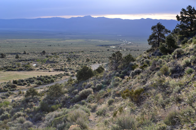
Humboldt-Toiyabe National Forest Stillwater Field Office BLM ( map link ) I stopped by the Mineral County Library in Hawthorne to do a few things on the web. The stop lasted a bit longer than expected because they have jigsaw puzzles out for working. I managed to head out in good time to find a camp site in the light and getting to the top of the top of Lucky Boy Pass took less time than expected as the road was recently graded. What to do with 40 minutes of light? The world was clearly directing me to go find the "Below Corey" geocache . I decided to let it push me along that way since it would mean I at least stepped foot into the forest. Along this road, it is essentially Bureau of Land Management on the north side of the road and National Forest on the south side. Besides, I do like a lonely cache and this one hadn't been visited in 6 years! This is doubly surprising since nearby ones have had much more recent visits. Lucky Boy Pass Road so recently polished...

Toquima Cave

Image
Humboldt-Toiyabe National Forest Click for map. A sign pointing down a long dirt road had the word "cave" on it, so I turned down it. Another historical marker beside it elaborated that the cave up ahead was small, but would contain pictographs and was located "East of the summit, north of the highway," whatever exactly that might mean. FS-001 probably is not considered a highway by many, but the long, straight, flat section across the Big Smoky Valley does allow some pretty fast speeds on the dirt. The roads marked "hot springs" on the way were tempting, but I managed to keep to the road for the cave. There were no other indications of it, but when I got to the summit, there was a handy campground on the north side. That was certainly handy just when I needed one, so I turned in. A short way in is a little "trail" sign and a big information sign for Toquima Cave. The trail drifts off east and north from the summit, just as indicat...

Ophir Canyon and Murphy Mine

Image
Humboldt-Toiyabe National Forest Click for map. My trip to Ophir Summit came up short when I encountered and bothered to read a sign just before a junction explicitly forbidding sedans and 2WD pickup trucks. While that does not exactly include my vehicle, it certainly does get to the spirit of it. Besides, below that it classes jeeps as "not recommended". It looks like better road than that ahead of me, but I backed the little car into a shady spot next to an old mine and parked anyway. There is one other vehicle and the guy down in the creek doing some preliminary prospecting that goes with it pops up at the sound of my motor. Asked if the road is really that bad, he says he started up it and turned around when things got too narrow for his taste. The historic marker down at the start of this road talks up the ghost town of Ophir somewhere up there, so I know there is still something to see further up. The creek looks like it will not present a problem to cross...

South Twin River

Image
Humboldt-Toiyabe National Forest Click for map. For some reason I have thought of Nevada as a flat land, maybe because there was a vast sea here once. I decided to break myself of this thinking through practical experimentation. Look at a map and there is a bit of green in the middle like some sort of bear scratch. That is some of Humboldt-Toiyabe National Forest and it sits upon islands of mountains, many of them a bit too tall to go visiting without extra gear for a few more weeks. The forest claims to be the largest in the contiguous states, but that is a little misleading since it is scattered in chunks all over Nevada and California. It was becoming clear that if everything is planned, there will be no time left to do it, so I took off with only a scaffold of a plan to hang everything on. First on my list of places to be is Arc Dome Wilderness. The mountain itself is one of those that is tall enough to have a bit too much snow on it for a casual climb until next month...