Posts

Showing posts with the label city views

Mineral Belt Trail

Image
Leadville City Trail (map link) The Mineral Belt Trail is a paved biking and walking path that circles Leadville. Usually, 11.6 miles of pavement wouldn't sound very attractive, not even if it is a National Recreation Trail, but with all the rain the reliable surface has its appeal. Additionally, it comes with numerous interpretive signs that are all unique and very few generic. If you stop, you're going to learn something and it's actually about Leadville. I decided to do it with an extra excursion on dirt up Iron Hill. I parked in a big lot off US-24 south of Leadville, which does seem to be the nominal start point. I then took off in a counterclockwise direction, which brought me first to the 11 mile marker, so must be considered the wrong way. It seemed like an excellent direction anyway. Starting at the beginning by the baseball fields. I encountered a number of buildings and other mining relics very quickly. Though I'm sure there's ample to say abou...
Annie & Mary Trail with Powers Creek Industrial Loop Trail

Image
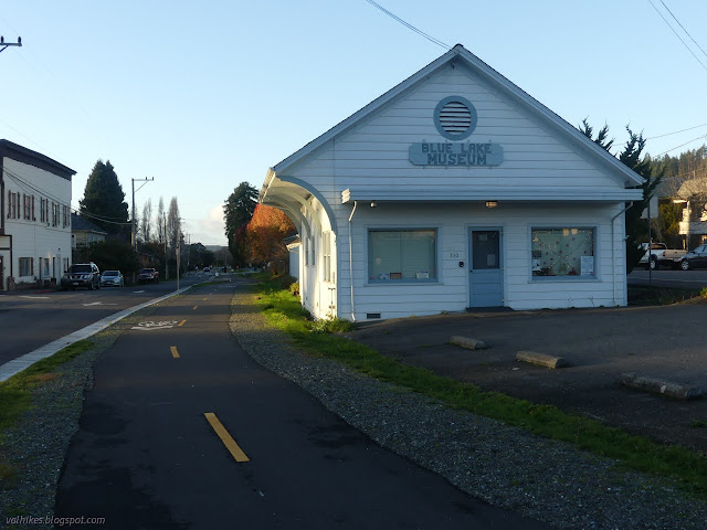
Blue Lake (map link) The Annie & Mary Trail is planned to stretch from Blue Lake to Arcata, generally along the old Arcata and Mad River Railroad route. It will form the northernmost 6.8 miles of the Great Redwood Trail , assuming that isn't derailed by Montana coal concerns . The first mile of multiuse trail was completed last year after some 20 years of work. (Getting a trail really is a long haul project.) Although it is paved and through the city, I decided I should go and see it. There is a bit of parking near the southeast end of the trail, but I actually parked way over on the far side of the bridge where quite a bit of parking, generally utilized by fishermen on the Mad River, can be found. The view from the bridge of the North Fork (ahead) coming into the Mad River (right). I then headed across the bridge and north, taking the right at the Y to find the start of the trail. This end of the trail is among distinctly historic buildings that I've driven past...

San Pablo Ridge to Wildcat Peak

Image
Wildcat Canyon Regional Park Tilden Nature Area Click for map. There's been some shuffling going on and then other shuffling and driving a truck halfway across the north end of the country and then being more than done with that and I really need to get a hike going. What is near at the moment and big enough for an all day extravaganza is Wildcat Canyon Regional Park, one of the East Bay Regional Park District's parks. They have a site for each of their many parks and supply PDF maps, so it is easy to plan something. I planned to go up Wildcat Peak with plenty of ridge journey on the way and canyon journey on the way back starting from a handy end of a random street that has access and, as it turns out, pretty easy parking even around 10 AM, which is a little late for starting an all day extravaganza. Getting started on the fire road. The web site lists complicated hours by month, but the sign here just wants us out between 10 PM and 5 AM. The road has a loc...

Woodridge and Rocky Incline

Image
Woodridge Open Space Lang Ranch Open Space Click for map. Down into the Thousand Oaks area for one last set of trails that are part of the COSCA Open Space Challenge with whoever is in the group. Trouble is, with Geowoodstock on and it being Memorial Day weekend, it looks like all the social geocachers have wandered off somewhere (or caught a cold) and the "group" is me. Well, that is just sad for me. The required trails to be hit today are the Woodridge Loop and Rocky Incline (marked as Hidden Canyon on some maps). The first wraps around a gated community in the hills near it, the second touches into the loop I did while popping up to the top of Simi Peak . The loop has a small parking lot area that is mostly gravel, but paved on one end. The end heading south is obvious next to the paved portion of the lot and the end heading north has a gravel path leading to a spot across the street from it, so is not too hard to find. My plan was to start south, so south I go...

Ortega Reservoir via Polo Club

Image
Summerland The Montecito Trails Foundation maintains paths along easements and beside some roads primarily as bridal paths but also allow hikers and sometimes bicycles. Many of these follow the creeks of the area. One of the weekend hikes the Sierra Club puts on was going to follow some of these, and I decided to tag along. This one starts along one of those creek trails, then climbs past lemons and winds steeply up the side of a canyon to get to the covered reservoir. We got stories all along the way and ate some lunch at the top before returning a slightly different route. I took only a few pictures along the way. Starting off passing a manicured bit of grass surrounded by flowers.

Simi Peak

Image
Lang Ranch Open Space Oakbrook Regional Park Santa Monica Mountains National Recreation Area Woodridge Open Space The original plan was a shuttle hike along the Albertson Fireroad, but the instigator of that plan decided against hiking today after all. By bending the route around, I could get the peak, so I went for much of that original plan anyway, just removing the need for a shuttle. There is plenty of parking at either trailhead and a packed dirt path connects the two. I choose to start at Oakbrook View Trail, which comes first along the road. The sign is offset from the road, but it is still easy to find at the start of some park areas. An open space across from a park where a line in the grass leads to an information sign. I will start here. The trail starts climbing through oaks up a little hill. Houses built on a few different plans stand in neat curves below, but not for very far. Grassy hills surround the neighborhood. A light mist lingers in the gen...

Twin Peaks

Image
Ojai front country After just over five miles of hiking, I was not quite ready to say I was done. It is only 2PM. Anyway, I had a plan for finishing early: check out trails on the western side of the main trail. Back so soon? Heading out along Horn Canyon again. Quickly, there is an unmarked trail to the left that shows quite a lot of use. This crosses the creek and wiggles up first unused, then used road. I was not looking for a road, so when L. Moore promises to parallel the lower trail up the canyon, I go for it. From it, there is a trail marked Twin Peaks. I am not really looking for something all the way up to the local peaks, so keep on going. L. Moore tops out at a spot marked "Parkers Corner" then clearly heads back down into the canyon. Well, there was a sign for it down there, so that makes sense. This is not what I want either, so back to the last trail and start climbing. If you want a trail, here is a trail. Getting climbing past ...

Arroyo Burro

Image
Santa Barbara front country The rain did not start at midnight and it is still somewhat warm and sunny and I could jaunt at least a little way up the hill before the green shadow passing Lompoc on the weather map gets to here. I almost take the turn for Gibraltar Road before remembering where I am headed up by the water filtration plant. So off I go, on the still quite dry trail. The poison oak is almost entirely dormant making the picnic table in the middle of it look much more inviting. The junction to start up Arroyo Burro instead of Jesusita is still marked. There is plenty of dirt beside the steep paved road to walk on and it remains well marked, too. With the utility road section, it all seems steeper and harder than I remember. Maybe that easy slope yesterday spoiled me for this. Whatever, it does give ample opportunity to just turn around and try to take in what may be the most expansive views of the city that the trails have to offer. The cathedral sized cav...

Las Llajas Canyon and Chumash Trail

Image
Marr Ranch Open Space There seems to be quite a bit of hiking to the northeast of Simi Valley. For another foray into this territory, I have chosen another long loop with elements of canyon and ridge. This time, I am starting with the canyon so have arrived at the locked gate of the Las Llajas Trailhead at a break along the edge of a small house farm. There are a large number of other cars already here. Disappointingly, the road is paved. It drops gently down into the canyon past another paved road entering from the west. The pavement stops, for the most part replaced by mud, at the bottom before a second road enters from the west. Information and rules at the trailhead. Surveying the canyon ahead from a small hilltop beside the road. Trail up the hills seems to be public, but connects behind a "no trespassing" sign on the gate below. My route is up the canyon to the right.

Conejo Canyons

Image
Thousand Oaks The cool is upon us for a day or two before temperatures shoot back up into the 90s. I have decided to join some geocachers to wander the hills of the open space in Thousand Oaks. It does lead to some odd spur trail choices, but also lets me go into new places and tick off that I have been there when I get home. (At least this collection does not fill up the house.) Rain is threatening as we start down the utility road. Starting down into the canyons along the utility roads. We are not going far into the canyons. At the first junction, we turn for a steep climb as the rain starts down. It has already finished as we get to the model plane runway. There are a few fliers out today and they are sweeping the water off as we climb further toward the flag at the peak. Newbury Park stretches out south of the freeway to Boney Mountain. Geocachers (well, one just often hikes with a geocacher) at the flag and taking in the view. (One is conditioning fo...

Ventura foothills

Image
Ventura I took advantage of a minor break in the heat to explore the hills behind Ventura. Here are a few photos from that wandering. Looking down on the Ventura Harbor when just starting out.

San Marcos Foothills Preserve

Image
Santa Barbara County Park The county has some nice open spaces and parks, but the San Marcos Foothills Preserve may well be the most beautiful of them all. It sits among grassy hills studded with oak and pepper trees with views of the mountains and the ocean. We pass a small encampment of painters, two pointed at the land and one pointed at the sea, just before coming to the preserve parking. Light breezes and warm sunshine give no memory of yesterday's rain, but a few muddy spots do. Some of the ocean views before even starting off into the preserve. A lizard sits on a fence at the end of the road. There is a large map showing a network of trails and property boundaries around the edges. It shows no contours, so is largely just flat green and not particularly useful. There is a main trail extending eastward and we take this. It curves around the hills, staying rather flat and giving a lot of length. Smaller trails head off of it in a couple places.

Painted Cave fuel break

Image
Los Padres National Forest (map link) There are quite a few short hikes off of Camino Cielo. Explore it and there is likely a new one waiting somewhere. For me for this one, someone else actually did the exploring to find it. I just noticed there was a geocache in the middle of supposedly trail free area and in this cache is a " travel bug ". These things get lost all the time, but it belongs to someone, it was given a goal, it builds up a history as it moves from place to place and hand to hand, and this one has been in one place for three years. Sure, it is illogical to care about them, but it is also a stunning day for a quick afternoon butt-kicker at the top of the ridge. Some minor reconnaissance shows a fuel break in satellite photos and a dotted line with no designation on the 1995 Goleta and San Marcos Pass quads between San Antonio Creek and Maria Ygnacio Creek. Arrival at a small turnout with cables to block motorcycle travel, but otherwise the same as ...

Cathedral Peak

Image
Santa Barbara front country Locate the trailhead. I am feeling it is about time to tackle Cathedral Peak again, so it is off to fight for parking at Tunnel Trail on what is meant to be a cool and clear weekend day. I can only manage a spot that clocks a quarter mile before even reaching the gate to start on the trail. It is a minor addition to a much longer plan. I climb Tunnel along the old pavement that becomes quite broken after the water pipe. The trail follows the left fork of the catway briefly, then turns off to the right into the chaparral while I continue on Jesusita that forks off to the right after not much longer. The pool is full again, but there is only a small trickle of water flowing through the creek as I cross it and leave Jesusita for the use trails that clamber up Cathedral Peak and around Seven Falls to Three Pools. There is a little bit of storm damage to the otherwise smooth paving at the start of Tunnel Trail. Looking up at the southern pea...

Arroyo Burro Trail (front side)

Image
Santa Barbara front country Locate the trailhead. Arroyo Burro is unique among the front country trails climbing to Camino Cielo. All the other routes find their way to the top in 4-4.5 miles, but this one takes nearly 6 miles to reach the top. It does not get that long by simply climbing on an easy grade like the various roads. It explores everything, climbing and dropping and climbing again, first on ridge line and then into a canyon and up the edge. A 3% chance of rain this morning has materialized into brief, hard bouts of falling water, but I am set on climbing the hill. The start is familiar at the west end of Jesusita Trail. The mud from the recent rain is an odd thing, sticking together enough so it is not slippery, but not piling up much on my shoes. It is an effort to extract each foot for the next step. Fortunately, this does not last very long. Heading up into the rocks and chaparral and clouds. Early on, a trail comes up from Stevens Park that is not...

Franklin Canyon

Image
Santa Monica Mountains Conservancy Locate the trailhead. The Los Angeles group of HIKE the GEEK are trying to get regular hikes together again and decided to hike in Franklin Canyon from a low point to a high point. The canyon is a narrow strip of green with sides sufficient to block out cell signals. At the bottom, the only indication of the vast city nearby are, well, the hoards of people wandering around, generally walking their dogs and a wall or two high on the edge. Oh, and photo enforced stop signs. There really are quite a lot of people. Our initial low point is the parking lot closest to the lower reservoir and we wander across the lawn of a former residence to find the trail heading up. The Conservancy rangers are putting together something to celebrate some sort of graduation for one of their volunteers as we go by. The trail starts in some trees at the edge of the grass and quickly climbs out of them and up the side of the canyon. The houses at the edge o...