Posts

Showing posts with the label Navajo Nation

Tsegi Overlook

Image
Navajo Nation Rough location: 36.67588, -110.53802. I was debating stopping by the Navajo National Monument and decided, well, why not? It's only a few miles off the road. The landscape was getting very different, so I stopped for the overlook on the way. Besides, the snow on the red rocks can't be beat. The overlook comes with a pair of interpretive signs, but the one I find interesting is the one about how the climatic zones found going up mountains are reversed here and found going down into the canyons. The sign about climatic zones. Not that one can really see these changes in vegetation without descending down into the canyon. I believe that requires a permit in the general area and can't be done here. The canyon is closed to hiking. Still very pretty to look at. Looking out over the canyon. A more encompassing view of the canyons. Funny to see how the snow settles in and around the pines. ©2019 Valerie Norton Written 9 Dec 2019
Monument Valley

Image
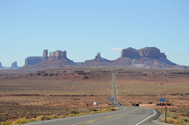
Navajo Nation Rough location: 37.102367, -109.98923. I had a bit of a scare at midnight when I heard plops of water on the roof. The sign says "impassible when wet" in rather big letters and with my rig, that will be more true than with most. I wasn't sure I'd be able to leave in the morning like I planned. I told myself that after so many months of dry, it couldn't possibly be enough water. I woke up to find that it was actually snow and, indeed, there's not enough of it to worry about. Judging by the cars coming from the south, it was bigger there. The monuments are all dusted with snow in Monument Valley. The Utah portion is littered with turnouts to pull aside and look about. The Arizona portion is a little less accommodating. Careful along the bit where Forrest Gump decided he was done running. There were two out to run that bit while I drove by and I expect it's an absurdly popular activity. It's even in that "101 Ways to Experience S...