Posts

Showing posts with the label Humboldt Bay National Wildlife Refuge

Shifting Sands Loop of Ma-le'l Dunes North

Image
Humboldt Bay National Wildlife Refuge Click for interactive map The fact that the National Wildlife Refuge doesn't allow dogs (or horses or bikes or even running) tends to create more possibilities for wildlife encounters. That this particular bit is closed Tuesday to Thursday and sits beside a bit that's closed to all except those who have obtained a permit makes it a little more wild. For one frequent volunteer with the Friends of the Dunes, that meant getting to watch a family of otters diving and chomping away at their catch from the end of one trail. After the regular third Sunday removal of invasive beach grass on the far north end of Ma-le'l South, I headed out to where the otters had been seen, not that I really expected to see them too. Kayakers on the Mad River Slough send the shorebirds on the nearby island into flight. The otters were seen a the end of Tsoutsgish Trail, a very flat route following the old railroad grade at the edge of Mad River Sloug...

Humboldt Bay Trail connected

Image
Humboldt Bay National Wildlife Refuge and more interactive map link The Humboldt Bay Trail is meant to be one continuous trail connecting the local communities with a multiuse path. For years there has been the "Bay Trail North" and "Bay Trail South", but now, finally, it is all one trail! This connection was meant to be completed last November, but the contractor (who is of the area and knows the weather) miscalculated and didn't get the paving in before the rains softened everything too much for the heavy equipment. So we waited very impatiently for this last four mile stretch between Arcata and Eureka to finally be completed. It's more than a decade in planning and haggling and work. As of the last Saturday of June, it is officially open. I joined the Volunteer Trail Stewards cleaning up the "north" section from Arcata Marsh to No Longer Two Rocks on that day, but decided to hold off actually walking it until it was a little less busy. It...

Ma-le'l Dunes, south and north, for the wallflowers

Image
Arcata Field Office BLM Humboldt Bay National Wildlife Refuge ( map link ) The wallflowers are blooming and maybe it's time to make a wander over the Ma-le'l Dunes once more. We spotted them on the way to pulling the invasive marram grass last week, little yellow pompoms in a large depression and spotting a few other places in the dunes. Since I seem to be using flowers as motivation to document a place again, the critically endangered Erysimum menziesii , Menzies' Wallflower, was as good an excuse as any. It really is just an excuse. I wanted to wander the dunes. Beware. There has been some rabies found in grey foxes in the northern dunes. Information signs about trails in the south section of dunes are at both ends of the long parking area. I like the forest portions of the trails here, so I headed past a rabies warning on a less obvious trail that climbs up the old dunes hosting the trees. It follows a long and narrow crest between valleys of surprising depth...

Hookton Slough

Image
Humboldt Bay National Wildlife Refuge (Pink. Map link.) I headed over to Hookton Slough. It has a more generous gate timing of closing at sunset. The trail follows an old levee along the edge of the slough almost to the beach below Table Bluff. The wildlife refuge ends there. Since beaches are public, you can probably continue on at low tide, but I've not done this. I just strolled along the levee. Since they don't allow dogs, horses, bicycles, or even running, that's all one can do without a boat. They do allow you to put in with an unpowered boat and start in on the water trails through the bay. The rock armored edge of the levee beside Hookton Slough. I spotted movement in the water and found striped shore crabs in abundance among the rocks put down to armor the levee edge. They seemed to see me, too, and tended to be scrambling away. Not all of them, though. Some stayed out to be photographed, albeit underwater. A couple of the striped shore crabs on the...

Shorebird Loop

Image
Humboldt Bay National Wildlife Refuge (Map link.) It can be sunny on the coast if you time it just right. I went for a sunny round on the Shorebird Loop in the Salmon Creek Unit of the Humboldt Bay National Wildlife Refuge. The parking lot is open, but when going for that brief window of sun in the afternoon, it is important to realize that they close at 5PM. It is tempting to think sunset or up to an hour after like practically everything else with gates, but that is not the case. In summer, it's also important to notice the actual time because the sun is still very high at 5PM. The trail starts on the boardwalk at the visitor center where signs helpfully note that the gate closes at 5PM and this is a tsunami hazard area. The have an otter on display until September . The visitor center is still closed, but it's by a window so everyone can admire one side of the art. I headed out pondering the wet areas and the birds. The migrating ones that spend so much time s...

Ma-le'l Dunes north

Image
Humboldt Bay National Wildlife Refuge (Map link.) I was out to Friends of the Dunes on Saturday for the "Dune Ecosystem Restoration Team" event yanking invasive beach grass from the foredunes, and it made it quite clear the seasons have changed since I was last on the dunes. The shore buckwheat is looking rather stunning and there's lots of other flowers out now too. They're all really enjoying having the room that was once a near monoculture of invasive. (See the calendar here for similar volunteer opportunities.) I decided to visit the north part of the Ma-le'l Dunes once more . They're not too keen on any fast movement in the conservation area, so no dogs, horses, bicycles, or even running. I followed Tsoutsgish Trail along the old railroad grade. Trees on one side are slowly falling into the slough and trees on the other slowly getting suffocated by sand. We try to remember that this is alright. This is a land of change. It sits on sands and s...

Ma-le'l Dunes North

Image
Humboldt Bay National Wildlife Refuge Click for map. The Lanphere and Ma-le'l Dunes are one of three sites that were recently designated as National Natural Landmarks . The designation does not imply that you can actually visit them, and for Lanphere Dunes a visit requires a permit or guided tour. Ma-le'l Dunes are split in two by the nearby gun club with the south section being BLM land that is open daily. The north section is part of the Humboldt Bay National Wildlife Refuge and only open from Friday through Monday. As it was Friday and I had already visited the south section on a geocaching wander , I made my way up the rough road to the parking at the north end. The view from my parking spot over the Mad River Slough. There's a touch of snow at the tops of the mountains from the last storm. I brought Rachel's tall rubber boots along since I've noticed these areas get full of puddles, but then left them and just put on my usual shoes, which turned ou...

Hookton Slough Trail

Image
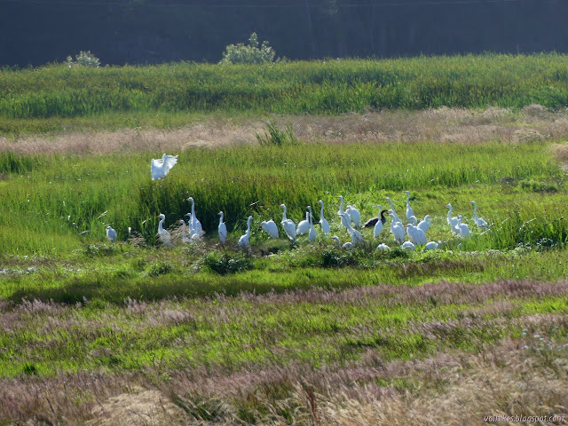
Humboldt Bay National Wildlife Refuge Click for map. The second trail on Humboldt Bay National Wildlife Refuge has a parking lot on up the road, but they've closed the gate on that one too. Parking is a little harder to come by nearby, but I did manage to get off the pavement safely to give the trail a try. There's no long hike to get to it from the road. Another closed gate, but a lot closer to the regular trail parking. Daffodils have joined the wild onions in bloom here. The trail is nice and wide to keep that mandatory "social distancing" if there was anyone else here. The slough is along the right side and water puddles on the left. It is split off from the ocean by the dyke the trail follows, but is likely to be a little brackish. The ducks and herons and egrets seem to like that side better. Some of that wide trail beside the slough. Great egret stalking along some sort of dry land.

Shorebird Loop Trail

Image
Humboldt Bay National Wildlife Refuge Click for map. Under the Humboldt County shelter-in-place order, we are allowed to get outside for exercise with the caveat that "social distancing" is mandatory. They also define the physical distancing that is being referred to as social distancing. I have a permit for more Lost Coast Trail exploration, but realized I still have some closer exploration I could do. I found two trails to try out on the wildlife refuge. For my first hike, I went for the Shorebird Loop Trail which includes another Redwood EdVenture Quest . Due to COVID-19, the gate is closed, but there is a large dirt lot just outside it and the sign on the gate only states the visitor center and bathrooms are closed. Trails are still open. Since that visitor center is more than a mile away, that does mean I'll be walking more to access the trail than I will on the trail itself. Well, I need plenty of walking. No public vehicle entry at this time. There...