Posts

Showing posts with the label HPS

Frazier Mountain on snowhoes
Image
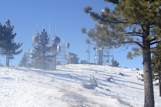
Los Padres National Forest Click for map. Frazier Mountain is the second mountain on the Hundred Peaks Section's list of peaks that I have been up, but only in a car. Since I don't feel like counting drive-ups, I need a plan to hike it. I've had one to go in from the east side at the edge of Hungry Valley, but with all the snow on the ground, a 20 mile hike is probably too much for the short days. From the north, I can get up and down by two routes in 7 or 7.5 miles. That's still almost 15 miles and the trip up Tecuya showed the snow can start very early, and that was the south side of the mountain. How long can one go on snowshoes in a day? They certainly aren't as fast nor as easy walking as hiking on dirt. Hopefully I'll have the good sense to quit if it gets to be too much, not that I have a good record of that. With the memory of the frigid wind at the top of Tecuya, I have my puffy mittens and a few other things to be sure I'm warm enough. ...

Tecuya Mountain

Image
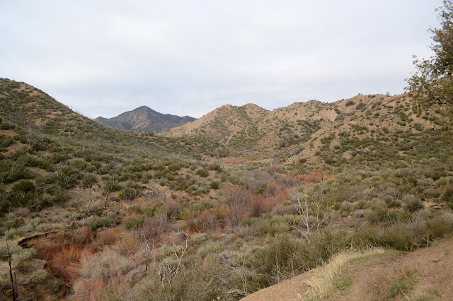
Los Padres National Forest Click for map. For my second demonstration of how not to approach ice in a car, I entered an iced over corner with an uphill slant in third gear. This is too fast. So after it started to spin one way and I managed, through great "skill", to get it spinning faster the other way, but still headed right into the snow bank, there was the "joy" of trying to remove it from said snow bank. The delay probably doesn't mean too much. This is a short hike. I think I'll follow the motorcycle trail to the road and the road up past to Tecuya Ridge area, then back up to the mountain and down a ridge to the motorcycle trail again. Or maybe the other way around. Either way, I'm heading up Cold Springs Trail first. It is currently closed to motorcycles. Lock on Cold Springs Trail for the winter season. Still fine to hike. There's a couple people walking their dogs back down as I head up. The initial impression of the trail is...

Cuyama Peak

Image
Los Padres National Forest Click for map. The automated weather says today is the brief sunny moment between a couple small storms, or did when I could get a weather report. There are some clouds, but they are clearing. Getting up to the peak is going to be a 12 mile hike if I take trails. I plan to go up using a ridge for a shortcut and come back on the trails, but it will still be a 20+ mile day. If the gate weren't locked, it could be shortened by three miles, but I'm pretty sure my car wouldn't make it across the river so it doesn't really matter that the gate is locked. My arms still hurt from shifting trees on Deal Trail, so I really hope Tinta is not in a similar shape. Starting the same place as for the loop with Deal Trail, but a bit earlier. There's a bit more ice on the unstable log that crosses most of the Cuyama River, but I'm not keen for another spill into the water. It was 24°F earlier and probably hasn't got much warmer yet. ...

McPherson Peak and Peak Mountain

Image
Los Padres National Forest Click for map. Here I am at Aliso Park again staring at McPherson Peak, or into the trees in its direction at least. My undoing! For seven miserable hours. That was a week short of two years ago now. It somehow feels both longer and shorter. I'm going to reverse my path this time. That way the battle that is finding the peak trail will be done in plenty of light. I've already done the initial part and found where the trail starts from the campground. Just past where the trail starts up the hill heading north, you can find the remnant of the old and official route of the road as it goes south up the canyon. It is easier to see as it rejoins the current road than as it passes through the campground. More importantly, where it once crossed the creek, there is a thin line that does not and instead continues north, climbing, along the hill quickly becoming very distinct trail. The trail starts in the southwest corner of the campground. There...

Silver Peak

Image
Barstow BLM San Bernardino National Forest Click for map. When I realized I'd have extra morning chores before the hike up Granite Peaks, I probably should have turned my attention to the shorter Silver Peak hike, but it does seem a little less romantic a thing. This is another Hundred Peaks Section listed peak and it seems more straightforward. There's a couple of ridges that present themselves as likely start points to connect to a road over the top. Yep, that's right, it can be done as a drive up. I ain't counting no drive ups. Most people have hiked up it from the south side when they engage a similar ethos. The road is open to there, but I'm here, so I'll try it from the east, give or take some degrees north. I did stop a bit short of my previous parking spot because I felt I was almost there anyway only to find I still had a mile to go. Whatever. It's a much shorter hike. I can do another mile on the road up. Silver Peak and just this plai...

Granite Peaks West

Image
Barstow BLM San Bernardino National Forest Click for map. I managed to drive up with less beating on my car than the day before when I was only seeing if I could. The road has plenty of wide spots and I took one just before an intersection. I'm going down the road at the intersection and expect it to be worse. With a higher car, I could probably get a mile closer. With 4WD, I could get two miles closer. To further slow down my start, I had to make some pancake mix before I could turn it into breakfast. It's no use fretting about such things. I get moving along. The side road is narrower, but generally not so rough except for a couple nasty dips. The road is not so bad here and has plenty of parking on the weed covered side. Round Mountain on the right has a few little mines that weren't noticeable in comparison to the huge mass of tailings on the left. Somewhere out there is another road that I also considered for my approach, but could not determine if it...

Ryan Mountain

Image
Joshua Tree National Park Click for map. The second hike I signed up for was originally going to be Mineral and Tip Top, two on the far northeast side of San Bernardino National Forest, but there was a report that the road was more impassible than usual after the recent rain. Instead the group decided to do a loop over Ryan Mountain and Lost Horse Mountain as a shuttle. I'd been trying to get some interest in doing this as a loop on Sunday, so that worked out for me. Well, discounting that I'd have liked to do both. Again, the $30 entrance fee is taken care of by flashing a senior pass belonging to someone else in the car. Then we're off to the Ryan Mountain Trailhead and setting up the shuttle. Then we're off! Almost. We have to jog over from the "Indian Cave" trail we actually end up starting down. We're a little eager. The trail to the "Indian Cave", which seems to be the rocks resting with a space between up ahead and not a cave....

Queen Mountain

Image
Joshua Tree National Park Click for map. I decided to be social and signed up for some hikes going on as part of the Holiday Hooplah. This is an annual party put on by the Hundred Peaks Section of the Angeles Chapter of the Sierra Club with hikes in and around Joshua Tree National Park. I've been to a bunch already, so am running out of new peaks to climb. (For more Sierra Club outings including these past Holiday Hooplahs, click the "Sierra Club" tag.) Today, I am up for Queen Mountain and Mount Inspiration in two separate hikes. I get to save the $30 entrance fee because I can sit in a car with someone with a senior pass. First is Queen Mountain, which is going to be a little bit further than usual because the roads were closed after the recent rains. Parking is at an interpretive turnout instead of the usual small loop of dirt at the end of a road. We can see Queen Mountain right away. It is a lot of flat and a deceptive amount of up. Of the two taller bu...

Remington Ridge to Lightner Peak

Image
Sequoia National Forest Click for map. It is time for another peak, surely. The rain following the hike up Mill Creek was snow in the very high elevations and I can see the dusting on a few of the peaks nearby. If this has added to more already on the higher peaks, I don't know. Hopefully if it is there, it is still little enough to trudge through. Remington Ridge is another motorcycle trail that gets plenty of hikers. It gets plenty of the motorcycles too and I can see their tread in the trail along with one pair of boot prints on top of them all. It's some 5 or 6 miles up to the peak from here and I would again like to be back by dark. No rain expected today, it just gets cold without the sunlight. Signs at the start to make it easy to find. There are all sorts of people parked across the road from the trail and further up the road in the larger turnouts. The trail looks almost untouched today, so they are here for something else. I expect one of the area hot...

Winston Ridge and Peak

Image
Angeles National Forest San Gabriel Mountains National Monument Click for map. My last hike for the day of a Hundred Peaks Section listed peak is out to Winston ridge. I hiked Winston Peak already one afternoon , but had not realized that I was "supposed" to continue on to the ridge beyond. They are a logical pair. Now I go for the ridge and will probably stop by the peak on the way back. First around the side. The road is a single gentle slope down to the saddle where use trails start out to the high point of the ridge beyond the saddle. The Pacific Crest Trail winds and dips and climbs so that it is both longer and steeper. I have been on both and know this, but the thought of taking the road when the trail is available seems wrong. Besides, it should have a bit more shade in the warm day. So, with my water filled up again, I turn down the trail right of the road at the side of the turnout to wind along the trail. Angeles sometimes has these dinky little w...