Cuyama Peak
Los Padres National Forest
Click for map.
The automated weather says today is the brief sunny moment between a couple small storms, or did when I could get a weather report. There are some clouds, but they are clearing. Getting up to the peak is going to be a 12 mile hike if I take trails. I plan to go up using a ridge for a shortcut and come back on the trails, but it will still be a 20+ mile day. If the gate weren't locked, it could be shortened by three miles, but I'm pretty sure my car wouldn't make it across the river so it doesn't really matter that the gate is locked. My arms still hurt from shifting trees on Deal Trail, so I really hope Tinta is not in a similar shape.
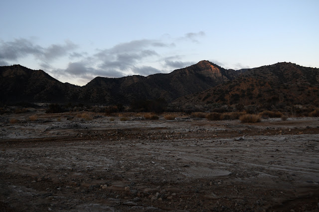
There's a bit more ice on the unstable log that crosses most of the Cuyama River, but I'm not keen for another spill into the water. It was 24°F earlier and probably hasn't got much warmer yet. Just 10 feet further are some rocks that make perfectly stable steps to cross without any threats at all.


The road to the right got torn up even more than the road to the left when the rains came. The crossings are all dry. Tinta Creek doesn't have as much in it.


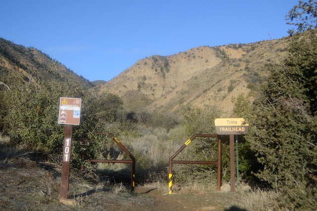
The campground looks a little done over. It has been looking that way for a while. The trailhead hasn't had much change either. No wilderness just beyond on this one, it's a motorcycle trail. It is rated "more difficult" but it sometimes seems like the Pinos Ranger District is out to get the lesser rider or vehicle and underrates things.
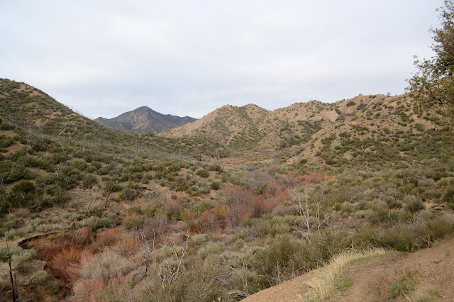
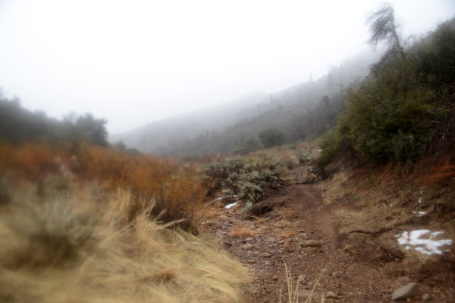
The old road that was here quickly vanishes as the canyon narrows. The water appears by the first crossing. There is flow here after all. It grows by the second. There's not much need for the gate since no one but a motorcycle is getting up the hill.


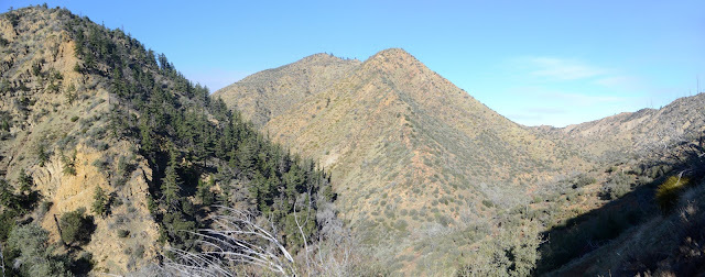
At what seems it should be the top, the trail turns and climbs a little more before drifting downward to the long, easy valley below. This is where we stopped when approaching this trail on our bicycles to get the geocaches along it. Silly us, because the rocky climb isn't all that long.
My sunny day seems to be deteriorating as I get closer to the peak. It's deteriorating in every direction even. The way down doesn't entirely drift as it crosses a deep gully with a little water in the bottom, but after that it is easy, at least for me. There's a log that has been giving the motorcycles a bit of difficulty. Up and down it goes. I note a switchback that has been lost for a rutted direct route instead. The it gets tough, for me at least, when it crosses the creek at a spot that has become a deep pool. It is with difficulty that I find a way to hop it.

I'm pretty sure that mountain is getting misted now, but I'm going to finish this climb anyway. I'm a little surprised to see that the road in Brubaker Canyon really exists. There are old signs on the trail and a gate on the road. It passes into private property below and would be a shorter route.

For today, it is a sign post. While Bill told me the Hundred Peaks Section uses this ridge to get to Cuyama Peak, I'm not sure where they start. There looks to be two likely routes, one starting on the ridge right by the junction and the other waiting until the next gully before making the ridge and following it. There's a significant bit of extra climbing to follow the ridge entirely, but that's the one I'm guessing it is. If not, it should at least be passable until I get to the use trail.

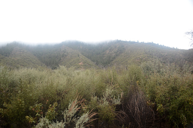
There's not a lot of trail sign on the ridge, but there are open spots, often just to the west of the ridge. Nice, steep open spots. There is more trail sign after I finish the dip. Sometimes I find myself following the bear trail sign instead because he stays closer to the ridge edge. Up ahead is a post with a single insulator to hold a single line. The telephone line came this way, too. They kept a bit to the west, too.

I get a little rain, and then the cloud closes in on me and it stops for the most part. I'm following a rock backbone of the ridge but getting suspicious that others have stayed down low where they can just walk on the dirt instead of doing a clambering balancing act. I try the lower route on the next crest and it works out well. I'm happy there's no wind to go with all this moisture, but still pull on my windbreaker when I stop for a bite to eat. It was just in time as the wind hits me in the next hundred feet. Not bad, but much easier to take with the windbreaker on.

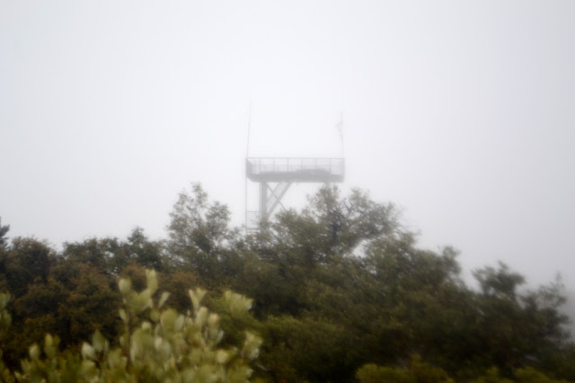
The ramp up is not too bad and is finally signaled just about over when I can see the scaffold of the lookout once again. Down to my left, I can see a bit of road coming up to meet me. Following the ridge, I come over the top, stopping a little while to try to locate more of the benchmark than a reference mark. There doesn't seem to be more remaining.

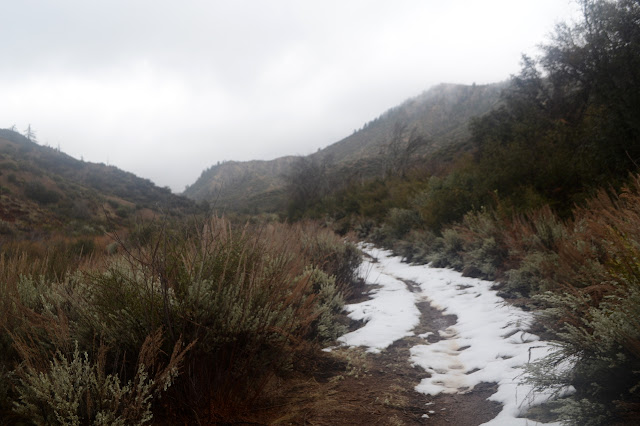
I'm hoping for clearing for my peak time. It's been nice to me like that before on a couple occasions. It begins to snow instead, so I start down the road. It's pretty, in its way. Brown road, red buckwheat, white snow. Careful not to slip on the developing mud.

The snow turns back to rain before the first switchback. I slip a little once, but today the sticks are enough to keep me upright. There is a huge patch of snow before the top of Tinta Trail and then a huge space for walking on the trail. There's been a tank through here recently. Well, probably a bulldozer or tractor. Either way, it was rolling on tread, not wheels. It plowed out trail under the cliff at the very start by the peak road and plowed out drainage spots along the way and cut away the brush in a wide path.
There's been a big storm through here. It has blown down a lot of trees, but nothing is movable on this trail. There's been a motorcycle through since the big snow so some are probably moved for me and some have the branches crushed enough for a motorcycle, absolutely illegal when the gates on the roads were locked, to come through. I'm not amused by the motorcycle, but I'm thinking more about this strange treaded creature. I recall the second half of the trail coming down to Lizard Head being very brushy with only a narrow walkway between.

The treaded thing continues down to Brubaker, where it presumably took the road down. The trail is not so wide or flat side to side or clear of brush afterward.

I get across the small but tough crossing long before it is getting dark. That's what I wanted most. Secondarily, I'd like to get to the road by dark. The trail gets on with its ups and downs and I get on with following them until that climb to stay high out of the canyon. I wonder what is being passed by in those narrows down there. Is it just tight? Are there waterfalls?

I'd have gotten to the road around sunset, but my stomach is shouting at me and there's a very nice rock seat down at the bottom of the switchbacks and across the creek. Still, it isn't long after. There's still those three miles that can be sometimes driven. The road is soggier now and ready to send me sliding. Sometimes I take the grassy edges instead of trying to navigate the puddles and gunk. The crossings are still dry up until the roads join for crossing the river. It has not risen noticeably and the rocks still make a solid dry crossing. I'm willing to count that peak now. I wasn't willing while I had only ridden up it in a truck. The GPS only clocked 20.4 miles. I was expecting 10 up and 12 down, but it was more like 9.5 up and 11 down.
©2020 Valerie Norton
Written 27 Jan 2020
Liked this? Interesting? Click the three bars at the top left for the menu to read more or subscribe!


Comments