Posts

Showing posts from July, 2023

Boulder Loop: Middle Boulder Lake, Cement Banks, and East Boulder Lake

Image
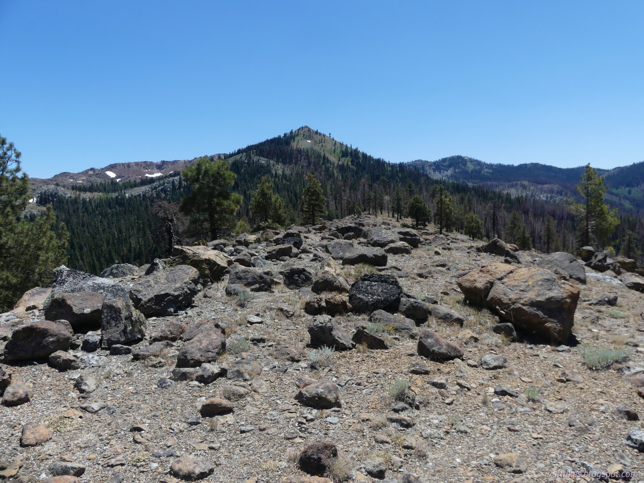
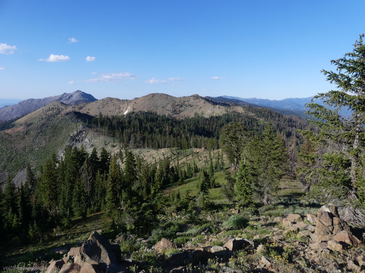
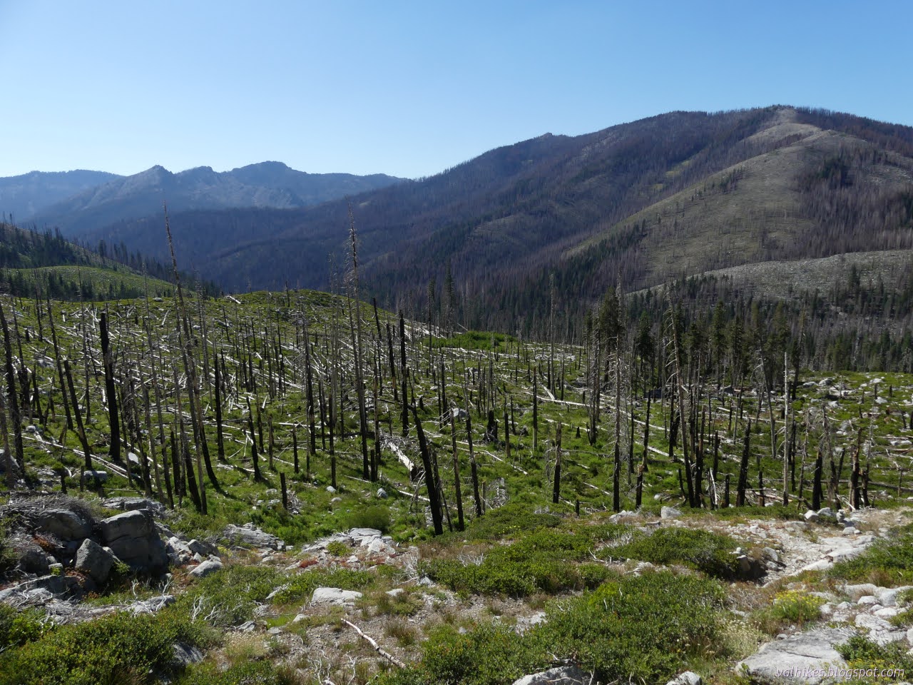
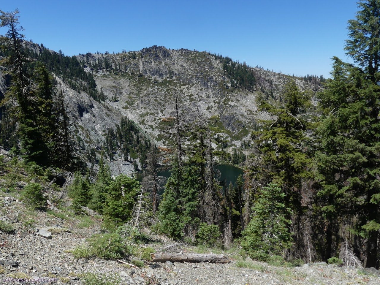
Klamath National Forest (green lines, map link ) DAY 1  |  DAY 2  |  DAY 3  |  DAY 4  |  DAY 5  |  DAY 6 Morning at Telephone Lake. It's a funky looking thing. Perhaps the two lobes look a bit like a telephone receiver with enough foreshortening? I would run into clues for another reason to call it Telephone Lake later. The water is significantly below the rim and below the high water mark. Telephone Lake The nicer view of Telephone Lake. The rocks at the back glowed nicely in the sunset, but I didn't have my camera with me as I watched it. I took off down the trail. It's all rather badly burned. Hoofprints marked where the equestrian went. I got upset at how much milling and messing up the trail he did until noticing that the milling prints are the two toed ones of cows. Cows are trying to lead hikers on this trail astray at a few strategic points. The horse prints managed not to be lured and neither was I. Making a way toward, but never getting to,

Boulder Loop: Doe Lake, Eagle Peak, and Telephone Lake

Image
Shasta-Trinity National Forest Klamath National Forest (yellow line, map link ) DAY 1  |  DAY 2  |  DAY 3  |  DAY 4  |  DAY 5  |  DAY 6 My plan for the day was to continue along the trail to Doe Lake and on to what signs would tell me was Bloody Run. Just short of the run running into the PCT, I would turn to take a trail halfway between it and Eagle Creek which curves around to Big Marshy Lake. That's the nice end point by miles, but I'm very hesitant to camp by things called "Marshy" as they seem to imply "mosquito-y", so push on past that and the marked marsh and up and over to East Boulder Lake. I didn't get quite so early a start as the day before, but it was still before 8AM as I took off. Morning and Granite Lake is still in shadow. Unfortunately, I really needed to get more than just the one bag of water the night before and I didn't have any hiking water for the three dry miles of trail coming up. I stopped to get some and

Boulder Loop: Granite Lake

Image
Klamath National Forest Shasta-Trinity National Forest (orange line, map link ) DAY 1  |  DAY 2  |  DAY 3  |  DAY 4  |  DAY 5  |  DAY 6 With suggestions that it could be a hard day with much trail finding, I got an early start. It didn't feel like all that early. Not quite this early. Calculations to be in a spot to see good morning sky colors paid off. I had followed what looked like trail and got to a tiny pond the evening before. The map said I should have got to the other side. I tried again, but still came up on the wrong side of the little pond. Reflecting upon the small pond. From there, nothing else looked like trail. I headed up figuring I would cross it, hopefully, if I climb slower than the trail. I never seemed to quite get as low as it, though. I kept looking down, scanning the slope for a bench of some sort, and there was nothing. Looking back across the lake basin to one of the interesting ridges. The clutter and lack of char near the ba

Boulder Loop: South Fork Lakes

Image
Klamath National Forest (red line, map link ) DAY 1  |  DAY 2  |  DAY 3  |  DAY 4  |  DAY 5  |  DAY 6 From the trails around Carter Meadows, I got all the way to Carter Meadows Summit where the Pacific Crest Trail crosses the road to Cecilville to start my own backpacking trip. There are a number of trails that wander about and then get back to the PCT. I picked out a few and set the reliable PCT for my return. I pulled into a spot that would leave the car baking in the sun from the moment it came up to shortly before it goes down and surveyed a landscape that had not fared well in the 2021 Haypress Fire. It looked like the entire valley of trees had gone up like torches. I tried to stay in the shade of the car's hatch as I packed five nights of food and some emergency potatoes into the bear can. (I was thinking I might overstay my permit by a night and sleep at the camp a mile down the trail rather than find a dispersed spot after. I didn't. Emergency potatoes rea

BFTA Trinity Alps: Long Gulch Lake

Image
Klamath National Forest (purple lines, map link ) DAY 1  |  DAY 2  |  DAY 3  |  DAY 4  |  DAY 5  |  DAY 6-7 The trouble with staying at Long Gulch Lake is that it is open range for cattle. They've been known to decide to wander through camps knocking things over and generally trashing the area. And when they're done with that, they'll wander over and sit on tents. It's happened before. So as long as they were there (they were) we needed someone to make sure they didn't do all that to our camp. They actually stayed away for a bit longer than usual this day. I didn't even hear cow bells until around 10AM. A little mist rises from Long Gulch Lake in the morning. A single Canada goose on a log in the lake. Winged cattle according to some since they graze the grass too. The rest of the crew was returning to Fish Lake Creek Trail for tread work, which is hard work.

BFTA Trinity Alps: Rush Creek Trail

Image
Klamath National Forest Shasta-Trinity National Forest (blue line, map link ) DAY 1  |  DAY 2  |  DAY 3  |  DAY 4  |  DAY 5  |  DAY 6-7 We were on again for working and back on the Bigfoot Trail from the saddle to Rush Creek Lake. The specific trails we would be working are actually Deadman Peak Trail (9W16), Rush Creek Trail (5460), and ever so slightly onto McNeil Trail (5471) before turning down the trail to Rush Creek Lake to finish the work once more at a lake. Again we proceeded up to the saddle above Long Gulch and this time turned to the middle trail which progresses somewhat level around the top of South Fork Coffee Creek. Back in the saddle again, this time with our attention turned to a trail that stays fairly level to continue through that next saddle to the left. We found work quickly. A couple trees needed logged out. South Fork Coffee Creek seems to have come through the 2021 Haypress Fire well. I had a limb saw this day and plenty to use it on.

BFTA Trinity Alps: Trail Gulch Tie Trail

Image
Klamath National Forest Shasta-Trinity National Forest (green line, map link ) DAY 1  |  DAY 2  |  DAY 3  |  DAY 4  |  DAY 5  |  DAY 6-7 The Bigfoot Trail Alliance actually builds in a rest day in the middle of their long trail work stints and this was the day. Do anything you like! Hang out in camp or hike out somewhere as you see fit. Still, the Forest Service personnel along with us were not getting a rest day. They were tasked with getting the trail from Long Gulch Lake to Trail Gulch Lake in order. Technically, this is the rest of Long Gulch Lake Trail (5505) to the saddle, Trail Gulch Tie (5503) across the top to a second saddle, and a bit of Trail Gulch Trail (5502) down. The spur to actually access Trail Gulch Lake is apparently not a system trail, but it's been signed. This seemed like a reasonable hike for the day, so I grabbed loppers and headed off. I should have got a limb saw too. The old sign here agrees: Long Gulch Lake is here and Trail Gulch Lake

BFTA Trinity Alps: South Fork Coffee Creek Trail

Image
Klamath National Forest Shasta-Trinity National Forest (tan line, map link ) DAY 1  |  DAY 2  |  DAY 3  |  DAY 4  |  DAY 5  |  DAY 6-7 This day, the target trail was along the South Fork of Coffee Creek. This one is not part of the Bigfoot Trail, but it's always good to have alternatives in good shape too. Besides, it was right there and in need. We hiked up the now clear trail to the saddle above and took to the leftmost trail, not including the faintly visible use trail going up to Deadman Peak. This trail takes a downhill slant that is easily gathering the rain water, so at first we ask trail or erosion? Further down, it got more clear. Both. We had a bit of work before coming upon the first meadow. Coming to the first large meadow. The faint trail goes past the lone tree just ahead. Trail faded as it crossed the small meadows. It practically vanished across the large one. We built up a large cairn at one side and continued on... but not that far. This was the

BFTA Trinity Alps: Fish Lake Creek Trail

Image
Klamath National Forest (orange line, map link ) DAY 1  |  DAY 2  |  DAY 3  |  DAY 4  |  DAY 5  |  DAY 6-7 From our camp at Long Gulch Lake, we had access to four different trails to work and would spend a little time on all of them. Our first target was the trail between there and Fish Lake. We headed back to the junction and found a few trees to log out on the way up the last little piece of Long Gulch Trail to the saddle. A couple were small enough for a Katanaboy, but another couple needed the real saw. Meadow and trees in Long Gulch. The ridge gets very steep where the trail to Fish Lake goes. We gathered at the saddle and sorted out the various trails that are up there. Most are signed, even if not all that clearly. They aren't all that clear on the ground either. From here, we would be on the Bigfoot Trail, the specific trail that the Bigfoot Trail Alliance has been formed to maintain. We headed up along the ridge, cutting out one more log, and the trail

BFTA Trinity Alps: Long Gulch Trail

Image
Klamath National Forest (red line, map link ) DAY 1  |  DAY 2  |  DAY 3  |  DAY 4  |  DAY 5  |  DAY 6-7 I was signed up for not one, but TWO weeks of trail work with the Bigfoot Trail Alliance. Well, I never actually ever said "yes" to the second week, but I got an email that said I was on the list and reply if I wasn't coming and I didn't reply, so I was committed. And in between? Well, somewhere in between. I was too busy writing up the bunch of hikes around Mad River to get any more detailed than this. This first week was in the Trinity Alps Wilderness. Base camp was at Long Gulch Lake, so the first day was hiking up Long Gulch Trail and Long Gulch Lake Trail and settling into camp. (There's some debate about the identity of this canyon. It was marked as Trail Gulch by USGS since 1955, but was Long Gulch in 1934. Now it's Long Gulch again, lake, trail, and gulch, on the National Map built by USGS. This is sensible. It's the longer gulch of

follow by email