Posts

Showing posts with the label Conejo Open Space Conservation Agency

Woodridge and Rocky Incline

Image
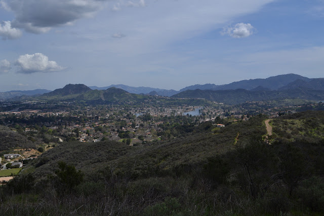
Woodridge Open Space Lang Ranch Open Space Click for map. Down into the Thousand Oaks area for one last set of trails that are part of the COSCA Open Space Challenge with whoever is in the group. Trouble is, with Geowoodstock on and it being Memorial Day weekend, it looks like all the social geocachers have wandered off somewhere (or caught a cold) and the "group" is me. Well, that is just sad for me. The required trails to be hit today are the Woodridge Loop and Rocky Incline (marked as Hidden Canyon on some maps). The first wraps around a gated community in the hills near it, the second touches into the loop I did while popping up to the top of Simi Peak . The loop has a small parking lot area that is mostly gravel, but paved on one end. The end heading south is obvious next to the paved portion of the lot and the end heading north has a gravel path leading to a spot across the street from it, so is not too hard to find. My plan was to start south, so south I go...

Western Plateau, Elliott Peak, and Hawk Canyon

Image
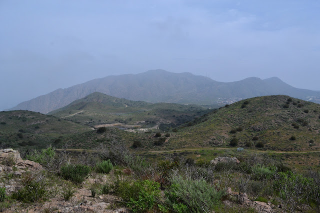
Conejo Canyons Open Space Click for map. After missing one, I am out for another round of trails for the Conejo Open Space Challenge with geocahers. Today, our required trails are a pair of short pieces in the Conejo Canyons Open Space: Elliott Peak and Hawk Canyon. They are joined together with a long and elaborate loop that goes for an estimated 8 miles. I arrive a bit confused about where to start. We are only five strong today and Matt says I am in charge because I was the one doing the little bit of pushing to make sure everyone remembered there was a hike scheduled for the day, what it was, and determined a meeting time. (I did all that for the last one, too, and was not even going.) This is unfortunate because, as I say, I seem to be a bit confused about where the start is. I promptly compound it all and get somehow more confused and we go ahead and start down a different trail which will get us to our loop and does mean we have a nice parking lot to leave the cars. It...

Vista Del Mar and Prickly Pear Trails

Image
Dos Vientos Open Space Click for map. For the third (only the second for me) COSCA Challenge related geocaching hike, we have two required trails planned: Vista Del Mar and Prickly Pear. The main streets in the areas do not allow parking and most side streets seem to be gated, so we met at Dos Vientos Community Park, where there is quite a lot of parking. I had thought that this would be high enough and far enough from the beach to get out of the coastal gloom that has recently closed in, but no such luck. The area is socked in. There is a little lifting as we wait for the start time, but not enough to see the little mountain peak. Due to the holiday, there are only five total once start time rolls around. We take off across the park, somewhat uncertain as to where the trail is exactly. It sorts itself out easily enough as we get into the right area and we start up Park View Trail. The foggy hills across the park. There is no sign as the trail splits. The right goes of...

Whitehorse Canyon and Conejo Ridge

Image
South Ranch Open Space Conejo Ridge Open Space Click for map. The Conejo Open Space Conservation Agency has offered up the 2018 Open Space Challenge, asking the public to "experience" a selection of 10 of "our best trails" with a prize drawing at the end for those who do so and report it. The local geocacher community contains a few avid maintainers of COSCA trails, so they set out to complete the challenge by including each listed trail in a series of approximately 7 mile hikes and inviting geocachers at large to join them every other Sunday. The challenge runs from March 1 to May 31, so there is plenty of time. Each route was put together by the fellow who built the Ventura County Trails web site, so there is practically professional trip planning. (He is also a local geocacher. There are clues scattered around the site.) Still, looking at the suggested route superimposed on satellite imagery, it looked like we might want to have it in at least one ...

Conejo Canyons

Image
Thousand Oaks The cool is upon us for a day or two before temperatures shoot back up into the 90s. I have decided to join some geocachers to wander the hills of the open space in Thousand Oaks. It does lead to some odd spur trail choices, but also lets me go into new places and tick off that I have been there when I get home. (At least this collection does not fill up the house.) Rain is threatening as we start down the utility road. Starting down into the canyons along the utility roads. We are not going far into the canyons. At the first junction, we turn for a steep climb as the rain starts down. It has already finished as we get to the model plane runway. There are a few fliers out today and they are sweeping the water off as we climb further toward the flag at the peak. Newbury Park stretches out south of the freeway to Boney Mountain. Geocachers (well, one just often hikes with a geocacher) at the flag and taking in the view. (One is conditioning fo...

Wildwood Park

Image
Thousand Oaks Map link. I needed an excuse to head south for some shopping for materials to practice on for the making of a backpacking quilt, a craziness I have decided to undertake. I've found the perfect trail for the group of geeks in Thousand Oaks, but can never seem to get them to go. I decided to try it out on my own. I arrived at the main parking area at the end of Avenida de los Arboles and grabbed my supplies. There was a great electronics failure for this hike and here I discovered the first one. The camera pocket was empty. I'd left the camera on the coffee table. This wasn't so bad since I was wondering what to do with the rest of the day if I was going on such a short hike. Paper maps are available for the visitor to borrow in a box by a sign decorated with a larger map on one side and common animals on the other. I already had one printed out so attempted to head out along the Moonridge Trail only to find my route looping back to the Mesa Trail...