Posts

Showing posts from May, 2021

Rohner Park

Image
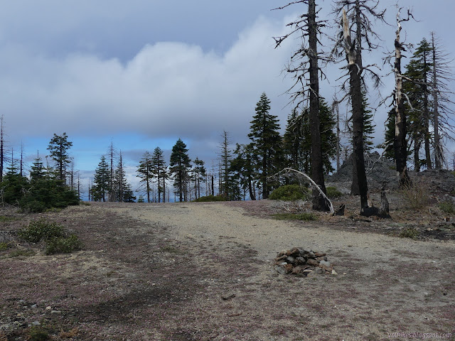
Fortuna (Map link.) I was set to make one last stop in my great loop traveling the whole of Forest Route 1 through Six Rivers National Forest. (That started here .) The forest was long gone. The multitude of boats heading to Ruth Lake were passed. I had made it to that marine layer I'd looked down on from Cold Springs Lookout . That was nice, because the day had been very noticeably warmer than the last from the moment I woke up and more so once the sun hit Beckers Racetrack . I found some parking along some cones by the baseball fields and found the trail to hike the redwoods. I could have parked a little closer had I known where I was going. Take the right at the road sign and, if the gate is open, there is parking by the trailhead to see the redwoods. There's a sign with a map showing trails, both paved and unpaved. The paved trails were a loop road through the trees that is now for hiking and bicycling. I took the first right on a small, unpaved trail that climb

Cold Springs Lookout

Image
Trinity National Forest Six Rivers National Forest (Map link.) I have visited some rather hard to get to fire lookout locations and thought, while poking around Blake Mountain that I might as well visit the easy ones too. Still on South Fork Mountain, but many miles south, there was a lookout on a peak by some cold springs. It has a road, so I could potentially drive right up. It is at the edge of the footprint of the Route Fire of 2015 and would probably be more work than just walking to clear out all the trees on the way. I found good parking on the far side of the road and started the walk up road 2N43. There's some green and a lot of dead among these trees bordering 2N43. Plenty of green ground cover like violets . There actually had been some tree clearing on the road, but it splits and the clearing follows the right fork. That presumably goes to the inholdings on the north side of the peak near the actual springs. The high point and lookout location is up the

Beckers Racetrack, Pilot Creek, Pilot Ridge, and Henry Ridge

Image
Six Rivers National Forest (Map link.) I must admit, there was something slightly harrowing about going down 2N17 to Becker Racetrack the day before. The Forest Service topo says it's an improved (but unpaved) road and the Motor Vehicle Use Map (MVUM) even claims I can do the unimproved portions of the road with any street legal vehicle. I had no reason to push it because my planned loop starts shortly after the end of the improved section. It still seemed steep and full of big, sharp rocks when going down. Somehow it didn't look so bad in my mirrors. This road is seasonal. The MVUM doesn't say what the season is but the gate was open and did not have the Port Orford Cedar closure information of the seasonal gates that were still closed. Someone had recently cut out the fallen trees, but there's a mass of standing dead waiting to come down along most of it. It was a worry as I chose a place to camp among the green trees at the edge of the meadow. It wasn't a

Blake Mountain and Spring

Image
Six Rivers National Forest Trinity National Forest (Map link.) Blake Mountain is the named high point of South Fork Mountain. I planned to start at Blake Springs Campground for the little wander to the top. There is no sign for the campground nor much evidence of it left. I think I ended up stopping near the south end of the old campground. It is a turnout with some actual green trees in the area and has a couple roads connecting to an old bladed road. It would have still been drivable if not for the trees across it. I started north along the road passing a couple of what looked like bladed pull-in points, as is typical of a campground. (USGS actually claims the campground was at the spring.) The green topped trees quickly get interspersed with standing dead while going along the old road from the turnout. There are actually three locations one might find benchmarks around this high poing. My map claimed I should find the USGS benchmark just past one pull-in, so I wandered

Carson Opening

Image
Six Rivers National Forest Trinity National Forest (Map link.) FR-1 is among heavily burned trees as it turns south on South Fork Mountain and it stays that way. It was a long stretch of road before I found anything that resembled a usable parking spot, much less something I might want to park in. I found that at Carson Opening. Apparently I stopped just before the public lands. There is a large swath of inholding generally east of the road until that point. There is a huge open area west of the road, south of a "private lands" sign. I walked along it and up a small spur near a high point to take in the area of Pilot Creek and the surrounding ridges. As long as the wind isn't blowing hard, the spot could make a nice dispersed camping spot and I suspect it has been. Fun little rocky outcrops are along the ridge top. The sprawling crowd of standing dead trees starts a fair way below. Across the way is the road to the other side of Dan East Trail. To the northwe

Whiting Spring

Image
Six Rivers National Forest (Map link.) I had two shorter trails in the plan for this day, but I was extremely certain that at least one wouldn't work out. I saw the sign for 5E41, stopped a bit past it, pondered, then turned back to risk my car a second time across a mile or so of FR-1 to attempt to park. (It is worth noting that while the road is entirely paved, it is so pitted with potholes, some large enough to eat a small car tire, that it requires constant vigilance to drive. This vigilance should not distract from watching for oncoming traffic on narrow curves. Also watch for fallen rocks and trees.) As this is actually a short Jeep road, there isn't actually any parking near it. I only managed to get halfway off the pavement, but well out of the lane of travel, so declared it good enough. It's not a very high traffic area and on a long straight section anyway. I had other reasons to be pretty sure no one would come down the road in their vehicle to join me at

Bug Creek and Board Camp Mountain

Image
Six Rivers National Forest (Map link.) I woke up early in the morning and looked up at a lovely Milky Way arching overhead, perhaps with a bit of green tint. I savored its beauty for a few moments, but it's not the sort of thing one expects to see during the full moon. I got up to look around to the west to find the moon. It was maybe two fingers above the horizon, among the trees from my perspective, and deep red, a bit brown toward the lower left. It was definitely in full eclipse. I knew it had to be early in the morning. There's a different solar eclipse for every location, but everyone gets the same lunar eclipse. I savored its beauty for a moment too, wondered what had woken me for it, then tucked myself away from the cold night air and back into a little more sleep.   There wasn't long before I had to drive the rest of the way to the rather improved camp beside the start of the Board Camp Mountain Trail 4E27. It was still cold when I got there. I wouldn'

Horse Mountain Mine

Image
Six Rivers National Forest (Map link.) After wandering around the peak of Horse Mountain once more, I moved just a short way down the road to the gate above Horse Mountain Mine. It will probably open soon, but is still closed to try to protect healthy Port Orford cedars in the watershed below and especially those right next to it. All the better for me, since I was planning on walking it instead of driving it. There is a big turnout in front of the gate making parking easy. The top of 6N38, which leaves directly from Titlow Hill to drop down to Horse Mountain Mine. The road was absolutely lined with fawn lilies as I started down. There's some little streams similarly populated by onions and moss and something that looks like it will be irises. Out of the water, a few other irises can be found already blooming. I very quickly came upon evidence of mining. It's either a gravel quarry or a mine and the local area history would suggest mine. A bit of boxcar? I gues

Indian Butte and Horse Mountain

Image
Six Rivers National Forest (Map link.) Road trip! Well, maybe not so big as that. I wanted to return to Bug Creek without the finish of driving at the stroke of midnight, so I elected to do a bit of camping. As long as I was camping, I might as well be out a few days and perhaps even see the rest of Forest Route 1 starting with the familiar and moving right along. One other thing I wanted to do was explore the area of Horse Mountain in less snow and tag Indian Butte while I was at it. I found plenty of room to get out of the way of traffic at the road toward Indian Butte from Horse Mountain. This road is closed at the moment in a effort to protect the Port Orford cedar from killer fungus, which suits me quite well. The start of the hike at the junction between public road and seasonal road. The weather was seeming a bit unstable, blowing clouds across the mountain, leaving sun sometimes and murk near or far to mess with the views most times. With all the water in the sky, the

Beith Creek Ridge Route

Image
Arcata Community Forest (Map link.) I decided to do another loop around Beith Creek with the camera since it has a rather different selection of plants to contrast with the nearby azalea reserve . For one thing, the Rhododendrons are marcrophyllum rather than occidentale. They're a little later blooming, but I hoped to see one or two around. Right now, it's irises doing the showing off.   I didn't really have to go all the way to Prairie Creek to find wild ginger . I just needed to know to look. Didn't need to go far to find a rhododendron, either. It is way down below the trail, though. This is at full 25x zoom. The irises are much more friendly and grow right next to the path. Right at the start, the thimbleberries were really full of flowers, but that's something that can be found in both places. I'm not certain why the ginger and irises aren't found near the azaleas. Perhaps I just missed them. I turned to follow the Beith Creek Loop c

follow by email