Posts

Showing posts with the label Anza-Borrego Desert State Park

Garnet Mountain

Image
Anza-Borrego Desert State Park Cleveland National Forest Click for map. With a few hours of light left in the day, I have plenty of time for the short hike up Garnet Mountain. It is easily accessed from a sliver of land between Cleveland National Forest and Anza-Borrego Desert State Park. There are a couple folks enjoying the view at the end of the road as I start and one more coming up the old road bed that hosts the Pacific Crest Trail looking like he is chugging through a chunk of it. He is quite a picture in plastic slip on sandals, hauling an army duffel with pack straps, and cradling a gallon of water in his arms. He adds to it all a greeting of, "Beautiful country, isn't it?" with so much glee underneath it that there is no mistaking that he is really enjoying being on this trail. But it is, so there you go. I follow behind him a short way. Entering Anza-Borrego Desert State Park with Garnet Mountain above. The shape of old greyback, that is San...
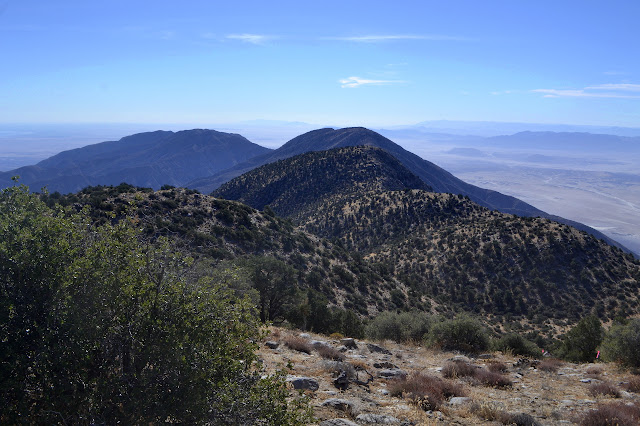
Big Rabbit: Rabbit Peak

Image
Anza-Borrego Desert State Park Click for map. DAY 1  |  DAY 2 The night was already colder than expected when we went to bed, so we were slightly worried. Somehow it did not get much colder and was already getting warmer by our sunrise wake up time. Pudding again for this morning, in "special dark" chocolate. The shaking elicits an, "It's loud," from my neighbor with just a touch of animosity, so I yield to the thought of pulling on my shoes and going back to the top of the mountain where the sunrise will be better. Such is life. We are out just about on time for the four rolling miles out to Rabbit Peak. Good morning star shine, it is time to boogie. Shedding a bit more elevation before the higher peak.

Big Rabbit: Villager Peak

Image
Anza-Borrego Desert State Park Click for map. DAY 1  |  DAY 2 The hikers gathered at just the right crossing of Truckhaven and S22, the latest coming in at midnight, to camp and get a mildly early start in the morning. Who would have thought the state park would allow dispersed camping? Just have to keep it within one car length of an established road. I give my banana pudding* a nice, long shake and put it aside in the cool morning air to refrigerate before carefully examining my foot for even the slightest glimmer of pain. No motion seems to set it off, so I get to wear my trail runners. It makes me feel safer to have a bigger range of movement on a wild "trail". I get some hot chocolate together to go with the banana pudding and scarf down half of it before getting a rather loud full signal. I head over to the actual meet point. We get signed in and extra sure that everyone has enough water. My brain keeps grunting that this will be a particularly heavy pack unti...

Calcite Mine and halfway to Travelers Peak

Image
Anza-Borrego Desert State Park Click for map. I signed up for an overnight backpack way down south and since getting there involves driving halfway to Phoenix (well, 20 miles short of) and then turning right to drive some more, I decided to leave at a time that might not have as much traffic and could give me time to hike at the end. Just a few tens of miles of slow curd around the 405 and one complete freeway stoppage later, I have arrived at the start of a road to an old calcite mine and a good approach to climbing Travelers Peak with an hour and ten minutes to sunset. It is plenty of time to check out the mine, but probably not enough to head up the peak. I had rather hoped this would serve as a shakedown for how my injured foot* is doing and if I can get away with wearing my soft trail runners instead of my immobilizer boots for the overnight. Getting into the scramble up the mountain would be better for that than the road walk to the mine. Of course, maybe I can drive the r...

super bloom

Image
Anza-Borrego Desert State Park The super bloom going on around Borrego Springs and in Anza-Borrego Desert State Park is expected to reach its peak in the middle of March, so the Hundred Peaks Section planned a rare outing without any peaks to climb for the ides. Looking at just the cost of gas, the price of admission does seem staggering for a single day looking about. Still, this is supposed to be a 1 in 20 years level event, so I decided to get up in the early dark and get myself down there to see this bloom. First stop along Henderson under Coyote Peak. Our first stop is along Henderson Road, but we have been seeing flowers for a while at this point. At first glance, there are only about three types of flowers in the field. Most noticeable are masses of yellow of desert sunflower. Big floppy white flowers of the dune evening primrose are quick to catch the eye. Big puffs of purple of desert sand verbena complete the initial colorful impression. Dune evening ...

Combs Peak

Anza-Borrego Desert State Park The third day of peak bagging with the Hundred Peaks Section hikers finds us carpooling down a pretty good dirt road to a widening at a crossing of the Pacific Crest Trail. I did not drive, so as I take stock of my pack at the trail and notice my camera missing, I cannot just walk over and grab it. There will be no pictures. We gather beside a sign where the destinations are the county line and the highway beyond. We will not get as far as either of those. Our destination along the trail is just the next saddle. We head north and curve around the hills. Some snow remains here, but only behind the most sheltering of steep northern slopes. There are quite a lot of dog prints in the snow. We start to climb, but it is at a very easy pace. The peaks to the east must be some favorite ones for some of my fellow hikers because as they become more visible, there is talk about this bit of ridge and that bit of climbing. They seem to be Village...