Posts

Showing posts with the label Sheep Mountain Wilderness

Vincent's Cabin

Image
Angeles National Forest San Gabriel Mountains National Monument Click for map. I thought I'd spend the night over by Vincent's place. The cabin is supposedly built by a Civil War veteran, so it has some years on it and I will certainly not be staying in it. It is a little way down the Mine Gulch Trail, one of the five trail routes and four road routes to leave Vincent Gap. It is not the hardest to find. That one goes northwest and is a National Recreation Trail, so should get better treatment, but currently has not so much as a sign. The Pacific Crest Trail wanders through from the northeast to the southwest (for the northbound direction) and gets quite a lot of traffic going up Mount Baden-Powell. I ignored that and skirted a permanently locked gate on an old road headed south. A short way down, it is signed for Big Horn Mine along road on the right and Mine Gulch along trail on the left. I hung the left. The right is quite a popular destination and I could hear pe...
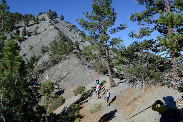
Pine Mountain, Dawson Peak, Wright Mountain

Image
San Bernardino National Forest San Gabriel Mountains National Monument Click for map. I seem to be on some sort of kick to climb a bunch more Hundred Peaks Section listed peaks . I signed up for an official outing to climb three peaks clustered north of Mount San Antonio, better known as Baldy. The section will let anyone come along, free of charge, although they do like to know something about you for the harder hikes so it is best to sign up for something easy first. This one mentions some "loose and exposed Class 2 terrain" as a reason it is "not for beginners", so probably counts as a harder hike. But they know me by now. At some point years ago, I had taken note of Pine Mountain, the North Backbone Trail that crosses it, and the Blue Ridge Road and put them in the list of things I wanted to experience, so an outing doing Pine Mountain and a few others seems like a perfect way to do it. Meeting at the turn to Blue Ridge at 6:30AM to beat the heat a lit...

West Baldy and Mount San Antonio

Image
Angeles National Forest Bernard went up Baldy (formally known as Mount San Antonio) last year on his birthday and has been wanting to go again. I was up it once, but that was more than 10 years ago before I had a digital camera to easily document when. Maybe 2003. The weather looks uncertain, but so it goes. Everything is thick with clouds, but we break through them just before parking. There are more clouds above, but they are far above the tallest mountain in the San Gabriels. Once packed and ready, we squeeze past a sturdy gate with maps and start up the road toward San Antonio Falls. There is a good view of them along the approach, but the clouds move with us as we take the little trail to the base so that we cannot see them up close. The clouds open up again as we leave. Start hiking up the gated road to get to the top. San Antonio Falls tumbles down a steep canyon from Baldy Bowl above.

Mountain Row: Mount Burnham and Mount Baden-Powell

Image
Angeles National Forest Locate the trailhead. DAY 1  |  DAY 2  |  DAY 3 (Day 3 of  2  3) I am up with the moon again, but this time after a wonderful night's sleep. The wind blew fiercely for a couple of hours with the sunset, but with my feet turned into it, my head was nicely sheltered. Once it stopped, it was just cool, 9000 foot air all night. The lights of the distant cities in the plains beyond the foothills are lovely. Looking over things in the morning, I find that there was a bit of moisture put down where the wind was blowing in the evening. After breakfast in the dark, there is enough time to head back to Mount Hawkins for a bit of nonsense and be there for the dawn. Up with the moon and a couple of planets.

Mount Hawkins Loop

Image
Angeles National Forest Locate the trailhead. When doing the loop of trails out of Crystal Lake that brought me up to the top of Islip, I noted that the map I was handed marked a trail along Hawkins Ridge as well, allowing for another loop that stops by the two Mt. Hawkins. To do it, I again traveled up to Windy Gap, then turned east along the Pacific Crest Trail, the only direction I hadn't yet traveled from Windy Gap that contained a trail. Climbing up, the ridge trail leaves to the south, then a trail to Lily Spring. The mountain rises as a cliff to the south and at the far side, a trail proceeds up the top of Mt. Hawkins. Proceeding back to the ridge trail, I traveled down along the ridge down to South Mt. Hawkins. After taking in the view from there, I traveled back along the fire road until it crossed the trail and followed the trail back down from there. The lot in the campground next to the trail head was still closed with most of the campground, so I parked behi...

Big Horn Mine

Image
Angeles National Forest Locate the trailhead. The area around Iron Mountain is riddled with mines. I've got a hike hitting many of those mines in my dream hikes, but that has not happened yet. While looking around the map for the various mines, I found one far up north that would be much easier to get to as it was down an unimproved road just a couple miles from the highway. Looking it up, I found that it is a popular hike that is still possible to make and that the cabin of the man the gap and gulch it starts at is named for can be viewed nearby. They say it follows the old wagon road to the mine, but I'm not so sure that's entirely true, although it is probably close enough. I printed out a map and headed to Vincent Gap. Vincent Gulch is a wide open valley heading down toward the San Gabriel River (prairie fork going to the east fork). Mount Baldy is visible in the background and the Blue Ridge is to the east. The trail starts next to the Pacific Cr...

Allison Gulch Falls

Image
Angeles National Forest Locate the trailhead. I decided to go off to up Allison Gulch and maybe up to the mine above. I wasn't able to find others to come along, so decided climbing up out of the canyon along long gone trails would be a bad idea and it was already getting latish. I decided to just go to the falls on up the canyon. I got ahold of a permit for entering the wilderness. Didn't pay quite enough attention given the permit mostly filled out and thus had one saying I was going to the "bridge to nowhere". I was only starting off that way, but would turn off eventually. So I started down the road. The campground was full of emergency vehicles and it looked like search and rescue were doing exercises with a zipline over the river. They were all packed into bright yellow rain gear since it had been raining the night before and here it seemed to have lasted a little longer here. There were even a few drops falling now and then. Then the road ende...

Bridge to Nowhere

Image
Angeles National Forest Locate the trailhead. The "Bridge to Nowhere" isn't really such. Hike information can be found here . The instructions for getting there could be improved quite a bit, though. After getting off on Arcadia in Arcadia, turn north and follow the road out of the city and along the reservoir. Turn right on East Fork Road to cross a large bridge over the river and wiggle around a little more. That road does dead end at the ranger station if you go around the hairpin turn it talks about, but if you catch the road into the Sheep Mountain Wilderness to the left on that hairpin turn you pass a few trailheads on the way to the end of the road. Park in the large lot by the gate on the road and continue down it passing yet another trailhead to some other destination. The trail follows the old road route up to the bridge built for the road. At least half of it is actually on the old road bed, but there are places where the roadbed are long gone and ...