Posts

Showing posts with the label Arcata BLM

Waluplh-Lighthouse Ranch

Image
California Coastal National Monument Click for interactive map After poking around Ocean Ranch , I headed up the hill to Lighthouse Ranch, one of the 6 pieces of California Coastal National Monument that can be visited along the mainland. There's a loop trail, interpretive signs, picnic tables, and a toilet. If you are trying to get a stamp for your National Parks passport, you probably have to go to the Arcata BLM Field Office. Other nearby pieces of the National Monument are the Trinidad Head Lighthouse to the north, which is only open during certain hours on certain days; Lost Coast Headlands to the south, which has a little more trail but the road in can suffer winter damage; and of course most the rocks and islands you can still see at high tide. This is the easiest to visit. The pathway entry from the unpaved parking at Waluplh-Lighthouse Ranch. The path is well established and the edges get mowed. Taking the right side of the loop, the trail comes quickly to t...

Hikshari' to the Old Growth with an electric magnifier

Image
Headwaters Forest Reserve Click for map I decided it was time for a pilgrimage to the spot of old growth coastal redwood trees they'll let the public visit regularly, at least if they're on foot and without a dog after the bridge at mile 3. They do give the bikes parking just before the curve down to that bridge, so one can bike most the way. I wouldn't, but one could. I hoped the South Side Trail would be open. The BLM website suggests it could be in May if the water is low enough. The docent led hikes on the Salmon Creek side of the Reserve (plus an extra birding walk by Ken Burton to celebrate the 25th anniversary of the creation of the Reserve ) have started. (I should finally do one of those, but I would have to rely on a fellow hiker and likely stranger get from the meet point to the trailhead.) Paved big trail at the start of the Elk River Trail. The South Side Trail was still marked as closed as I passed. I wanted to take it on the way back, so I held...

Boundary Trail and Big Butte

Image
Six Rivers National Forest Mendocino National Forest Arcata Field Office BLM ( map link ) I had moved down the road to find a nice camping area and found myself at the trailhead for Boundary Trail. It wasn't on my mapped itinerary. It wasn't even on the extra stuff I've been thinking about but don't intend to hike that also got into my itinerary. However, I had been thinking about it when I first thought about visiting Yolla Bolly-Middle Eel Wilderness years ago, before the burn. This might have been my entry point for an epic loop, but the fact that the trails after Boundary Trail were not included on the Forest Service topo maps made me reconsider and it never happened. I'd had three biggish hikes and now this mysterious trail was available to me with no further effort. And do you know, I've never been to Mendocino National Forest before? At least not as an adult. I decided on doing a little hike just out to the mysterious "Mon. 128" about 1....

Lost Coast: Punta Gorda Lighthouse

Image
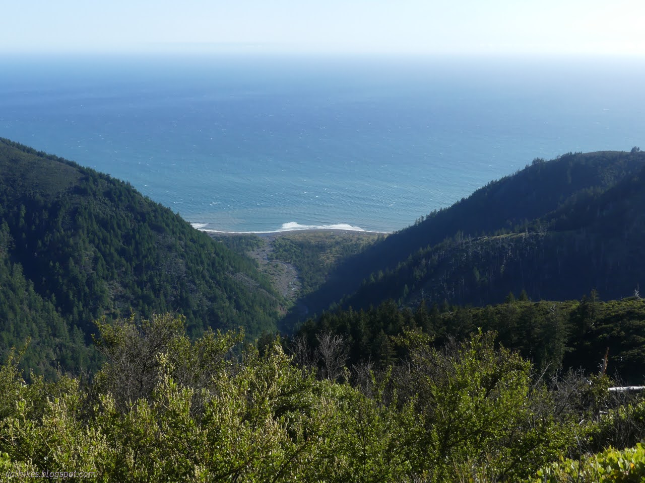
King Range National Conservation Area, Arcata BLM (brown line, map link ) DAY 1  |  DAY 2  |  DAY 3  |  DAY 4  |  DAY 5  |  DAY 6  |  DAY 7 With just a short way to go and since it takes a long time for the sun to get over the hills, I took a while to get started. Powerhouse and fuel tank in the morning light and a bit of processing to see what's happening in the shadows. In fact, the first hikers of the day came by just after I finished packing and wandered over to the sign about elephant seals. Listening to their strange clacking noises and thinking how I'd now seen them in very different seasons (October before), I wondered when you don't get to see them. The sign promptly answered. August. You don't get to see elephant seals in August. And you might miss them at the end of March. At this time, there should be molting females. I'd seen a few clearly molting and hadn't managed to spot a male. I should have ...

Lost Coast: Cooskie Creek Route

Image
King Range National Conservation Area, Arcata BLM (purple line, map link ) DAY 1  |  DAY 2  |  DAY 3  |  DAY 4  |  DAY 5  |  DAY 6  |  DAY 7 I looked around at how soaked everything was from the dew and decided I had enough water to cook breakfast right there (well, on a rock under the Douglas fir) while waiting for everything to dry out a little. My windbreak trees became morning shade trees, but they were still blocking some strong gusts most excellently, so I wouldn't want to trade them. Good soggy morning! So I headed out on the faint old road to join a much better road until getting pointed off to the left at a gate. Trail gets really faint there, but it's all much easier to follow on the second pass than it was on the first. A bit sunnier, but most spots aren't much drier than they were. After the short road section, follow near the fence on the faint track. If truly desperate for water and it ...

Lost Coast: King Crest and Spanish Ridge

Image
King Range National Conservation Area, Arcata BLM (blue line, map link ) DAY 1  |  DAY 2  |  DAY 3  |  DAY 4  |  DAY 5  |  DAY 6  |  DAY 7 Even high in Bear Hollow Camp, the morning was soggy with dew. I found, again, that if I'm too lazy to extend my poles, I can't have enough room under the tarp for the morning sit-ups. It wasn't cloudy when I got up, but the rising marine layer arrived about the time I left. I had a little over 3L of water in the bag in case it got hot now that I had left the cooling ocean below. The inland areas were set to warm over the next few days, but these peaks weren't looking at quite so much. Still, it can get hot if there's sun reflecting off marine layer. My legs were already tired of crawling and raising at the end by the time I got to the main trail from camp. I proceeded upward with a philosophy that if you don't expect it to get better, you won't be disappointed. I guess there i...

Lost Coast: Rattlesnake Ridge

Image
King Range National Conservation Area, Arcata BLM (green line, map link ) DAY 1  |  DAY 2  |  DAY 3  |  DAY 4  |  DAY 5  |  DAY 6  |  DAY 7 No rain, but my tarp was soggy with dew for the morning. A big fat moon sat above the ocean and I realized that except for a brief blurry light in the sky the morning before, I'd seen no sign of the moon at all so far. I breakfasted and packed not intending to head up Horse Mountain Creek Trail after all. I also didn't really care to go up Buck Creek Trail. I figured I'd camp at Randall Creek. I just needed to be reasonably early traveling the impassible zone on the way back to Miller Flat. A delightful tease of sunlight played on a piece of the waves, let in by the window of the canyon of Horse Mountain Creek. Otherwise, I was consumed by the shadow of the cliffs. The short way to Shelter Cove under the morning moonlight. Shadow and sun across the hills ahead as mists p...

Lost Coast: Big Flat to Shelter Cove and bounce

Image
King Range National Conservation Area, Arcata BLM (yellow line, map link ) DAY 1  |  DAY 2  |  DAY 3  |  DAY 4  |  DAY 5  |  DAY 6  |  DAY 7 So, my tarping didn't perform so well for the storm. I'd let the one stake go without dropping a rock on it, so I had to get up in the middle of the night and resecure it. There was a rock all of 2 feet away to drop on top of it. That left the foot of my quilt wet on the surface. The wind kept changing direction, but it didn't do so laden with rain until early in the morning. I'd figured I'd just use my poncho for protection if it did that, but hadn't decided how that would work, so it took a while to sort and wasn't very effective when done. I simply pulled it across, hopefully wet side out in the dark. Anyway, things only got moist and it's not down nor particularly cold. The rain seemed to encourage the broadleaved stonecrop flowers to pop open. Big Creek after a ni...

Lost Coast: Punta Gorda to Big Creek

Image
King Range National Conservation Area, Arcata BLM (orange line, map link ) DAY 1  |  DAY 2  |  DAY 3  |  DAY 4  |  DAY 5  |  DAY 6  |  DAY 7 Waves of rain passed in the night and it was dry but windy when I started the day. I needed to make it early because some parts of the trail can only be done at a low tide (below 3 feet, generally, but a couple spots are getting reported as below 2.7 feet now) and the first 4 mile section of this (referred to as the impassible zone) was coming up in 2.4 miles. The low tide was early and one of those especially tight spots is the north side of Randall Creek, the very end of this impassible zone. Yes, the tide would be coming in rather than receding as recommended, but it was a rather flat ocean and I have been here before. I had a pretty hard deadline of noon for the first 6.4 miles, which is tight but really shouldn't be hard to make. However, that rain overnight wasn't the r...

Lost Coast: Windy Point

Image
King Range National Conservation Area, Arcata BLM (red line, map link ) DAY 1  |  DAY 2  |  DAY 3  |  DAY 4  |  DAY 5  |  DAY 6  |  DAY 7 Well, an air fryer was obtained and even though this one doesn't have a "dehydrate" button, it turns out beans dehydrate well at 180°F, taking only about 3 hours for a pound. In 3 days, I had 3 pounds of various varieties and it was suddenly much easier to think about going out backpacking. I could try out the Lost Coast Trail the way everyone tells me it should be experienced, then wander back my own way because that shuttle is way too expensive and there's more to see than the beach. The tides would be super low in a couple days and the only weather a brief storm zipping past mostly in the night. Clouds (and storms) make things more interesting. Yeah, that's how it works, right? I decided on doing the biggest loop, so after pounding along the beach from north to south (as the ...

Ma-le'l Dunes, south and north, for the wallflowers

Image
Arcata Field Office BLM Humboldt Bay National Wildlife Refuge ( map link ) The wallflowers are blooming and maybe it's time to make a wander over the Ma-le'l Dunes once more. We spotted them on the way to pulling the invasive marram grass last week, little yellow pompoms in a large depression and spotting a few other places in the dunes. Since I seem to be using flowers as motivation to document a place again, the critically endangered Erysimum menziesii , Menzies' Wallflower, was as good an excuse as any. It really is just an excuse. I wanted to wander the dunes. Beware. There has been some rabies found in grey foxes in the northern dunes. Information signs about trails in the south section of dunes are at both ends of the long parking area. I like the forest portions of the trails here, so I headed past a rabies warning on a less obvious trail that climbs up the old dunes hosting the trees. It follows a long and narrow crest between valleys of surprising depth...

Fetid Adderstongue on the South Fork Elk River

Image
Headwaters Forest Reserve ( map link ) I was experimenting with the Seek app from iNaturalist (I'll say something about it at the end) and remembered to check on the fetid adderstongue. I found a couple leaves approximately where I remembered, then a couple seed pods getting a start, then a burst of flowers! Well, three. Not great, but not bad. A second plant had one more. Blooming fetid adderstongue was meant to be my trigger to go looking for them above the Elk River last year . I spotted them near the Eel River mostly in seed and jumped for it worried it was getting late for their season already. I see so many more seed pods developing than flowers. There weren't a lot then, at least not that I found. I decided to try it again, but didn't expect much. According to the plant phenology reported on iNaturalist observations , February is by far the biggest month to find blooming, falling off sharply by March. I was actually the thought of maybe seeing salmon run ...