Lost Coast: King Crest and Spanish Ridge
King Range National Conservation Area, Arcata BLM
(blue line, map link)
DAY 1 | DAY 2 | DAY 3 | DAY 4 | DAY 5 | DAY 6 | DAY 7
Even high in Bear Hollow Camp, the morning was soggy with dew. I found, again, that if I'm too lazy to extend my poles, I can't have enough room under the tarp for the morning sit-ups. It wasn't cloudy when I got up, but the rising marine layer arrived about the time I left. I had a little over 3L of water in the bag in case it got hot now that I had left the cooling ocean below. The inland areas were set to warm over the next few days, but these peaks weren't looking at quite so much. Still, it can get hot if there's sun reflecting off marine layer. My legs were already tired of crawling and raising at the end by the time I got to the main trail from camp. I proceeded upward with a philosophy that if you don't expect it to get better, you won't be disappointed. I guess there is another option, but I wasn't disappointed.


I made it to the junction and the landscape had dried out a bit, reducing the amount of ceanothus and other things blocking the trail. From the junction, it is about 2.6 miles to spur off to King Peak, Humboldt County's prominence point. I decided I didn't really want to do those miles. This was easier since I've already tagged the top before and after camping at Maple Camp in 2020. I turned to chancing the 3.1 miles or so to the Smith Etter Road instead.


Don't expect it to get better and you won't be disappointed, I reminded myself with this new trail. The King Crest Trail gave me a lot fewer challenges than Rattlesnake Ridge, but it served up a couple worse ones. Ceanothus blocked the trail all the way down to the ground at one. I got out the saw and took out the lowest one, giving enough room to slither under and pull the pack behind me. Didn't have to take the pack off at any time on the other trail. A fallen log made part of a track around another blockage. I took that and found someone had pruned away the branches that would make it harder to get back to the trail. Someone had been through before me.

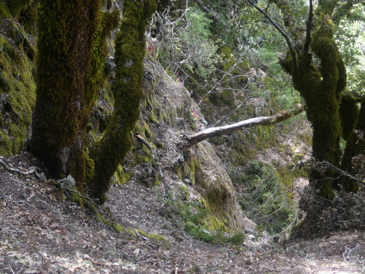
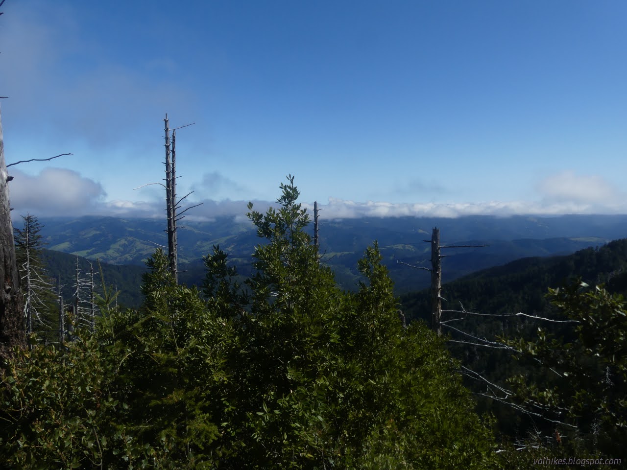
The trail was as I remembered, getting close to, but not quite falling off a couple slides. Little switchbacks down narrow rocky spots among trees. There were lots of little trees to toss off after finding a good leverage point. A couple were rather blocking. Maybe there really had been no one through since winter in spite of the trimming seen.

I got to the far end of the saddle and the trail widened into old road, at least for some of the route. There was still a little to clear to get through. I ended up doing quite a bit of trail work.


Around a corner and up and over a tiny bump, I was at the trailhead. The sign marked some underestimated mileages including 8 for the whole trail. It's over 11 miles. There's a new sign by the parking. I turned to get my road miles done. It's about 4.7 miles along this public road between Northslide Trailhead (north end of King Crest Trail) and Spanish Ridge Trailhead, but this one closes in winter. I'd been told it was still closed, but wasn't sure if that would still be true when I got to it. I saw one vehicle, but it had government plates and a pole saw in the back. It'll be open soon. Surprisingly, I also saw a couple chunks of snow. That was unexpected.


I found a funky spot where there seemed to be a spur road out to a turn around. It could be used as a camp and being just behind a wilderness sign, you even get to stay in the wilderness. It turns out to be the closest camp to Telegraph Spring, about a quarter mile off. And is Telegraph Spring hard to find?

Nope. Telegraph Spring was not hard to find. The pouring water sound didn't help hide it either. I should have evaluated my water at that point, but was still thinking I'd get all the way to Cooskie Creek to camp. So I didn't.

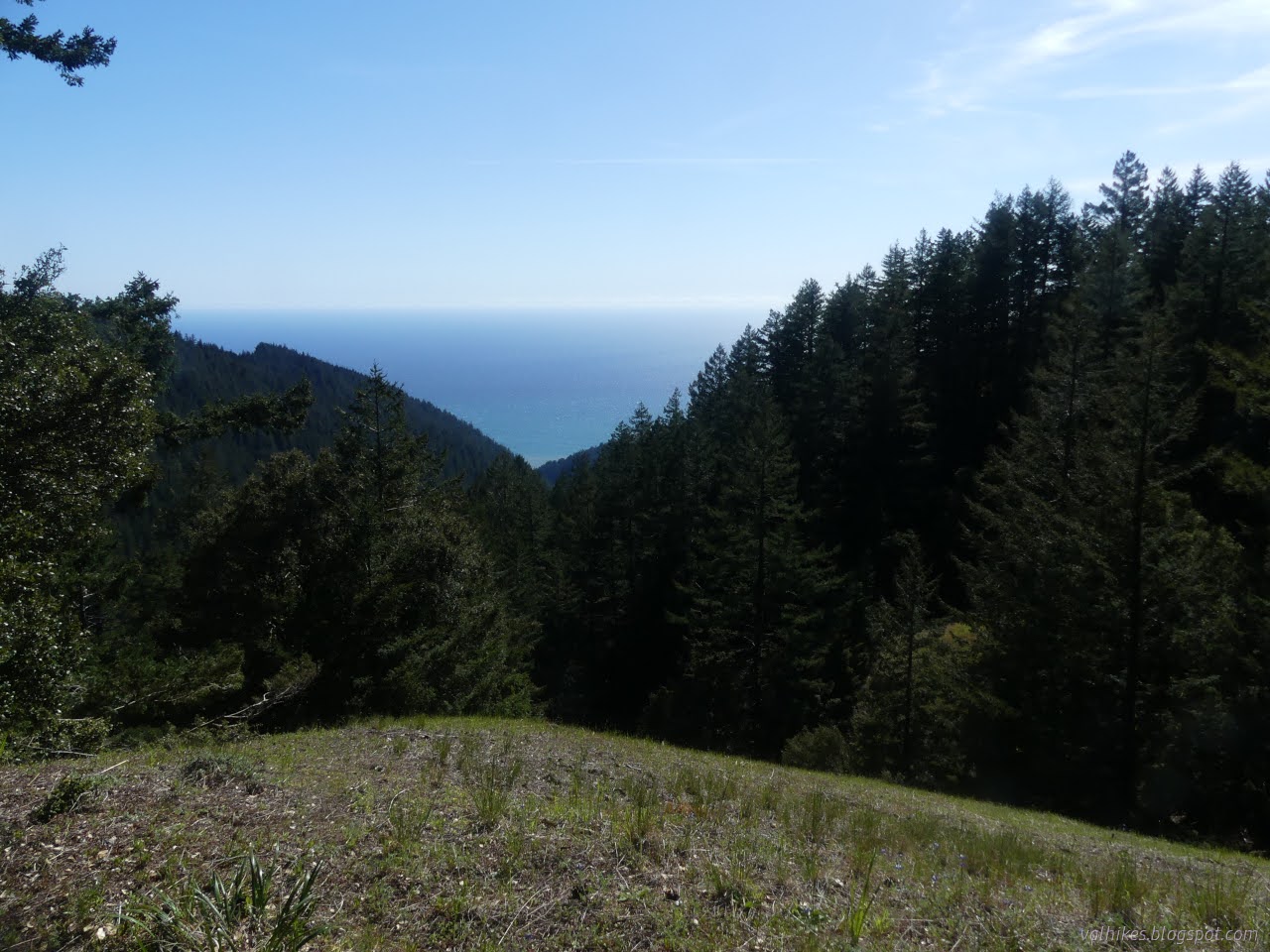
The first part of Spanish Ridge Trail climbs steeply through the trees on an old road. There were a few trees down. As it gets high and exits the trees, there's a nice overlook with an old turnout even. It must have been well used as the grass is still short on it. Onward it goes, into the meadows.

I finally checked on the water and decided there was enough to cook supper at least, then get to the creek to cook breakfast. It hadn't been particularly hot at all. A little cold at times, in fact. I had started with way too much.


There is a marker to direct hikers toward the ocean if they want to follow Spanish Ridge Trail. It has been stripped of mentions of the Cooskie Ridge Route, but this is the southern end. One can either go through the trees, still on old road, or follow a track north over the hill that joins up with the lower one on the other side. I went through the trees, finding more coralroot orchids among them, all of them just budding.


I was getting close to joining private property access road, briefly, when I got to what might have been meant to be a turnout, but never got used. Tall grasses and scattered ferns grew all over the flat area. The trees to the east were making a superb wind break against the stiff breeze behind them. I decided this was it, my home for the night.


Of course, this made a wonderful spot for the sunset, which lasted a good, long time.


same trip, next day ⇒
*Lost Coast album*
©2023 Valerie Norton
Written 24 May 2023
Liked this? Interesting? Click the three bars at the top left for the menu to read more or subscribe!


Comments