Posts

Showing posts with the label Tulare County

Jennie Lakes: Weaver Lake
Image
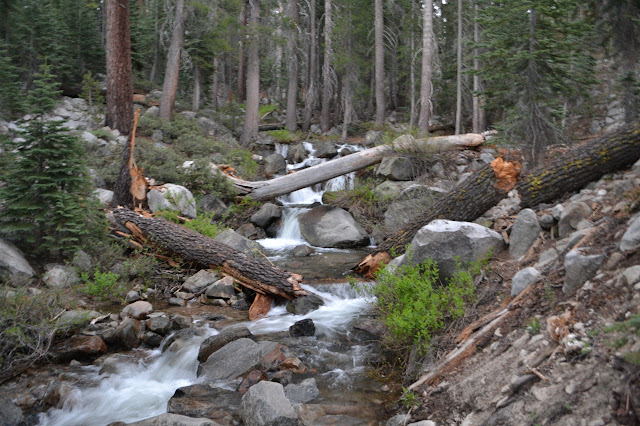
Sequoia National Forest Giant Sequoia National Monument Click for map. DAY 1  |  DAY 2  |  DAY 3  |  DAY 4 I am up at the first hint of light. It is easy to get up in such mild weather. Martha has not taken it as quite so mild, so I let her have the neoprene socks for the early morning foot soaking. I did mention I was overpacked. We collect ourselves together and head up the little bit of trail to the crossing to finally give it a try just as it gets light enough to see into the water. I feel like it got quieter about halfway through the night, but the water level really does not look any different. We drop down to the crossing with smooth running water consistently across a wide section and cross. It does not seem to pull much at my legs as I go. Somehow the snow melt is not even cold. Much ado about nothing. A bit of blur as the camera gathers enough light in the dawn. The trail crosses in the crescent below the broken log with...

Jennie Lakes: Belle Canyon and Rowell Meadow

Image
Kings Canyon National Park Sequoia National Forest Giant Sequoia National Monument Click for map. DAY 1  |  DAY 2  |  DAY 3  |  DAY 4 It was another mild night, but the mosquitoes very nearly vanished early on into it. The sun comes quickly here and the morning golden hour is really quite something. I enjoy it with breakfast and happily the mosquitoes seem to be slow to wake up. Our northerly view from near camp: the morning sun as it hits Ball Dome. Morning over Ranger Lake. We head out to the trail again and wander gently downward, still high above the valley bottom. The air seems a lot clearer today and the snow on the far mountains is much more defined. The snowy distances.

Jennie Lakes: Twin Lakes and Ranger Lake

Image
Sequoia National Forest Giant Sequoia National Monument Sequoia National Park Kings Canyon National Park Click for map. DAY 1  |  DAY 2  |  DAY 3  |  DAY 4 The night was almost too mild and a few of the mosquitoes stuck around through it. Also, I am way overpacked for such mild nights. It is what the National Weather Service predicted and what the history of a fairly local weather station confirmed, but how could I believe that in the face of knowing there is still snow on the ground? It sits in great lumps all around me. The morning brings wakeful campers, but not a lot of noise except for the one excitable dog. People seem to gather themselves up at a leisurely pace and wander away again, mostly turning back down the trail. It is the same with us, except that we are continuing out further. Jennie Lake has a nice rocky backdrop to the south. A few clearly do not yet want to get up. Far on the east side, I can see a hammock th...

Jennie Lakes: Shell Mountain and Jennie Lake

Image
Sequoia National Forest Giant Sequoia National Monument Click for map. DAY 1  |  DAY 2  |  DAY 3  |  DAY 4 The Forest Service does not charge anyone to enter the Giant Sequoia National Monument, but we cannot get to Jennie Lakes without passing an entrance station for one of the National Parks and they want some money. Martha just flashed her pass which not only got us in free, it allowed us to use the shorter, faster line past the entrance station on this crazy holiday weekend. After finding a far parking space to wait in line to chat with a Park Ranger in Grant Grove Village, we are still an hour later than we wanted to be at the trailhead. Permits to hike in Jennie Lakes Wilderness are self issue at the trailhead and that is enough to camp within the Monument and take day excursions into the two Parks, but camping in the Parks requires a different permit subject to quotas and fees. The only space left in the lot is the overflow parking and ...

Mount Whitney

Image
August 1991 Inyo National Forest Sequoia National Park I was the ripe old age of 14 in 1991, so my first trip up to Mount Whitney was not my own plan or execution. Instead, it was part of the intermediate backpacking unit at Camp Mountain Meadows. Or at least slightly higher than beginner. It may well have been my third backpacking trip ever and the previous one did not go entirely to plan . The first one was when I was 9. This one also did not go as planned, but in two ways inconsequential to getting to the goal. First, permits had not been reserved for our group, so the original plan to go in at Onion Valley and proceed south had to be scrapped when walk-in permits could not be obtained for a group the size of a Girl Scout Camp unit. Instead, we camped out at the Cottonwood Lakes backpacker camp at the trailhead (which I remember being quite crowded) and Klikitat got up at 4AM to sit next to the ranger station to be first in line when they opened. I think she said the s...

Williamson: Williamson Bowl

Image
Inyo National Forest Sequoia National Forest DAY 1  |  DAY 2  |  DAY 3  |  DAY 4  |  DAY 5  |  DAY 6 Another morning by the lake and still no fish are jumping, but we are going fishing. Just not here. We pack it all up only to drop it again just the other side of the rocks. Dave has decided that it will be easier to get to Big Sur for a family weekend if he walks out today and Devon likes that hike a little better than the one over the trailless rocks, so they are both bailing on us again. We wave them off while we unload our packs, the start the first navigational challenge. Looking down on the lake at the next level below. Williamson Creek gets its start here. We are heading down to it and over the lip to the next one. Photo by Dave from above us. This is where I want to grab my camera and thumb to a photograph of the area we will be hiking down to remind me of the route. Reconnaissance photos are really...

Williamson: Shepherd Pass

Image
Inyo National Forest Sequoia National Park DAY 1  |  DAY 2  |  DAY 3  |  DAY 4  |  DAY 5  |  DAY 6 The morning sun comes up directly down the canyon and I go for the camera to take a picture. The camera promptly does nothing at all. I check the settings and it is on and everything looks right, but there is not even a complaint of a low battery when I press the shutter. I left it on when I tucked it into my pack last night and it probably spent the night trying to focus on the inside of the pack. The action was to protect it from dew I knew would not manifest and indeed did not. Battery failure number two. I did that once before with dire consequences for any chance at picture taking, so at least I am not in a panic that my expensive camera is now broken, but I should have learned. Of course since the battery will last for weeks, short of egregious operator error, I do not have a spare. With the telephoto and trip...

Cone Peaks: Jordan Hot Springs

Image
Inyo National Forest Sequoia National Forest DAY 1  |  DAY 2  |  DAY 3  |  DAY 4 (The night was too warm even for my light quilt until a breeze came up to mix the night air a little bit. Soaking in the hot spring under the bright Milky Way was great, but now it is morning and time to hike out on an often hot trail. The moon rose a thin crescent in the dawn light, but the sun is very slow to get up after it. Since I had no photos of the spring after getting in at sunset, some in shadow would just have to do. The meadow and my late night neighbors are not yet in sun either. The main pool at Jordan Hot Spring with the cold water channel to help regulate the water temperature. The main pool is bubbling everywhere. I do not remember it having that many "air jets" a couple years ago, but it is probably not something that changes much. Little hot creeks flow in in a couple places. As much as the tub was too hot to soak in for more tha...

Cone Peaks: Templeton Mountain

Image
Inyo National Forest DAY 1  |  DAY 2  |  DAY 3  |  DAY 4 Templeton, the original impetus for this trip plan, sits serenely across a short meadow and a random little hill. Should I get to a "better" position to start up it, or just clamber right up it and that little hill for good measure? Packed up, I go searching for that elusive trail, but there really is no certain sign of it. There is a funny looking post on the far side of the meadow that looks to have trail beside it. Maybe. And maybe that is a line there. As I hit the creek, there are a couple rocks set out to help hop it without getting my feet too wet, although the meadow plants are doing a good job of wetting my shoes already. The post turns out to be another location poster with an unfamiliar format, but this one is only about 7 years old. It is at the edge of dry land and points to something right by the creek only 51.6 meters away. I look, but nothing is obvious. Locatio...

Cone Peaks: Brown Mountain

Image
Inyo National Forest DAY 1  |  DAY 2  |  DAY 3  |  DAY 4 With the wet ground and falling temperatures in the night, there was a fair bit of dew. As the sky brightens, a moo drifts across the grass. Ah, wildlife. The mist hangs over the meadows, especially around the river, but it increases and moves as the sun rises and warms the wet ground. I thought I was well situated to get some morning rays, but it just takes forever to get over the mountains. Mist on the meadows in the morning. Eventually, I realize the sun actually is glowing up there in the sky, however what was a sky full of stars has somehow turned into a sky full of clouds. There is no telling how long it will take the sun to come out, so everything will just have to be put away wet. Since I ignored the road to find water and then camp last night, I have to go find it again in the morning. This is easy, it is right where I left it. Then I have to try to navigate the man...

Cone Peaks: Monache Mountain

Image
Sequoia National Forest Inyo National Forest DAY 1  |  DAY 2  |  DAY 3  |  DAY 4 I left Templeton Mountain unclimbed almost two years ago and decided to try for it again. The impetus to climb this silly looking nearly perfect cone of a peak was to look for a benchmark that is on the 1905 Olancha 30' map. There are others, so I decided to add a few more to the trip to make a big loop with a return that may as well visit Jordan Hot Springs again. I stopped by the Blackrock Ranger Station to self issue a wilderness permit then got up to the parking lot just after hitting the breaks to avoid hitting a bear. Seeing the bear makes me really want to get rid of food trash and maybe food before leaving the car, but there are no trash cans or bear boxes available. So it goes. There is a beautiful hazard tree central to the lot. So it goes. To avoid walking the same trails as much as possible, I decide to head over to Monache Meadows via motorcyc...

Sunday Peak

Image
Sequoia National Forest We climbed Sunday Peak with our backpacks weighed down with #10 cans of peaches and things out of the kitchen to get the feel of a weighted pack before going out for a three day trip. It was probably meant to shake out whoever might have signed up for a backpacking unit even though they should not have. I remember it being a sunset hike and we all had a grand time, so there was no actual shaking. I probably hiked it again in a similar way before going out on a five day trip another year. The camp is gone, but the driving directions still say to park near the sign for Camp Mountain Meadows GSA. I am rightly suspicious the sign is gone, but it has simply been replaced with one for the trail so that it is still easy to find. The area could be confusing with a motorcycle trail running past and the old camp road heading down to the meadows the camp was named for, but there is a second sign a little deeper in that makes the correct route clear. This wa...

Coyote Peaks: Coyote Peaks

Image
Sequoia National Park Sequoia National Forest DAY 1  |  DAY 2  |  DAY 3 The rain overnight was not so bad as we feared it might be. It was actually stopping as we set up and cleared off overnight only to cloud up and rain again shortly before morning. None of the rain was particularly hard. It is clearing again as we get up and everything is drying quickly. First, we have to finish what was supposed to happen yesterday, a short jaunt up and over Coyote Lakes Pass. Trail wraps around the edge of the meadow to a well established campsite, then gets headed toward the pass. It seems to make perfectly straight lines as it switchbacks up the last couple hundred feet. Water can flow here, but currently it is a dry meadow moistened by rain. Coming up to the north side of Coyote Lakes Pass, which is not so big, especially if starting out at around 10,000 feet. Looking back over the bowl that is the headwaters of Coyote Creek.

Coyote Peaks: Coyote Pass

Image
Sequoia National Forest Sequoia National Park DAY 1  |  DAY 2  |  DAY 3 After getting a mound of water for breakfast and another mound for hiking for the day, a procedure that seems to take forever with a Sawyer mini, Bernard is somehow still sleeping. The shaded creek is full of tiny Humboldt lilies and I enjoy my nice hot breakfast before giving him a little kick to get started on the hiking for the day. Today we climb and, as far as we know, this is the last water before the lakes at the top. The trail is a lot easier to find as we start today than it was as we ended yesterday. Humboldt lilies are among the thick green around Rifle Creek. Back out into the scar left by the 2012 Lion Fire, but at least some sawyers have come by. The trail becomes faint in places as we twist up through the forest. There are still a few big logs to jump over, but it is not so bad that the few mule prints we find on the trail seem out of place. Pistol Cree...

Coyote Peaks: Little Kern River

Image
Sequoia National Forest DAY 1  |  DAY 2  |  DAY 3 Bernard wanted to hit the trail for a few days, which became a few less days. When he was saying 5 days, I was thinking Woodchuck Country and Blackcap Basin, but when he said we would have to be back by Monday, I quickly changed to the peaks I looked at last November and decided I could not include after all. The unknown nature of water availability was the problem then and is still a problem now, but easier to deal with on a shorter trip carrying less food. After calling in for my permit, I realized I could do the loop clockwise and water would probably be easier on the way up. We must have psychic people filling these out, because that was how my permit was already set up for me. We dropped ourselves in Lewis Camp the evening before, ready to hit the trail in the morning. Again entering Golden Trout Wilderness from Lewis Camp. I was told to expect water only at the river and lakes because of th...

Golden Trout Wilderness tour: Lewis Camp

Image
Sequoia National Forest Locate the trailhead. DAY 1  |  DAY 2  |  DAY 3  |  DAY 4  |  DAY 5  |  DAY 6  |  DAY 7  |  DAY 8 A little poking around find the remains of a dead horse left just up the hill from the trail and the trail that cuts across to the Little Kern River from Willow Meadows. Away from the camp, the trail is quite obvious as it climbs steadily, once needing a little switchback. The area is burned at the top. Coming into the burn area and finding the manzanita almost completely gone. More burned trees and manzanita. The last peaks as the Great Western Divide comes to its southern end. A sign tells me where I am going and where I am coming from as I cross a trail that comes up from the Trout Meadows Ranger Station and drops down to Burnt Corral Meadows. It might make a nice alternate route back adding on about 4.5 easy miles to get there and then cross the Little Kern R...

Golden Trout Wilderness tour: Jordan Hot Springs

Image
Inyo National Forest Locate the trailhead. DAY 1  |  DAY 2  |  DAY 3  |  DAY 4  |  DAY 5  |  DAY 6  |  DAY 7  |  DAY 8 Today is a very easy day. The morning is to be looking for monuments around Casa Vieja Meadows and wandering three miles or so down the trail. The afternoon is to be sitting in the hot springs and exploring old cabins from when it was a commercial concern. The morning sun on the meadow is stunning, and after some battling with the camera in need of a new battery, I can capture a slightly lesser moment of the light. Then, with breakfast put away, I turn my attention to climbing the small peak just north of my campsite. Manzanita makes a feeble attempt to block my way sometimes and I am quickly into a cold wind, but soon find myself on Doc Peak, as it is labeled in the OpenStreetMap. It is another labeled with a benchmark on the 1905 Olancha 30' map and on the more recent 1987 Casa...

Golden Trout Wilderness tour: Casa Vieja Meadows

Image
Inyo National Forest Locate the trailhead. DAY 1  |  DAY 2  |  DAY 3  |  DAY 4  |  DAY 5  |  DAY 6  |  DAY 7  |  DAY 8 A good study of the map while having supper for breakfast suggests I am hanging out by Movie Stringer. One of the guys with the stock had suggested I should try to get down into it for water. Looks like he had a good idea there, although he also thought I would be traveling through Ramshaw Meadows for a bit but I only got close enough to see it through the trees briefly, and thought Ramshaw Meadows would be my last chance for water before the peak so did not know about all the water in the Kern Peak Stringer. The trail up to the peak shows much less evidence of stock travel than the other trails, he probably has never actually gone up it. He said there was a corner in Ramshaw, too, so at least one of the three I have found marked on the map is really there. I want to poke around T...