Posts

Showing posts with the label Los Padres National Forest

Frazier Mountain on snowhoes

Image
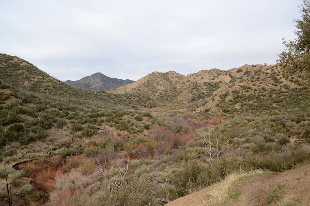
Los Padres National Forest Click for map. Frazier Mountain is the second mountain on the Hundred Peaks Section's list of peaks that I have been up, but only in a car. Since I don't feel like counting drive-ups, I need a plan to hike it. I've had one to go in from the east side at the edge of Hungry Valley, but with all the snow on the ground, a 20 mile hike is probably too much for the short days. From the north, I can get up and down by two routes in 7 or 7.5 miles. That's still almost 15 miles and the trip up Tecuya showed the snow can start very early, and that was the south side of the mountain. How long can one go on snowshoes in a day? They certainly aren't as fast nor as easy walking as hiking on dirt. Hopefully I'll have the good sense to quit if it gets to be too much, not that I have a good record of that. With the memory of the frigid wind at the top of Tecuya, I have my puffy mittens and a few other things to be sure I'm warm enough. ...

Tecuya Mountain

Image
Los Padres National Forest Click for map. For my second demonstration of how not to approach ice in a car, I entered an iced over corner with an uphill slant in third gear. This is too fast. So after it started to spin one way and I managed, through great "skill", to get it spinning faster the other way, but still headed right into the snow bank, there was the "joy" of trying to remove it from said snow bank. The delay probably doesn't mean too much. This is a short hike. I think I'll follow the motorcycle trail to the road and the road up past to Tecuya Ridge area, then back up to the mountain and down a ridge to the motorcycle trail again. Or maybe the other way around. Either way, I'm heading up Cold Springs Trail first. It is currently closed to motorcycles. Lock on Cold Springs Trail for the winter season. Still fine to hike. There's a couple people walking their dogs back down as I head up. The initial impression of the trail is...

Cuyama Peak

Image
Los Padres National Forest Click for map. The automated weather says today is the brief sunny moment between a couple small storms, or did when I could get a weather report. There are some clouds, but they are clearing. Getting up to the peak is going to be a 12 mile hike if I take trails. I plan to go up using a ridge for a shortcut and come back on the trails, but it will still be a 20+ mile day. If the gate weren't locked, it could be shortened by three miles, but I'm pretty sure my car wouldn't make it across the river so it doesn't really matter that the gate is locked. My arms still hurt from shifting trees on Deal Trail, so I really hope Tinta is not in a similar shape. Starting the same place as for the loop with Deal Trail, but a bit earlier. There's a bit more ice on the unstable log that crosses most of the Cuyama River, but I'm not keen for another spill into the water. It was 24°F earlier and probably hasn't got much warmer yet. ...

Deal Trail

Image
Los Padres National Forest Click for map. I come to the gate at Rancho Nuevo to climb a peak, but not today. Today is for another round on Deal Trail, which loops up and around to find its way back to CA-33, then I get to come back down. It's an excellent candidate for dropping a bike off at the top to get back, but I haven't got one anymore, so it will be a road walk to finish. There's one of the many wilderness information beside the gate. Leave no trace principles, a map, and fire recovery information. I think we're getting to year 14 of recovery for this area. The gate is closed for the winter season, not that it would help me if it weren't. The first thing it does is cross the Cuyama River. Today, this is a series of ever deeper ditches until I finally get to one that holds water. It is more of a big creek today. There is a log to cross it. I'm not a fan, but go for the increasingly ice covered and wobbly bridge. Even with poles for balance,...

McPherson Peak and Peak Mountain

Image
Los Padres National Forest Click for map. Here I am at Aliso Park again staring at McPherson Peak, or into the trees in its direction at least. My undoing! For seven miserable hours. That was a week short of two years ago now. It somehow feels both longer and shorter. I'm going to reverse my path this time. That way the battle that is finding the peak trail will be done in plenty of light. I've already done the initial part and found where the trail starts from the campground. Just past where the trail starts up the hill heading north, you can find the remnant of the old and official route of the road as it goes south up the canyon. It is easier to see as it rejoins the current road than as it passes through the campground. More importantly, where it once crossed the creek, there is a thin line that does not and instead continues north, climbing, along the hill quickly becoming very distinct trail. The trail starts in the southwest corner of the campground. There...

Cozy Dell to Valley View Camp

Image
Los Padres National Forest Click for map. I've been thinking I should go back to Cozy Dell for years now, then Thomas came roaring through, but I still kept thinking it. Thomas is a fire, of course. It stayed California's biggest for 6 whole months. That was just over two years ago and the forest was open again before it was officially out. Bernard's somehow never been on this trail, so he wanted to come along. It's not that he's never noticed it when passing along on CA-33 to somewhere further by a little or a lot, just that he's never stopped to see where it goes. There's a bit of potential for exploration, but I only plan to take the official trails to check on Valley View Camp. If I lived in Ojai, I would know all the little tracks up here and have got myself to Nordhoff Peak by a half dozen different routes including some from here, I expect. I've done it by a quarter dozen others anyway. The trail is well signed at the highway and ther...

Lizards Mouth Rock

Image
Los Padres National Forest Click for map. I popped around to Santa Barbara and visited Bernard, who was skipping the holidays for the Wednesday night hikes, but out for the very short Lizards Mouth hike for the weekend. We hiked a mile extra along Camino Cielo on the way in and got that shortened for the way out. That meant passing the Playground, which wasn't so busy, before getting to the rock, which was bustling and humming with all the folks out for the last weekend of the year. Clear, but that doesn't mean there's much to see of Carpinteria on down the coast. The last couple storms through actually dropped some snow, at least on the stuff that's 5000 feet high. Some fell lower, but it's gone now. Some rocks of the Playground below. Further is a reservoir, the lagoon at UCSB, and the Channel Islands. The separation between Santa Cruz and Santa Rosa can just be seen from here. I take the first trail into the exposed rocks around Lizards ...

Sisar Canyon and Horn Canyon

Image
Los Padres National Forest Click for map. I actually took the time to ask if someone else wanted to hike and when the dust settled, we were three strong and had a shuttle hike going up Sisar Canyon (which Matt wanted to do) and down Horn Canyon (which I was more keen about) doing maintenance on all the geocaches along the way. The hike up is via road which makes for a very gentle climb, at least by our standards, nearly up to the top of the hills (AKA mountains) behind Ojai. Parking has changed at Sisar since I was last there . Previously, there was a nice lot after a not particularly nice bit of dirt road, but now the road has a gate because people wouldn't quit treating the adjacent private property like it was public property, and in rather abusive ways at that. Now they have ruined it for us all and there is much less parking further back. We left a car at the bottom of Horn, which has not changed much , then got around to Sisar in time to claim one of the few spots....

Montecito Peak

Image
Los Padres National Forest Click for map. I feel like I have been avoiding the front country since the Thomas Fire except some brief looks early on. I see it on regular evening hikes with folks during the Wednesday conditioning hike and the Friday social hike, but I tend not to write up those hikes. Before leaving easy access to it, I decided to hike up Montecito Peak one last time. The usual approach via Cold Spring Trail is still closed, so the easiest entry to climb the peak is now Hot Springs Trail instead. The exclusion zone signs at the bottom have now vanished, so things are getting better. The very start of the trail looks the same, but things change just a step past that. New fencing is everywhere replacing what was washed out to sea. The creek flows down a canyon deeper and rockier and more open to the sun than before. The creek actually flows, which has not been seen this late in the summer in recent years. For one familiar, it all feels different. For someone who...

Upper Sisquoc trail work

Image
Los Padres National Forest Click for map. I signed up for a little more trail work, this time along the trail I bailed along when it got just a bit cold and snowed on me . At the time, I hopped over, around, and even under quite a few trees in just a few miles. Since then, there have been a lot of work to clear them all out. They said 300 trees have been cleared. Surely it was not quite so much? Then again, maybe it was. Another 20 remain and that is what we are out for today along with plenty of brushing and a little tread work. (It isn't that I have any influence. I'm just lucky to have hit the trail shortly before the work was done.) We drove the 20 miles behind the locked gate up to Bluff Camp for the night yesterday afternoon, so had a few miles drive still to get to the trailhead at Alamar Saddle. Safety talk and tool grabbing is quick with a group that mostly has been around and done this sort of thing. So we head down with a plan to make the trail nice from Upp...