Sisar Canyon and Horn Canyon
Los Padres National Forest
Click for map.
I actually took the time to ask if someone else wanted to hike and when the dust settled, we were three strong and had a shuttle hike going up Sisar Canyon (which Matt wanted to do) and down Horn Canyon (which I was more keen about) doing maintenance on all the geocaches along the way. The hike up is via road which makes for a very gentle climb, at least by our standards, nearly up to the top of the hills (AKA mountains) behind Ojai. Parking has changed at Sisar since I was last there. Previously, there was a nice lot after a not particularly nice bit of dirt road, but now the road has a gate because people wouldn't quit treating the adjacent private property like it was public property, and in rather abusive ways at that. Now they have ruined it for us all and there is much less parking further back. We left a car at the bottom of Horn, which has not changed much, then got around to Sisar in time to claim one of the few spots. Actually it is not that bad. We were only the second to take a spot as we started up the road.

The first thing I notice is that the road is now in quite good repair. It probably helps that it does not have all that public going over it in all weather anymore. Likely it got some maintenance when the fire was edging along toward this area. We are down under mature trees and there is evidence of fire, but only at low levels, at least for the most part. Then we pass into a flat that really burned and a thick layer of ash still covers the ground.

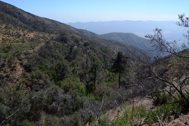
We get a break from the trees to see a couple of good looking swimming holes. The creeks seem to all be running now. Then it is on to a few more trees as we get more and more frequent evidence of burn.

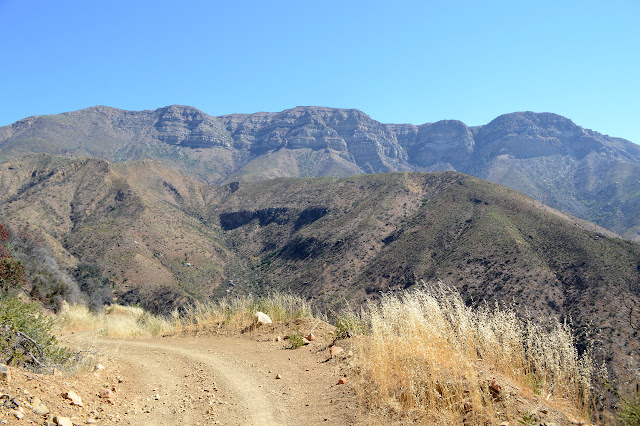
Finally the road swings back and climbs into the hills where it is all burn everywhere. Bits of the hills with their southern aspect were protected by sparse but mature specimens of a few types of plants, but now it is wiped clean down to the roots.


We saw some random specimens of poodledog bush lower down, but it gets more common as we climb. One plant growing up with some buddies in the side of the road is even putting out a purple flower to show a little of what is to come. Bright and happy and full of promise of misery. We who are trained to look out for and avoid poison oak have no defenses against this one, but it is another to try to never touch. Unfortunately, it also seems to be what is giving the upper hills the tint of green.

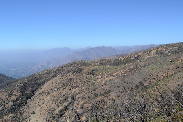
We gradually come around to a vantage point above The Pines and can see the state of it. They look thin, but green and living. Maybe all the others dying off and then all the work put into getting the area safe for camping again saved the rest of them. If the alternative is a bunch of tall matchsticks, they look really good.
Nearing the junction with Horn Canyon Trail, there is a car with some familiar faces sitting inside. Enjoying the air conditioning, which they dutifully give up so as not to tease us too much. Not that the weather is all that hot or that we feel much need for air conditioning. They have been playing on the west end of the ridge and say they have only come this far east to go after a single poor, lonely cache that has been left unsigned for 5 years now when we come strolling along with the owner in tow. Our little band is double in number as we wander down the tenth of a mile to recover the burned remnants of the lonely cache. We cannot read the log to be sure it really was as lonely as it claimed online, but we are in no doubt that it is what we were searching for as we sign the log for a replacement.

With the successful find, our new hiking companions take off back up the hill for the car leaving the next one, just as lonely, to us three on our own. The trail down is easy to follow, but I am worried what it will be like in a few months. Short poodledog plants are everywhere, even right in the middle of the trail. For now, they are small enough to avoid easily and most the ones in the trail are small enough for a good stomp. I am not above giving them a good stomp, either. Plenty are already too big for that and they will eventually grow waist high to shoulder high, at least. They will sprout extra stalks to fill in a wider area. The whole area will be hard to get through for any who are allergic, all topped with the stink of the thick, sweet scent of the leaves and especially flowers. I have to admit, it will be pretty when it blooms purple across these hills, at least that first year. At least when one doesn't know what it is.
The poodledog plants get thinner as we proceed down the hill. They definitely tend to the higher elevations. The trail itself follows down a series of hills and flats. Above The Pines Camp, the mystery sign post I spotted before now has a buddy. The lost trail they marked is now open to use but even harder to find definitively. The poodledog seems gone by the time we get down to the camp.

Bits of metal remain from old stoves that were once brought up here. Numerous fire rinds sit here now. Troughs that used to gather water from the spring are dry, but they probably were this time the last few years, too. I want to see the spring, so I start down the old path that used to lead to it. I have not been very far down this path, but a charred and burned irrigation line still leads the way back from the spring to a trough in camp. Sometimes there is a piece of hose that still looks like hose. The path climbs a bit and then drops suddenly leaving me in the bottom of a gully. I can still see evidence of hose and keep on going up for a while. The trouble is, I don't really know how far up I should go and it is often dry at this time of year. All I can find are bay laurel coming back from their roots. This small canyon had not been wet enough to save the vegetation.


The other two are getting a bit antsy by the time I give up after not finding even a little bit of water. I tell them I am on my way back and they are well down the trail by the time I get back into camp. I photograph a few more things and then hurry after them to find one returning from looking for an old ammo can that was hidden well off trail. Even this is gone from the fire, except it isn't. Someone must have "helpfully" moved it closer to the trail because it sits open about 10 feet from where the unsuccessful searcher is standing. Missing ammo cans always take the most surprising ways to turn up again. They seem to often buckle and deform in fire, so this one is actually looking pretty good if very rusted. It needs a new rubber gasket, but we hide it again in a new place.

Even with so much burn, there is still a noticeable change in the vegetation as we descend. The sudden buzz of bees makes it easy to look for some of the few flowers. The loud sound of water below reminds us that there really is water in many places out here. Most the trail is clear except for sumac coming up from the roots in a very bushy style. For most, this is no problem. For Matt who has recently found himself to be allergic to sumac, this is a worrying development. There are a few different kinds, hopefully this is not the one, but so far he has incomplete information about his allergy. He only knows it results in a misery that would be nicer if it was just a bad poison oak rash.


The creek is running nice and strong when we finally get down to it. I am not sure I have seen it so full, but I have not given it much chance either. I have only been in the area twice. While we are down near the creek, there are plenty of trees, but as we climb out again to follow the trail, we get into more burn. The school itself was not harmed, but it must have been quite an effort.


We are all quite done with geocaches by the time we come out the Horn Canyon Trailhead. It feels a little edifying that even those who determinedly make sure the local trails have a geocache every tenth of a mile are capable of being tired of it after 12 miles. Anyway, no one is making us go for all of them. That is all our doing. And it was really good to see some more of our fire scared hills.
©2018 Valerie Norton
Posted 11 October 2018
Liked this? Interesting? Click the three bars at the top left for the menu to read more or subscribe!


Comments