Posts

Showing posts from September, 2021

Lacks Creek: return

Image
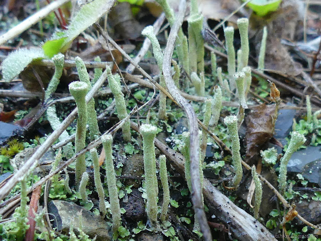
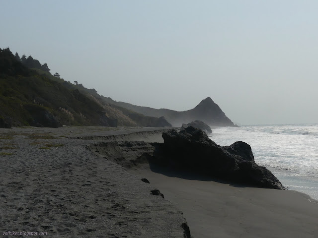
Lacks Creek Management Area, Aracata BLM (Map link. Red line for day 3.) DAY 1  |  DAY 2  |  DAY 3 I only had to hike out, except stay within the lines. I could have popped down the Faulkner Trail to see all of the prairie, which is just a mile long, but decided against. I didn't want to get back late. I retraced the route back on the trail. The puddles and trickles were smaller on the way. The ground cones are looking a bit like pine cones now that they are well past their sell by date. A sort of bird's nest fungus .

Lacks Creek: Prairie Trail

Image
Lacks Creek Management Area, Aracata BLM (Map link. Green/blue line for day 2.) DAY 1  |  DAY 2  |  DAY 3 Water just kept on settling out of the air all night. It wasn't raining, but it might as well have been. When the stars were long vanished, I went ahead and set up that useless tent I'd brought by the light of I'm not sure what. No stars, no nearby cities, maybe the half moon was up somewhere above the thick fog, but still no need to turn on a headlamp. It was just that little bit warmer and drier and somehow a little bit of heartburn finished up too. Everything inside the tent was dry again by morning. The morning was a slow one under all that mist. The sun breaks over the edge of the hills just as a thin spot in the fog passes. Of the three central trees, the evening bear was up at the top of the one on the left. I grabbed my food bag and wandered along the old road that makes a flat area for the campsite (as near as I can guess). I didn't get far

Lacks Creek: Beaver Ridge

Image
Lacks Creek Management Area (Aracata BLM) (Map link. Purple line for day 1.) DAY 1  |  DAY 2  |  DAY 3 It was again the day right after a bit of a rain, the second since the dry season, as I parked again at the main road junction at Lacks Creek. This time, I was packed up and ready to hang out for 2.5 days on the west side where the longer trails are. ( The visit to the east side is here. ) Finding information on these is difficult and someone at the Bureau of Land Management (BLM) is really bad at producing working links. (Many can just be edited. They've used an entire sentence as a link? Really? They do know the edit.blm.gov server isn't public facing, don't they? Some are utterly without relation to where they should be pointing.) The main page with summary information and directions can be found here . They do neglect to warn the casual planner that this area does not allow dispersed camping unlike most BLM areas. There are a number of official campsites on

Stone Lagoon and the Arch

Image
Humboldt Lagoons State Park Redwood National Park (Map link.) I was determined to experience the bit of California Coastal Trail along Stone Lagoon as it was "built". The predicted weekend rain wouldn't be enough to raise the level of the lagoon sufficiently to leave the north end of the trail once more underwater, but it might be enough to allow some attention to the inland areas that have otherwise been smoky and even slightly on fire. Now is the perfect time to finally walk the whole of this short trail. I planned to go all the way to the parking lot at the north end, then return the same way. I did have some thoughts about heading to Sharp Point and then walking the beach south from there, but the tides weren't looking very cooperative. They were coming in about 3 feet at sunrise and then climbing to about 6 feet at sunset with a brief backtrack in the middle to about 3 feet again. Sometimes there's just no such thing as a low tide all day. On the trai

Stagecoach Hill Azalea Nature Trail

Image
Humboldt Lagoons State Park (Map link.) I was heading to Dry Lagoon again, but I decided to stop and see what the nature trail holds in this season. The azalea flowers have long gone, of course. The irises are just bunches of thick leaves. The columbines have vanished. What is there? An empty lot as usual and the green is encroaching on the sign, but the trail is highly visible. I headed down and took the left at the unmarked split for the loop, staying under the forest for longer. Dozens of these russula mushrooms , big and small, were popping up throughout the forest. Sitka spruce forest in the morning light. I broke out of the forest into the open areas where the azaleas flourish and found the trail seems to be getting narrower, but it is certainly not devoid of flowers. The native aster has some fresh flowers still coming. (I just love the minute dew drops.)

Mad River Sand Spit

Image
Mad River County Park (Map link.) Following another round of destruction for invasive marram grasses at Friends of the Dunes , I decided to take advantage of the first day in a week with more than an hour of sunshine on the beach. I headed up to a rather full parking lot at the Mad River County Beach and took off along the dune trail that parallels the river, leaving nearly every single one of them behind. I had been looking for a day to get out to the mouth the hard way, and this was it. It was still quite foggy to the north and I quickly lost that sun. A large path leaves the northeast end of the parking lot heading north along the Mad River. Portions of this trail flood in winter, but it was all quite dry coming to the end of the dry season. It looks like there's a bit of hill between the trail and the river, but that is an illusion created by the willows along the edge. There are a couple of spur trails that punch through it to get to the water along the way. I trie

Ghost Pipes on CREA Trail

Image
Prairie Creek Redwoods State Park (Map link.) Back at the north end of the Rhododendron Trail, I was prepared to see what had become of the ghost pipes ( Monotropa uniflora ). They look pretty cool in pictures when in seed, not that I had any idea how long it takes them to get that way or how long they hang around once they do. By this point, I had realized that in forgetting my GPS, I lost the points stored in the GPS for the other monotropes (subfamily Monotropoideae ) along the trail. I had no worries about finding some evidence of the ghost pipes. I set my Hiking Project app to recording the track, but still hadn't proven it was actually saving anything. I started up Peakbagger as a backup since I have been able to save tracks stored in it. Peakbagger is a delight for just being useful while having no ulterior motive. It also needed an extra permission to keep it working in the background, but managed to ask for it with a simple dialog. Sign at the north end of the Rh

Moorman Pond Trail

Image
Prairie Creek Redwoods State Park (Map link.) I stopped by another of the short, unconnected trails in Prairie Creek to start the day. I managed to remember my camera this time, but somehow neglected to bring my GPS. So I got out that new phone and started one of the programs that should be able to record a track. Oruxmaps pointed me at some permissions it needed, so I scrolled down and gave it permission to not sleep and then found it difficult to test if it was working as desired. It wasn't keen on taking points if I wasn't moving. Ah, technology. So I started off along the trail that winds low near the stream briefly, then climbs a little way out of the immediate environment of that water. The Moorman Pond Trail is marked only by a grove sign and trash can. As usual, tall trees, each with its own oddities, are in abundance with ferns at their feet. The land drops off quickly to the right where there is a flat with the stream. So I enjoyed the trees as I wal

follow by email