Moorman Pond Trail
Prairie Creek Redwoods State Park
(Map link.)
I stopped by another of the short, unconnected trails in Prairie Creek to start the day. I managed to remember my camera this time, but somehow neglected to bring my GPS. So I got out that new phone and started one of the programs that should be able to record a track. Oruxmaps pointed me at some permissions it needed, so I scrolled down and gave it permission to not sleep and then found it difficult to test if it was working as desired. It wasn't keen on taking points if I wasn't moving. Ah, technology. So I started off along the trail that winds low near the stream briefly, then climbs a little way out of the immediate environment of that water.


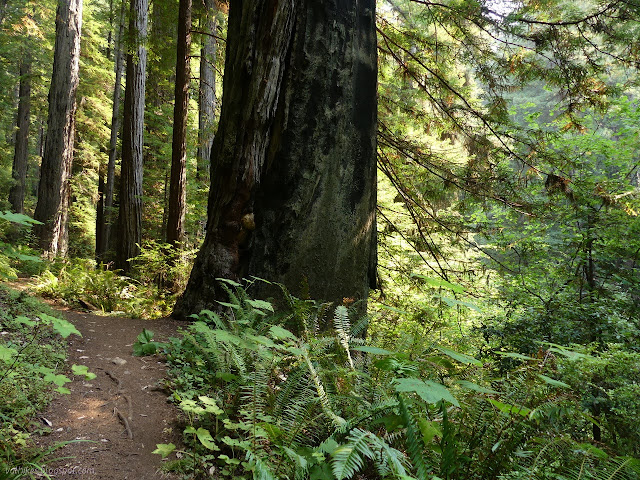
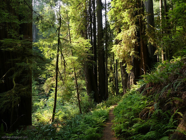
So I enjoyed the trees as I walked along. Flowers, on the other hand, are in short supply at the moment.

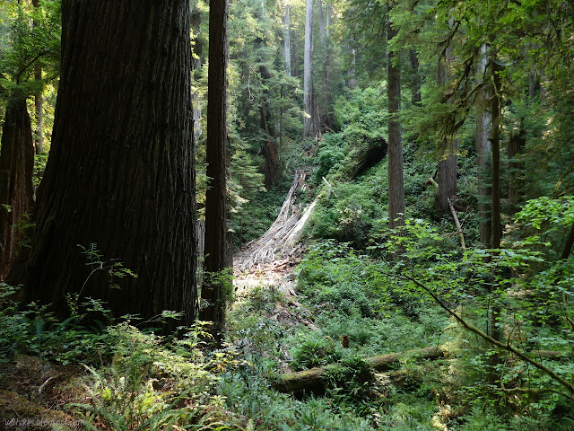
Then the trail turned to switchback down to the stream level again and ran right into that splintered tree pictured above. I couldn't find any more of it on either side of the tree debris. Some people had cut the switchback, but it didn't look like they actually got anywhere for their trouble.

I was feeling this all was rather missing a pond, which would have been a unique feature. Well, there are some large pools here and there along streams and creeks. The map on the back of the park brochure shows a trail that continues a little further, then splits into two very short spurs. I pulled out the phone to find that I was also missing a track as it added the first point not by the car. I tried AllTrails, but it got upset that it couldn't connect. I clicked "continue without a track" but it was in a state of "I can't do that, Dave." (It had never been logged in via this device, so maybe it was upset that some initial setup that it can only do online wasn't complete.) I started up Hiking Project, and it was happy to start tracking without even needing special settings. It also resisted testing while not moving. I headed back, still enjoying the trees and not worrying about the probable equipment failure.
I finished and found that while Oruxmaps hadn't been collecting points again, Hiking Project had been a little excessive with collecting points, producing a route of tight winds that is actually quite straight. I could find no way to save the track directly. It uploads to the web site when connected and can then be downloaded from there. (This requires an account.) It simplifies transfer to a computer if a data connection is available, but is impossible if there is none.
I headed to the northern end of the Rhododendron Trail for the main hike and couldn't help but notice that the map there shows the Moorman Pond Trail going up for a while, then dropping down and continuing off the edge. There's more in a plan somewhere, at least.
*photo album*
©2021 Valerie Norton
Written 20 Sep 2021
Liked this? Interesting? Click the three bars at the top left for the menu to read more or subscribe!


Comments