Stone Lagoon and the Arch
Humboldt Lagoons State Park
Redwood National Park
(Map link.)
I was determined to experience the bit of California Coastal Trail along Stone Lagoon as it was "built". The predicted weekend rain wouldn't be enough to raise the level of the lagoon sufficiently to leave the north end of the trail once more underwater, but it might be enough to allow some attention to the inland areas that have otherwise been smoky and even slightly on fire. Now is the perfect time to finally walk the whole of this short trail. I planned to go all the way to the parking lot at the north end, then return the same way. I did have some thoughts about heading to Sharp Point and then walking the beach south from there, but the tides weren't looking very cooperative. They were coming in about 3 feet at sunrise and then climbing to about 6 feet at sunset with a brief backtrack in the middle to about 3 feet again. Sometimes there's just no such thing as a low tide all day. On the trail, that doesn't matter. I marveled that since my last visit, someone had lined the parking lot and it already looked old, then got started north on the still unmarked trail through the dunes.


The trail is still unmarked as it starts up into the bluffs, too. It is still clear enough, but the vegetation seems to be encroaching a little more. It wasn't particularly at first. At first, I was just enjoying that it was drier than it has been. The trickles of water that inspire reinforcement of the trail are soggy, but that is about it.


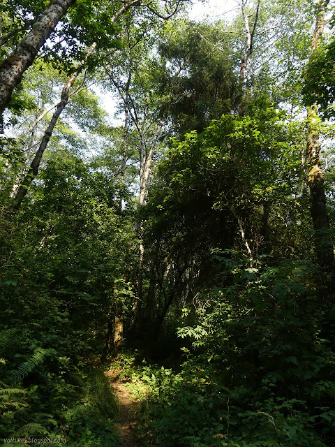
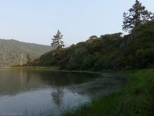
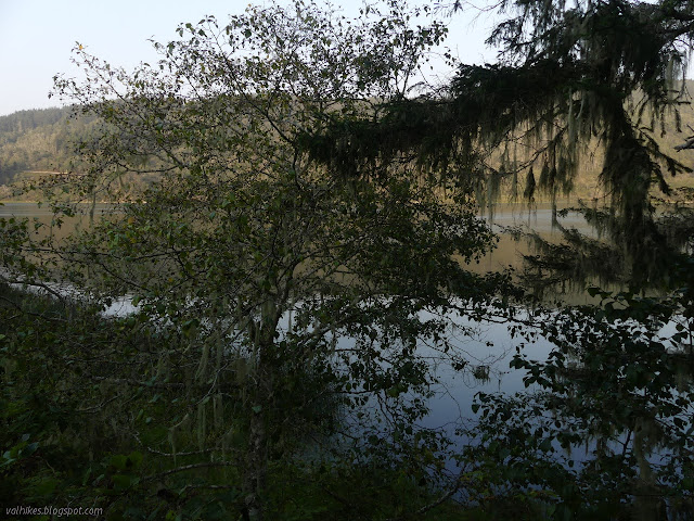
There's just a couple of spots to see Stone Lagoon through the trees and it looks very much the same from those views. I skipped checking the campground, but was quite happy to see the tree that had been directing all traffic that way was gone.


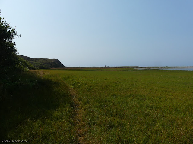
I navigated the last bit of very soggy trail, with its one bit of bridge getting eaten by vegetation, down to the water's edge. There's plenty of room to walk the edge with the water about five feet lower than in winter. I took the left and plodded through the grasses, then along the rocks. One rockfall makes a slight scramble, but it is not too bad. I passed some short cliffs along the way and suspect that walking this route in winter wouldn't just be a matter of some waders, at least not in January.


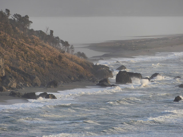
I arrived at the beach to find another sign of the changing seasons as I stood at the top of a tall cliff of sand. The beach is already getting eaten away by storms. Looking south, it did look suspiciously like it might have grown since I was last there. Or, at least, the rocks had shrunk and they don't usually shrink much.
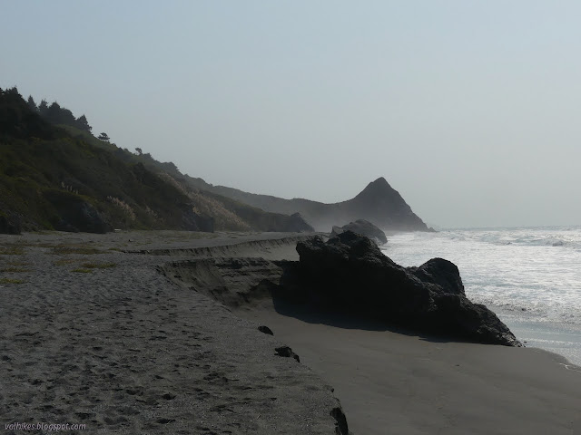

I turned north and walked along until the cliff was rather short and rounded. It was taller than I was where I started. I continued along, generally keeping to the stiffer wet sand.


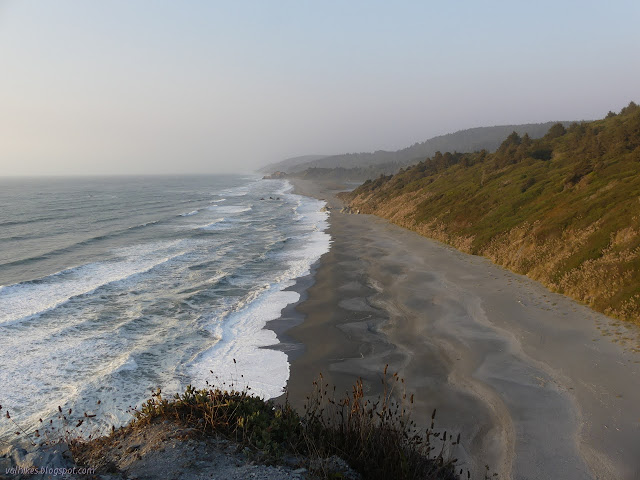
As I got near the Stone Lagoon parking area, I noticed the strangest thing. Although the tide wasn't particularly low, it looked as though the point was clear. I decided to go for it and put on a little speed, although sand will totally punish a person for trying to hurry.


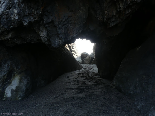
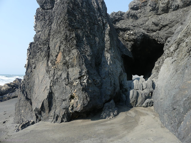
It was still sandy around the point when I got to it. It took only the most casual of timing to get around the first bit of rock. The second bit of rock is already to that arch I found when investigating the area of Freshwater Lagoon. Of course I had to go through it. Many others had already since the tide was last high.
I took some not especially careful timing to get around the outside of the point with the arch and back around the second point. Flawless point passage!

Then I headed back to the parking area. A few people were out, but not as many as had been at the Dry Lagoon parking area. I continued back along the most established path on the lagoon side of the barrier beach.


I found the trail around the edge of the lagoon once more and followed it back.

I considered following the shore all the way around to the campground. I remember seeing a track on Alltrails that did that, but it doesn't look like it can be done. There are barriers visible from both ends. I followed the trail up and then down to the camp instead. The water flowing under the (first) bridge, the only reliably non-brackish source near camp, was not much more than a trickle.

I actually found an occupant in the campground. It is good to see it getting used. I chatted shortly, but it was getting late. I headed back up the trail, but decided to stop once more at Sharp Point. The trail past the campground spur is getting so brushy that the use trail to Sharp Point was actually kind of nice.

From the top of Sharp Point at high tide, I could see what I couldn't see while standing on the beach. There might be splashes from the rocks on the beach, but there's a high shelf of sorts that is still dry. At least there was right then. Some of it is definitely on blue goo and the whole thing may be changeable. I enjoyed my time at the top, but only briefly.
I let my desire to walk up the beach get the better of me and ignored good sense. I found a trail down on the point side of the saddle and followed it down. It has some rather vertical sections. It got down to a spot very close to the water, but still dry. The waves seemed to spend their energy on rocks far out. I made my way as quickly as seemed safe noticing my legs were getting tired after all the sand. The blue goo areas were nice and dry and hard. I almost slipped on a bit of natural concrete covered over in moss watered by a natural seep instead. I kept thinking the waves were getting threatening, but none actually were.


I kept a bit of a hurrying pace as, well, it was still getting late.

*photo album*
©2021 Valerie Norton
Written 11 Oct 2021
Liked this? Interesting? Click the three bars at the top left for the menu to read more or subscribe!


Comments