Posts

Showing posts with the label beach

Ocean Ranch

Image
Eel River Wildlife Area Click for interactive map A little after I first (and last) visited Ocean Ranch , the California Department of Fish and Wildlife launched a restoration project in this bit of the Eel River Wildlife Area that I keep meaning to check out. It gets a mention sometimes on the twice monthly DERT days by Friends of the Dunes because they decided to test the best removal system for the invasive beach grass we pull by hand. The winner for efficiency includes fire. I pulled into the now paved parking lot at the top because that's all I was expecting, only to find there is now a paved road where there was a gated, uneven track down to another parking area with picnicking that is open sunrise to sunset. The wooden sign got an upgrade. There was very obviously a billowing plume of smoke originating from somewhere over by the mouth of the Eel River. A blackberry hunter suspected that folks who came to Crab County Park for the 4th to light up massive mounds of ...

Ossagon Creek, Fern Canyon, and Friendship Ridge

Image
Prairie Creek Redwoods State Park Click for interactive map I thought I'd go see the gnome plants in Prairie Creek, then, realizing they haven't been spotted until later in the season, decided to see what has become of Ossagon Trail over the years since I took it. It's a short trail, so I decided to meander along to Fern Canyon via the California Coastal Trail (and the little waterfall that should be less little today) and then loop around over Friendship Ridge before coming back. Or I might do it the other way around. Being a weekend, Fern Canyon would be crowded, but the weekend was the break in the rain. Sunday should even bee a sun day, so that's when I went. Signs and paved parking and even trash service at the trailhead for Ossagon Trail. Ossagon Trail is one of the few in the park where you may ride a bike. It is not, in spite of defacement of the sign, a trail where you may walk your dog. Neither the state parks nor the national park allow dogs on th...

Tidytips on Manila and Samoa Dunes

Image
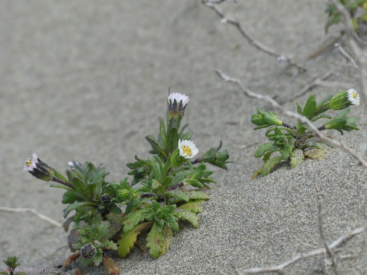
Humboldt Coastal Nature Center Manila Dunes Recreation Area Samoa Dunes and Wetlands Conservation Area Click for full screen map The dunes are about to explode with bright flowers. It's getting some start now, particularly showing off a few of the endemic and endangered flowers. I've shown off the Humboldt Bay (Menzie's) wallflowers before. This time I was out to find some beach Layia, also known as beach tidytips. (Blooming, this time. Not just leaf clusters like I saw on the Hikshari' sand spit !) I started at the Humboldt Coastal Nature Center and headed for the high dunes. It's been a while since I spent some time on these highest of places in an area entirely built of whatever the ocean tosses up. Besides, the Wildberries Trail was flooded recently. The Humboldt Coastal Nature Center is a striking building. Stop inside for all kinds of information and there are bathrooms and bicycle parking to the left. The trail over the high dunes starts on t...

Me'tsko River and Beach and Dunes

Image
Clam Beach County Park Little River State Beach ( map link ) I decided the place I wanted to go for this window of sunshine between the rain was Little River State Beach, which I previously visited on an even sunnier June day full of flowers . There aren't quite so many flowers as March starts. It's not very big, so I decided I should take in some of the county's Clam Beach to the south and Moonstone Beach to the north. The tide would be out late in the afternoon, so I left the areas with cliffs for late. I started in the county's North Lot, which was quite busy at one end and flooded at the other. Lots of dogs out, but all but one with obedient people leashing them. North of the lot is Little River State Beach which only allows dogs leashed on the waveslope. They take their position as critical snowy plover habitat seriously and loose dogs are huge threat to the ground nesting birds. Plenty of parking under the bluffs at the beach. There's trail aroun...

Lost Coast: Punta Gorda Lighthouse

Image
King Range National Conservation Area, Arcata BLM (brown line, map link ) DAY 1  |  DAY 2  |  DAY 3  |  DAY 4  |  DAY 5  |  DAY 6  |  DAY 7 With just a short way to go and since it takes a long time for the sun to get over the hills, I took a while to get started. Powerhouse and fuel tank in the morning light and a bit of processing to see what's happening in the shadows. In fact, the first hikers of the day came by just after I finished packing and wandered over to the sign about elephant seals. Listening to their strange clacking noises and thinking how I'd now seen them in very different seasons (October before), I wondered when you don't get to see them. The sign promptly answered. August. You don't get to see elephant seals in August. And you might miss them at the end of March. At this time, there should be molting females. I'd seen a few clearly molting and hadn't managed to spot a male. I should have ...

Lost Coast: Big Flat to Shelter Cove and bounce

Image
King Range National Conservation Area, Arcata BLM (yellow line, map link ) DAY 1  |  DAY 2  |  DAY 3  |  DAY 4  |  DAY 5  |  DAY 6  |  DAY 7 So, my tarping didn't perform so well for the storm. I'd let the one stake go without dropping a rock on it, so I had to get up in the middle of the night and resecure it. There was a rock all of 2 feet away to drop on top of it. That left the foot of my quilt wet on the surface. The wind kept changing direction, but it didn't do so laden with rain until early in the morning. I'd figured I'd just use my poncho for protection if it did that, but hadn't decided how that would work, so it took a while to sort and wasn't very effective when done. I simply pulled it across, hopefully wet side out in the dark. Anyway, things only got moist and it's not down nor particularly cold. The rain seemed to encourage the broadleaved stonecrop flowers to pop open. Big Creek after a ni...

Lost Coast: Punta Gorda to Big Creek

Image
King Range National Conservation Area, Arcata BLM (orange line, map link ) DAY 1  |  DAY 2  |  DAY 3  |  DAY 4  |  DAY 5  |  DAY 6  |  DAY 7 Waves of rain passed in the night and it was dry but windy when I started the day. I needed to make it early because some parts of the trail can only be done at a low tide (below 3 feet, generally, but a couple spots are getting reported as below 2.7 feet now) and the first 4 mile section of this (referred to as the impassible zone) was coming up in 2.4 miles. The low tide was early and one of those especially tight spots is the north side of Randall Creek, the very end of this impassible zone. Yes, the tide would be coming in rather than receding as recommended, but it was a rather flat ocean and I have been here before. I had a pretty hard deadline of noon for the first 6.4 miles, which is tight but really shouldn't be hard to make. However, that rain overnight wasn't the r...

Lost Coast: Windy Point

Image
King Range National Conservation Area, Arcata BLM (red line, map link ) DAY 1  |  DAY 2  |  DAY 3  |  DAY 4  |  DAY 5  |  DAY 6  |  DAY 7 Well, an air fryer was obtained and even though this one doesn't have a "dehydrate" button, it turns out beans dehydrate well at 180°F, taking only about 3 hours for a pound. In 3 days, I had 3 pounds of various varieties and it was suddenly much easier to think about going out backpacking. I could try out the Lost Coast Trail the way everyone tells me it should be experienced, then wander back my own way because that shuttle is way too expensive and there's more to see than the beach. The tides would be super low in a couple days and the only weather a brief storm zipping past mostly in the night. Clouds (and storms) make things more interesting. Yeah, that's how it works, right? I decided on doing the biggest loop, so after pounding along the beach from north to south (as the ...

Mosley Island

Image
Eel River Wildlife Area ( map link ) After the railroad and tunnel , my next objective for the day was to visit a couple of units in the Eel River Wildlife Area . This is California Department of Fish and Wildlife land that doesn't require a hunting permit of any kind to access. Its purpose is to "protect and enhance coastal wetland habitat". I have previously hiked on the Ocean Ranch Unit . Today, I would explore the Cannibal Island Unit, which occupies the north and west sides of Cannibal Island and the north side of Mosley Island. It looks like there are a couple of ways to access the parts on Cannibal Island on county roads (noted by the yellow tag on the road signs), but they aren't terribly good roads and they are a bit flooded at the moment. I was aiming for Crab Park, a Humboldt County park, at the end of the road as the only obvious place to park. It is more of a turn around. The road is paved to the bridge from Cannibal Island to Mosley Island, then wa...

Agate Beach and around the Rim

Image
Sue-meg State Park ( map link ) I almost got enticed by the siren song of a King Range permit that was sitting spare for Tuesday, which was the start of both good tides and good weather for the Lost Coast Trail. But! I want to do too big a trip to get ready in the half day that I had to sort things out, so I let that treasure go, likely unused by anyone. I decided to get out to Sue-meg for the first time since its older name was applied to the whole state park, not just the ceremonial village within, during some of that perfect weather and tides. There is an $8 fee to drive in, but it is free to walk in or bike in. Trails don't allow bikes or dogs. Fancy new signs to mark the park under the old Sitka spruce. I headed for Sue-meg Village first. It isn't a village in the sense that no one lives there, but it does have purpose beyond showing off the local architecture. The outside of one sturdy home. Inside a house including its big bear-proof doorway. Next, I h...

Ma-le'l Dunes, south and north, for the wallflowers

Image
Arcata Field Office BLM Humboldt Bay National Wildlife Refuge ( map link ) The wallflowers are blooming and maybe it's time to make a wander over the Ma-le'l Dunes once more. We spotted them on the way to pulling the invasive marram grass last week, little yellow pompoms in a large depression and spotting a few other places in the dunes. Since I seem to be using flowers as motivation to document a place again, the critically endangered Erysimum menziesii , Menzies' Wallflower, was as good an excuse as any. It really is just an excuse. I wanted to wander the dunes. Beware. There has been some rabies found in grey foxes in the northern dunes. Information signs about trails in the south section of dunes are at both ends of the long parking area. I like the forest portions of the trails here, so I headed past a rabies warning on a less obvious trail that climbs up the old dunes hosting the trees. It follows a long and narrow crest between valleys of surprising depth...