Tidytips on Manila and Samoa Dunes
Humboldt Coastal Nature Center
Manila Dunes Recreation Area
Samoa Dunes and Wetlands Conservation Area

The dunes are about to explode with bright flowers. It's getting some start now, particularly showing off a few of the endemic and endangered flowers. I've shown off the Humboldt Bay (Menzie's) wallflowers before. This time I was out to find some beach Layia, also known as beach tidytips. (Blooming, this time. Not just leaf clusters like I saw on the Hikshari' sand spit!) I started at the Humboldt Coastal Nature Center and headed for the high dunes. It's been a while since I spent some time on these highest of places in an area entirely built of whatever the ocean tosses up. Besides, the Wildberries Trail was flooded recently.


The trails are generally easy to follow, but the signs seem to go missing. It can be hard to tell what is official trail and what isn't. They are trying to preserve those plants off the side of the trail, so it's imporatant make the attempt to stay on trail. I managed mostly.

The trail drops before climbing to the higher dunes, skirting along the edge of some emergent wetlands. It's not too badly flooded at the moment and there's usually a way past along this trail anyway.


The low point is brief, then the trail starts climbing. There is also an option to stay fairly low and get to the beach. At this point, I took that option for the beach.


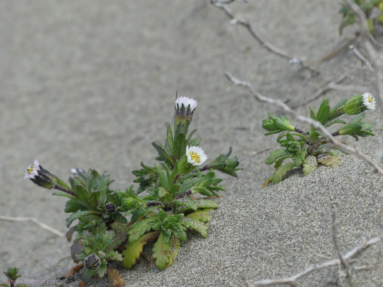
Off on the edge of the trail, I found the first of my quarry.

They are tiny! They are smaller than the last knuckle of my pinky finger. I wondered if they open further, maybe show off some different colored tips as some of the genus is known for. (They don't. This is it.) I continued out to the beach. The wind blasted at me and I noticed that it smelled particularly, well, like beach today.


I soon headed back up to the dunes via the South Beach Access Trail. Along it, I found a sign saying horses and hikers may go this way on a faint trail. I could hardly believe it. I decided to take that trail and followed it to the property boundary. The tidytips were all along it, some right in the middle of the trail. We keep getting told that they like a bit of disturbance, but we're not allowed to work by them if they are there. They're never among the thick patches European beach grass we pull, though. It's too stable and stuffy for them.


The groundcover transitions to largely European beach grass and ice plant upon entering the Manila Dunes Recreation Area. I wonder which one wins in a battle of invasives? There remain patches of open sand where a more interesting diversity can be found. I took another look at the beach, then headed inland.


The rising winter water table has left quite a lot of water over the trail I chose. I was going to turn back when a woman passed by saying she'd be going around the water. More accurately, it was through less water, but I made it without too much leakage into my socks. It's a bit of work climbing on the wide, sandy trail. I stopped by the map at the Community Center and the platform on the tsunami evacuation area.

At the map, I decided I wanted to try WoLal Trail through the dune forest before continuing south. Not all of the trails to get there were very easy to see. I made some wrong turns, some of it encouraged by illegal bike riding. (None of these areas allow bikes.)


After coming nearly to the end of the trail as it dumps into a street beside a home, I headed back into the forest to continue south through the Samoa Dunes and Wetlands Conservation Area. The forest seems thicker here although the trails are obviously old roads. They follow in the high spots and the low spots of where the trees have captured these old dunes.


I wound through many trails, not quite getting anywhere directly.


Eventually I was on a trail that ended in the side of a well used, sandy trail. I followed it one last little bit out to a parking area and a sign identifying the area. That was my finish going south. I turned back and followed the sandy trail to the waterline.


The waterline is called that not for the line of water that tends to develop there but for the buried water main below it. The trail is actually dry were I hit it and I followed it for just a little bit too long.


I had got back into the Manila Dunes Recreation Area and the Sunset Dune Trail offered the last route out before the Blackberry Hollow Trail, which happens to be what they call the waterline, started to fill in with water. I was able to skirt it only getting mild moisture in my shoes before escaping on the Strawberry Dune Trail instead.


After scampering along the foredunes briefly, I scampered down to the beach once more for another short glance.

And then I turned once more for the high dunes at the Nature Center. First there was a little navigation of the flooded Waterline Trail.


And from the top, I got onto an unofficial but well used trail down the back, then wandered fainter but official trails the long way back to the parking area.
*photo album* where there's even more photos. It might be time to let the inner editor get more say as this was 3x as many photos as I like in a single post. Imagine how much worse it would be if I'd got hold of a handheld microscope, which is a thing I am currently pondering.
©2024 Valerie Norton
Written 8 Apr 2024
Liked this? Interesting? Click the three bars at the top left for the menu to read more or subscribe!


Comments